WFLA-TV (Tampa Bay) Chief Meteorologist and Climate Specialist. BS Atmospheric Sciences Cornell U. MA Climate Columbia U. Past CBS News NY and Miami, Tampa, WPB
Cool Florida Winter - But ironically Record Warm Earth!
The Winter ahead looks cool in the Southern US. BUT importantly - NOT cold. It’s one of the only places on Earth that will be cooler than normal this winter. This map is called the “Super Ensemble” - it’s a mix of 10 of the World’s best seasonal computer models. This shows a clear signal of a strong winter subtropical jet stream across the US South - a common feature of El Niño - and this one has record shattering warmth in the El Niño Pacific.
This means: Cool - but few, if any, freezes for #Florida.
**Nothing like last winter**. To the contrary there will be frequent cool fronts, extra cloud cover, much above normal rain but not rainy all the time. And most of these fronts will have moderated cool air behind them, but the air won’t come from Canada, it will come from the Pacific.
Elsewhere the planet will experience its warmest month in modern history in February. El Niño would have peaked in December, and there’s a couple of month lag in warming the Earth. The average Global surface temps will be around +2C beyond pre-industrial levels for the first time on record and and very likely higher than anything in 120,000 years (before the last Ice Age). #ElNino #climatechange
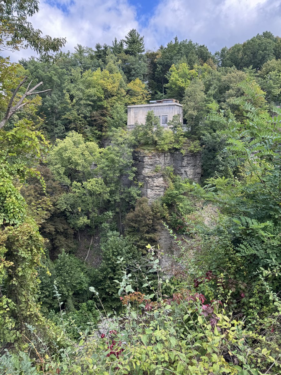
@HamiltonCain@Cornell@Saganismm@ProfCarlSagan He lived on Stewart Ave, just off Cornell’s Campus over the bridge that traversed the gorge (not sure what the town is called though officially).
Far too many people are worried about super HIGH intelligence destroying humanity, when we should be worried about super LOW intelligence destroying humanity.
On the Atlantic side of things, a historically quiet season continues. 99L could become a TC southwest of the Azores, but that's really the only major candidate at this point. The system off the East Coast on some models looks pretty non-tropical at this point. Pretty good chance we go through the whole month of September without a hurricane which is remarkable.
@du66_n@Cornell@Saganismm@ProfCarlSagan It didn’t mean much to me at 20, but it’s taken on a lot more meaning later in life. As time has gone on, I admire him more and more. He was right about so much.
*Earth’s Warmest Months in Millenia*
Global Temperature Anomalies may reach +2°C this winter (above pre-industrial levels) for the first time in modern history, and very likely in over 100,000 years, before the last ice age. The graph below shows the forecast from the World’s best computer models from many different nations. The ensemble mean peak month is 1.97, but this only goes through February. March may be even warmer.
They show it’s virtually certain Earth will break a record for its warmest month (and year in 2027) due to a boost from the most powerful #ElNino on record, on top of long term global warming. While 2C briefly tops the 2nd Paris Agreement threshold, it’s not considered a real breach. That’s because once El Niño weakens global temps will settle back down - BUT not all the way. So in that way Earth’s fever continues to rise step by step.
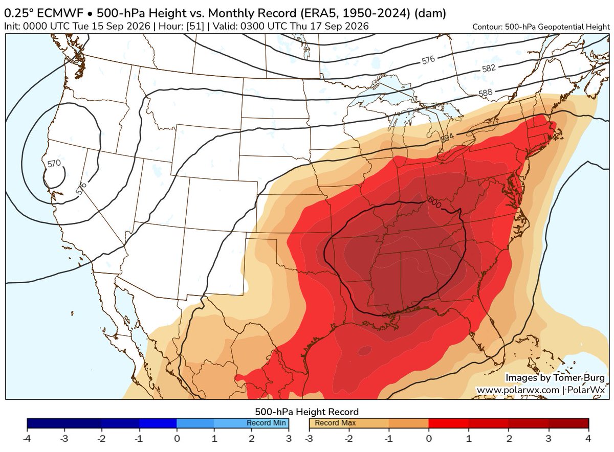
It is a hot end to summer. Everyone under the red shading experienced the strongest upper level ridge/ heat dome on record in September. It’s a huge area.
It’s the last week of summer in the Northern Hemisphere, but the season is going out with record-breaking heat. 🥵
A heat dome sent temperatures soaring in the south-central U.S. on Sept. 15, 2026. This map shows air temperatures from satellites and @NASAGoddard’s GEOS model.
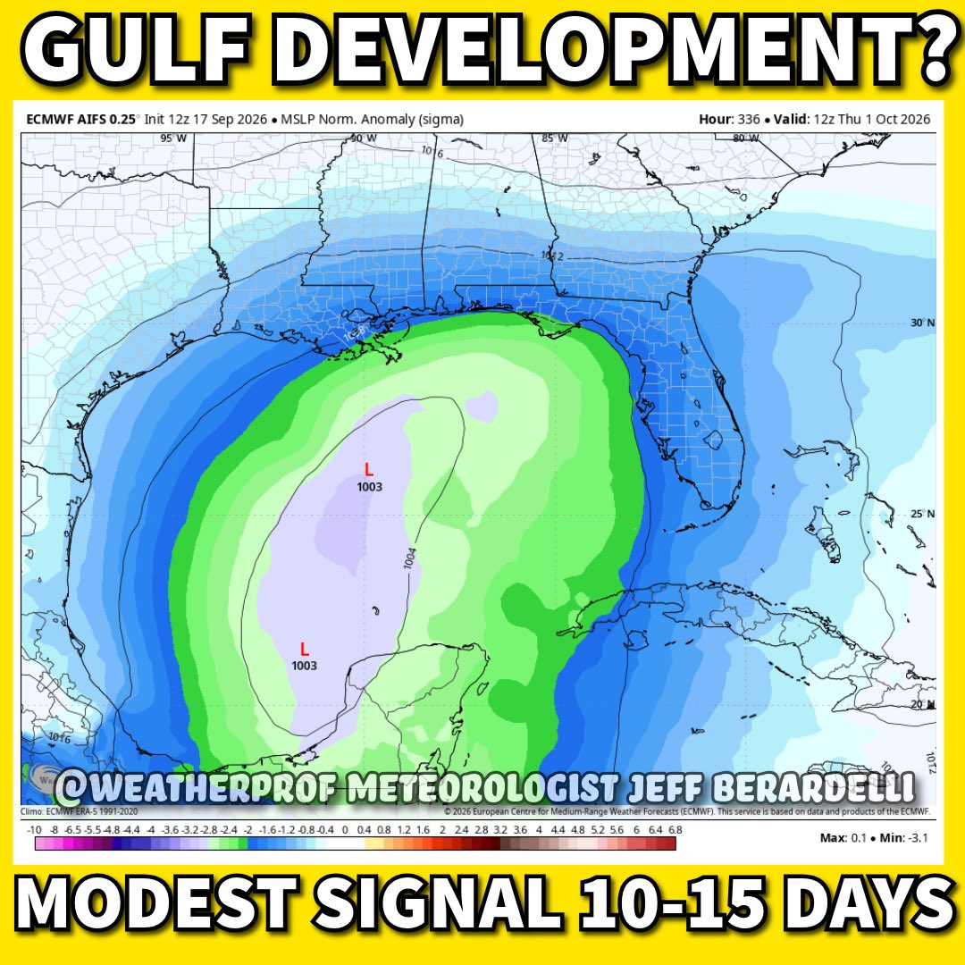
Hearing rumors of Gulf Development?
Before the hype or misinformation gets out of control, let’s get ahead of it.
Leveling with you: It’s “somewhat” possible in the 10-15 day range. Signal is modest/ medium at most. Not a strong signal. Conditions will be marginally favorable. Shear will be high surrounding it, so it has only a small geographical and time window to form. Bottom line: It’s very uncertain. Pictured here is the Euro AI pressure anomaly. It helps us to see where development is favored. It’s broad. Not focused. So it’s not a red flag, just a wait, watch, but don’t worry. I’ll let you know if it becomes more likely. #florida
This week’s heatwave has not gotten much attention because it’s Sept, people are sick of summer by now, and Sept temps - even under a record heat dome - don’t equal the crazy values of July. But this heat dome is epic, and not in a good way. Everyone covered in Magenta is experiencing the strongest upper level ridge/ heat dome on record for Mid September. It’s a huge area, more than 1/3rd of the nation, continuing the warmest summer on record into fall.