This weekend's project has been getting colorblind safe palettes up on the website. I'm working on them on 3 fronts.
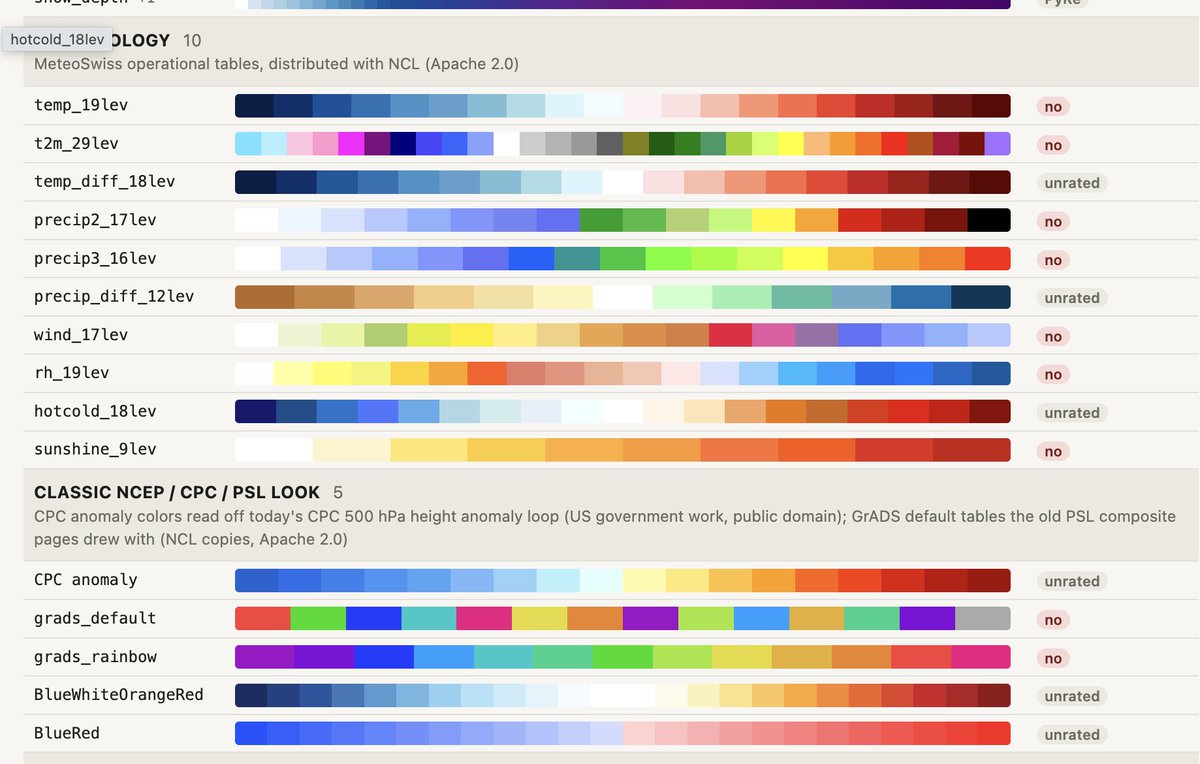
1) just let someone pick any colorscale (done)
2) Have a catalog of color safe scales to choose from (done)
3) Tweak them to align with pivots like freezing.
Built a hurricane recon game! Fly a WP-3D or WC-130J into Hurricane Isaias, Katrina, and more.
Punch the eyewall, drop sondes, score points. Real recon data and real Skew-Ts on the drops, plus a leaderboard.
Link below:👇
Did you know that most of the commonly used meteorology color scales are not readable if your user is color blind? I was concerned so ran these tests. Yikes! I havn't even tested Pyre's custom colors yet.
This is todays feature project. #accessibility#colorsafe
@NbergWX@iCyclone aren't they all just doing their own kind of math?
The bias of the physics models is interseting though and identifying that bias would be a deep deep dive into the data and physics. it could be possible that the physics models are using fewer data points than deep mind
i wish we could have a different name than "AI" because the public thinks AI = LLM and we're all going to die. This is pure math, and google / deep mind had the servers and minds (andrew ng) to do it right.
@NbergWX i wish we could have a different name than "AI" because the public thinks AI = LLM and we're all going to die. This is pure math, and google / deep mind had the servers and minds (andrew ng) to do it right.
@NbergWX i wish we could have a different name than "AI" because the public thinks AI = LLM and we're all going to die. This is pure math, and google / deep mind had the servers and minds (andrew ng) to do it right.
#الشرق_الأوسط
توقعات تساقط الثلوج لأشهر الشتاء، من شهر ديسمبر و حتى شهر مارس.
تم إعداد هذا التحليل باستخدام أساليب التحليل التماثلي، والمقاربات الإحصائية، والشبكات العصبية، بهدف تحديد ما لا يقل عن 23 موسمًا مماثلًا للموسم الجاري من حيث الأنماط والخصائص العامة .
أُضيفت إلى الخرائط المرفقة احتمالات حدوث التساقطات ال��لجية، بمختلف أنواعها وكمياتها، باللون الأحمر 🔴. وتشير شدة اللون 🔴 إلى ارتفاع الاحتمالية، وليس بالضرورة إلى كمية الثلوج المتوقعة.
🔵ديسمبر:
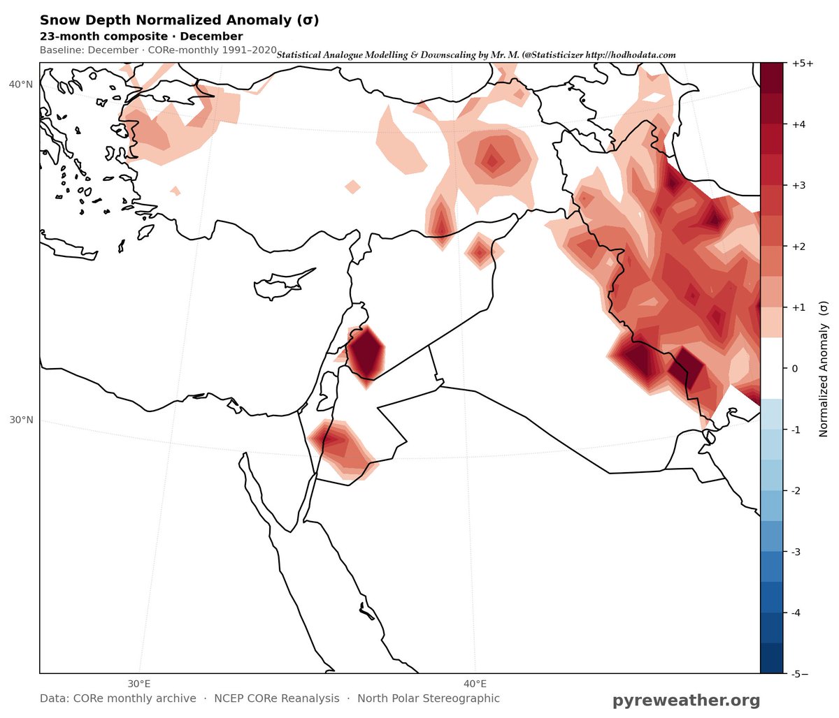
تزداد فرص التساقطات الثلجية فوق جنوب غرب سوريا، ومرتفعات جنوب الأردن، وشمال شرق العراق، وإقليم كردستان، وأقصى شرق العراق، إضافة إلى مرتفعات غرب إيران وشرق تركيا.
كما تظهر فرص متوسطة ومتقطعة لتساقط الثلوج فوق مرتفعات شمال شبه الجزيرة العربية، حيث تصل بعض الارتفاعات في المناطق الصحراوية إلى مستويات قد تكون ملائمة لتساقط الثلوج عند توافر بقية المسببات الجوية، مثل الرطوبة، وشدة الرياح، والتبريد في الطبقات العليا.
🔵يناير:
تظهر زيادة واضحة في احتمالات الثلوج فوق شرق سوريا والعراق وتركيا، مع امتداد الاحتمالات إلى أجزاء من شمال شبه الجزيرة العربية ولبنان والسواحل السورية.
ومن المهم الإشارة إلى أن جبال لبنان، من الناحية المناخية والتضاريسية، تُعد من أكثر المناطق ملاءمة للثلوج، وقد تشهد هطولات غزيرة نسبيًا. إلا أن نقص البيانات الأرشيفية المتاحة لبعض المناطق خلال فترة الحرب الأهلية اللبنانية، ولا سيما من ستينيات القرن الماضي وحتى أوائل التسعينيات، يؤثر في تمثيلها ضمن الخرائط الإحصائية الحالية، رغم أن الارتفاعات الجبلية تجعلها من المناطق ذات الاحتمالية المرتفعة فعليًا.
🔵فبراير:
تظهر فرص جيدة لتساقط الثلوج فوق مرتفعات الطفيلة والشوبك في الأردن، إضافة إلى أجزاء من سوريا وشرق تركيا وشمال العراق، ولا سيما إقليم كردستان.
🔵مارس:
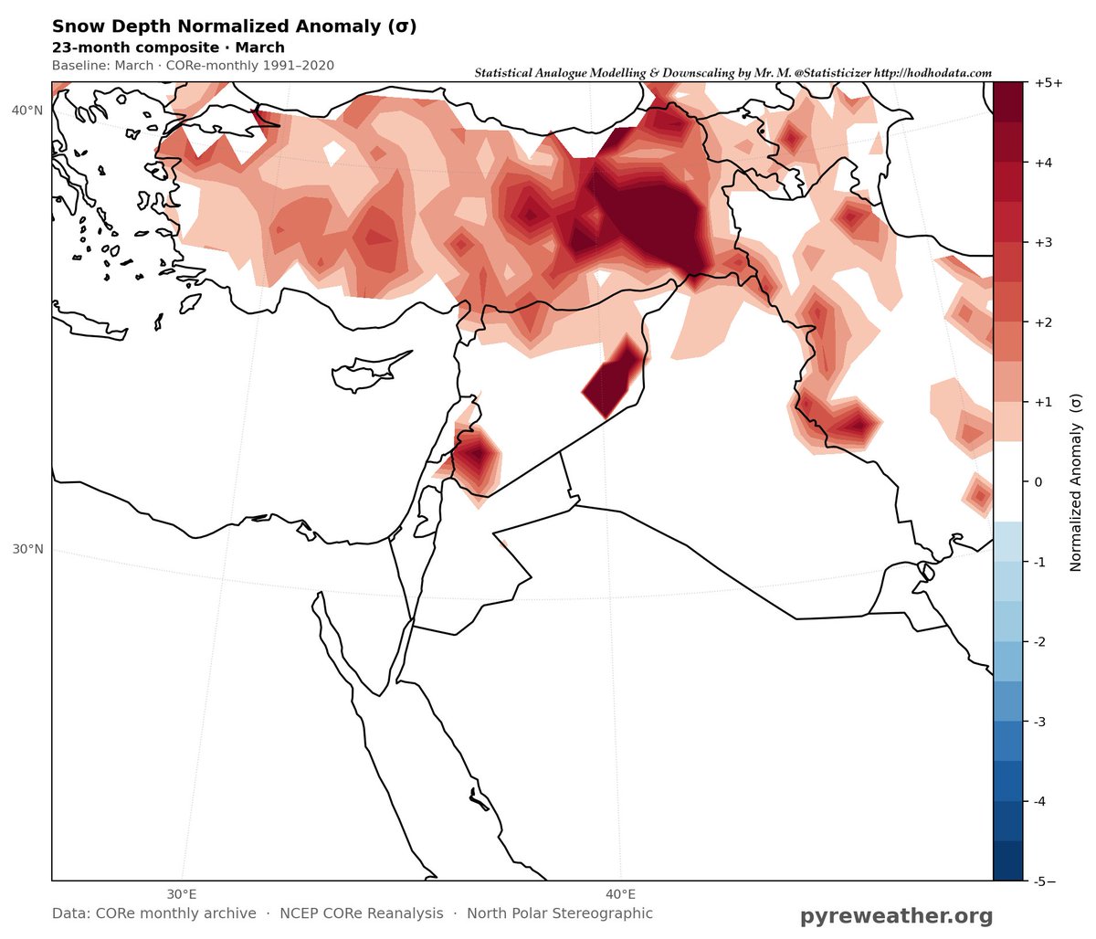
تتجدد فرص الثلوج فوق جنوب غرب سوريا وشرقها، إلى جانب شرق تركيا وشمال العراق. وتشير المخرجات الحالية إلى احتمالات أعلى نسبيًا فوق شرق تركيا.
وبطبيعة الحال، فإن توقعات شهر مارس ما تزال بعيدة زمنيًا، ولذلك فإن هذه المخرجات أولية وقابلة للتعديل مع اقتراب الفترة الزمنية وظهور أنماط جوية جديدة. ومن المحتمل أن تتغير بعض التفاصيل لاحقًا مع تحديث البيانات وإعادة تشغيل النماذج.
هذه قراءة احتمالية إحصائية وليست توقعًا حتميًا لحدوث الثلوج أو لكمياتها، وقد تتغير الاحتمالات مع تطور الحالة الجوية وتحديث المدخلات. اعيد ان شاء الله النموذج و التحليل باواخر نوفمبر للتدقيق .
والله سبحانه وتعالى أعلى وأعلم.
هذا التحليل احتمالية و يمثل ارجحيات الثلوج و ليس كمياتها الحتمية . ساقوم بتحديث نشرة الشتاء يناير-مارس بشهر ديسمبر ان شاء الله .
📊 تم احتساب هذه الاحتمالات وإعداد المخرجات الإحصائية من قبل كبير الإحصائيين في موقع الهدهد للبحوث والتحليل الإحصائي، السيد محمد الخ��يب @Statisticizer، وذلك باستخدام أساليب التحليل التماثلي والمقاربات الإحصائية والشبكات العصبية.
بدعم من شركة @pyreweather
https://t.co/AAChjhK20Q
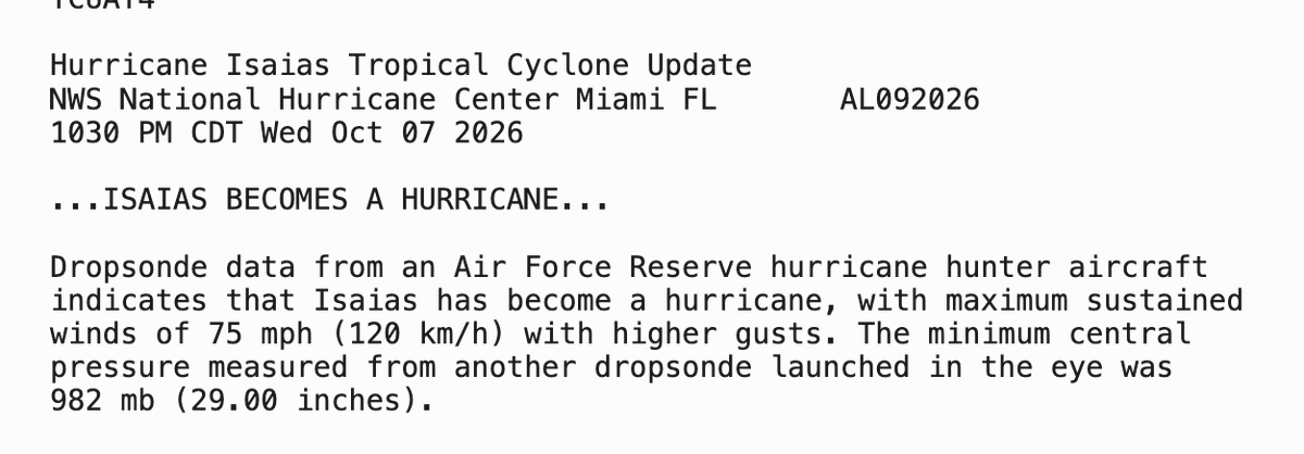
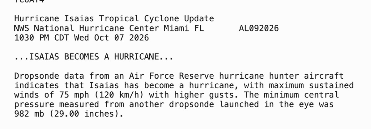
And here we have it... the first Atlantic Hurricane of the year. The latest hurricane in recorded history. Here's to well prepared residents, heeding warnings, safety for all and minimal property and life damage.
Aircraft Recon just made a pass moments ago on #Isaias down to 992mb at flight level. Looking at satellite, circulation looks to the left of main convection. We could see it reorganizing as well with those CG strikes. Intermediate advisory out in 45 minutes.
This is a fasicinating bit of historical weather reanalysis detective work!! We created our own case study of this event and posted a more detailed analysis on our discord server, but @Vigorro goes deep into historical investigation!
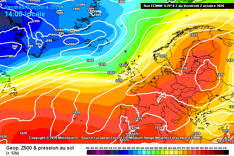
Respecto a lluvias siempre soy esceptico con eso de "esto nunca habia pasao" y siempre me gusta investigar... varios apañeros han comentado que estos dias se han llegado a producir diluvios con mapas mas sosos que la comida de hospital... en concreto se ha apuntado este...
@Vigorro Check out the site and let me know what you think, i created it as a student project last May and a lot of people are finding it super helpful.
https://t.co/gpaVp0IX2k
@Vigorro maybe i missed it, did you post the re-analysis maps? NOAA's site will not have last week's storm data since it stopped updating in March, but it still works for the older storsm you're mentioning ... and of course only goes back to 1950.
I've replicated many of the features