Corresponding HREF signal (00z init) which strongly indicates the maturation of a few supercellular clusters in E Saskatchewan by late afternoon/early evening.
Intrigued by the potential for some well-structured convection in Canada this evening. Low-level wind profiles will rapidly inflate around 00z in tandem with a stabilizing BL - any established (super)cells in this environment would likely attain classic ''mothership'' appearances
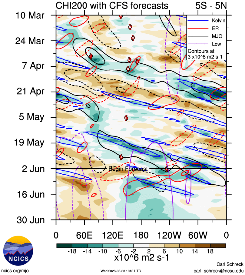
The details and intricacies are impossible to sift through at this range. However, a variety of ensemble guidance is strongly suggesting a major uptick in severe weather potential across the Northern/High Plains starting next week.
Can easily tell where the deepest updrafts (and their overshooting tops) are pulsating on visible satellite. Pretty common behaviour for newly-developed, small tropical cyclones as concentrated vorticity supports strong centralized convection
Newly-named #Amanda features a pretty healthy appearance for a compact tropical storm. Persistent, vorticity-rich convection & the associated hot towers will promote strengthening (potentially up to brief HU status?) before entering an increasingly dry environment by the weekend
The resultant cyclonic shear vorticity + strong upper divergence will yield a conducive environment for increased genesis potential. Pretty classic to see something like this occur in developing strong-super Ninos as enhanced westerly anomalies extend the MT much further eastward
Will be worth watching for low-latitude genesis in the far eastern WPAC around midmonth. A robust equatorial rossby wave - amplified by low-frequency + KW forcing near the dateline - will trail westward & provide a boost to low-level westerly anomalies in the deep tropics.
90E is classifiable as a tropical cyclone ATP. Can easily see its vigorous low-level circulation near the convective mass that concentrated vorticity for the cyclone overnight; also note the "curved" band of cool returns on LL microwave imagery in association with these features
The first case of EPAC TCG occurring this far westward (~130W) is pretty telling of an incoming strong-super niño given the bout(s) of anomalous westerlies that accompany the development of such events - note the strong MJO pulse currently passing through the region
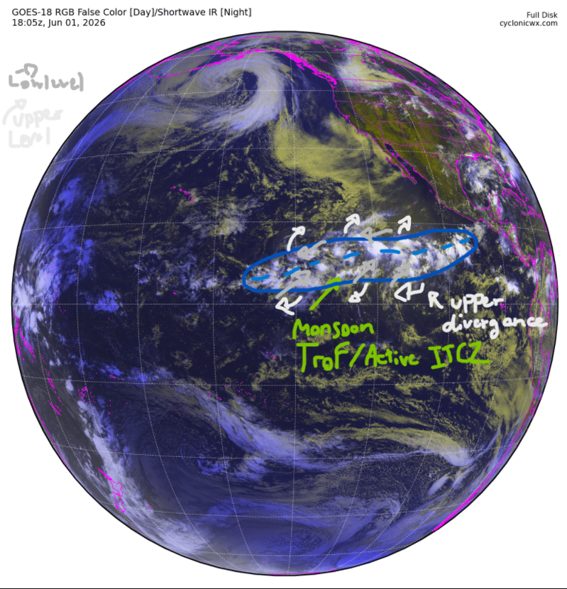
90E has been officially designated as the first invest of the Eastern Pacific hurricane season as of today - June 1st, 2026. Can already see a fairly concentrated vorticity maxima that'll gradually strengthen as it rolls up from the monsoon trough over the next couple days.
90E has been officially designated as the first invest of the Eastern Pacific hurricane season as of today - June 1st, 2026. Can already see a fairly concentrated vorticity maxima that'll gradually strengthen as it rolls up from the monsoon trough over the next couple days.
@WeathermanAAA_ Very favorable orientation & strength of the low-level flow to allow for vortex shedding off those islands - also note the marine stratocumulus which is common thanks to enhanced trades in the region.