We’re diving into the real challenges faced by project managers, IPPs, and EPCs. Join us to learn practical strategies to:
✅ Streamline workflows
✅ Cut unnecessary costs
✅ Meet deadlines with ease
📅 January 30 | 12pm CET
👉 Register now: https://t.co/DpbIP8VqT1
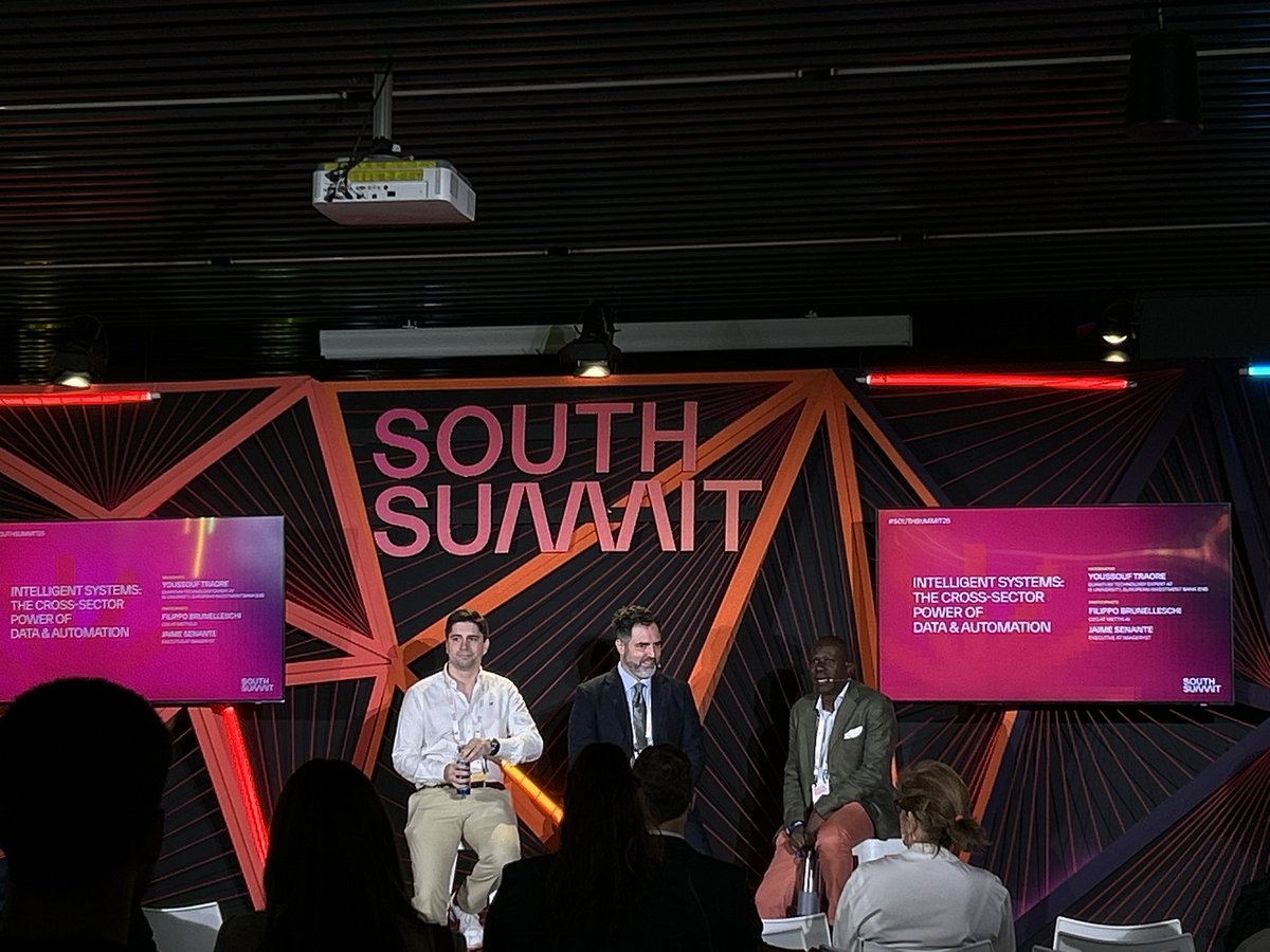
En #NISE2025 conocimos proyectos tecnológicos como @metad3v, empresa sevillana de desarrollo de software, o @imageryst , startup asturiana que cuenta con un novedoso SaaS. Talento de primer nivel reunido en Sevilla. 🚀 #SevillaCapitalEspacialEspañola
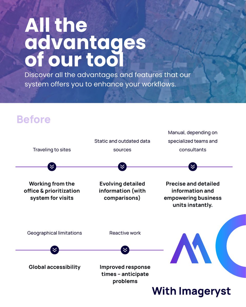
Before
❌ Manual reporting
❌ Limited visibility
❌ Disconnected processes
❌ Constant site visits
After
✅ Automated, shareable reports
✅ Visual updates from anywhere in the world
✅ Teams aligned in real time
✅ Fewer site visits = lower costs
https://t.co/A9cDGJTDXs
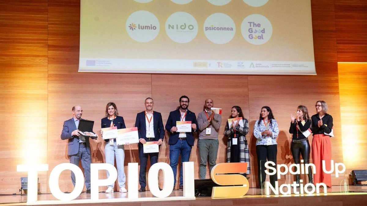
¡Grandes noticias en la #ComunidadLN! 💯🚀 La I edición de los 'TOP101 SPAIN UP NATION' reconoce como startups más innovadoras del país a:
@AbastoresCom - @ForestBank3 - @FullFastSpain - @imageryst - @MaccoRobotics - @psiconnea - @recircular_net - @thegoodgoalapp
De entre las seleccionadas se dio a conocer a los embajadores de cada territorio que destacan en esta área. ¡Enhorabuena doble para Abastores (Castilla-La Mancha)!
¡Felicidades a todos por el gran trabajo y reconocimiento! 🙌🙌
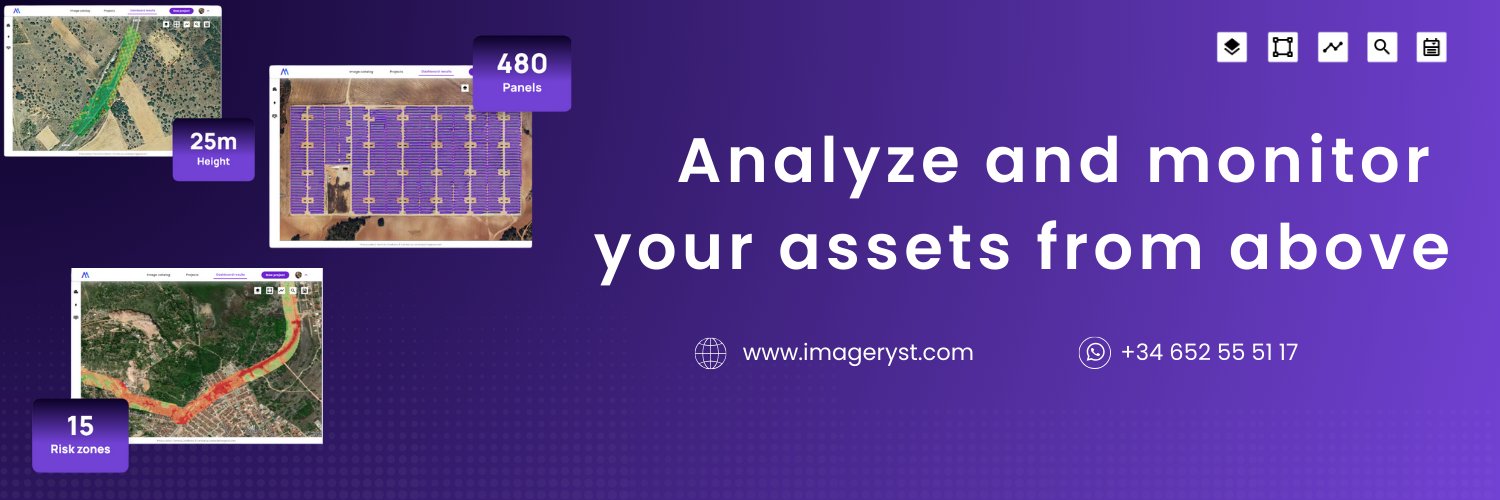
📡 Managing multiple international projects is no longer a logistical nightmare.
With satellite monitoring, you get up-to-date images of all your sites, wherever you are. No flights. No permits. No hassle.
Want to see how it works? Let’s talk.
https://t.co/Ofa3U2Ad3q
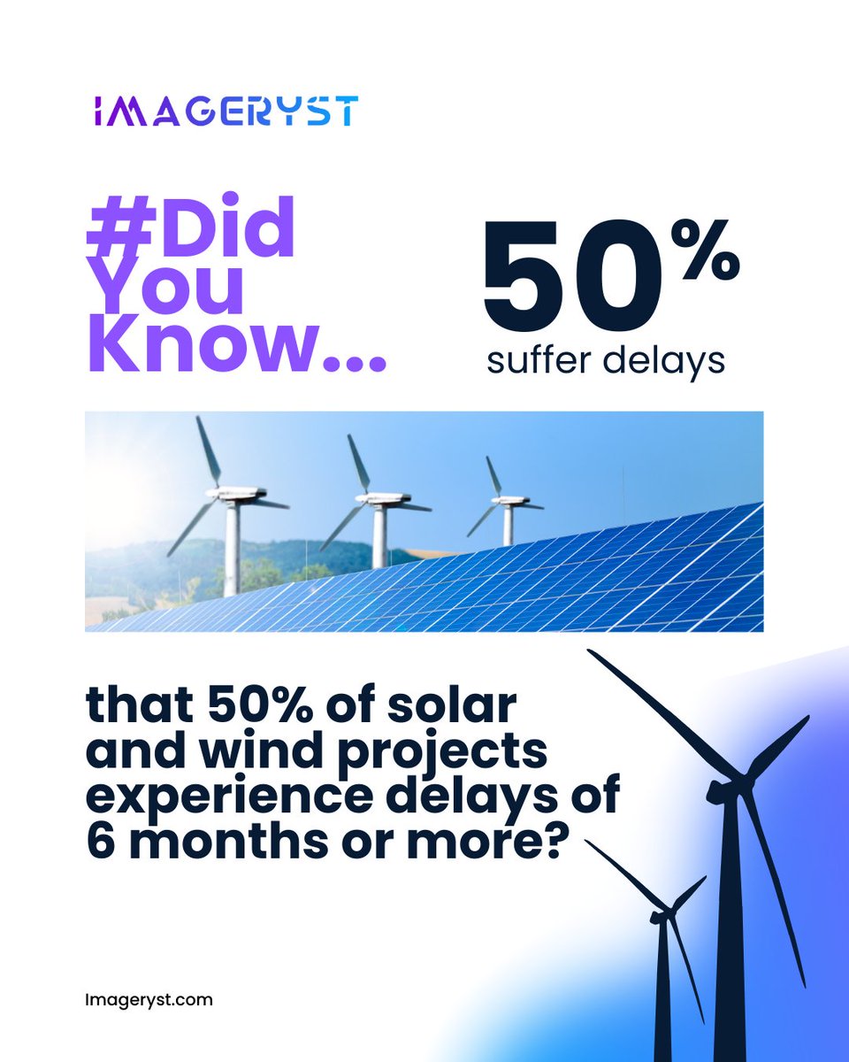
1 in 3 renewable energy projects has been canceled in the last 5 years.
What's the cause? Delays, out-of-control costs, and lack of visibility on the actual progress of the work.
We’re changing that with a simple yet powerful solution: #SatelliteImagery. https://t.co/t6DAgrDF8S
💡 With satellite technology, our clients have achieved:
🔹 A 20% reduction in operational costs
🔹 A 98% increase in supervision efficiency
🔹 The ability to detect errors before they lead to cost overruns
https://t.co/2ZijuufaAW
Let’s work together to unlock the full potential of your business decisions!
Ready for a demo? Simply leave your information below, and we'll call you as soon as possible to set up your personalized session.
🔜https://t.co/X45FNcerNq
🌱 See you at #Pulse by @rated_power! 🔋
On April 3rd & 4th, 2025, we’ll be at COAM Space, Madrid, taking part in the annual conference that brings together renewable energy professionals to discuss the challenges and opportunities of the enery transition.
#DidYouKnow that satellite data can boost the efficiency of solar and wind projects?
🔹 With Imageryst, you can:
📍 Pinpoint the best locations for solar and wind farms
📡 Assess solar and wind resources in real time
📊 Monitor asset conditions remotely
https://t.co/6FycKk2gn2
This webinar is ideal for:
✅Project developers
✅Independent Power Producers (IPPs)
✅EPC contractors (Engineering, Procurement, and Construction)
✅Environmental and compliance specialists
✅GIS and data analysts
Are you one of them?⤵️
https://t.co/ZgL0IkwYzy
🎒✈️ Time to pack our bags again, this time for @SolarStorageUK London! 🇬🇧
📍 Visit us at booth F67 and discover how geospatial technology can transform your solar projects.
More info 👇
https://t.co/eOPzgXYs55
📡 Geospatial data is transforming the energy sector. Are you leveraging its full potential?
🔍 Get expert insights and real-world strategies to maximize ROI in energy projects. Download it now! 👇
https://t.co/qzXqBwrM5w
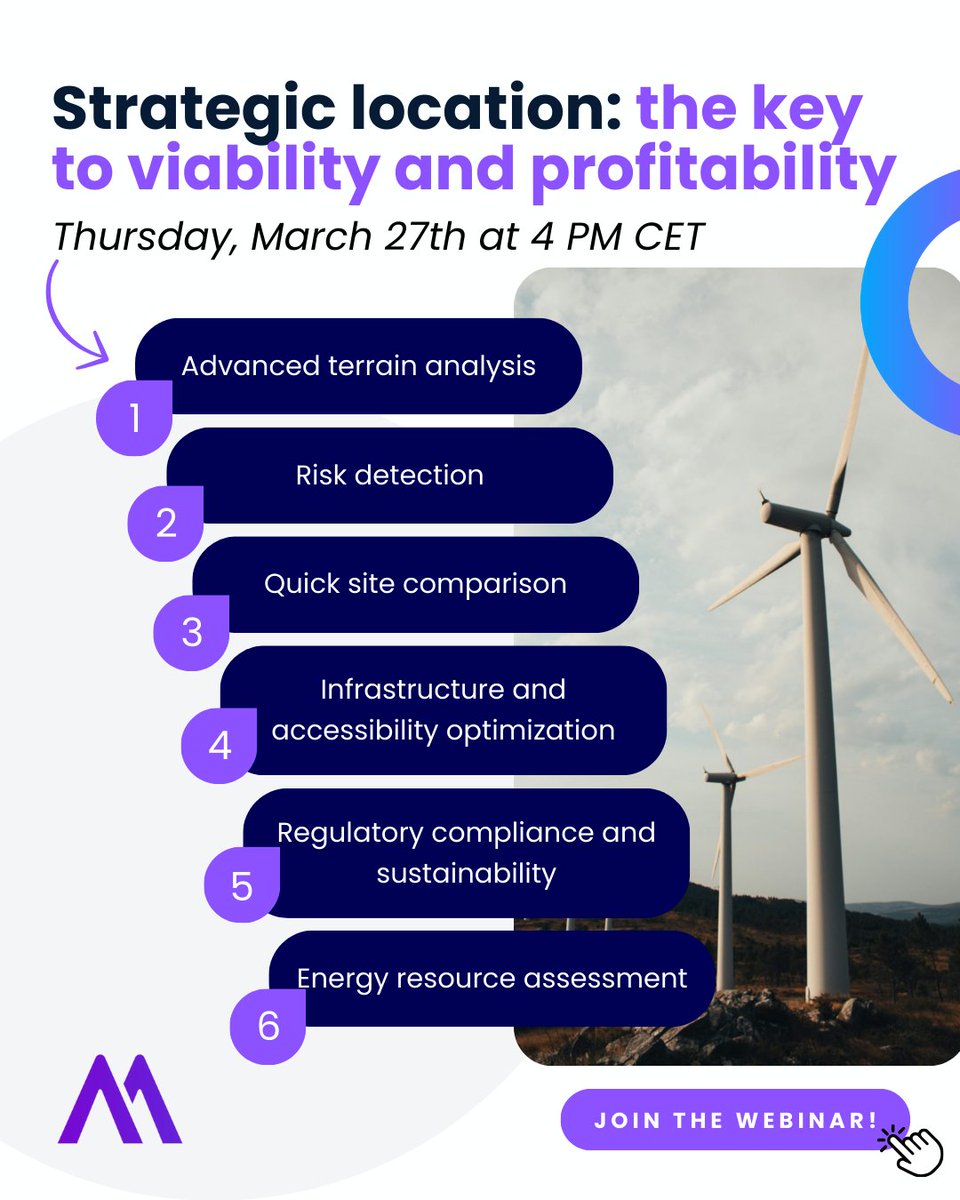
This webinar will explore how satellite imagery and geospatial analysis can transform site selection for renewable energy projects.
Are you ready? Join the webinar! ⤵️
https://t.co/jE0QbzVe83
The construction phase of renewable energy projects is critical—delays mean higher costs and lower profitability. How can you stay on track? Smarter monitoring.
Avoid costly delays – Watch our free On-Demand webinar! 🚀👇
https://t.co/MQEkZt08CE