Happy to report two of my first authored publications are accepted and published just this week!
- https://t.co/wXRYCeqorn (link has 50 days' free access)
- https://t.co/wFn6V17JyM (open access)
Happy to answer any questions and comments.
@EDIgotdata University of New Mexico IT says, "There is no estimation at the time when network services will be back online." https://t.co/ZxsbTvSzne Is EDI also impacted by this? I hope to get an estimation before our manuscript revision is due.
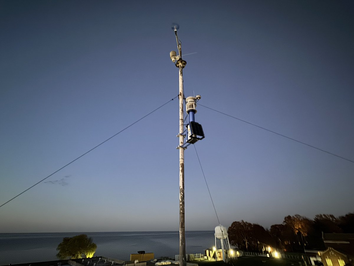
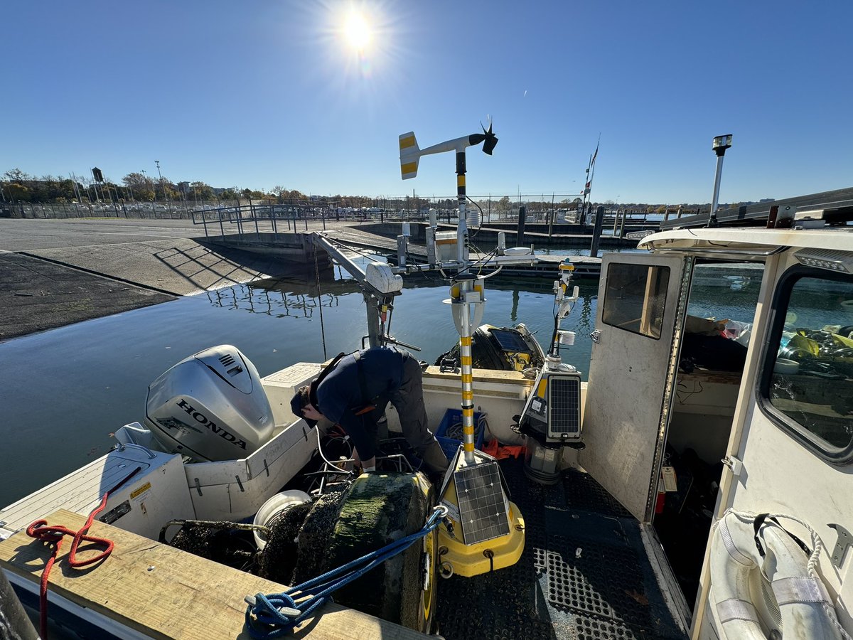
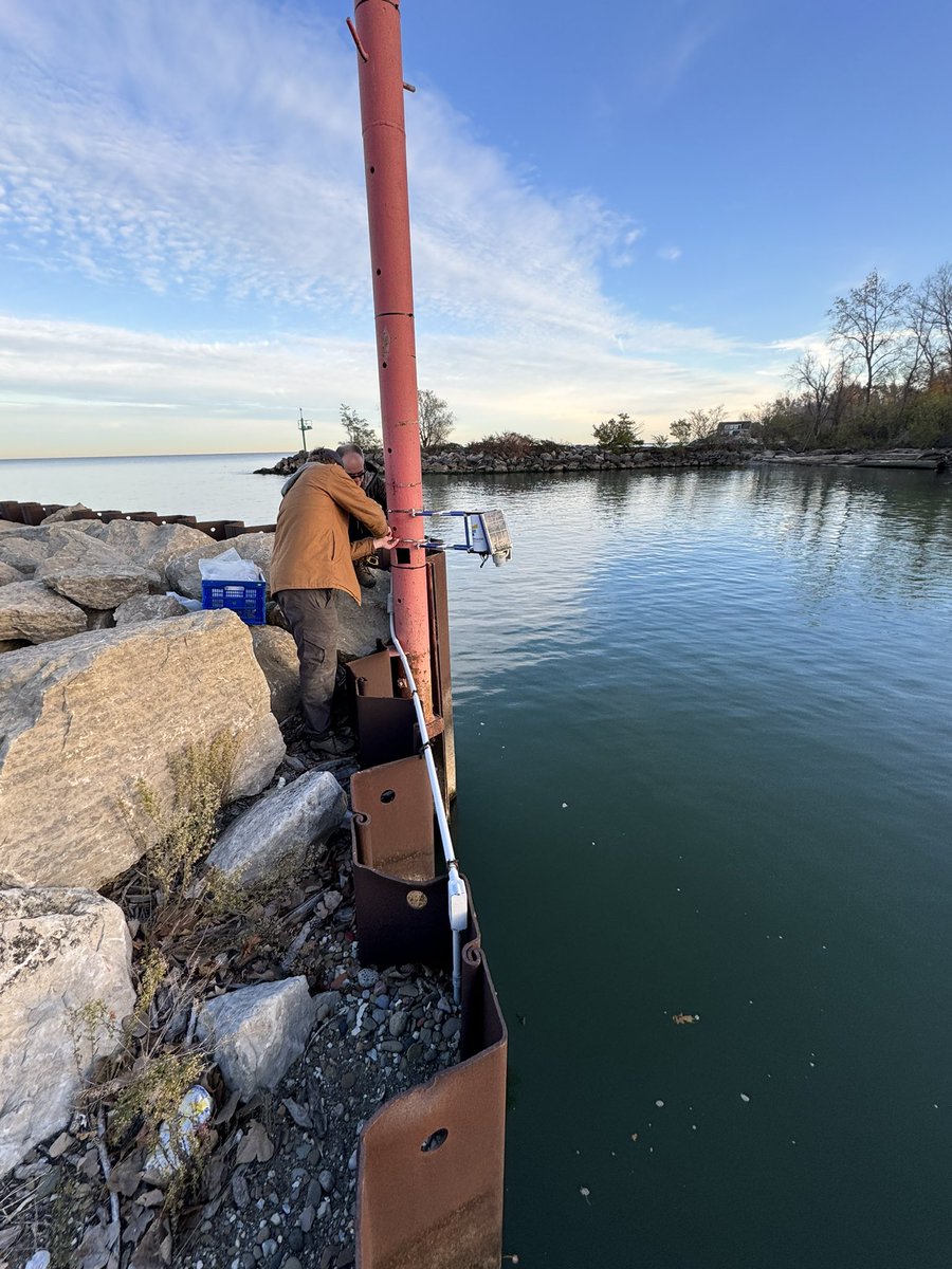
Sensors installed along Ohio Lake Erie shoreline yesterday, supporting public weather and marine conditions by @CLEH2OAlliance. Data can be viewed on https://t.co/ylMSwFs5bM. Technical support by @LimnoTech and @freeboardtech. @EddieGreatLakes
A robust El Niño is developing but how does the temperature of the surface of the tropical Pacific, thousands of miles away, change rain, snow, and temperature patterns over North America? Read the latest ENSO blog for more! https://t.co/DWJHHyfRpD
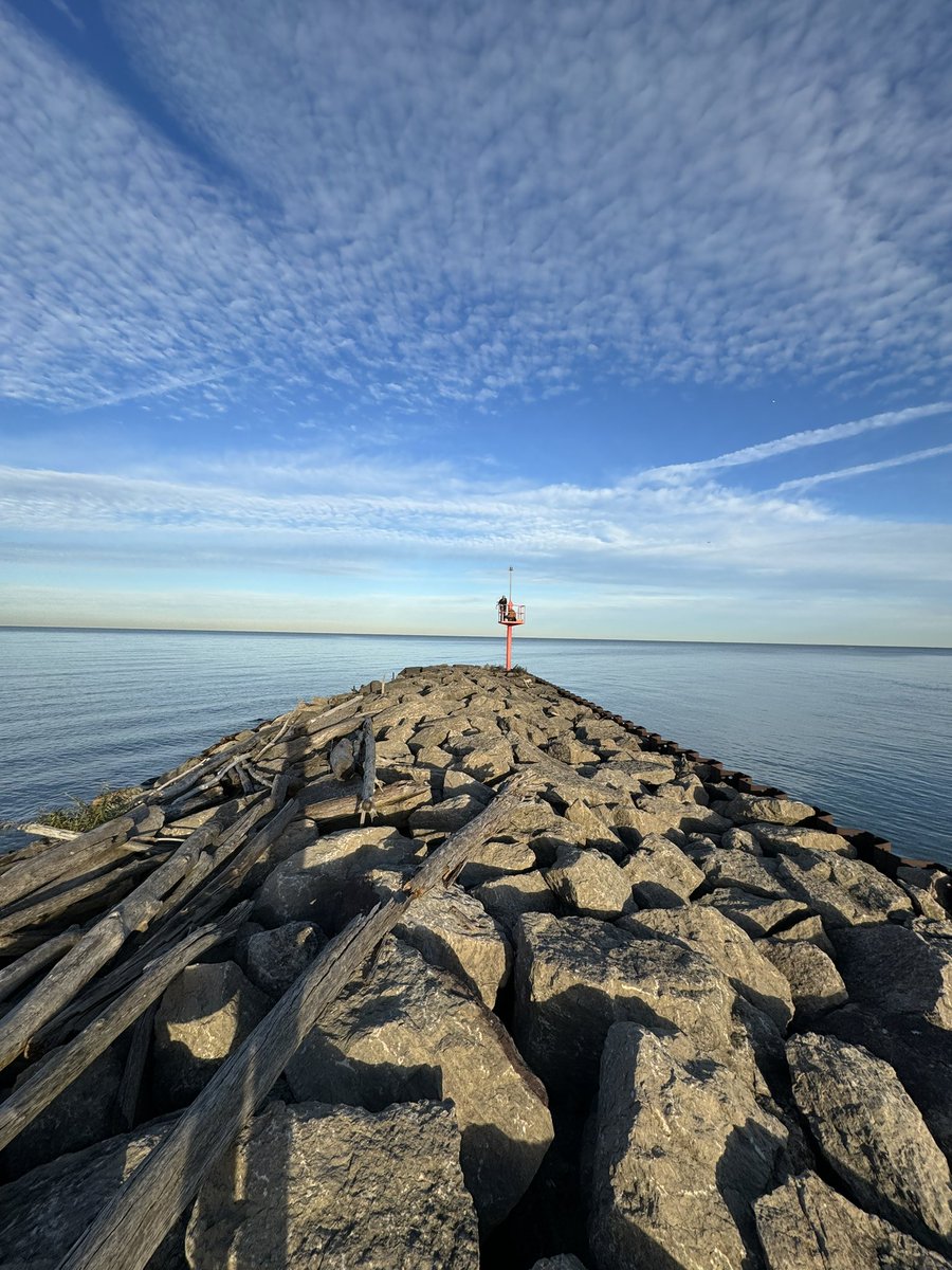
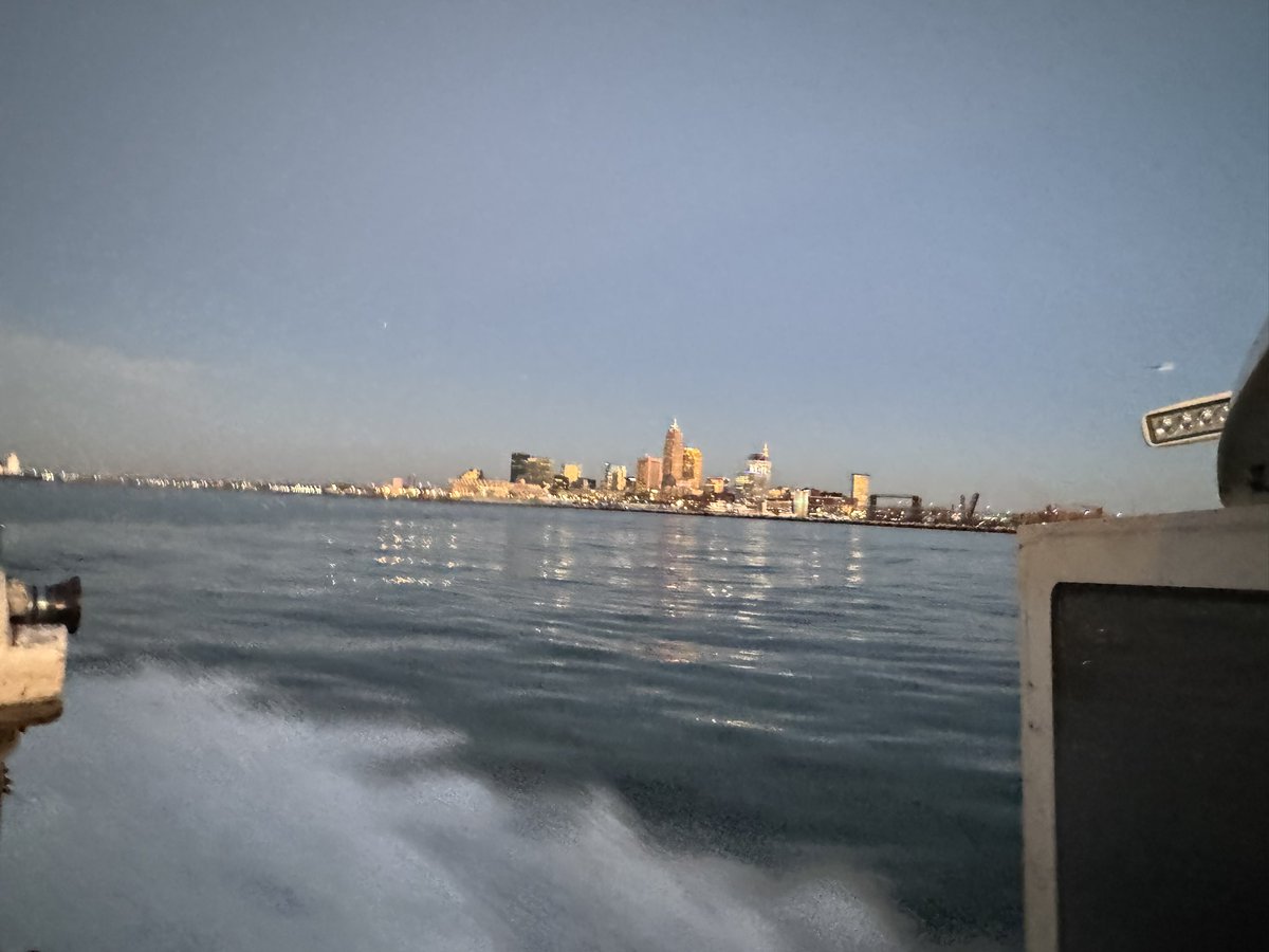
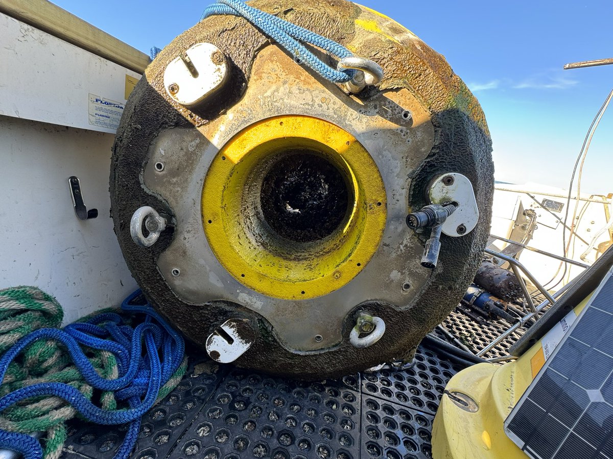
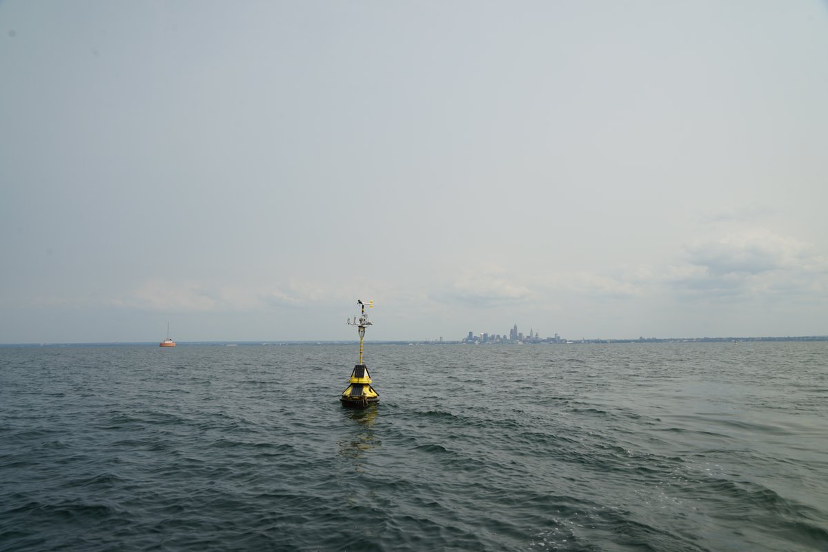
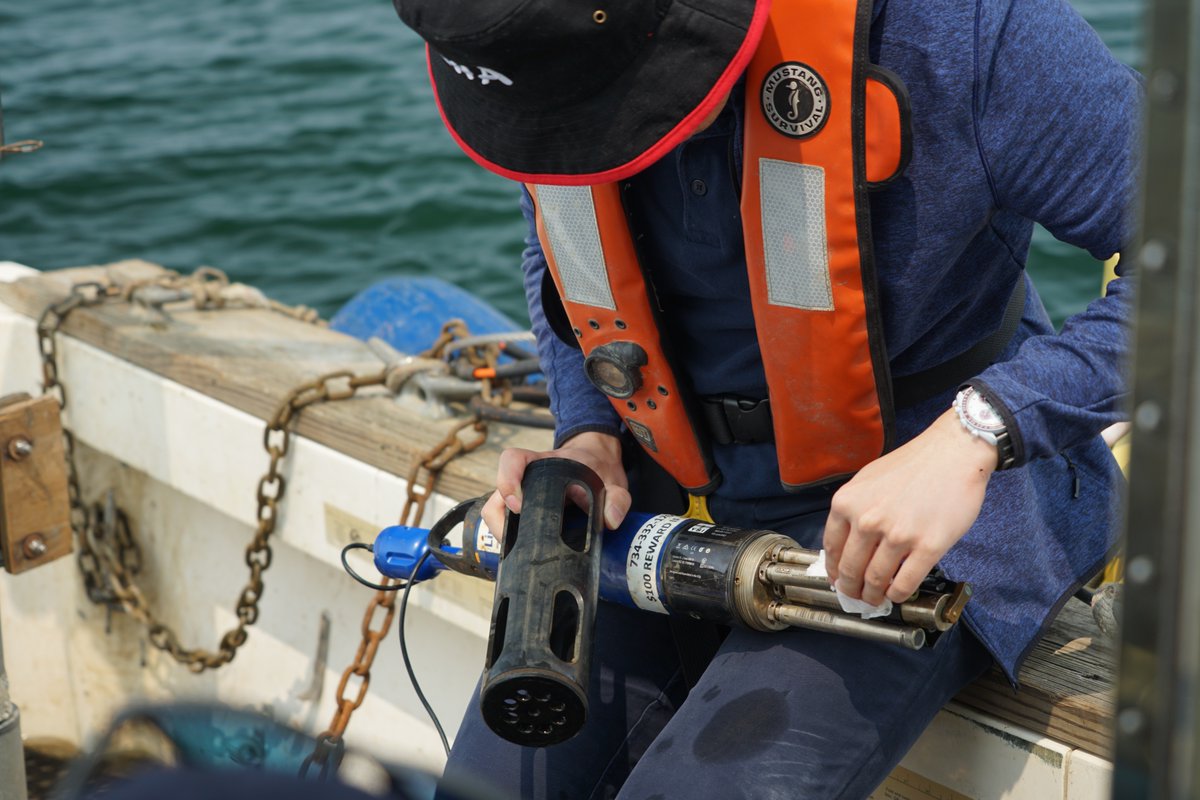
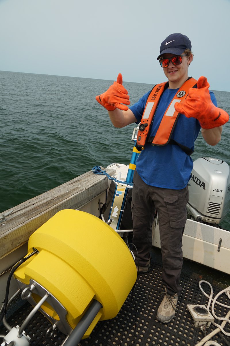
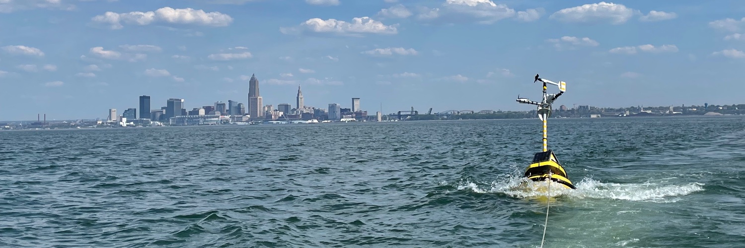
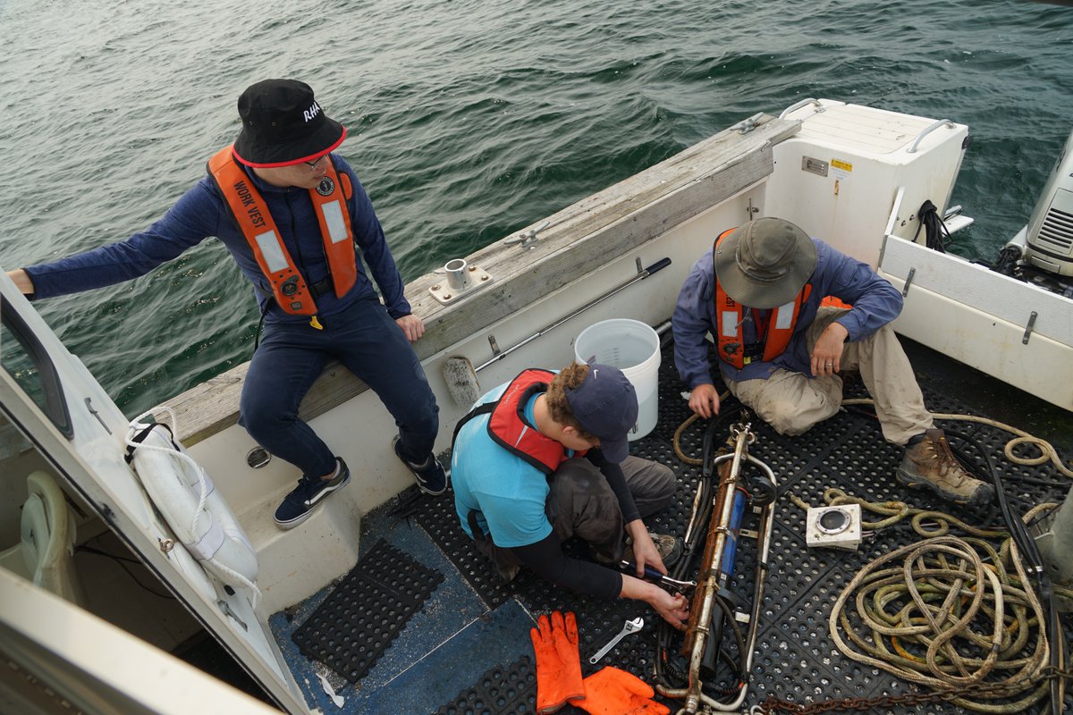
Lake Erie Buoy work completed yesterday: 2 buoys deployed, 4 buoys maintained, 63 mi and 11 hr traveled on Lake Erie. Great weather and calm water. Can't ask for more. Buoy data are available on https://t.co/dlvqCkcpmB. @CLEH2OAlliance@LimnoTech@EddieGreatLakes
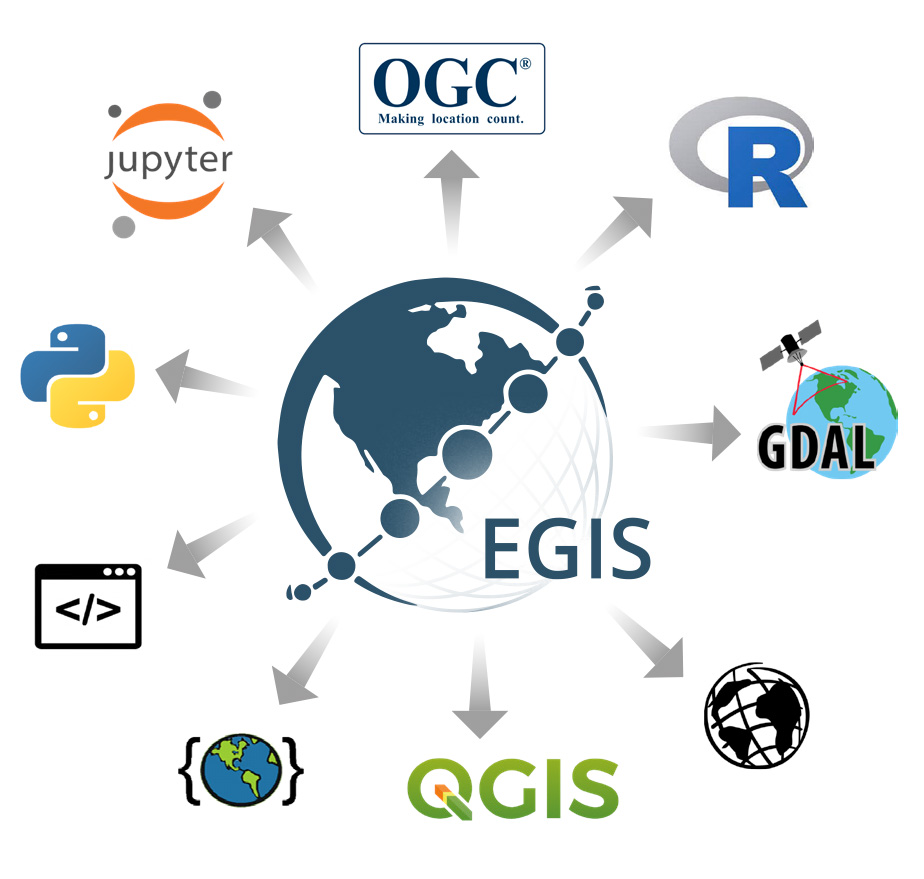
Webinar: Increasing NASA Earth Science Data Accessibility with GIS
Join us on 6/21 at 2pm EDT (UTC/GMT-4) for an intro to @NASAEarth Science Data Systems #GIS initiatives and demos of GIS services you can use in your data workflows.
To register: https://t.co/1eLapskSpz
Did you know that the ocean plays an important role in transporting heat around the planet? It even impacts our global and local climates. Will climate change also impact this global circulation? Read more to find out: https://t.co/UGDIMNMoVt
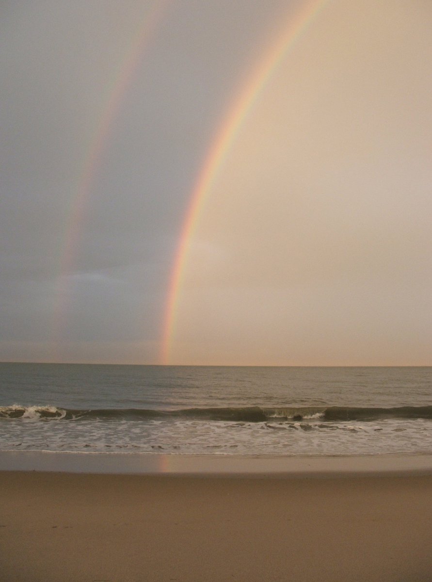
Water Science School - Rainbows (Water and Light)
Are rainbows just a visual illusion or are they real physical aspects of nature.
https://t.co/yEqEyoolW8
#water#education
New detailed analysis by @USGS of bathymetric digital elevation models spanning much of #SFBay reveals a net loss of sediment since the 1980s, highlighting the need for ongoing study of the natural and human-caused changes in sediment volume in the Bay: https://t.co/48vxGhbjhR
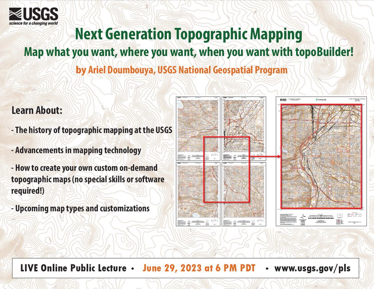
SAVE THE DATE! Thursday June 29, 2023, 6PM PT. USGS Online Public Lecture.
Next Generation Topographic Mapping - Map what you want, where you want, when you want with topoBuilder
By Ariel Doumbouya, USGS National Geospatial Program
https://t.co/jF556nVlxV
#maps#topographic
How #GreatLakes water is used & conserved: https://t.co/lFyjLQZXSX @WPR talks to an expert about how different states are allowed to use the water from the GLs & what protections are in place. 🎙️👂 #GreatLakesNews#GreatLakesInfo#TuesdayTalk
Changing the world always needs volunteers! 🌎 ✋ 💚
From shoreline cleanups to planting trees, we have many volunteer opportunities across the U.S. Join us!
#VolunteersWeek https://t.co/uYCzVXuIcb
Monitoring success of restoration projects is vital. With free for nonprofit tools like #GoogleEarthEngine, and free open scripts from https://t.co/DHYTfy32TA, cost effective yet accurate restoration monitoring at actionable scale (1 m) is now possible.
From our archives: Governments are touting tree-planting projects as a solution to climate change, but these efforts often fail.
In 2012, volunteers in the Philippines planted more than a million mangroves in an hour. But 98 percent of the seedlings died.
https://t.co/JsQIs5Nt3Y
It's #NationalTrailsDay! Join us at Overlook Park today. It's a volunteer day from 9 AM till noon. Afterward, #WalktheWatershed.
https://t.co/2vtXlYG6Al