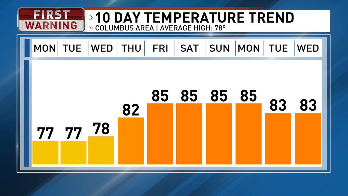
A HEAT ADVISORY has been issued for Tuesday-Thursday due to the heat index reaching triple digits these days. There is an increased risk for heat exhaustion and heat stroke. Stay safe and try to limit time outdoors during this heat wave.
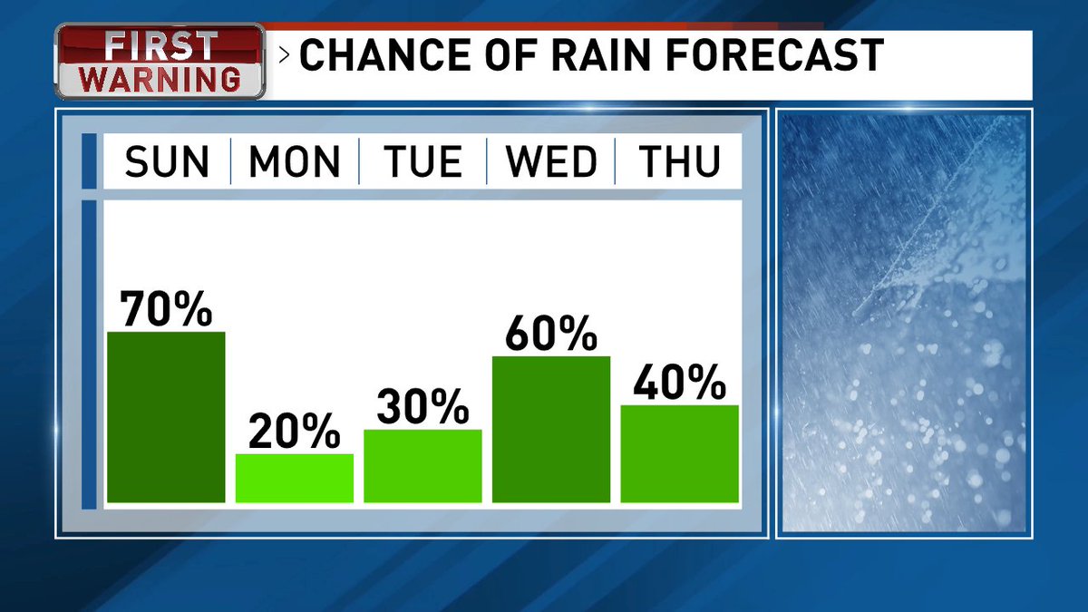
A Flood Watch is in effect until tomorrow morning as excessive rainfall moves through Central Ohio. Flooding of rivers, creeks, streams, and other low-lying and flood-prone locations could be a result.
A streak of heat is on the way to Central Ohio. While it doesn't look to break records, the heat index will be in the upper 90s and 100s during this time.
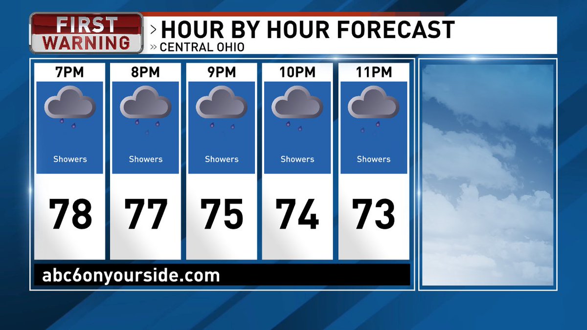
Strong storms will arrive overnight tonight. Damaging winds and heavy downpours are of highest concern. The system has slowed a bit and you may encounter some heavy rain and t-storms out the door Monday morning.
Current SEVERE THUNDERSTORM WARNING for Franklin, Fairfield, and Licking counties until 4:45pm. 60mph wind gusts could cause damage to trees and power lines.
A SEVERE THUNDERSTORM WARNING has been issued for Franklin, Delaware, Madison, and Union counties until 4:15 pm. Expect damaging winds causing damage to trees and power lines.
All of Central Ohio is now in a SEVERE THUNDERSTORM WATCH until 9pm. Damaging winds, hail, and an isolated tornado could impact the area during this time. Stay #weatheraware
Strong storms will bring damaging wind gusts to Central Ohio tomorrow. As of right now this looks to impact the area between 12pm and 7pm. Timing could shift. We will continue to update you.
A FLOOD WATCH is in effect until later tonight for portions of Central Ohio. We do not expect to see wide spread issues, but localized flooding is a concern. Use extra caution if you are in a flood prone area.
Rain will be widespread by tomorrow afternoon leading to wet roads for Memorial Day Weekend travel. It is going to rain through the Memorial Day Holiday.