@Willjum1 Hey I seen your latest underground cave farm video. You can run wiring to the cave from the top, so you don’t have to switch out batteries. It works in like 90% of caves
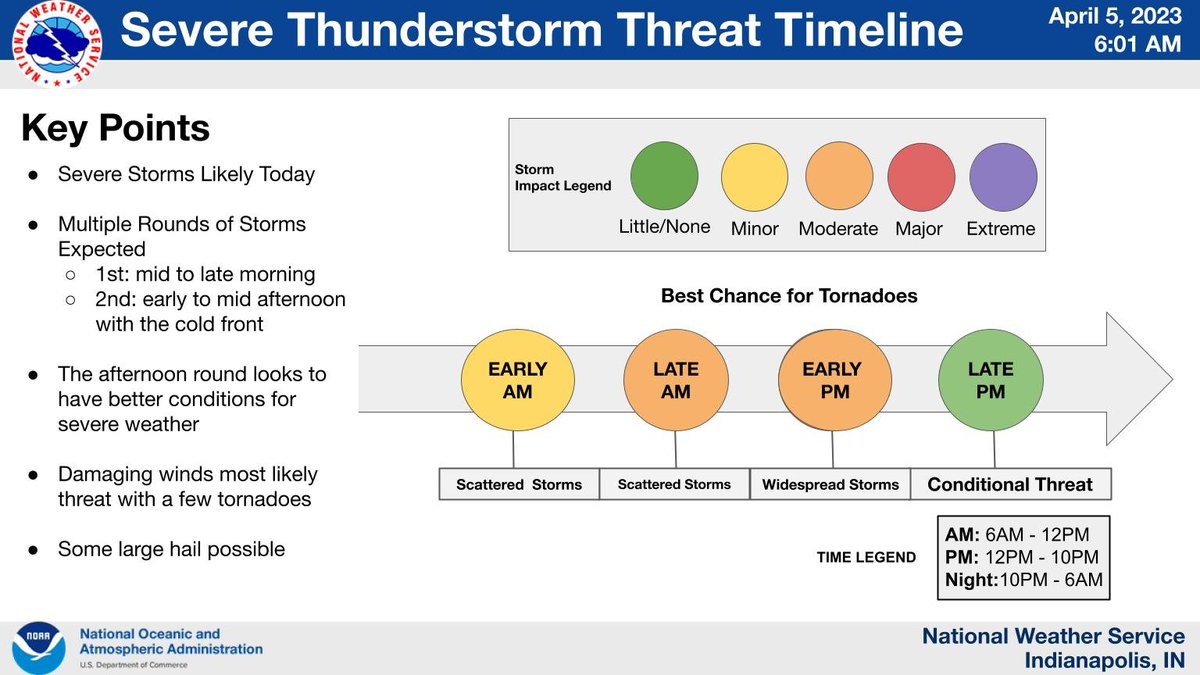
Thunderstorms today will come in multiple rounds with some severe storms possible. The first round will arrive this morning & the second will arrive this afternoon. Damaging winds, tornadoes, and hail will all be possible. Stay alert, have multiple ways to receive warnings #INwx
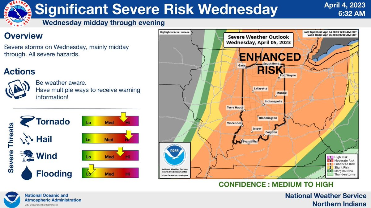
Increasing risk for a severe weather outbreak midday Wednesday through the evening hours. Tornadoes, possibly EF2 or greater, large hail, possibly 2 inches diameter or greater and wind gusts of 60 to 70 mph are also possible. Stay weather aware!
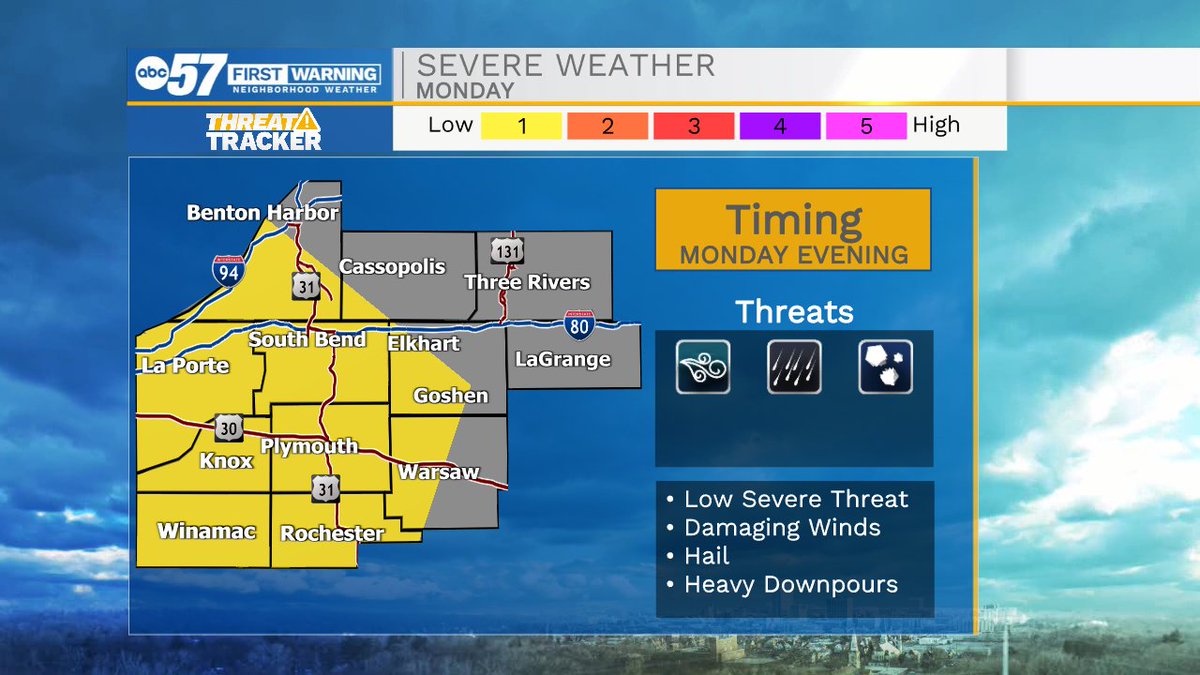
Tomorrow morning a few showers and isolated thunderstorms will roll through Michiana. There is a low severe threat in place for our far southern counties. The rain and storm activity will clear just after lunchtime.
A quick round of showers and storms are moving through Michiana to the southeast. This will not impact local areas for very long, as it is a very thin line.
Storms look to pack a bit of a punch when they arrive here later this evening. Arrival time right now looks to be between 10-11pm this evening. The main threat will be very strong wind gusts up to 70-75mph.
The humidity will slowly decrease throughout the afternoon, bringing comfortable conditions during the heat of the day! Get outside to enjoy the nice weather before heat, humidity, rain, and storm chances all return for the weekend.
There is a flood advisory in effect until 9:15pm this evening for Berrien and western Cass counties. We could see more areas added to this later this evening due to the prolonged heavy downpours. Watch for water on the roadways, especially after dark!
We have seen some decent rain showers today throughout the area, with more on the way for this evening! I am sure farmers are happy to finally see the much-needed rain!
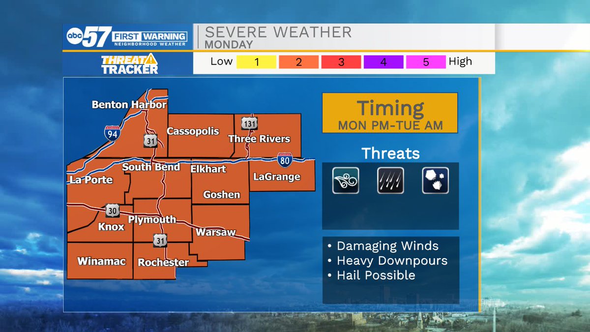
Isolated showers and storms will impact Michiana tomorrow. The strong to severe potential will arrive during the evening hours and linger into early Tuesday morning.
We are tracking more nice weather for tomorrow with plenty of sunshine and average high temperatures. Rain and storm chances return to the forecast Monday evening/night. For now, most storm activity looks to stay sub-severe.