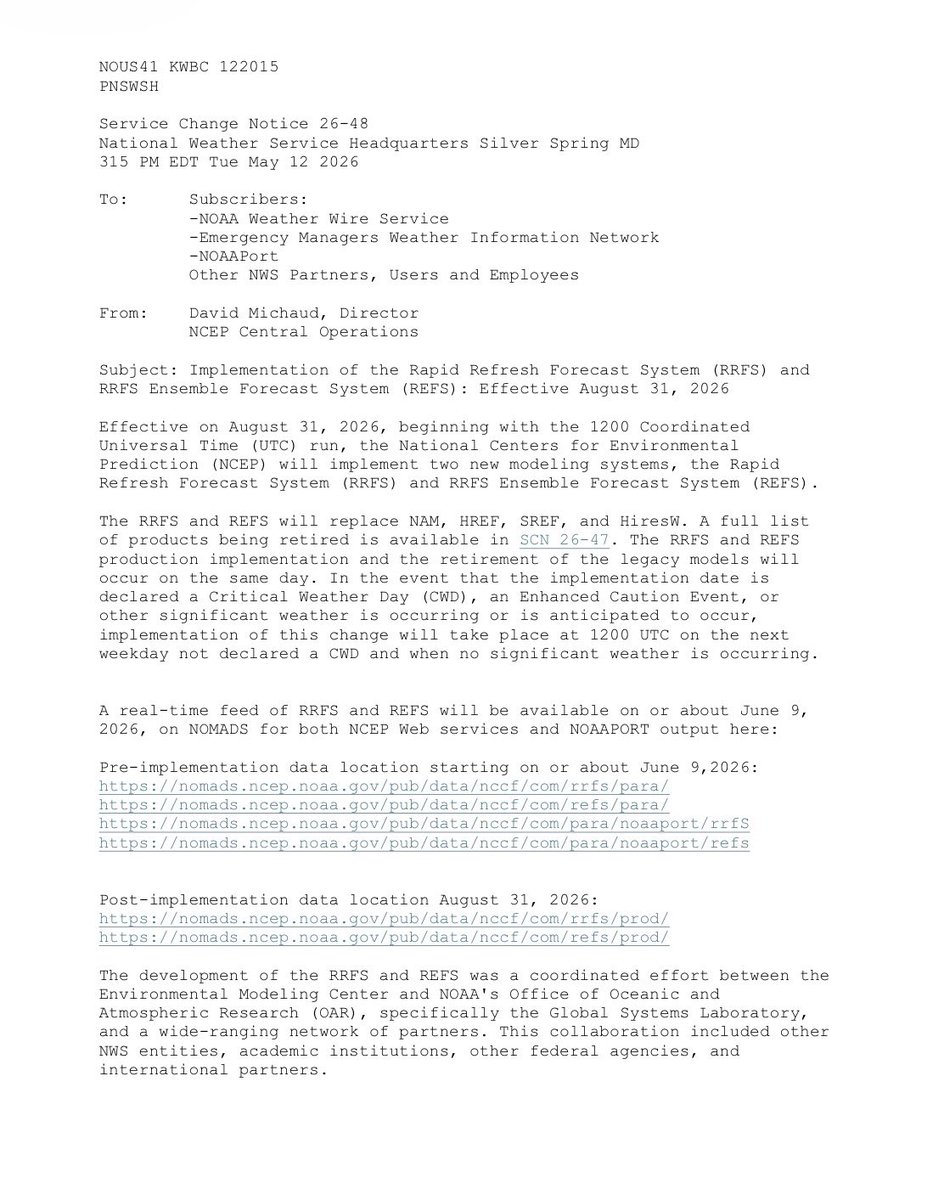
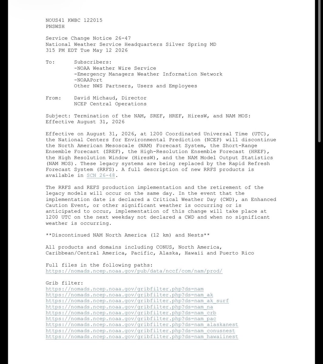
New AMS statement responds to a proposed OMB rule that would restructure federal grantmaking. The rule "would damage the nation’s ability to understand, predict, and respond to ... natural hazards with negative impacts on public safety and the economy."
🔗https://t.co/n26VNtnVPu
Shout out to @CIRA_CSU for finding one of the cooler satellite animations I've seen in a minute.
Outflows and gravity waves gliding over Lake Superior.
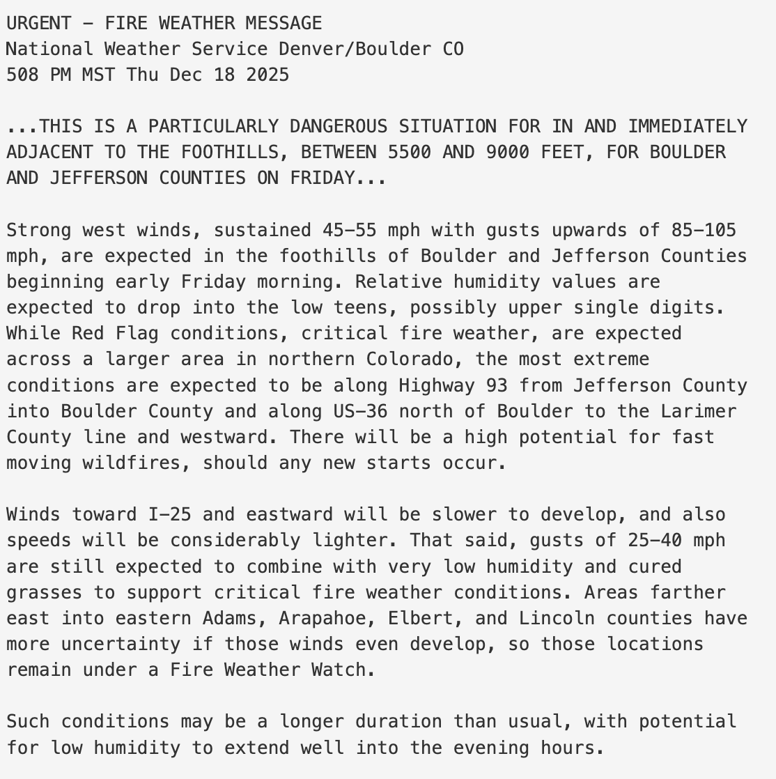
NWS in Boulder, CO has just issued a rare "Particularly Dangerous Situation" (PDS) Red Flag Warning for extreme fire weather risk on Friday. Historically, PDS RFW issuances (including in California) have pinpointed days on which the most dangerous wildfires have occurred. #COwx
For non-mets that care about continued improvement in weather forecasting and modeling, speaking out about the NCAR situation is important. The NOAA issues earlier this year were troubling but budgetary. This is more sinister in nature. What you can do: https://t.co/MznNhWc3P1
NCAR is essentially its own cog in the climate AND weather community wheel. The structure of NCAR is one of the backbones of weather research in this country.
American computer models for weather forecasting/the GFS have consistently fallen further behind the Europeans/ECMWF as time has gone on.
Breaking up NCAR is only going to greatly exacerbate this longstanding & ever growing issue.
NCAR does **way** more than climate research
This would be an extremely short-sighted move. NCAR is a world-class organization, and a leader in atmospheric science. And it's not as simple as "splitting up" the weather and climate portfolio. Seasonal/decadal (ENSO) and subseasonal (MJO) things that fall under the climate spectrum are hugely important to weather prediction and economic activity.
https://t.co/ylirdwkz4j
Unbelievable. This would be a terrible blow to American science, writ large. It would decimate not only climate research, but also the kind of weather, wildfire, & disaster research underpinning half a century of progress in prediction, early warning, & increased resilience.
Finally!
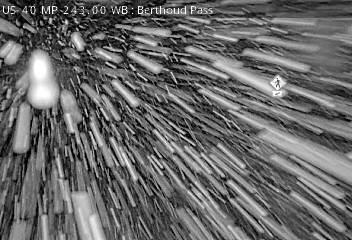
But take it easy if traveling in the mountains tonight to early Saturday morning. This heavier snow shower affecting Berthoud Pass sinking south to the I-70 mountain corridor through 1030-11 pm. #COwx
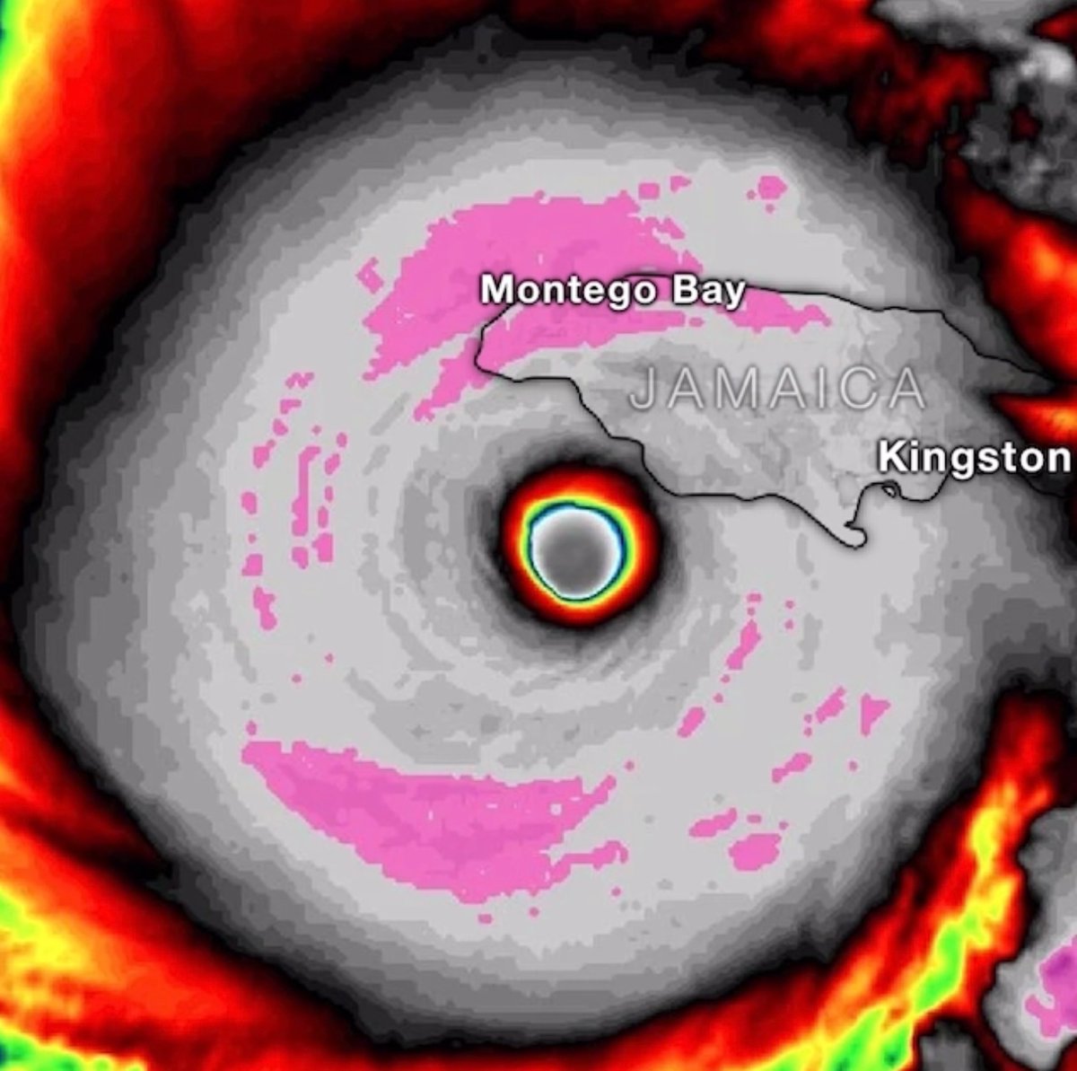
It’s official. The 252 MPH gust observed in Hurricane Melissa, moments before she made landfall in Jamaica, is the STRONGEST wind gust ever recorded by a Hurricane Hunter dropsonde on Earth.
It is almost unreal how extreme this storm was.
This footage from inside the eye of Category 5 Hurricane Melissa might be the most jaw-dropping video ever captured of a hurricane’s eye, showcasing the infamous “stadium effect."
This is unbelievably bad.
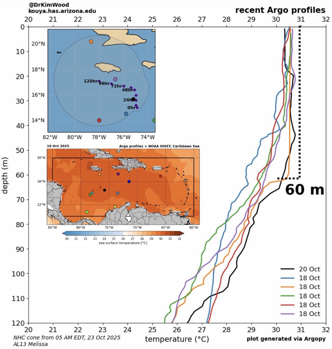
The warmth of the waters in the Caribbean Sea extends so deep that Melissa could remain stationary for days and still not upwell cooler water — 30°C over a layer extending down to 50 meters or more. This thing will basically have endless ocean fuel.