Springtime weather is melting the ice covering Hudson Bay in Canada, causing it to shift and recede from the shorelines.
@NOAA’s JPSS satellites captured this changing view from April 14 to May 3, 2026.
Credit: NOAA/@CIRA_CSU
It's #WhereInTheWorld Wednesday!
This peninsula in Wisconsin, seen by #NOAA21 on April 22, 2026, separates the southern part of the Green Bay from Lake Michigan. It is named after a treacherous water passage called "Porte Des Morts" that lies off the tip, where currents from the bay and lake converge.
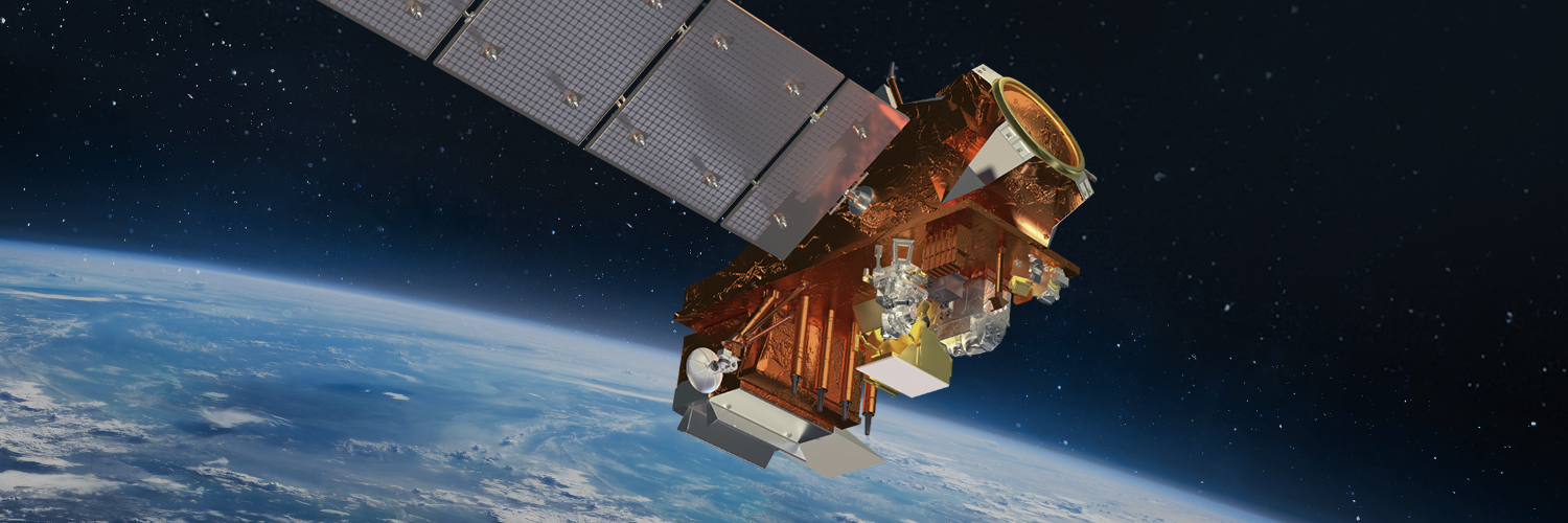
A new milestone for @NOAA’s upcoming #JPSS4 satellite has been reached with the successful integration of Libera, a @NASA-funded instrument built by @LASPatCU!
Libera will help measure reflected solar energy and heat emitted by Earth.
Learn more: https://t.co/ZAwYMrxkeS
Time for another #WhereInTheWorld Wednesday!
On April 21, 2026, the #NOAA21 🛰️ captured an image of this lake. It has been dry for most of recorded history, and was once connected to two other lakes during the Late Pleistocene. Though no one has seen that ancient body of water in modern times, geologists call it Lake Bonneville.
.@NOAA’s JPSS satellites captured the exhaust plume from a SpaceX Falcon 9 rocket launch over Cape Canaveral, Florida, on the night of April 21, 2026.
Using the #VIIRS Day/Night Band, the satellites showed the bright plume trailing over the Atlantic.
Happy #EarthDay! 🌎✨
In this view of Earth from April 21, 2026, #NOAA21 is helping keep watch from above. Orbiting pole to pole 14 times a day, @NOAA’s JPSS satellites provide full global coverage twice daily and support U.S. weather forecasting and severe weather monitoring.
Happy #EarthDay from @NOAA Satellites! 🌎
Since 1970, our satellites have watched over our planet, capturing its beauty and power from above. 🛰️
For #EarthDay2026, we celebrate our stunning, dynamic home—and the science that helps us better understand and protect it.
See our world from a different perspective in our #EarthFromOrbit video: https://t.co/1j5tym8uG9
#EarthDayNOAA
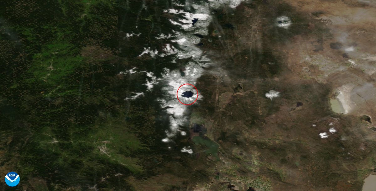
Get ready for another #WhereInTheWorld Wednesday!
Sometimes, when we look down at Earth with our satellites, it looks back!
On April 18, 2026, the #NOAA20🛰️engaged in a staring contest with this eye-shaped lake. It also happens to be the deepest lake in the United States, with a depth of nearly 2,000 feet. To add to all the whimsy, the “pupil” is known as Wizard Island!
Earth isn’t just getting brighter—some areas are brightening and others are dimming because of changes in nighttime lights.
The finding comes from analyzing 1.16 million NASA satellite images taken every night for nine years.
It's #WhereInTheWorld Wednesday!
This image taken by #NOAA21 on April 11, 2026, features the largest island in Lake Michigan. With a permanent population of around 700, it is a popular spot for golfing and hiking.
Springtime brings a greener view. 🌳
See how @NOAA’s JPSS satellites tracked seasonal greening across North America from December 2025 to March 2026 with the Normalized Difference Vegetation Index (NDVI).
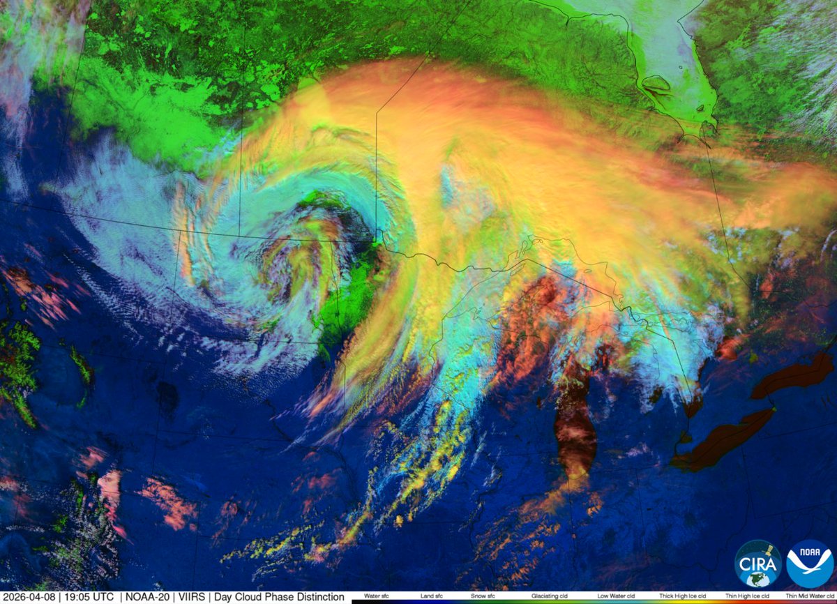
A clipper system moving across North America was seen by the #NOAA20 satellite on April 8, 2026.
This enhanced-color view shows the storm’s cloud structure as it brought wind, cooler temperatures, and snow to the Northern Plains and southern Canada. 🌨️
Credit: NOAA/@CIRA_CSU
It's #WhereInTheWorld Wednesday!
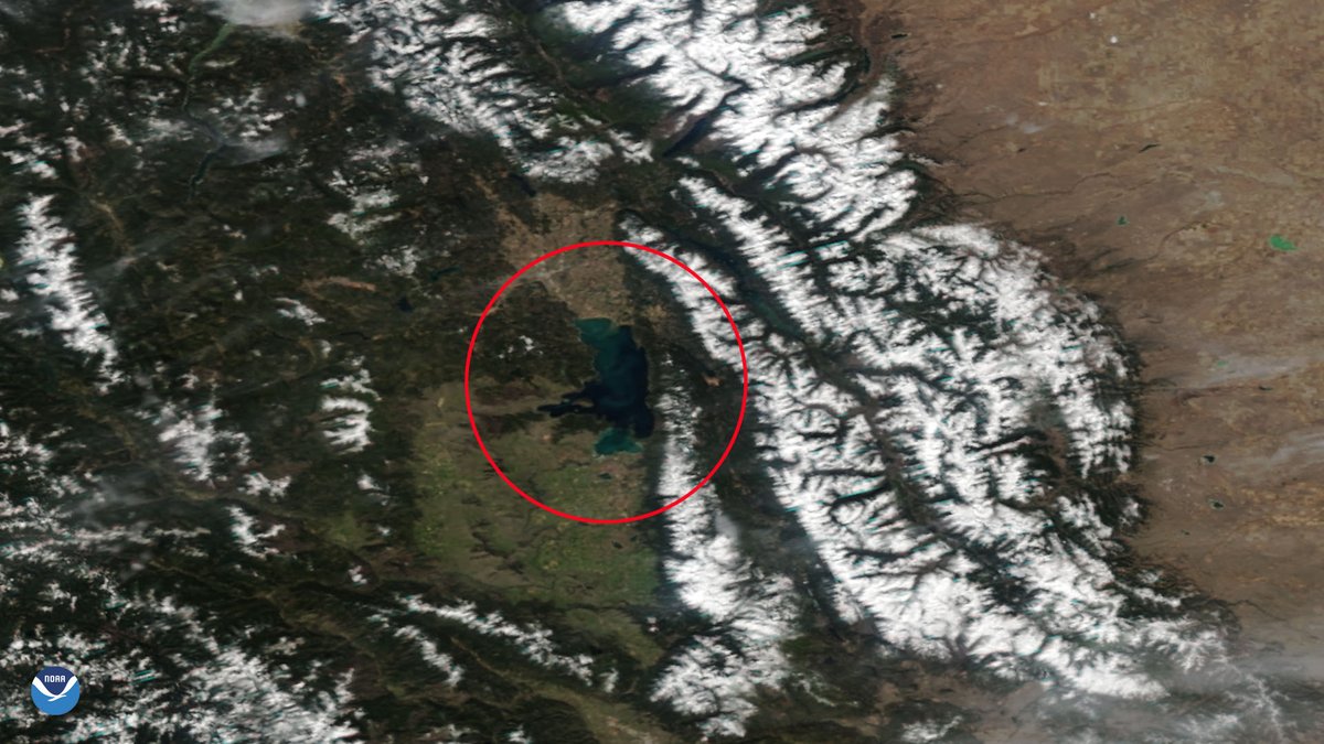
On April 6, 2026, the #NOAA21 🛰️ captured this beautiful image of the largest freshwater lake west of the Mississippi River in the contiguous United States. Carved by ancient glaciers, this deep lake rarely freezes entirely due to its constantly moving water.
It's #WhereInTheWorld Wednesday!
On March 9, 2026, the #NOAA20 🛰️ spotted this icy bay within Lake Huron that forms the space between Michigan's "thumb" region and the rest of the state's lower peninsula.
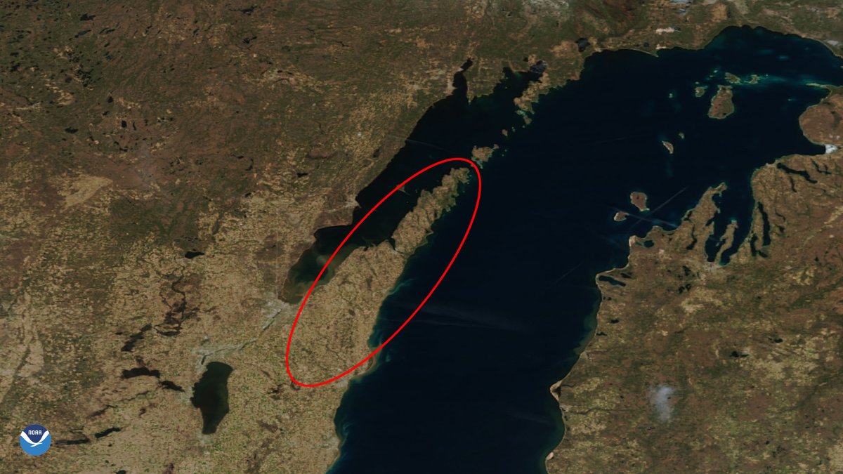
As April draws near, we are looking at how ice cover on Lake Superior changed throughout the month of March. Imagery captured on clearer days from @NOAA's @JPSSProgram satellites shows the lake ice sloshing around the lake and shifting along the shoreline.
#TimelapseTuesday
All equally compelling and evenly matched, the Top Four in the #NOAASatelliteShowdown highlight how satellite observations help keep us safe and weather forecasts informed.
Voting is open! 🗳️
Comment the letter of your favorite team below.
Fan favorite announced Friday!
A) Team Dust Storm
B) Team Atmospheric River
C) Team Kilauea
D) Team Aurora
All 16 contenders are in! 🌎
Every satellite view in #NOAASatelliteShowdown is now posted, and your likes count as votes.
The Top Four are revealed Monday!
River ice jams can block rivers like a temporary dam, increasing flood risk.
@NOAA’s JPSS satellites provide near real-time maps of river ice and flooding using #VIIRS flood products to help forecasters track changing conditions.
Read more: https://t.co/4uVTuffQyL