BOOOOOOOOMER SOOOOOOOOONER! The Sooners beat the #1 Team In the Nation. Oklahoma BEAT Texas 27-24. INCREDIBLE. It has been difficult being a Sooner fan, but this is INCREDIBLE!!!!!! I CAN'T BELIEVE IT!!! #Sooners#Oklahoma
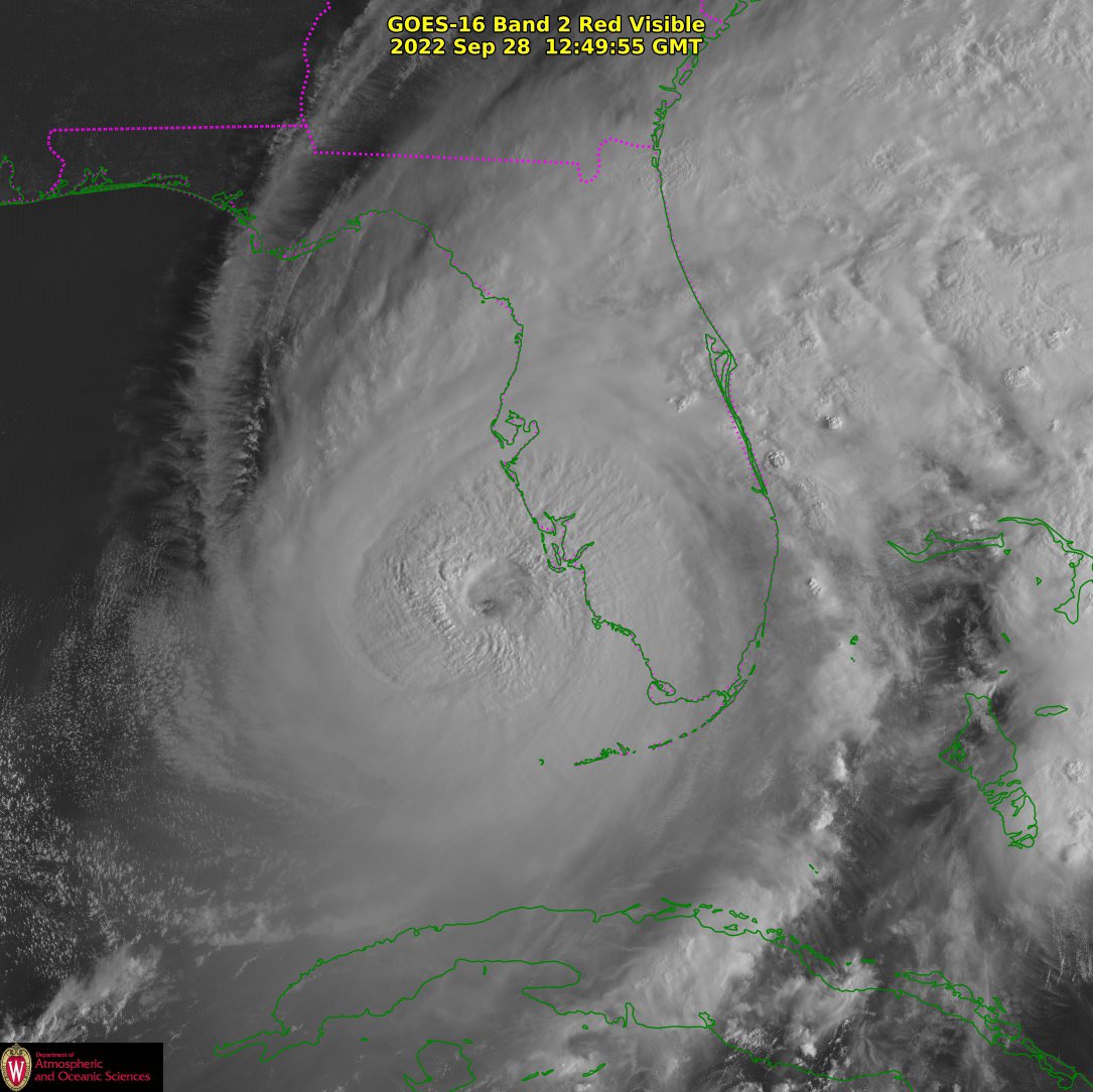
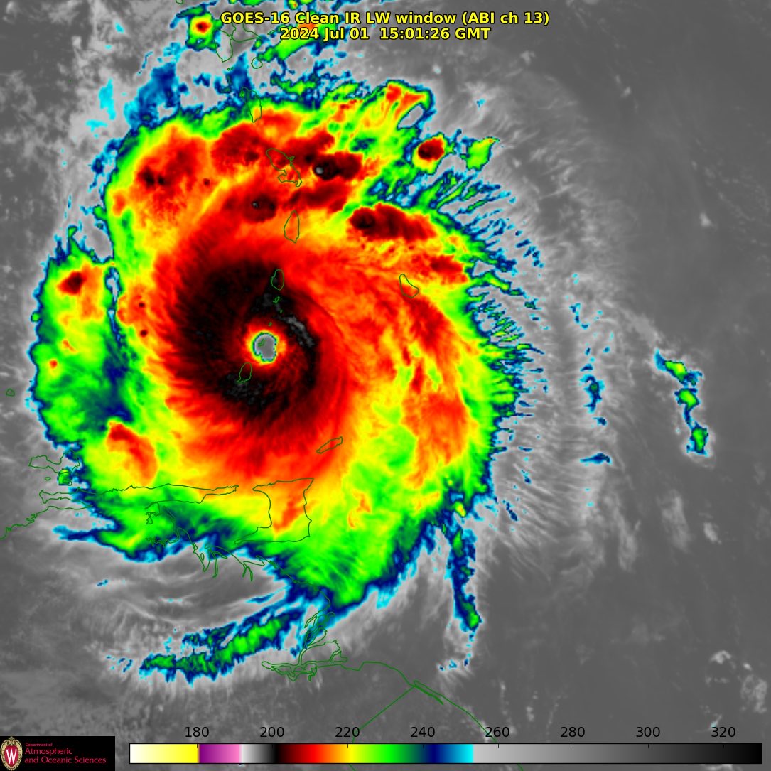
Wow! This is incredible! We are looking at the eye wall. Inside the eye, the winds are anywhere from calm to 25 mph or so. Then just outside the eye wall and in the wall, the winds are gusting to 200 mph.
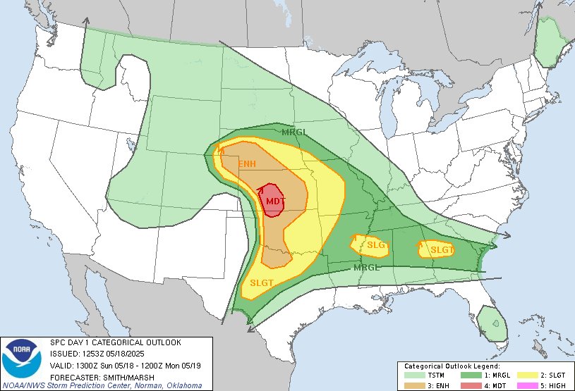
TORNADO, GORILLA HAIL & DERECHO WIND BAG THREAT THIS AFTERNOON AND NIGHT
Intense supercells are forecast to fire in the Oklahoma and Texas Panhandles around 3-4 pm capable of 5-6 inch diameter hail and #tornado production! These supercells will cause major problems as they push into western Oklahoma this evening, before evolving into a fast-moving bow echo capable of producing 100-120 mph winds, stronger in embedded tornado vortices. This line could impact the OKC and DFW areas tonight!
Full blown Dominator intercept mode today as we are meeting up with Andrew for our new anemometer.
Stay tuned to watches and warnings in the risk area!
Thank you @PettusWX for dominating these graphics
There is a level 4 out of 5 risk later today into tonight centered over southwestern Kansas. These maps are from the Storm Prediction Center, and they are showing a 15% probability of a strong to violent tornado happening within 25 miles of any spot over this risk area. This is a significant risk. The thunderstorms that form will head northeast towards eastern Kansas and western Missouri and we will monitor them very closely. #LRC #severeweather
THE WIDEST TORNADO IN IOWA STATE HISTORY
Here you can see the mega wedge #tornado cyclone near Essex, Iowa a few nights ago with a width of nearly 1.8 miles. The diameter of the massive tornado cyclone is estimated with the yellow bars. This tornado was rated EF1
(1/5) So we've hammered home that it will be just a weeee bit windy. Okay, a lota bit windy.
But what about the snow potential, let alone the 𝗯𝗹𝗶𝘇𝘇𝗮𝗿𝗱 𝘄𝗮𝗿𝗻𝗶𝗻𝗴 for parts of NW Missouri/NE Kansas and areas northward? Great question...
This is horrible news for numerical weather prediction in this country.
The data that comes from these key parts of our weather enterprise saves lives.
DOGE moves to cancel NOAA leases on key weather buildings https://t.co/QJ71pdsd1A
Severe weather is likely next week, another long range prediction verifying from Weather 20/20. The Severe Weather Forecast Guide is out predicting when and where severe weather will strike to help you plan. Secure your seat in our webinar and start planning now by getting your hands on this guide. Here is the link: https://t.co/v2RavPOrao and here is the link to the press release: https://t.co/9D0jh2Mqzn
Not just twin waterspouts but triplets dancing around each other off Palm Beach, Florida. This was caught by a Palm Beach Police Department cam this afternoon.
The far outer band of the remnants of Hurricane Beryl. @JeffPennerKSHB took this picture over Overland Park. It has a tropical downpour from this outer band! Wow!
Happy #Mabon / Autumn Equinox
A time to thank the waning sun for the harvest bestowed on us 🌾
Today Day & Night are again equal on the journey through the wheel of the year.
The return to darkness begins & the cycle of the natural world moves towards completion 🖤
Eyewall penetration of Hurricane #Fiona this morning. Not the prettiest eye, and not even the roughest eyewall. Still a great flight! Lots of data collected.
Follow @NHC_Atlantic and @NOAA_HurrHunter for official updates on any and all Atlantic tropical cyclones.
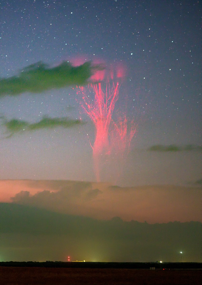
Bucketlist capture early this morning over Kansas. After thousands of hours with TLE's , finally a Giagantic Jet- still in disbelief. It also may be the furthest north ever captured- lots of analysis to do on this one. #kswx#okwx@NASAEarth