A downburst with damaging wind gusts impacted northeast Norman earlier this evening. Here’s a radar animation from the KTLX WSR-88D of reflectivity and velocity of the nearly stationary thunderstorm that produced the downburst: #okwx
Impressive 4-hour loop of the MCS that rolled through Northeast Oklahoma this evening. Widespread wind reports of 60-70 MPH gusts. Scattered damage reports are also filtering in.
#wxtwitter#severewx#okwx
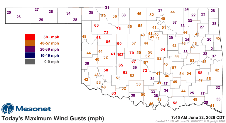
After discussions with the Storm Prediction Center, the line of storms that moved through the area late last night into early this morning will be preliminarily classified as a Derecho. Here is a little more information as to what that means: