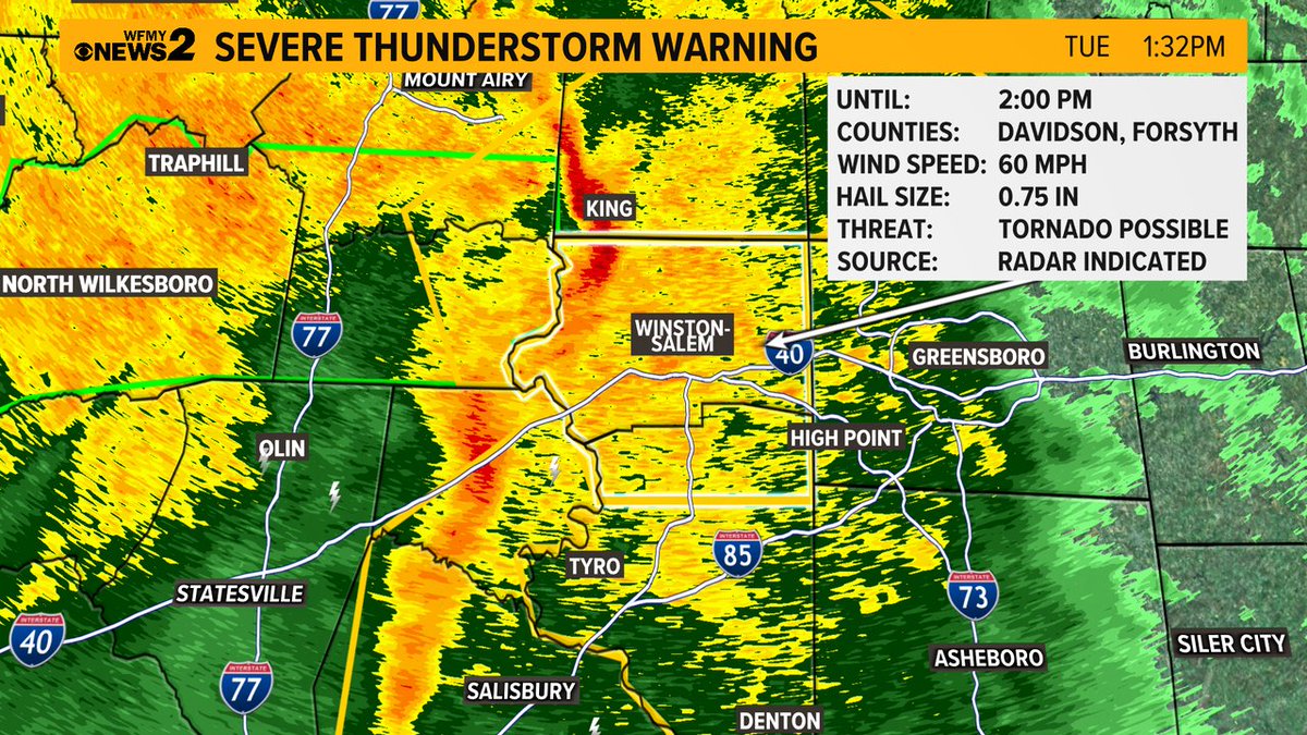
1:30PM -- Severe Thunderstorm Warning for very high winds in Forsyth and Davidson Counties. NWS has said it's possible a tornado could form in this cell. Be inside as it passes for 60 mph gusts. Moving east.
Klaussner closing: Who knew it was happening & when? The WARN Act requires companies to alert employees & others 60 days ahead of closing. Klaussner's letter came on the day of the shutdown. #2WTK#Klaussner#shutdown https://t.co/eN9lu2Sfcc via @WFMY
THURSDAY:
A line of showers/storms are possible Thursday between about 8A-12P for the Piedmont. A couple may be strong or severe with damaging wind.
Yes, this is different than we normally think about for timing. It's in and out pretty quick, clearing out some for the evening.
Please welcome @LaurenColemanTV as she joins our GMS family! I’m so excited she’s moving up from the evenings with us. She’ll fit right in with our antics LOL. Today is her first day with the c
I’m covering the evening shows so I’ll catch you a little later on. @WFMY
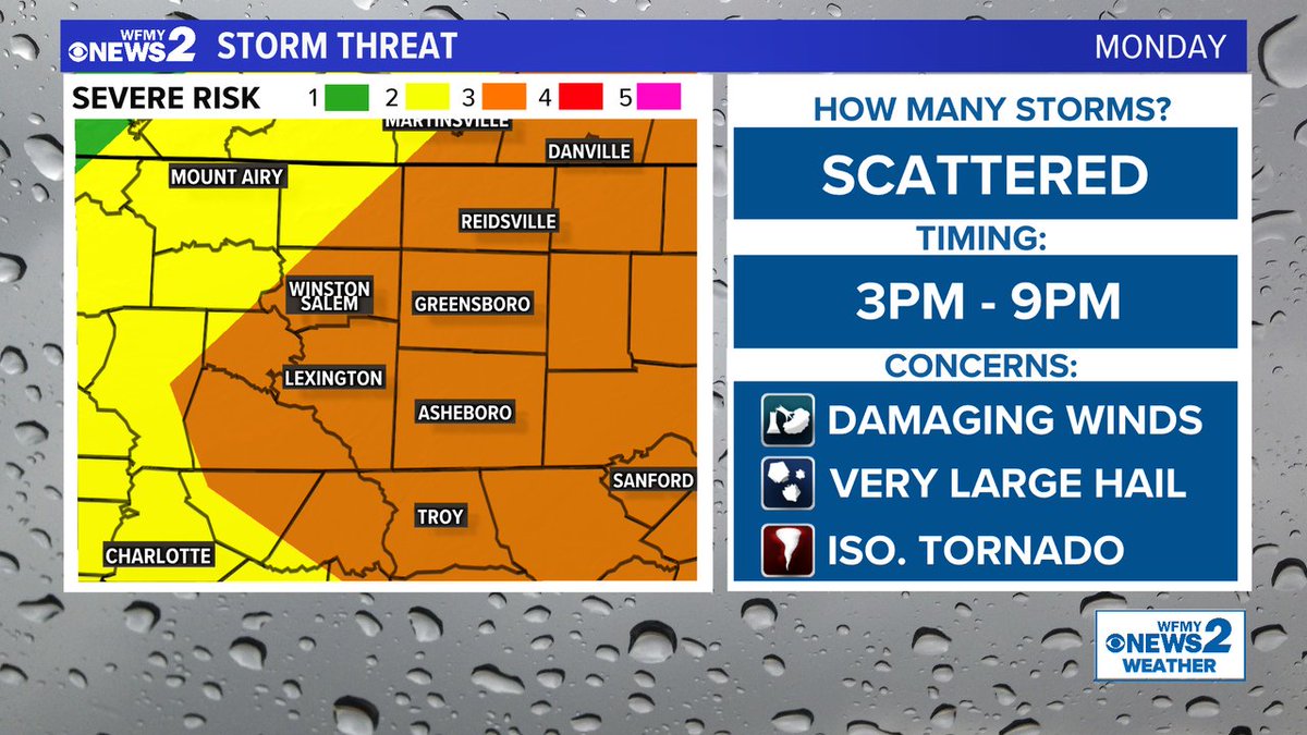
TODAY: Nasty storms are *possible* this evening, but not a guarantee for all.
Notice that we are saying "scattered" storms because not everybody will see one.
However, the storms that do form could produce very large hail and damaging wind gusts.
3pm west to 9pm east.
MONDAY: Severe Thunderstorms are very likely for the afternoon and evening across North Carolina. We need to be prepapred for damaging wind gusts, hail, and can't completely rule out a tornado. Timing is 3pm to 9pm roughly for our area.
This week is going to be a doozy.
It won't rain all the time, but round of heavy rain are possible each day - starting Monday.
In total, our area could end up with between 3-6 inches of rain.
12:15 - Line of torrential rain and thunderstorms slowly moving east. In Forsyth now, moving toward Guilford in the next hour. Mostly rain and lightning but gusty winds possible at times too.