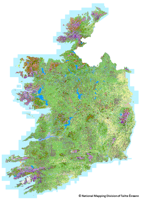
EPA and @TailteEireann have launched a National Land Cover Map of Ireland that categorises over 10 million landscape features for the 1st time. It'll help the govt & organisations better understand (and act on) development, habitat loss & climate change. https://t.co/5Y7qSD6rsy
@stephenbarry01 @Irishwildlife@IrishEnvNet@agriculture_ie We did use LPIS to map agri areas in Corine, the coarse resolution means anything smaller than 25h is generalised though.
EPA has launched CORINE 2018 land cover data for Ireland at #IEOS2018. Produced under Copernicus Land Monitoring Service @CopernicusLand for @EUEnvironment. View & download at https://t.co/36wG5aZWlS
@OrdnanceIreland have announced details of a national landcover mapping project at #IEOS2018. This great initiative will be supported by @EPAIreland and the National Landcover Working Group.
Ooh la lal. Peeps in #FlSen & #SCSen you have given all the money to all the people you Hate in #NYC, Frisco. Boston, LA and the Hamptons in New York. We don't give a damn about Muami they are always #makingDeals anways.#BecauseOfHim and #BecauseOf#GOP. https://t.co/SFqLzRA1ZF
The reluctant witness testified at a September hearing that Morehead had told his attorney “if he got in the prosecutor’s way, she would get in his way on his case.”
https://t.co/4KDo3b74uO