A SEVERE THUNDERSTORM WARNING is in effect until 5 a.m. for O'Brien and Nobles Counties.
Hazard: 70 mph winds
A line of storms is making its way into Northwest Iowa and Southwest Minnesota as of 4:30 a.m. moving southeast at 60 mph.
A SEVERE THUNDERSTORM WARNING is in effect until 6:15 a.m. for Clay, Dickinson, Jackson, Nobles, O'Brien and Osceola Counties for winds up to 60 mph.
At 5:40 a.m. a line of severe thunderstorms was located from around Lake Wilson to Paullina moving northeast at 55 mph.
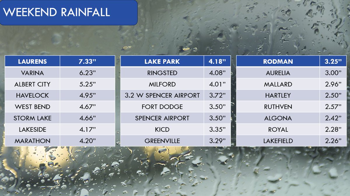
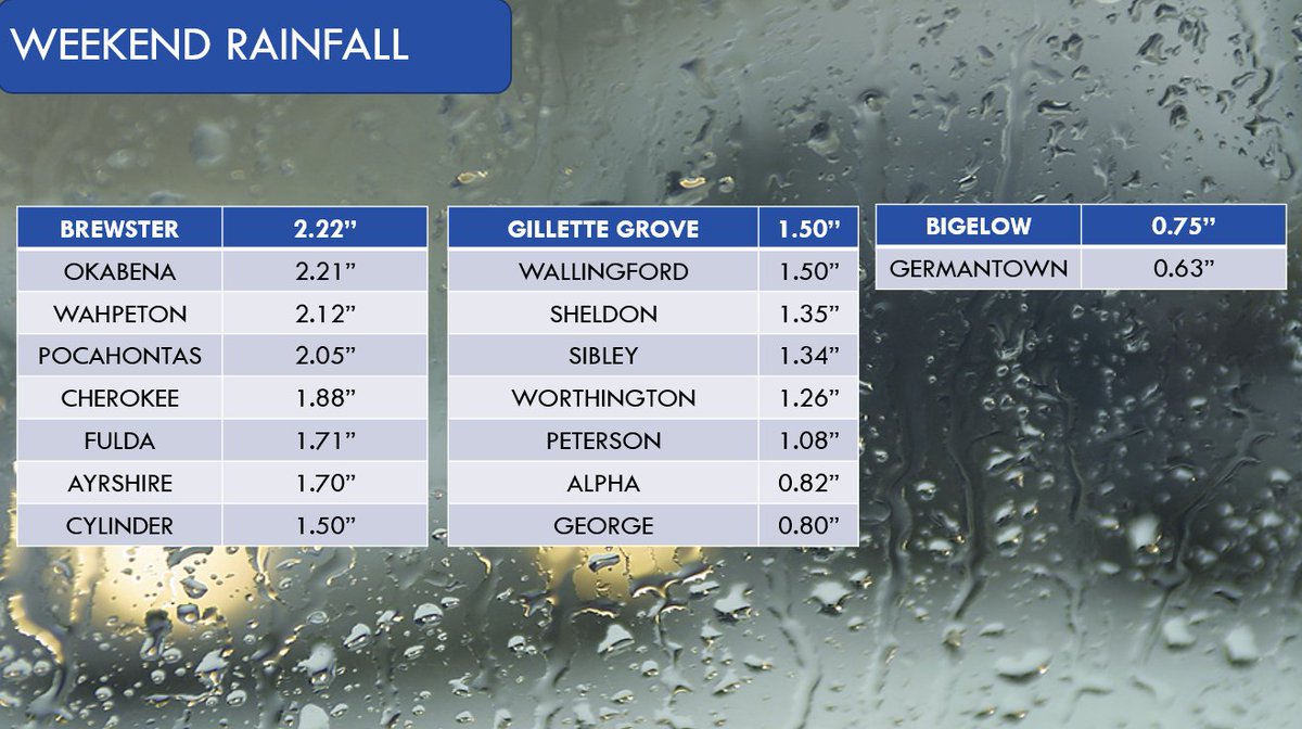
It looks as though Mother Nature was as tired of the drought across Northwest Iowa as we were and did as much as possible to end it over the weekend.
The totals below mostly reflect numbers from Friday through Sunday morning, however some locations have not yet updated.
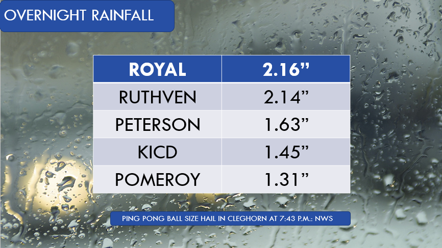
Rainfall was significant in parts of the area with thunderstorm activity overnight. The numbers below include the mostly lower totals from Wednesday morning. See the full list at https://t.co/78RGnA9lfp .
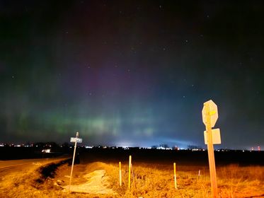
The Northern Lights made a fairly rare appearance over the area Thursday night. Ashley sent us these photos from Spencer.
If you see any cool or interesting weather phenomena, send your photos to [email protected].
A WINTER WEATHER ADVISORY will be in effect from 9 a.m. to 9 p.m. Thursday for Dickinson, Jackson, Nobles, O'Brien and Osceola Counties.
The biggest variable with this system is going to be temperature as the system moves in which will determine precipitation type.