TRAGIC TORNADO: The Appleton, WI tornado was likely based of Doppler radar an EF3 or EF4. There has been 24 EF3+ tornadoes ever recorded in Wisconsin during the month of July.
It’s going to be the first EF3+ tornado in the state during July since 1994.
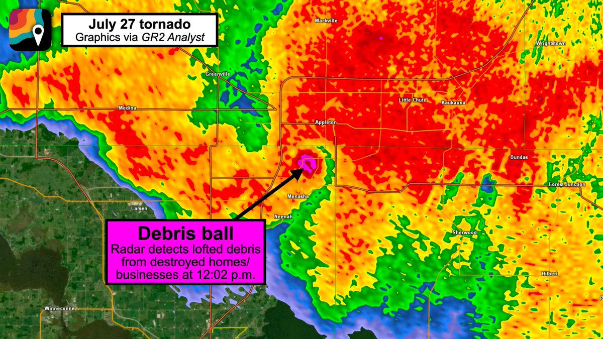
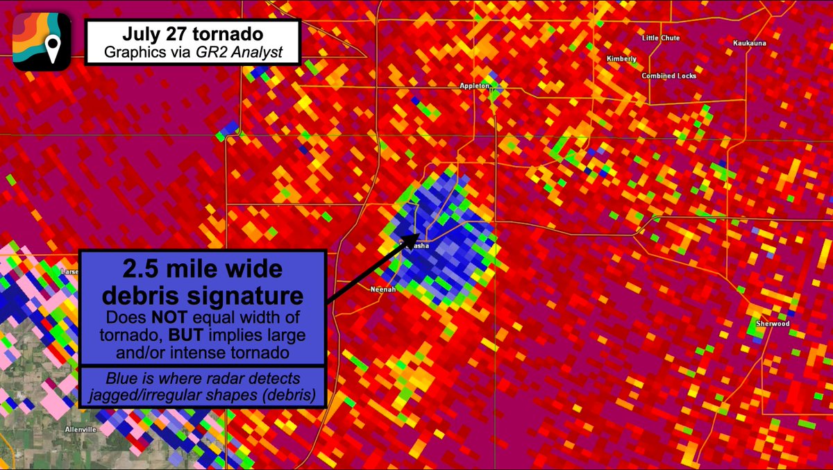
The debris ball just after 12pm CDT was over 2 miles large, but the tornado actually smaller than that.
Today was only an SPC “marginal” Level 1 risk going into the day in these areas. A reminder that big tornadoes can happen on lower outlooked days.
BREAKING: Appleton/Menasha tornado WAS LIKELY AN EF3, perhaps nearing EF4. Maximum winds probably 140 to 160+ mph!
Radar analysis suggests the tornado quickly formed between 11:55 a.m. and 11:59 a.m. somewhere near or just east of the railyards off West 2nd Street, then passing near Xavier High School and Prospect Avenue before crossing the Fox River. It then passed over U.S. 10, near the Menasha Youth Sports Complex and Route 47 (Appleton Road) and 3rd Street.
At 12:05 p.m., the tornado intensified, likely into an EF2 or EF3, and passed near/over Jefferson Park. An enormous debris ball appeared on radar, depicting pieces of homes and structures that had been lofted into the air.
The debris ball itself was more than 2.5 miles wide; that doesn't represent the width of the tornado, but does imply a large tornado.
The circulation appeared to further strengthen over Lake Winnebago while remaining near or just offshore the western side of the lake. (Tornadoes can intensify over water as they encounter less frictional drag.)
The tornado dissipated over the lake east of the town of Winnebago between 12:20 and 12:25 p.m. after being on the ground for approximately 30 minutes. Debris was lofted to between 16,000 and 20,000 feet, commensurate with a high-end EF2 to EF3 tornado.
Rotational velocity, or the difference between the fastest "toward" and "away from" pixels on radar velocity, was 96 knots. That's well within the range for an intense EF3+ tornado.
The tornado formed on a day when the Storm Prediction Center only called for a "marginal" tornado risk, BUT the setup was classic for northwest flow supercells. Dew points were near 80 degrees, meaning more humidity than anywhere in the Amazon Rainforest.
Moreover, there was a boundary draped south to north boundary on the west side of Lake Michigan. Our storm latched onto that boundary and gobbled up all the extra low-level helicity (spin) along it, stretching it efficiently and producing a significant tornado.
It's worth noting that the rating will ultimately come down to what damage the National Weather Service finds. The Enhanced Fujita scale does NOT rate tornadoes, but instead only rates damage. Damage is used as a proxy for tornado strength, though most tornadoes are 1-1.5 categories stronger in reality than their EF scale-rated damage implies.
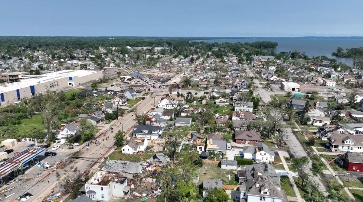
The level of destruction from the tornado in Appleton, Menasha, and Neenah, Wisconsin is unfathomable.
This just doesn’t happen here. I’ve lived here for 45 years, I know.
Photos are from NBC 26 in Green Bay
Unreal!! No single play encapsulates who LeBron James is more than this one 👀🔥🔥
He travels, gets blocked, then he flops. Then it’s a guarantee that he complained to the ref, then didn’t get back on defense!!
The NBA went from Michael Jordan to this!! 🤯🤯
Bill Maher: "[Charlie Kirk] was shot under a banner that said, 'prove me wrong.' Because he was a debater... So the people who mocked his death or justified it, I think you're gross... he people who are saying, now 'we're at war' I have no use for you."
The @Seahawks defense had more sacks (9) and takeaways (4) in 2 games at Levi's Stadium this season than the 49ers did in their 8 home games combined (7 sacks, 3 takeaways)
Kenneth Walker III also had more runs of 20+ yards (3) than the whole SF team (2) in that stadium
Absolutely incredible…
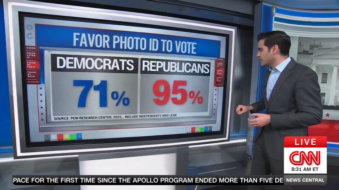
CNN showing that the overwhelming majority of Americans support Voter ID:
🔴Republicans - 95%
🔵Democrats - 71%
Voter ID is not "racist". It’s common sense.