Everybody loves trees!! Check out our latest work with @onetreeplanted using #ArcGIS to measure the amazing impact of their projects - https://t.co/G3eaWUOgD6 🌲🌳🌏🌴
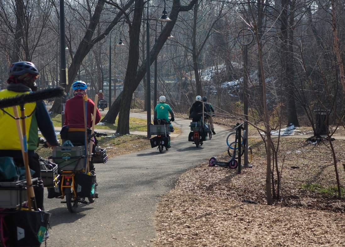
We had a lot of fun implementing #ArcGIS solutions for state and local government in Washington DC - focused on #transportation and #bike sharing. Check out the @Esri story at: https://t.co/MLnQ4meyXA
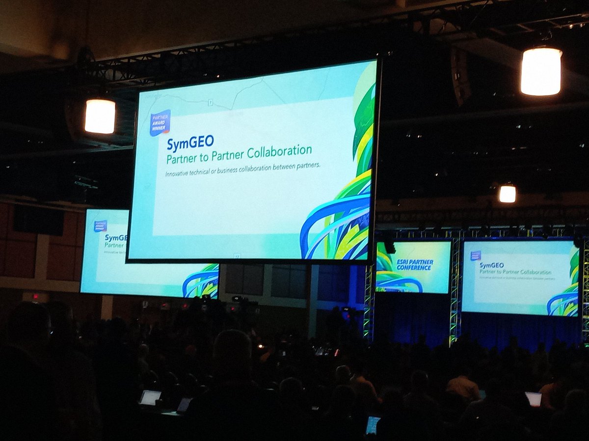
For the record, I was thinking laser tag or escape room when I suggested "team-building exercise" to my business partner at @symago...! #SweatEquity 😅😅
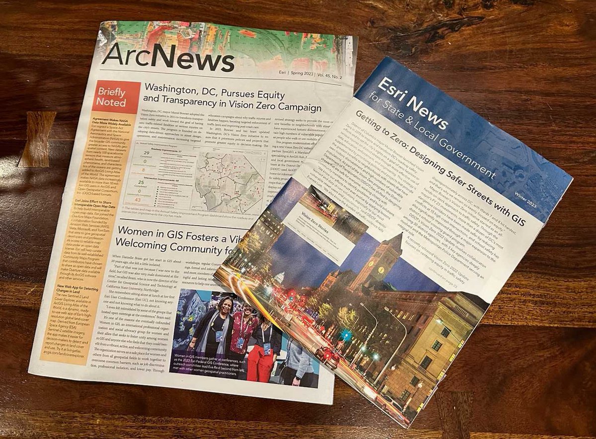
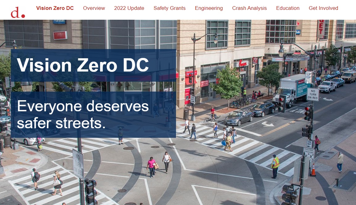
Wow, our work with @DCVisionZero was featured on the front page of both @ArcNewsMagazine AND @EsriSLGov - what an honor! Thank you @EsriPress https://t.co/AROI5cWkke @DDOTDC
The District of Columbia Department of Transportation has shifted to designing safe streets for everyone with the help of SymGEO, a GIS #EsriPartner specializing in #ArcGISHub, #ArcGISOnline, and state and local government solutions. @sym_geo
https://t.co/z4rlp4oP4U
"The new Vision Zero DC website will help us work closely with community members to identify problems and build solutions" - Linda Bailey, DDOT Vision Zero director.
Music to our ears! 🚲🛵🚙🛴👩🦯🏃♂️ @sym_geo
Newsworthy! DC releases new Vision Zero website to detail traffic safety data https://t.co/YjCh854Ax2 via @WUSA9 - built by @sym_geo using @ArcGISHub and @ArcGISApps
Optimistic that this will help promote safer travel behavior and reduce injuries / fatalities through more effective use of data, education, enforcement, and engineering! #VisionZero
Excited that DDOT launched the new #VisionZeroDC website today! Read our blog article at https://t.co/Q3QuMgPLDs
or official @DDOTDC press release at: https://t.co/ltZ3tKKqo7 - built using #ArcGIS#ArcGISHub
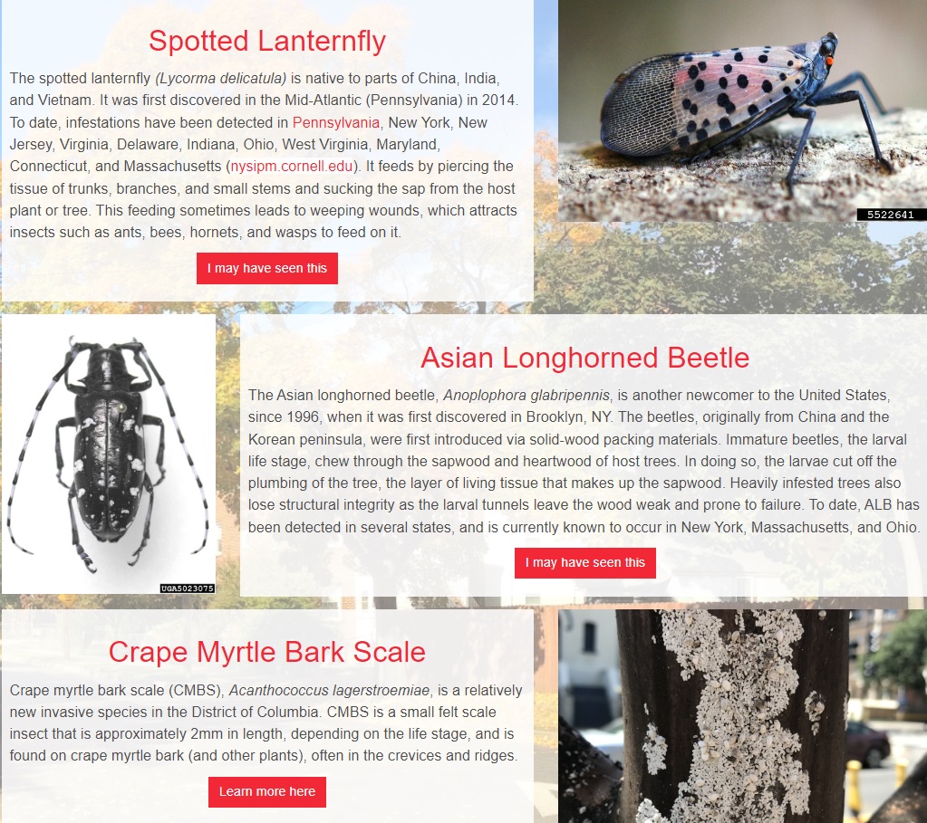
Attention DC residents: have you seen weird bugs on your trees? 🪳🌳 Find out if they are invasive (and report them!) using https://t.co/tTvHekpB4B @DDOTDC - built using @ArcGISHub and @ArcGISSurvey123#ArcGIS#community
@Esri Special Event Operations is a configurable solution that helps organize and manage special events, site maps, safety plans, and assignments. Learn how @DDOTDC now uses this solution! https://t.co/8rBl4xOpg4
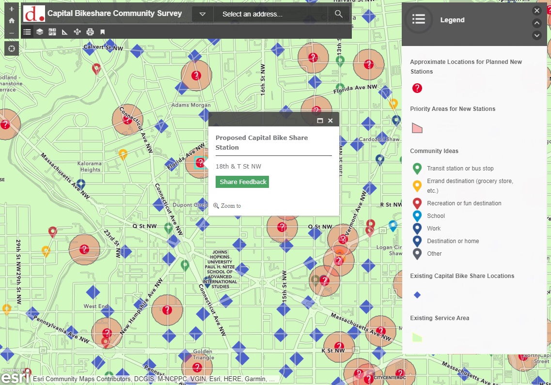
The Capital Bikeshare network is expanding! Take a look at the #ArcGIS tool we built for community feedback on proposed locations https://t.co/aDmpEF3JY1 using @ArcGISApps and @ArcGISHub@DDOTDC
Balancing workloads and exploring redistricting options is fun using #arcgis#dashboards! Check out the @DDOTDC Urban Forestry solution - https://t.co/3miYn96iwF
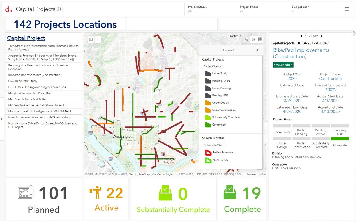
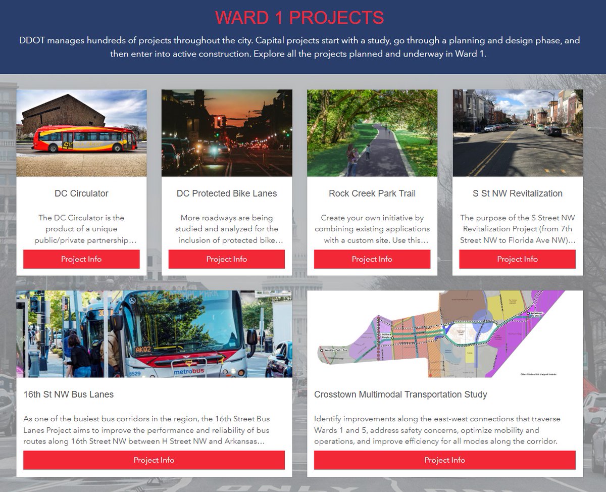
Take a look at how we helped @DDOTDC build their new capital projects website https://t.co/kuWvNT4JgG - organized by Ward, engaging, branded, mobile responsive, and built with @Esri@ArcGISHub technology! #ArcGIS#ArcGISHub#government