#EsriUC2023 Expo opens today, and our booth is ready for visitors! Here’s a quick tour of what you can expect to see. Stop by and say hello! Schedule a demo during UC or after the show: https://t.co/uKB4KCvo2u
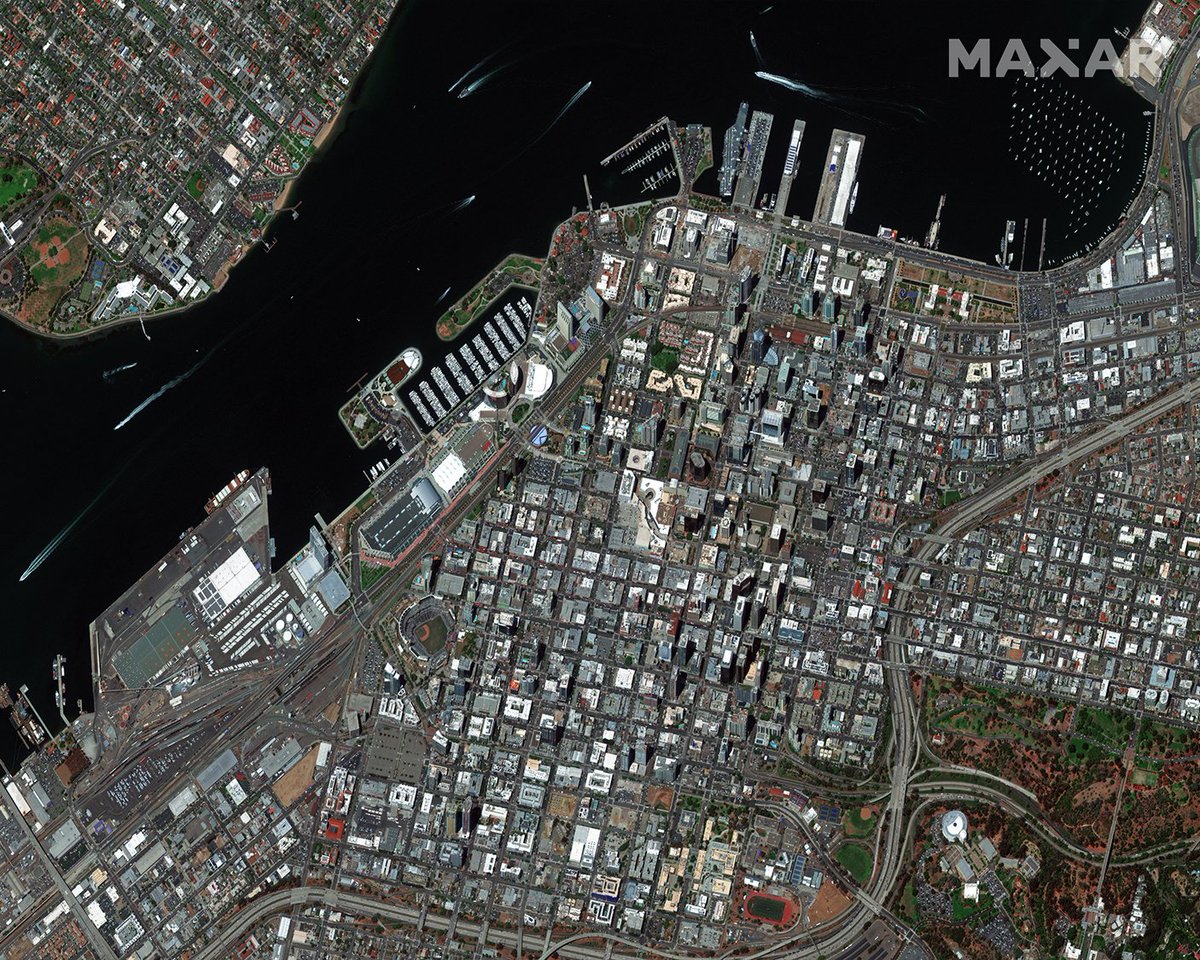
Spotted from space: the #GIS community is staying mappy in San Diego this week at #esriuc2023! See the full GeoEye-1 #satelliteimage at Maxar's booth today or schedule a virtual demo if you're missing the sunny weather! https://t.co/B5FMbieM5F
We’re ready for Day 2 of the #EsriUC2023 Expo! @Esri will be integrating Precision3D into @ArcGISOnline Living Atlas of the World for viewing. The product manager shares a highlight of the Precision3D demo that’s in our booth: https://t.co/SpQconO9xc
We’ll see you at #EsriUC2023, the world’s largest #GIS conference, in San Diego, CA, July 10-14, 2023!
Be sure to stop by our booth, 319, and see the demos of our newest products, capabilities and #satellite-derived data.
➡️ https://t.co/e7vOTAOwYb
Our Precision3D data will now be available for viewing in @Esri’s ArcGIS Online Living Atlas of the World. Esri will integrate our Precision3D Digital Surface Model, Digital Terrain Model, Buildings & Vegetation vector data for #ArcGIS users to view. https://t.co/fSL2mLeFww
Congratulations to the 2023 @NBA Champions, the Denver @nuggets! 🏆
Today they celebrated in #Denver with a parade and rally in Civic Center Park. You can see the huge crowds in this #satellite image from today, June 15, at 12:41 PM MDT. #bRINGItIn
.@Sturfee’s VPS Cities uses our Precision3D #digitaltwin as the most accurate #geospatial anchor for displaying #AR content. Hosted on @AWScloud, this cloud-based software development kit will bring next-gen video games to market, among other use cases.
https://t.co/pNd9toqMTM
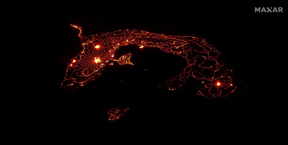
One of #Hawaii’s most active volcanos, #Kilauea, erupted this week, sending bursts 200ft high. This eruption is confined to the Hawai’i Volcanoes National Park & officials say there is no indication that populated areas are at risk. This WV3 nighttime image is from June 8, 2023.
See you at #AWE2023 next week!
We’ll be exhibiting for the first time and we’re bringing our #3D#digitaltwin of the entire Earth built for connecting extended reality to the real-world environment!
Visit us at booth 718! @ARealityEvent
🎉 We have some exciting news to share! The 14th annual Auggie Awards are in full swing! 🚀
🌐 Head over to https://t.co/ao1S0T43ZZ and make your voice heard. Cast your vote now and be a part of this year's Auggie Awards.
#AuggieAwards#AR#VR#XR
We’re excited to announce a new industry first: the first global, #satelliteimagery basemap at 30 cm high-definition (#HD) resolution thanks to innovations in tasking and image processing.
Learn more about this milestone: https://t.co/Qse08dvs3r
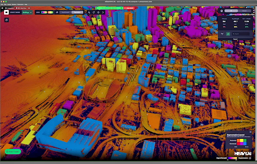
.@heavy_ai announced today it’s expanding its collaboration with @NVIDIA to include global management consulting firm Bain & Company and Maxar, providing #communication service providers with tools enabling greater efficiencies in #network deployments. https://t.co/IPmRYPEOPr
The World Wildlife Fund & British Antarctic Survey have teamed up with Maxar to recruit citizen #scientists to assist in #conservation efforts of Atlantic & Laptev #walrus populations. Learn how you can become a walrus detective! @World_Wildlife@BAS_News https://t.co/cmBo2PT7ds
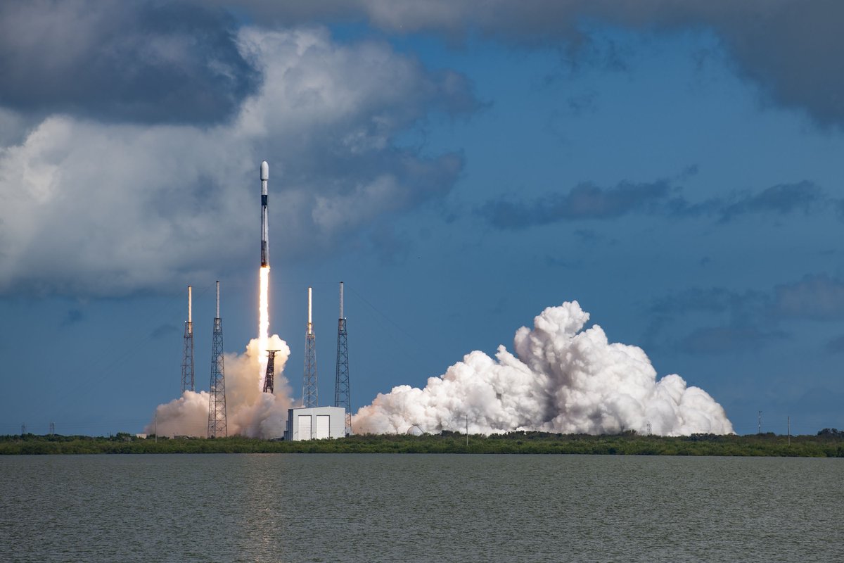
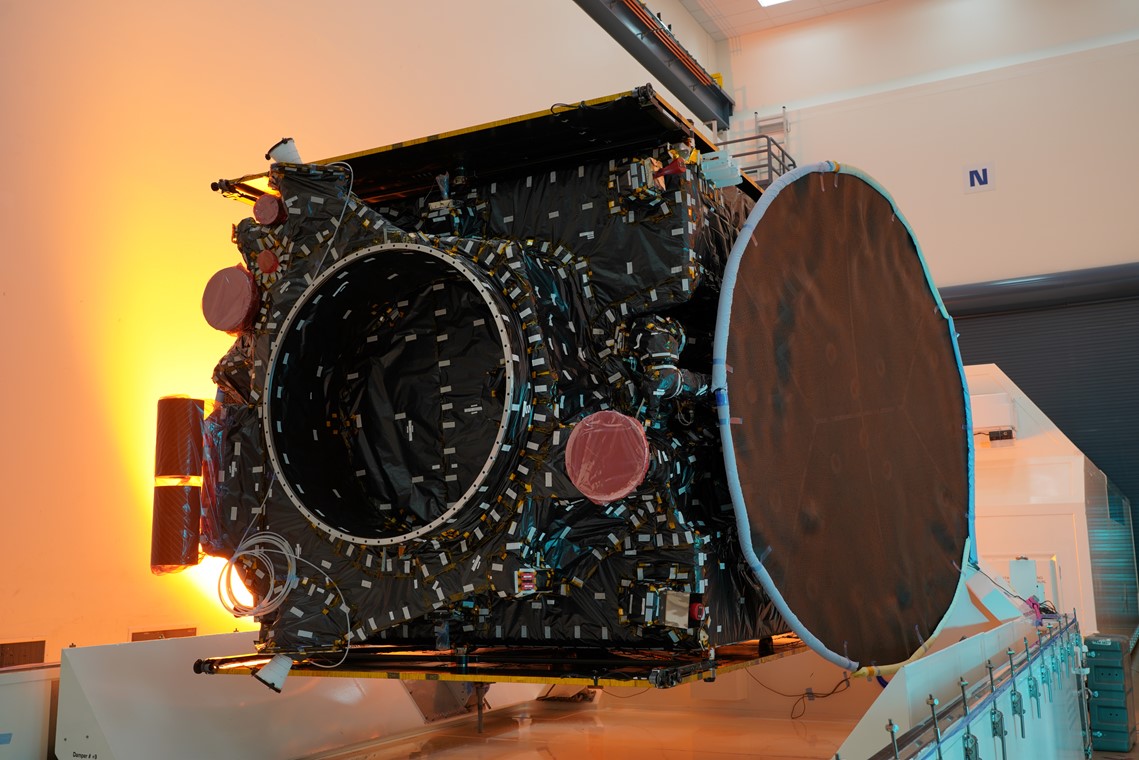
Today, we handed over Galaxy 31 and Galaxy 32 to @Intelsat for final on-orbit commissioning. The Maxar-built geostationary communications #satellites are part of Intelsat’s Galaxy fleet refresh and were launched on November 12, 2022. https://t.co/jVk6NevkzA
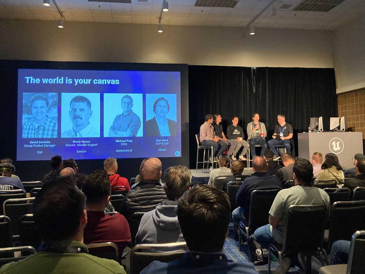
Thanks @EpicGames for hosting the awesome #UnrealFest! We had a great time meeting #UE5 users & demonstrating the possibilities of the #3D mirror world we’re building with @AiBlackshark for developers!
Check out our demo data available for download:
➡️ https://t.co/sAu4DAWXDV
We’ll see you in #NewOrleans, Oct 17-20, for #UnrealFest 2022. In the meantime, we’ve partnered with @AiBlackshark on our latest #TiltTheMap series (of New Orleans of course) fueled by our high-resolution commercial imagery and Blackshark’s #3D.
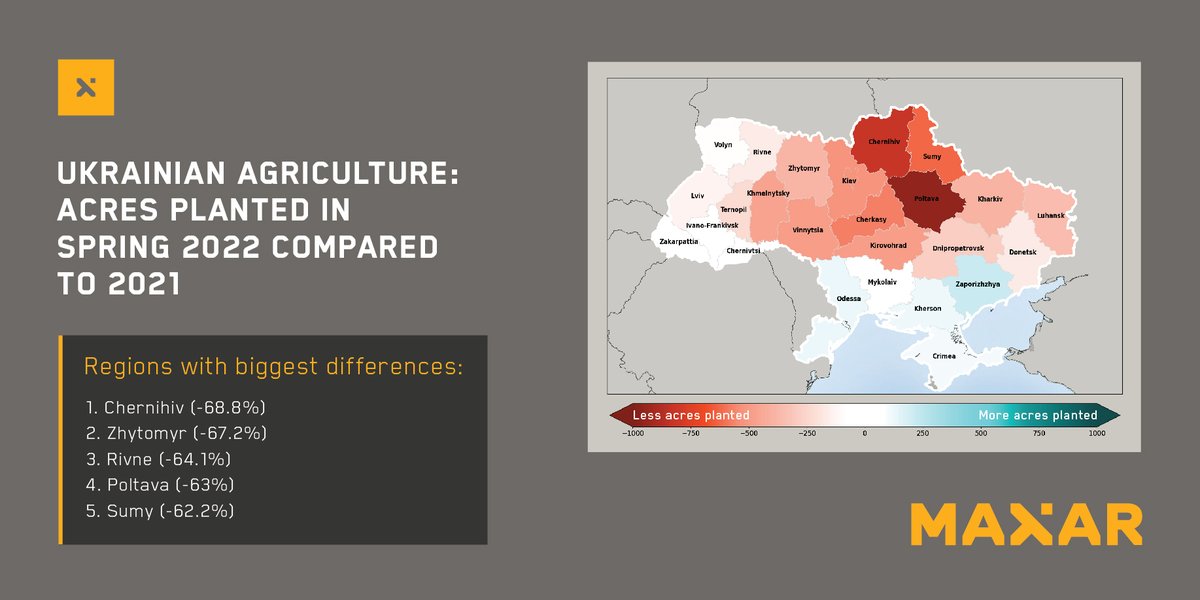
Maxar’s WeatherDesk, an on-demand product that transforms regularly changing #weather data into actionable insights, predicts a significant decline in Ukrainian #crop harvests due to #Russia’s invasion. #Ukraine#WX https://t.co/OQi8vARaMh
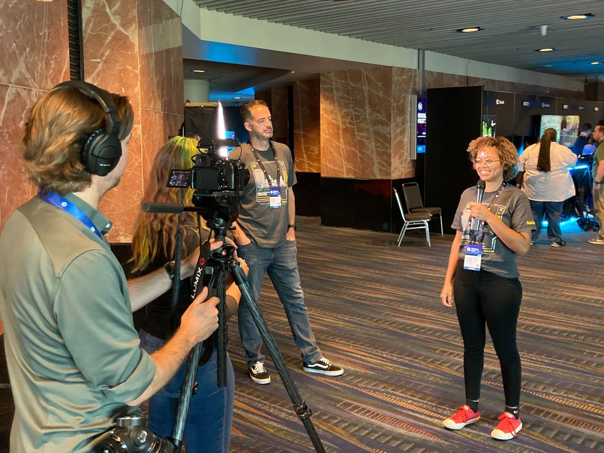
We got an exclusive tour of the @Maxar satellite factory and spoke with senior execs about how their satellite imagery has been critical during the war in Ukraine, their relationship with the US intelligence community and more. (W/ @MichaelTConte)