***Smoky haze from Canadian wildfires will continue to result in reduced air quality today.
Thunderstorms are possible today and tonight. Some of the storms may be strong to severe west of I-75 with damaging wind gusts the main threat.
A string of unsettled weather is expected through the week with shower and thunderstorm chances each day as an unusually strong upper low sits over the Ohio Valley. Afternoon highs will run below average under persistent cloud cover and several chances for precipitation. #ekywx
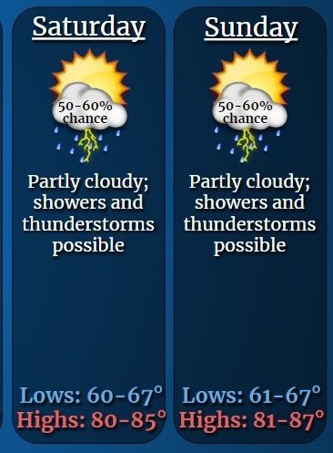
Looking ahead to @arrl#FieldDay23 in Eastern Kentucky, the current weather forecast is calling for partly cloudy skies a 50 to 60% chance of showers and thunderstorms. Saturday's high will be in the 80s. Sat. night temperatures will be in the 60s with Sunday again in the 80s.
***Thunderstorms will be likely today, before diminishing in areal coverage tonight. Isolated instances of heavy rainfall will be possible.
***SPOTTER INFORMATION STATEMENT...Spotter activation is not expected at this time.