Thank you, @FastCompany, for honoring us and Scout with the Data Design award! The finalist projects are all so inspiring, and we are humbled to be in such good company.
https://t.co/dhdtutU1IC
Interested in how to connect Python #jupyternotebook to #rhino3d? Check out the recording from KPFui’s Brandon Pachuca @emptybox#McNeel’s webinar!
https://t.co/kh0GrN1Xjt
We know you are all dying to understand how NYC manages what can and cannot be built in the city! Simple, informative, INTERESTING (we promise) piece on the ULURP process. #nyczoning#cityplanning#supertall?
https://t.co/YZm1ui9FLH
What is your favorite urban space? What makes a good place? We are drilling down these questions as we develop our placemaking precedent database for documenting the “ingredients” and refining our design “recipes”.
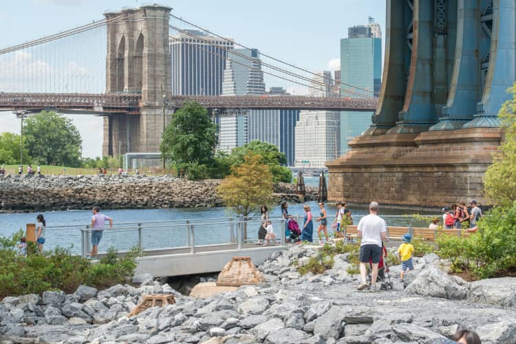
📷: Julienne Schaer @ Brooklyn Bridge Park @bbpnyc
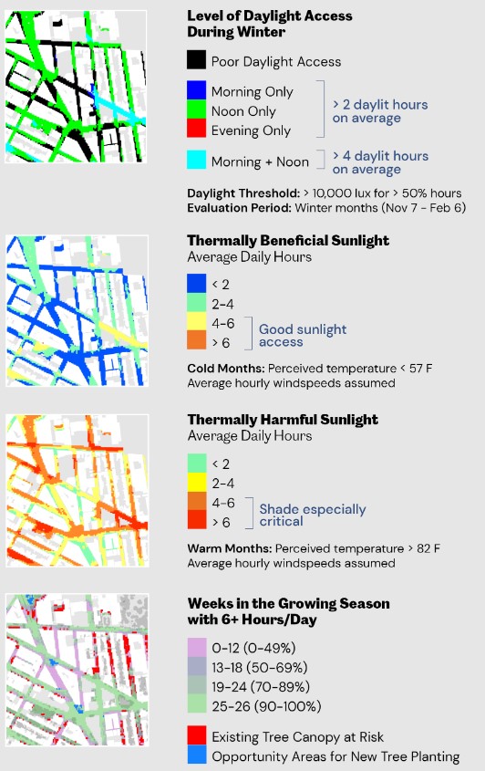
Working with the Environmental Performance team at KPF we did a series of daylight simulations across all five boroughs to introduce the performance targets for good public space as part of the @MASNYC A Framework for a City Built for Sunlight.
Read more: https://t.co/1YtzqlCYgM
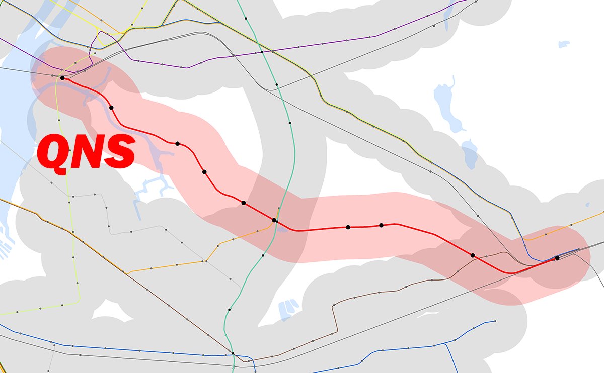
Over 210k people live within 1/2 mile of the proposed QNS subway line in Queens. Most of these NYC residents have few transit options - findings from the spatial analysis we conducted for the QNS feasibility study. Visit @QNSFriends to support this NYC public transit initiative!
@nytimes your recent op-ed on adding more Manhattan is very similar to the Lower Lower Manhattan project by KPFui director Luc Wilson and his classmates @ColumbiaGSAPP, (which you also published.) 🤔Check out the TEDx talk on LoLo!
https://t.co/boBiJ9gajG
Interested on how #mcneel 's Rhino.Compute API enables designers and data scientists to perform spatial analytics and modeling?
Join KPFui's urban data scientist and web developer Brandon Pachuca in a seminar tomorrow at 11am EDT via the link below!
https://t.co/SJYJ94LPLV
We leveraged @threejs and @mapbox to visualize daylight impacts to the Brooklyn Botanic Garden, which have expressed concern over several proposed development. The web-accessible tool cites the developments’ height and bulks to support decision-making for stakeholders.
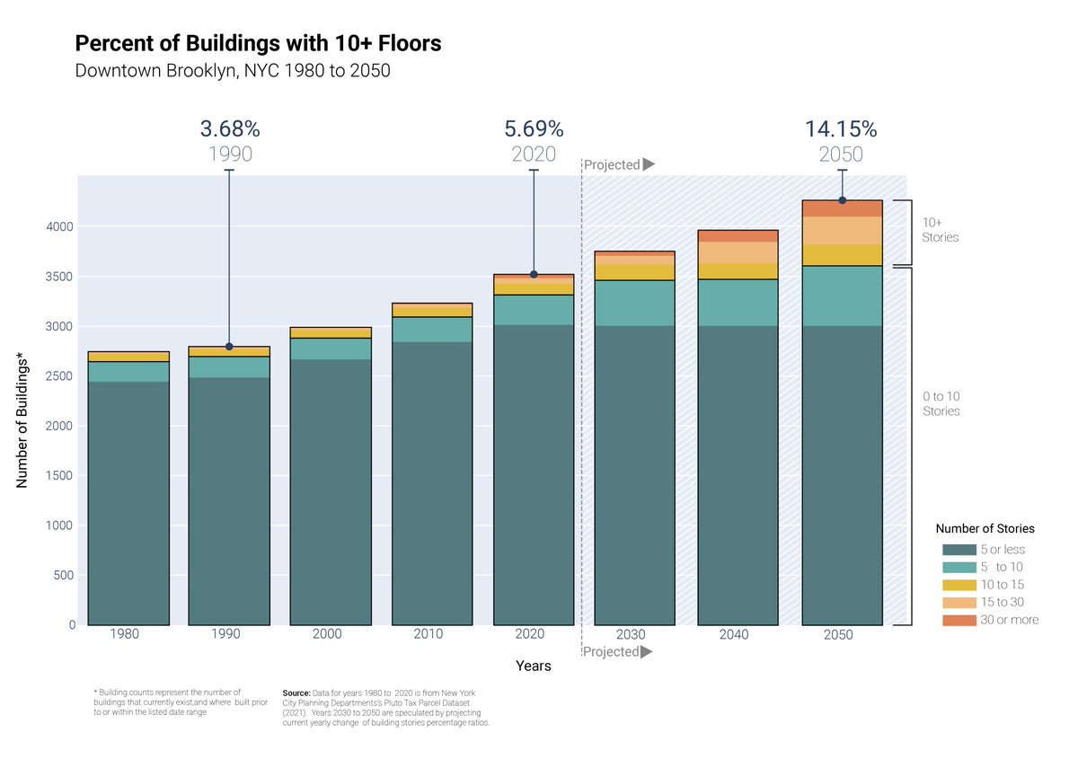
We recently provided data support for an article with @CTBUH. It is interesting how for downtown Brooklyn which feels like it has a lot of tall towers, only a small percentage of buildings are over 10 stories. #tallbuildings#cityscape#OpenData
The proposed QNS subway line in Queens would fill the largest gap in the NYC #transit Network - a finding from the latest round of spatial analysis we conducted for the QNS feasibility study.
Visit @QNSFriends to support this NYC public transit initiative!
KPFui's Brandon Pachuca will present Block Party, an interactive platform for engaging with NYC Community Boards, at the Open Data Week on March 10👏. Check out Block Party here: https://t.co/zPsay8tObn
https://t.co/W4ZvUApDfq
In @MetropolisMag's inaugural Responsible Disruptors Awards, @kpf_ui's mapping tool, Scout, was honored for its real-time visualization abilities. Learn more about the platform and how it "represents change for the better" here: https://t.co/RmT4eGOWug
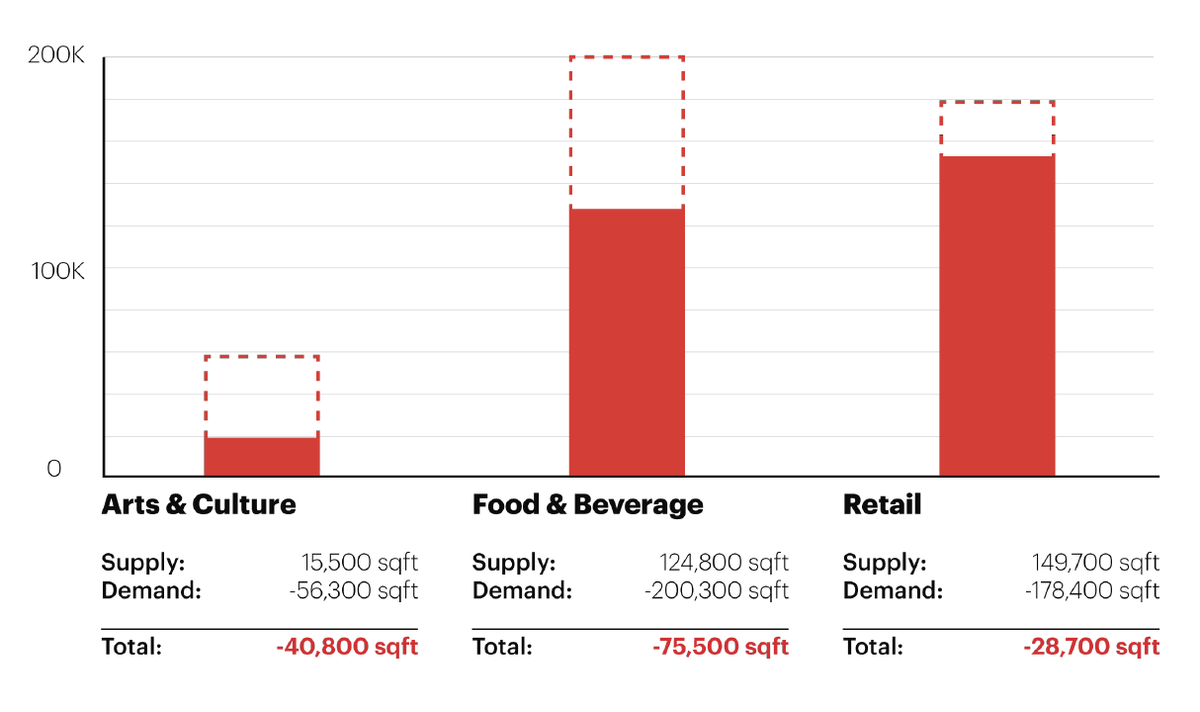
How do we be proactive in the pre-design phase? Combined with demographic data, we are creating a package with projected population growth, amenity demand, and trip generation to derive program and mobility recommendations even before design begins. #UrbanAnalytics
We have been working to leverage Rhino Compute to optimize KPF's design workflow. In this joint article with @IAAC, we discuss various compute workflows and exciting computational efficiency through our first-hand experiences.
https://t.co/gCMlfRWYeE
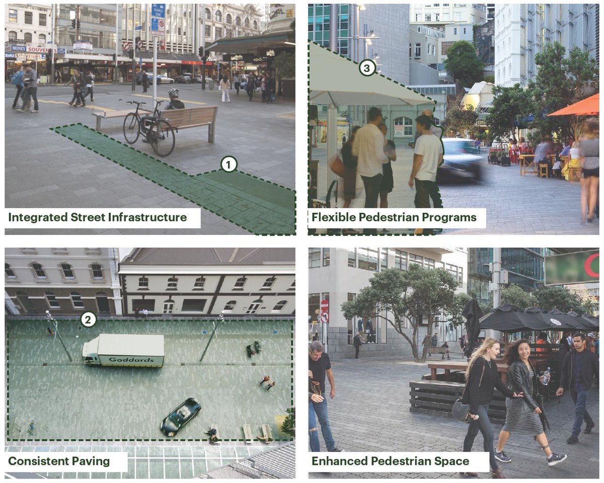
Pedestrians, cars, and cyclists all beautifully share Fort Street in downtown Auckland, NZ. As one of the public spaces we're interested in, #sharedstreets have much to offer by rethinking how different transit modes occupy the space of the urban street. #urbandesing#visionzero