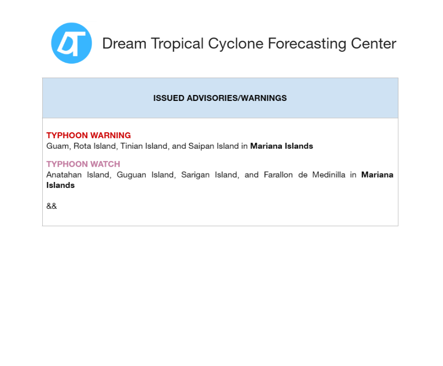
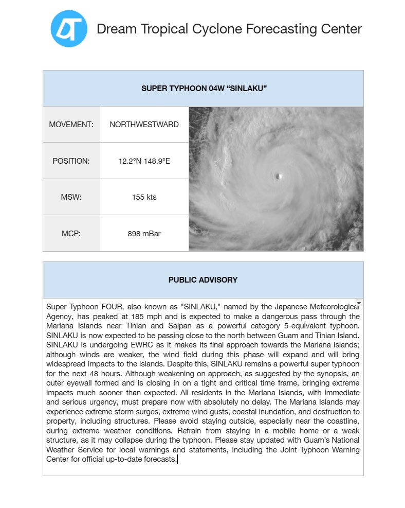
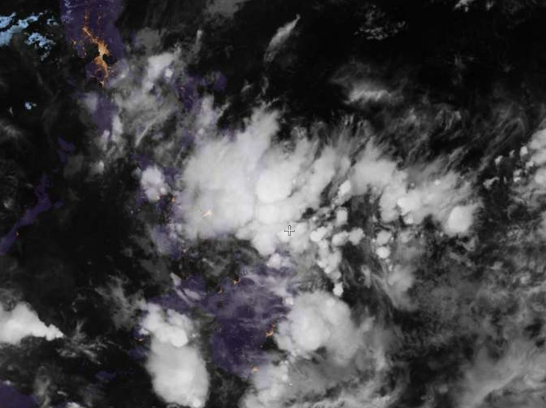
Super Typhoon #SINLAKU crosses over from the night to the light, uncovering WPAC's April historical beast approaching the Mariana Islands at this moment. This is what +ENSO can bring us this 2026.
07Z - SINLAKU with MSW 155 kts and MCP 899 mBar.
West Pacific Tropical Cyclone Advisory – 4a
Initial: 07z 13/04/2025 UTC
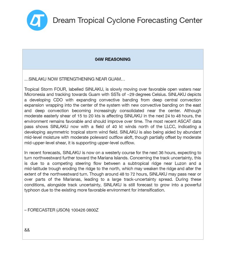
#STY#Sinlaku remains a powerful category 5 undergoing EWRC, may lead to a double eyewall event as it approaches dangerously close to #Mariana Islands including #Guam.
More forecast information below:
West Pacific Tropical Cyclone Advisory – 3a
Forecaster: Kryez
Initial: 08z 12/04/2025 UTC
#STY FOUR "#SINLAKU" is now a category 5-equivalent typhoon over #Micronesia to impact #Mariana Islands including #Guam as a potentially catastrophic storm.
Advisory and Cone below:
West Pacific Tropical Cyclone Advisory – 2a
Forecaster: Kryez
Initial: 08z 11/04/2025 UTC
TY FOUR or #Sinlaku#04W set to rapidly intensify towards #Mariana Islands and #Guam as a category 4 hurricane-equivalent storm. Guam should be prepared now.
More information below:
West Pacific Tropical Cyclone Advisory – 1a
Forecaster: KryezWX
Initial: 08z 06/09/2025 UTC
TS FOUR or #Sinlaku#04W now threatening #Mariana Islands and #Guam as a powerful #Typhoon
Information provided below with new 2026 graphics by @kryezzy DTCC:
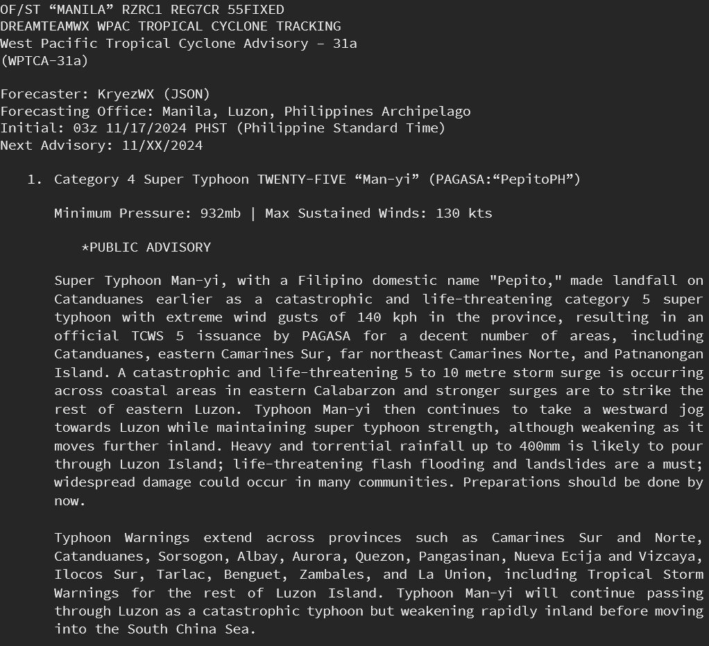
West Pacific Tropical Cyclone Advisory – 4a
Forecaster: KryezWX
Initial: 01z 06/09/2025 GMT+8
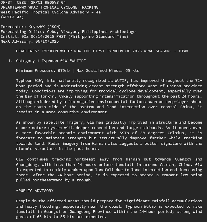
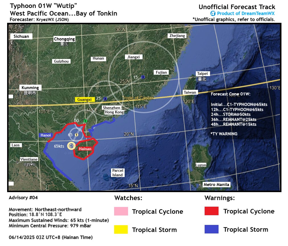
#Typhoon#Wutip#01W now the first typhoon of the 2025 season, nearing landfall in #Guangxi and #Guangdong after passing #Hainan in #China.
More information and forecast in attachment:
Worldwide Graphical TC
HEADLINES: #Barbara and #Cosme soon to dissipate / #01W to form as STS #Wutip in SCS
5 systems active across the world
Code Yellow
TS Watch in effect for #China
Active Systems: BARBARA, COSME, 01W, #94W, DISTURBANCE 1
DTWX Forecaster: KryezWX
Map below:
West Pacific Tropical Cyclone Advisory – 3a
Forecaster: KryezWX
Initial: 01z 06/09/2025 GMT+8
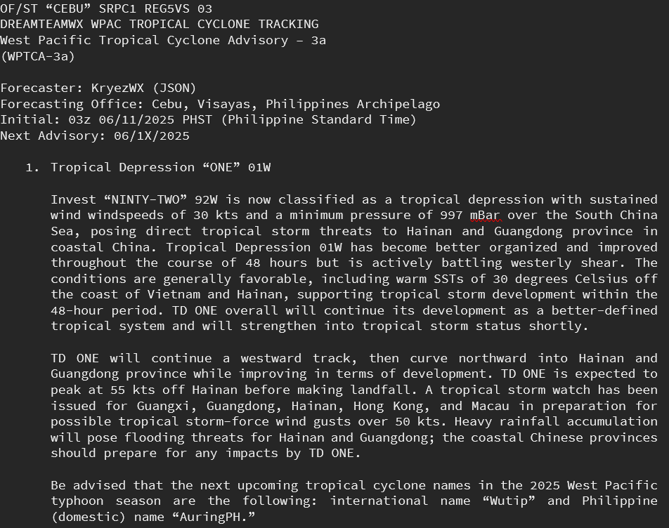
#01W expected to form as a #tropicalstorm into #HongKong, #Guangdong, and #Hainan this weekend. Flooding is expected for coastal #China.
More information and forecast in attachment:
West Pacific Tropical Cyclone Advisory – 2a
Forecaster: KryezWX
Initial: 01z 06/09/2025 PHST
#92W expected to form in #SCS as a weak #typhoon into #HongKong, #Guangdong, and #Hainan, flooding is expected but not limited to the #Philippines.
More information in attachment:
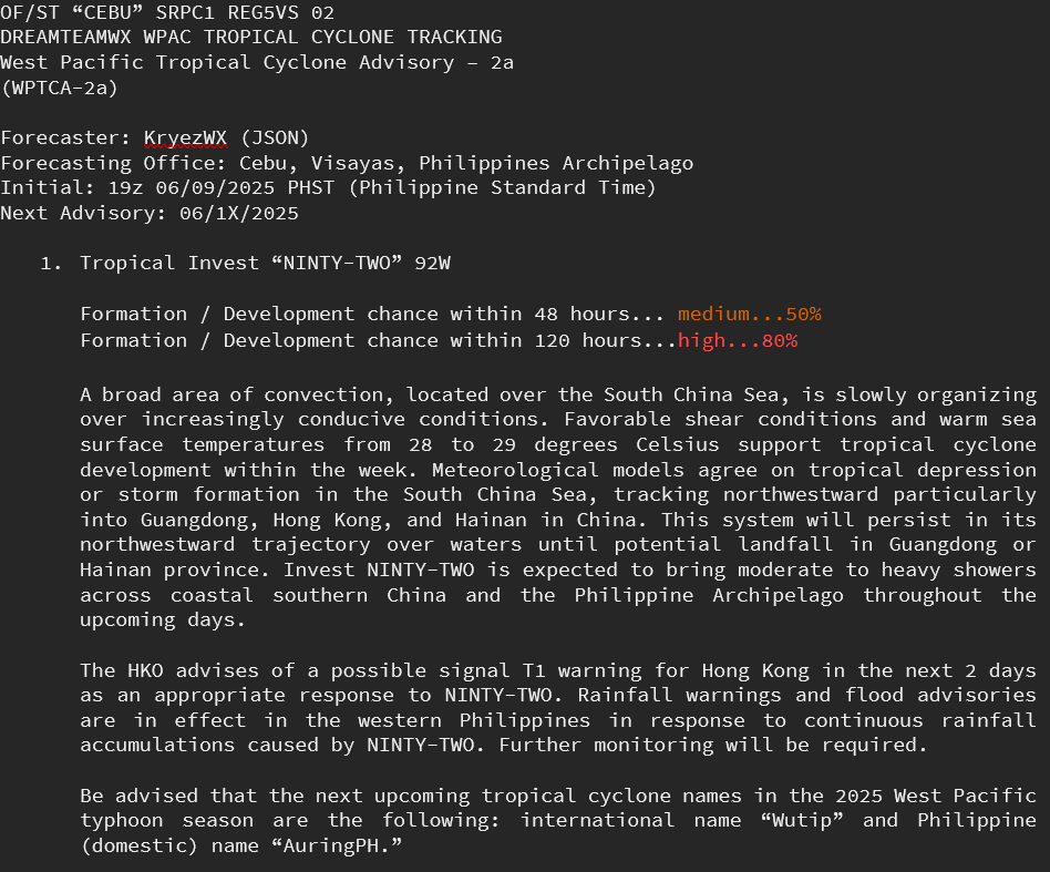
West Pacific Tropical Cyclone Advisory – 1a
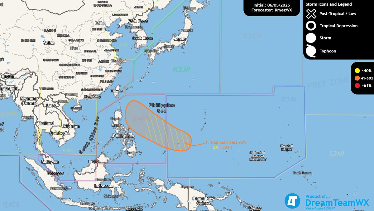
Forecaster: KryezWX Initial: 01z 06/05/2025 PHST
Tropical Invest #92W may develop as a weak #typhoon beyond 48 hours, risking #flooding in the #Philippines. More information provided in attachment.
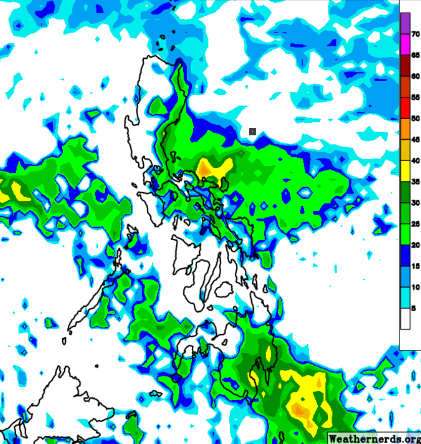
#LPA (post-#99w) and shearline sets up for nocturnal #svr over #Luzon tonight. Convection over the region is causing concern for severe weather. Strong winds and heavy rainfall accumulation are the major concerns for this event.
Map & more info in attachment below - #PHSVR
The #PHSVR agency in PWO Metro Manila, has issued a severe thunderstorm warning and thunderstorm warning for #MetroManila, #Cavite, West #Batangas, Lubang-Golo, and #Bataan.
Multiple nocturnal thunderstorms are forming over #Luzon Island.
Warnings in effect until 21:00 PHT.
2025 Global #Tropics "AIPAE: Aware, Inform, Prepare & Plan, Act, Evacuate"
Keep your eyes on our oceans for potentially brewing storms this 2025 tropical season; beware of dangerous tropical phenomena coming through.
According to CSU: 17NS, 9H, 4MH forecasted in the #NATL 2025
DreamTeamWX 2025: Philippine Severe Weather Centre new 2025 graphics for unofficial categorical severe weather and rainfall outlooks and forecasts. Inspired by the US SPC's outlooks using a similar system. Made by: @Kryezzy
EXPIREMENTAL GRAPHIC AND SCENARIO SHOWCASED BELOW:
#Cyclone#Zelia to make landfall on #WestAustralia today as a severe category 5.
Movement: Southward
Position: 19.3S 118.2E
Max Sustained Winds: 140 kts
Minimum Pressure: 920 mBar
Forecast by: @Kryezzy
Initial: 02Z 02/14/2025 AWST (GMT+8)
Forecast cone in attachment below:
#RAINFALL EVENT TO OCCUR BY MONDAY UNTIL WEDNESDAY (FEB 10 - FEB 12 2025)
RISKS FOR FLASH #FLOODING DUE TO AN ITCZ AND EXTENDING COLD SURGE ACROSS THE EAST-CENTRAL #PHILIPPINE REGION, IN #BICOL, EAST #VISAYAS, AND SOUTH #LUZON
GRAPHICS AND EXTENDED INFORMATION IN ATTACHMENT:
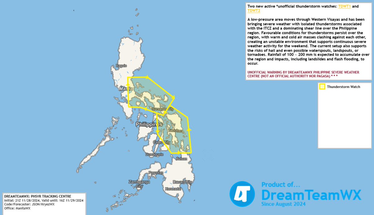
TWO UNOFFICIAL THUNDERSTORM WATCHES-DREAMTEAMWX:PHSVRTC UNOFFICIAL WARNING (NOT AN OFFICIAL AUTHORITY)
RISKS OF #TORNADOES AND #HAIL WITH SEVERE THUNDERSTORMS FOR AREAS SUCH AS #BICOL#QUEZON#SAMAR WITH HEAVY 100-200MM RAINFALL ACCUMULATION
MORE INFORMATION IN ATTACHMENT