GIS coordinator @CSCfi. Working with Paituli data service, supercomputer Puhti for GIS users and universities #ArcGIS consortium.
#GIS#FOSS4G#HPC @GeoPortti
Welcome to online workshop: STAC - how to find and use spatiotemporal data easily? 12.3.2025 at 13-16.
Introduction to Paituli STAC with ~100 Finnish raster datasets and STAC usage with QGIS and Python.
More info and registration: https://t.co/CDjYIOpUXq
#geoportti@CSCfi
Also some ArcGIS Desktop extensions not available any more, inc. Data Interoperability. Move to using ArcGIS Pro. ArcGIS Desktop is retired by ESRI on 1.3.2026.
ESRI has changed license availability for CSC ArcGIS consortium for Finnish universities:
* ArcGIS Pro floating licenses only until 31.3.2025. Use licenses via ArcGIS online.
* No Single Use licenses.
https://t.co/NLiFzoCMBv
@CSCfi has a new service Pukki for easy creation of a database.
* PostgreSQL and MariaDB.
* PostgreSQL with PostGIS and H3 etc
* Create from web interface or via command line.
* Max 200 GiB
* Back-ups.
More information: https://t.co/oVMcI9KGHR
#geoportti has supported Pukki.
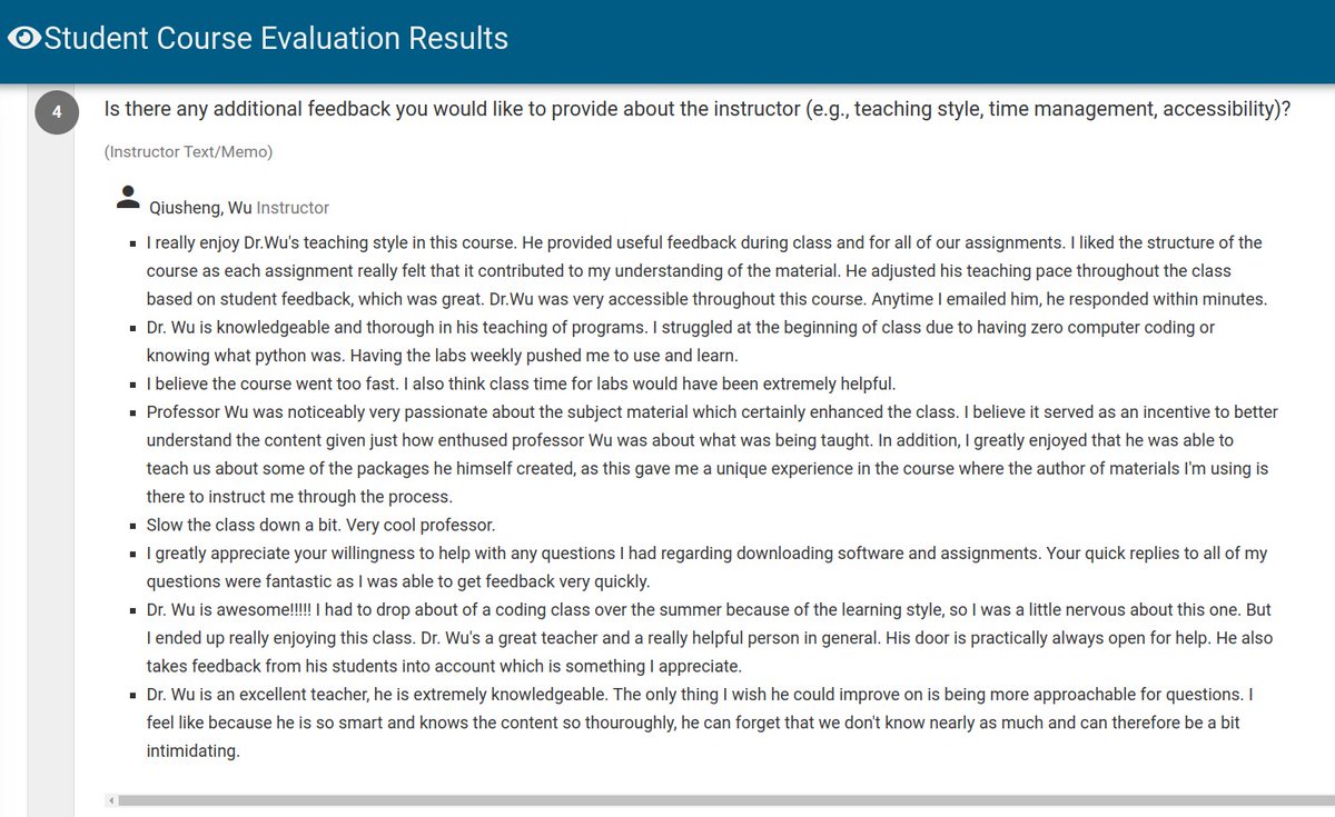
Thrilled to receive such positive feedback from students in my Introduction to GIS Programming course! Although it's a small in-person class I taught at the University of Tennessee, I've made all lecture materials and video recordings freely available online.
🌐 Course website: https://t.co/KYORBaD1yf
🎥 Video playlist: https://t.co/GBRMRoUhy4
Join us in exploring the world of GIS with open-source #geospatial software!
#GIS #Education #Python #Mapping
CSC supercomputers can be used free of charge for open academic research by Finnish universities and research institutes. Companies can use LUMI-supercomputer: https://t.co/HajFx4hTWw
"Geocomputing on the Supercomputer" course will take place 9-10.10.2024. Learn how to use supercomputers for spatial analysis. Participation at CSC or remotely, free of charge. Additional information and registration: https://t.co/BIEEBlDjaT.
Interested in High Performance Computing with spatial data? Next Monday 9th Sep at 13:00 (Finnish time) we organise a webinar focusing on training resources for GeoHPC using @CSCfi supercomputing resources. 🤓 The registration is open here: https://t.co/iD2fC4ckKA @geoportti
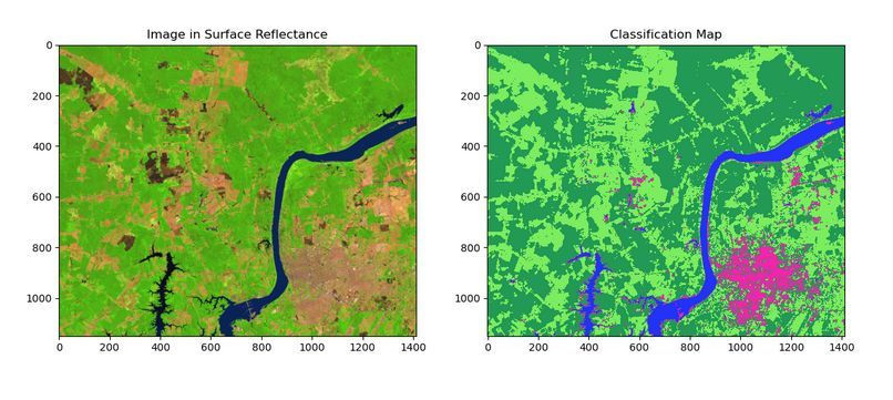
🛰️ A new paper "scikit-eo: A Python package for Remote Sensing Data Analysis" on a tool for #LULC analysis with various machine learning and neural networks algorithms.🛰️
Article: https://t.co/wapksTzQku
Software: https://t.co/uKscuTgsfm
#geopython#remotesensing#landcover
"Geocomputing on the Supercomputer" course will take place 9.-10.10.2024. More info and free registration: https://t.co/BIEEBlDjaT
@CSCfi @geoportti #locationinnovationhub
Maanmittauslaitos on julkaissut vanhat lehtijaossa olevat karttansa saataville georeferoituina karttakuvina. Karttakuvat muodostavat ainutlaatuisen kuvan Suomen luonnon ympäristön ja maankäytön muutoksista 1800-luvun puolivälistä alkaen tähän päivään.
https://t.co/EmWu02OCm7
Need to run multiple steps of your processing or analysis pipeline and a bash/python/R script does not quite fit the task? Try #Snakemake ! Introductory lectures and support for workflows on the supercomputer:
Our EO-guide has new section about Coperincus Data Space Ecosystem services, including links to example download scripts: https://t.co/Qpc5Gbgyqp
@CSCfi @geoportti
New self-learning course for spatial data analysis with R:
https://t.co/8hEngmpih1
Materials by @mkkallio are open to everybody.
For Finnish academia also web-RStudio is available for going through the materials and doing exercises.
@CSCfi @geoportti