Isolated to scattered showers and thunderstorms are expected to develop along a frontal boundary late Saturday evening, tracking southeast. Storms may become severe, capable of large hail, strong winds, and heavy rainfall. #lubwx#txwx
Hot Saturday with chances for scattered showers and thunderstorms in the afternoon. Cooler and wetter conditions arrive Sunday behind a passing cold front which may bring the potential for heavy rainfall. #lubwx#txwx
After some storms tonight, mostly dry & slightly cooler weather develops for Friday ahead of a hot Saturday. Widespread rain chances arrive Saturday night and continue through Sunday along with much cooler weather. #txwx
Isolated thunderstorms will be possible this evening west and south of the City of Lubbock. The severe weather threat will be low, however strong wind gusts and brief heavy downpours are possible. #lubwx#txwx
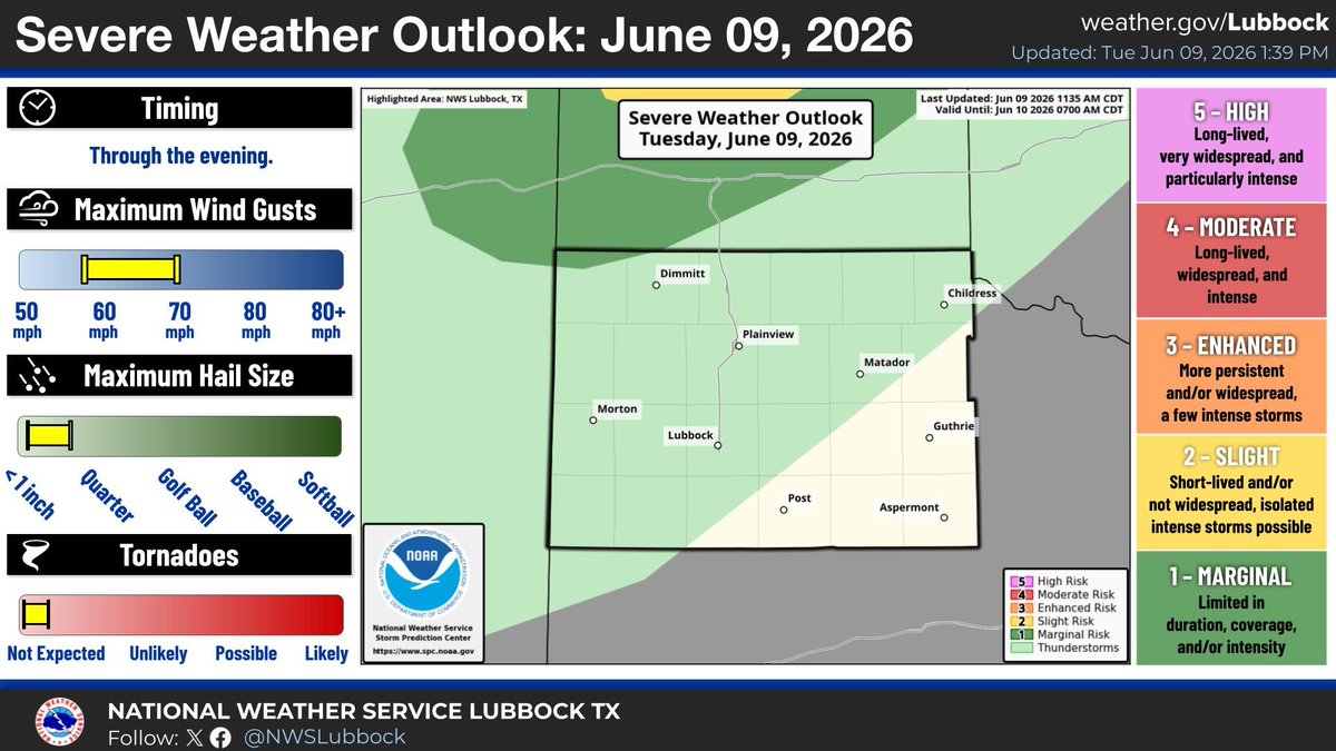
Thunderstorms will be possible across the far southwestern Texas Panhandle and northern South Plains late this afternoon and evening. Storms that are able to develop may produce strong winds up to 70 mph and small hail. #lubwx#txwx
Hot temperatures and daily thunderstorm chances are instore for the rest of this week. We could see a a slight cool down this weekend, however current high temperatures remain in the upper 80s and 90s. #lubwx#txwx
Isolated to scattered storms will be possible this afternoon, developing across the Caprock, tracking eastward off the Caprock through the late evening. Main threats will be small hail and strong wind gusts up to 70 mph. #lubwx#txwx