What if we could carry the joy of Christmas into every day of the year?
Tasha Layton’s new animated music video for “Christmas All Year Long” brings that idea to life with color, hope, and a whole lot of heart. 💫
Watch and read more >> https://t.co/292d1BWOUw
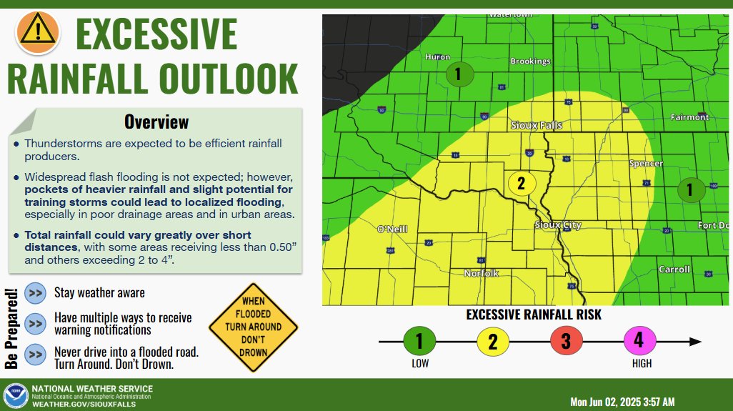
Thunderstorms may bring excessive rainfall late Monday afternoon and evening.
This map highlights the area with the greatest potential of seeing impactful rainfall that could lead to minor urban flooding or small stream rises.
Get ready for a nice soaking rain in portions of eastern KELOLAND the next 24 to 36 hours. We expect the best rain totals to fall east of the James Valley, with number over an inch possible in the areas shaded in light blue and purple on this map. https://t.co/s4JpSt98Jq #kelowx
3 things that Satan wants you to believe about your situation:
1. You can't.
2. God won't.
3. It will never get better.
When we hear these lies from the enemy, it's time to saturate our thoughts with God's Word and read it like the love letter it is.
Isolated thunderstorms are starting to develop west of the Missouri River. Through early evening, the threat for hail/strong wind with storms will increase west of a Wessington to White Lake to Pickstown line.
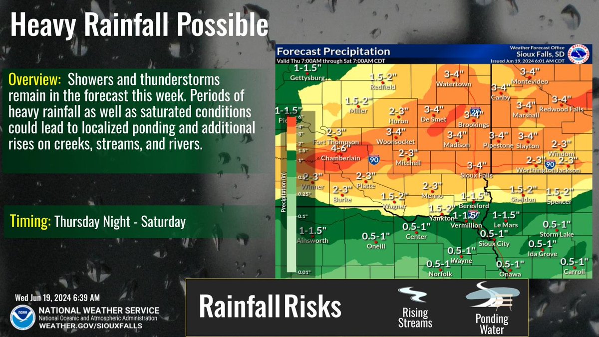
Additional heavy rainfall is expected later today through tonight. Here's a look at timing and how much.
With flooding on-going - Turn around, don't drown! Do NOT drive around barricades; those barricades are there for a reason!
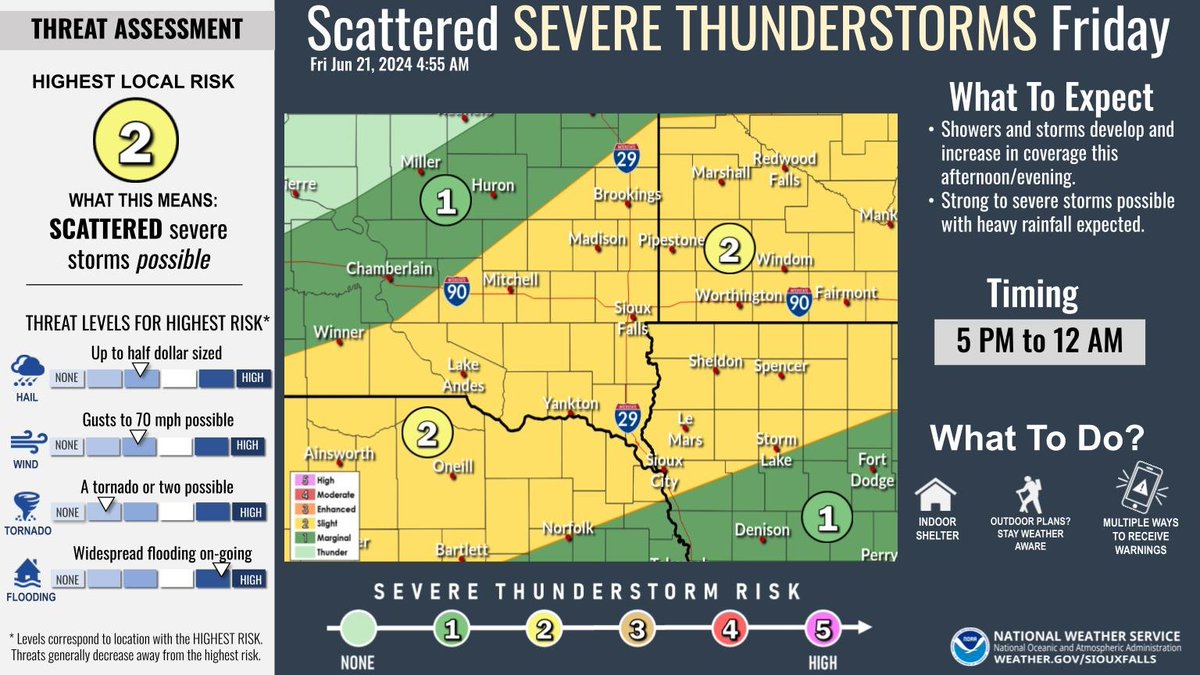
Showers and storms which redevelop this afternoon and evening could be strong to severe. All modes of severe weather are possible, and heavy rainfall is expected. Greatest threat from 5 PM to midnight. Have multiple ways to receive warnings!
Take advantage of the drier weather today to complete any outdoor activities. More periods of moderate to heavy rain are ahead late tonight through early Saturday!
We'll watch the skies carefully on Wednesday for the chance to see strong to severe storms. Regardless, it'll be a hot and humid day. We're also watching the weekend outlook for more rain. Your forecast: https://t.co/dYRBLPSGr5
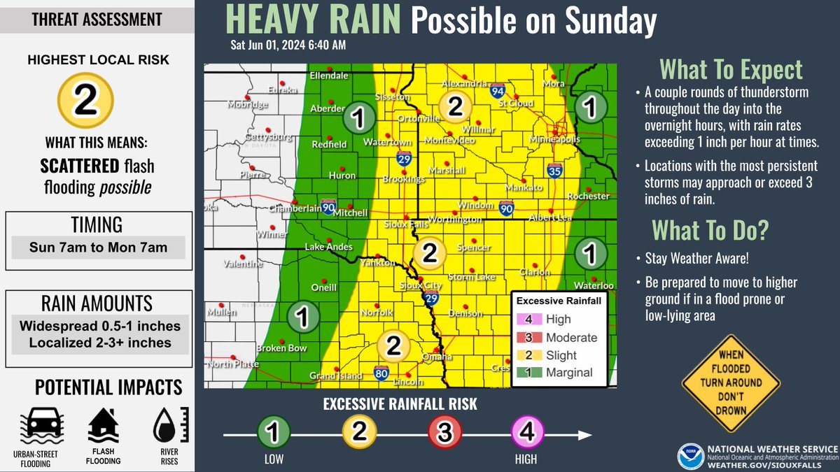
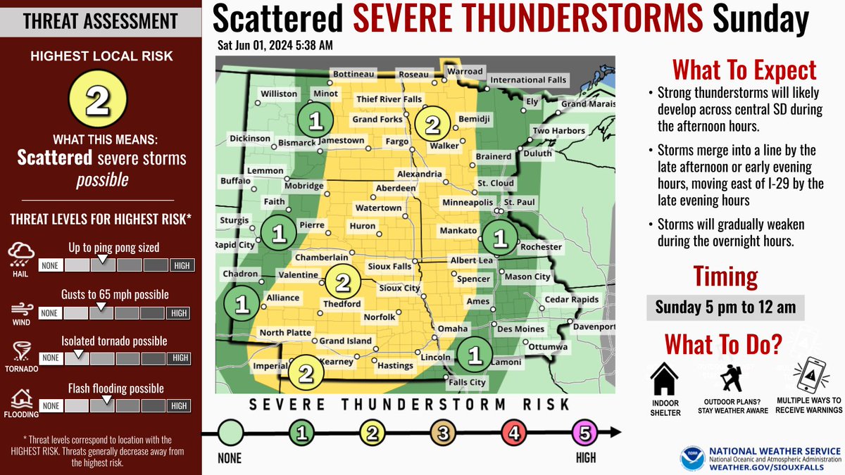
In addition to the severe thunderstorm chances on Sunday, there is a threat for heavy rainfall throughout the day and overnight into Monday. With rainfall rates exceeding 1 inch per hour at times, scattered urban and flash flooding issues will be possible along with river rises.
Here's a look at our severe weather chances for Sunday
⚠️Level 2 out of 5 Risk
🕔Late Sunday afternoon and overnight into Monday
⛈️ Ping pong ball sized hail possible
🌬️ Wind gusts to 65 mph
🌪️ Tornado possible
🌧️ Flash flooding possible
📻 Have a way to receive warnings
Here is an updated look at the timing and progression of the expected thunderstorms later today. Strong thunderstorms are expected to develop west of I-29 by the mid-afternoon hours, possibly becoming severe as they approach the I-29 corridor and continue eastwards.
Strong to severe thunderstorms are expected to develop west of I-29 between 2-4 PM, moving east of I-29 into the evening hours. Strong damaging wind gusts to 70mph and large half-dollar sized hail are the main threats.
Stay weather aware this afternoon and evening!