Severe thunderstorms are expected from Monday afternoon into early Monday night, with damaging winds the primary threat across the Washington, D.C. region. https://t.co/y47c5EtwEV
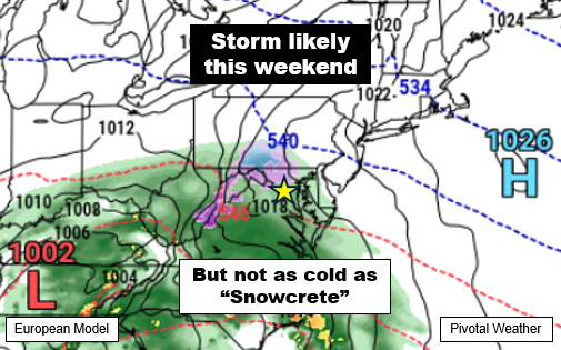
Our next storm chance in the DC area looks to arrive this weekend, with precipitation coming through sometime between late Saturday night and Monday morning.
Unlike with "Snowcrete," temperatures before the storm won't be super cold. In fact, highs should reach the upper 30s to mid-40s Tuesday through Saturday. And while we may dip to the upper 20s to low 30s Saturday night, it doesn't look like there will be a strong high pressure to our north to keep that colder air in place.
So while a period of accumulating snow or wintry mix is certainly possible, it's not definite, and most model data currently suggests a changeover to wintry mix and/or rain with temperatures on Sunday rising above freezing.
Temperatures may trend even warmer following the storm.
More details as we get closer.