A Winter Weather Advisory is in effect from 12p-12a Mon above 7000 ft for the Greater Lake Tahoe Area. Total snow accumulations of 2 to 4 inches. A dusting to an inch is possible for Lake Tahoe and Truckee communities. Plan on slippery road conditions, delays, and chain controls.
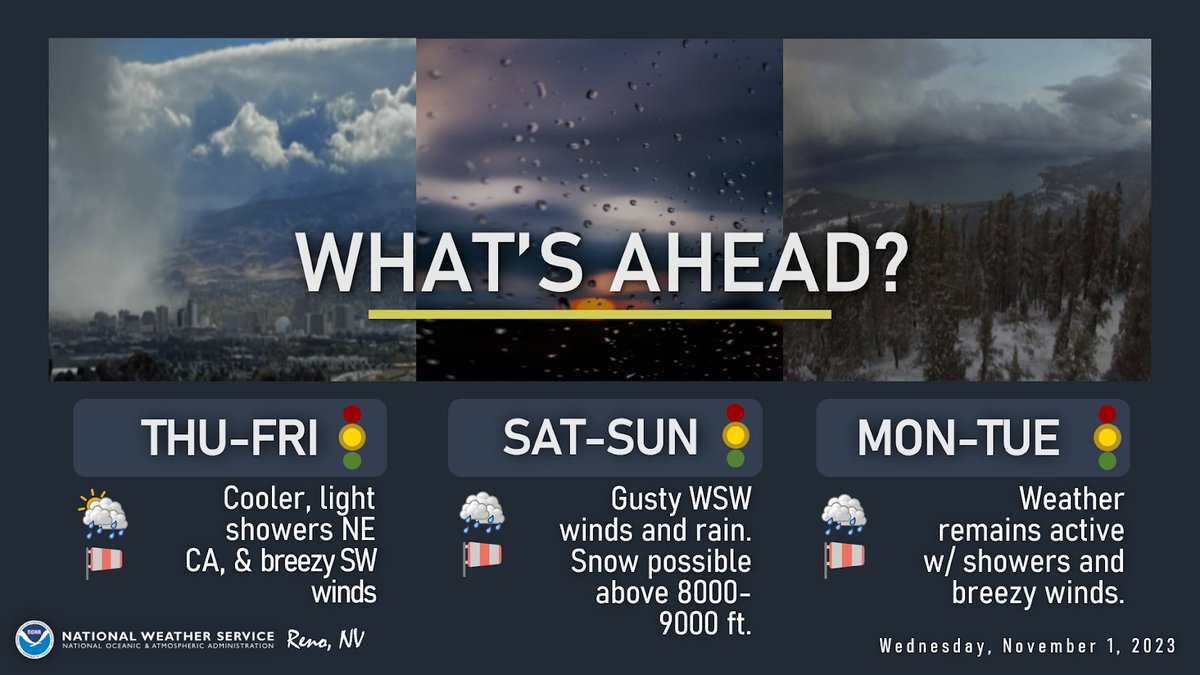
Our pattern shifts into a more active one as a couple warmer storm systems brush by the region Thu-Sun. Valley rain showers with high-elevation snow will be possible, especially Sat and Sun. The active pattern may continue into early next week with cooler systems a possibility.
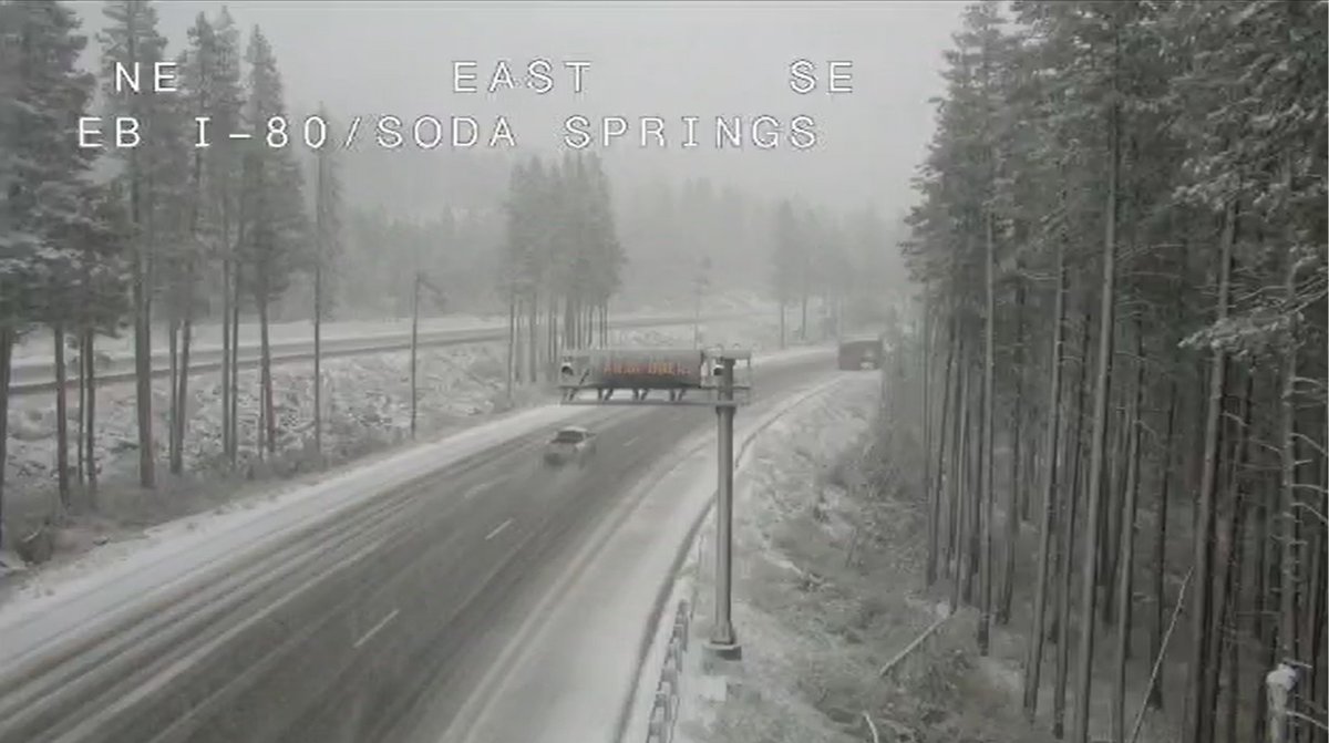
ANNNND WE HAVE CHAIN CONTROL!! Our first one for the year😳🥶❄️ 10/25/23 2:15pm
Roads are extremely slick, so slow down and increase your following distance!
• I-80 is R2 in both directions from the Donner Lake Interchange to Kingvale.
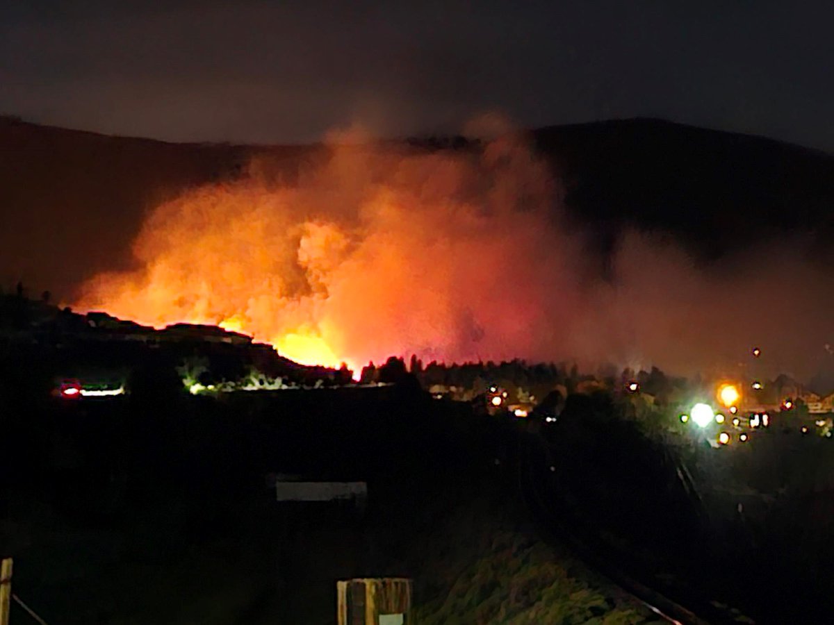
FIRE WATCH
The #HillFire is currently 42 acres in size and is behaving erratically due to wind. Structures are threatened at this time. Multiple agencies are working to put out the blaze.
Keep an eye out for more details from 2 News.
DID YOU FEEL IT?
A magnitude 3.7 earthquake just shook parts of Sun Valley.
There's no immediate information on any damage or injuries
Share your photos, videos below!
If you live in Pershing and Churchill counties and saw lightning to the east, the GOES-WEST Geostationary Lightning Mapper also saw the flashes as well from 22,000 miles above the equator. The incoming storm system will bring showers and cooler temps. Time to bundle up!
A Winter Weather Advisory has been issued for areas above 8000 ft in Mono Co from 11 PM Fri-8 PM Sun.
Snow accumulations of 1-3”, with localized heavier snow totals up to 6". Slick conditions are expected over the Eastern Sierra passes, esp. over Tioga and Sonora Passes.
Catastrophic floods have absolutely devastated Central Greece.
Zagora, Greece received 30 inches of rain in one day. That’s more rain than London typically sees in a year.
🎥 @RomainChvt
SPC has placed portions of our area under a Marginal Risk (level 1/5) of isolated severe thunderstorms tomorrow, including a majority of the west-central Basin & Range. ⛈
Impacts include frequent lightning, gusty outflow winds, hail to 1" diameter, and heavy rainfall. #nvwx