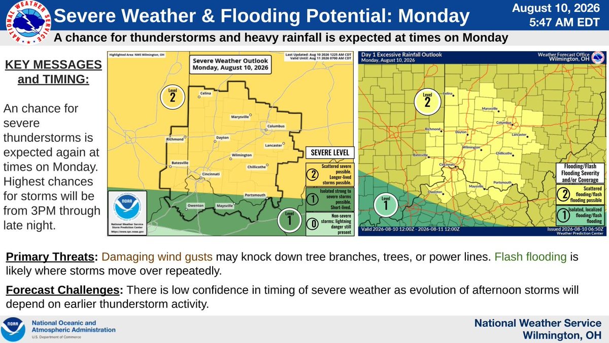
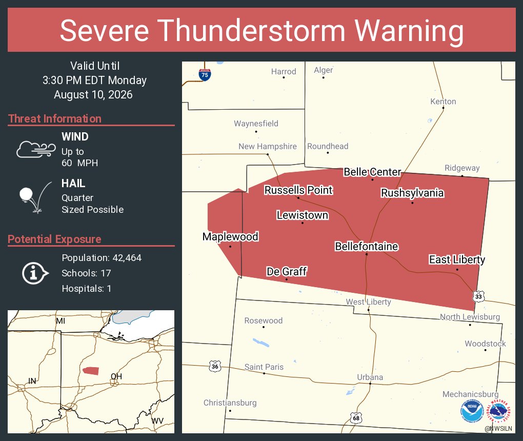
Storms will move out of the region early this morning. But additional storms will cross the area this afternoon. There will continue to be the potential for locally heavy rain and flooding as well as strong to damaging wind gusts.
Multiple rounds of storms are expected throughout the day today, with strong to damaging winds and very heavy rain and flash flooding being the primary threats. The heavy rain/flash flooding potential will linger through tonight into early Wednesday morning.
[4:27 am] Early morning thunderstorms will be capable of producing heavy rain and perhaps some small hail near and south of the Columbus area. Be cautious of high water on roadways.
A very active pattern coming up!! ⛈☔🌊⚡
Unfortunately, there is high uncertainty regarding timing of storms over the coming days, so we recommend checking radar before you head out and check frequently for forecast updates.
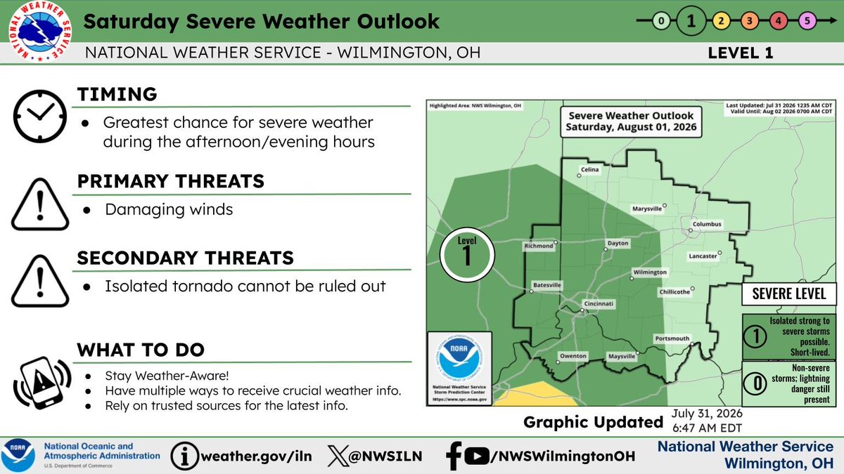
A low pressure system will bring the chance for widespread rainfall on Saturday through Saturday night. Heavy rain is possible. Rain chances will continue on Sunday as well.
Thunderstorms will develop ahead of an approaching cold front this afternoon into this evening. A few severe storms will be possible, with damaging wind being the main threat.
"There is a very significant gap between what climate science actually says and what you've been told it says."
Steve Koonin spent 50 years in science at Caltech, BP, and the US Department of Energy.
He argues that a generation has been taught to fear the future when the scientific evidence paints a more nuanced picture.
Watch the full ARC 2026 speech
It will be hot and humid for the next couple of days which will result in heat indices around 100. This could lead to heat exhaustion. The heat index will not be quite as high late in the week as clouds increase and the chance of showers and storms returns.
Hot and humid weather can affect your body’s ability to cool itself—sometimes in unexpected ways. 🥵 Stay #WeatherReady by knowing the signs of heat-related illness and how to respond.
Learn more: https://t.co/mauuS0G4YX #HeatSafety
Stay safe out there!
Very hot and humid this week. Drinks lots of water, take breaks to cool off if you need to be outside during the heat of the day, and check on your neighbors.
Heat dome builds across the region today. With the humid air mass also intact, 'feels-like' temps will range from the middle 90s to lower 100s during the hottest part of the day. Additionally, overnight lows will generally remain in the mid-70s, providing little to no relief.
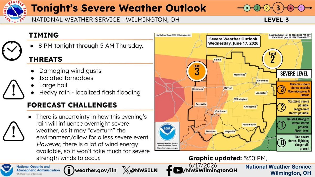
A subtle shift southeast in the Enhanced (Level 3) Severe Threat for overnight tonight & some updated messaging regarding forecast challenges.
Have multiple ways to receive weather alerts & have a plan in place for your home if severe weather or flooding occurs overnight!
Thunderstorms are expected to develop late this afternoon into this evening. A few storms could become strong to severe, with damaging winds being the primary threat.