Targeting a DERECHO THREAT in Minnesota tomorrow evening and overnight that could hammer Minneapolis with 100+ mph wind gusts tomorrow night!
High-resolution models are suggesting a long-lived wind bag will form in eastern Siuth Dakota tomorrow late afternoon and churn across central and southern Minnesota toward Minneapolis by late evening. This wind bag will likely leave a trail of significant samage in its wake. Stay tuned!
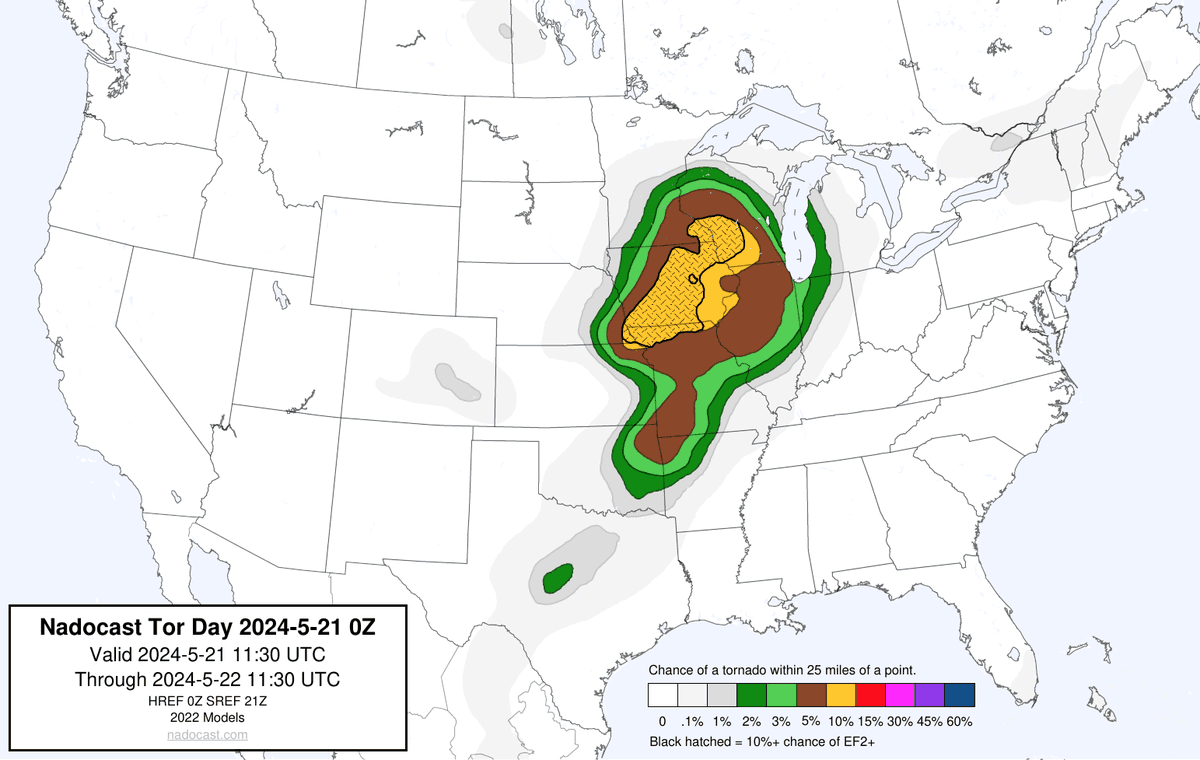
TORNADO OUTBREAK EXPECTED MONDAY IOWA, SOUTHERN MINNESOTA, WESTERN WISCONSIN
A fast-moving upper level jet stream will launch up to the Upper Midwest on Monday with big moisture surging up through Minneapolis! Very strong wind shear and instability will develop by Monday afternoon. Significant severe weather expected from Minnesota and western Wisconsin all the way to West Texas but the #tornado threat will be maximized in the highlighted area.
Reminder:
Anthony Edwards is only 22
Jaden McDaniels is 23
Naz Reid is 24
NAW is 25
Even younger prospects on the bench in Leonard Miller, Jaylen Clark, Luka Garza, and Josh Minott.
This is only the beginning.
🚨SIGNED NAZ REID JERSEY GIVEAWAY 🚨
How to enter: 👇🏻
1. Follow me
2. Reply to this tweet
3. Repost for extra entry
Thanks to @PristineAuction for sponsoring this giveaway! The best place to buy your favorite players’ memorabilia.
Winner will be chosen in 7 days.
Good luck and GO WOLVES 🐺
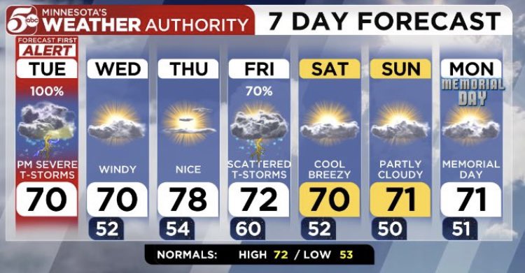
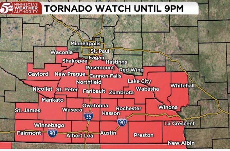
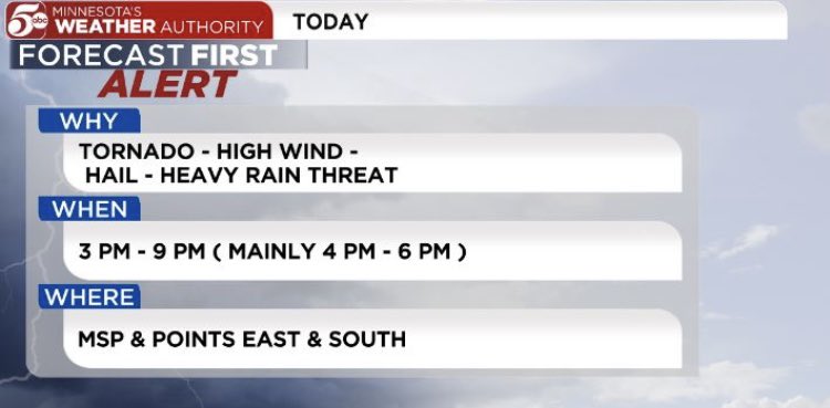
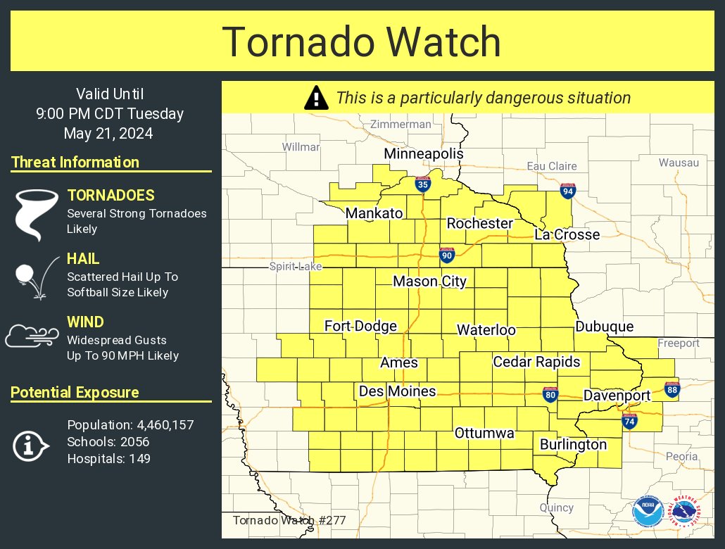
PDS (Particularly Dangerous Situation) Tornado Watch until 9pm & includes Carver, Scott & Dakota Counties of south Twin Cities-areas in Tornado Watch could see 90 mph Winds & Long Track Tornadoes - main threat for Tornadoes in Twin Cities south Metro Today is 4pm-6pm. @KSTP
Twin Cities residents: Strong storms will move into the entire metro right around rush hour and will produce very heavy rain, strong winds and possibly a tornado or two. This will be a good day to get home early if you can, and avoid being stuck on the road when these storms hit.
8:02am CDT #SPC Day1 Outlook Moderate Risk: over much of IA and nearby parts of southeastern Minnesota, Wisconsin, Illinois, and Missouri https://t.co/TgJgC6cQZw
STORM TOTAL: When the snow finally comes to an end by Thursday evening, we're looking at 15-20" with localized amounts of close to two feet for south central MN/western Wisconsin. Snow will be blowing and drifting, so getting accurate measurements will be difficult. (4/5)
Florida is the only state that hasn't had any form of snow (falling or on the ground) in the last 24 hours. Image is snow depth and last 24 hours of snowfall. Unless @NWSTallahassee saw a snowflake? #snow#rare
Democracy is sometimes messy, so sometimes it requires a little patience.
But that patience has been rewarded now for more than 240 years with a system of governance that has been the envy of the world.