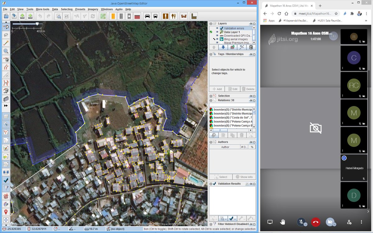
Four (4) #MapeandoMeuBairro community members participating in different activities under the GIS Day celebrations in Maputo. Advocating for wider use of #OpenData in public and private institutions! 💪💪
🔴 Mapa de violències amb enfocament de gènere a #GrandeMaputo per entendre l espai i la mobilitat, i així, poder interveni a través de polítiques públiques, rehabilitació i accions. Mapa participatiu d’un corredor metropolita @MapMeuBairro@ASFCatalunya#CooperacioAMB#CMM#AMT
Formação em português para todos interessados.
Introductory training sessions in open data mapping tools for whoever is interested. PORTUGUESE ONLY
#MapeandoMeuBairro
2/2
These maps are isochrones generated for two major Mozambican cities where existing data makes it at least possible to create those isochrones (and to respond to COVID), even if not 100% accurately. In other areas of Mozambique it is much harder to know: #WhereIsMyHospital?
1/2
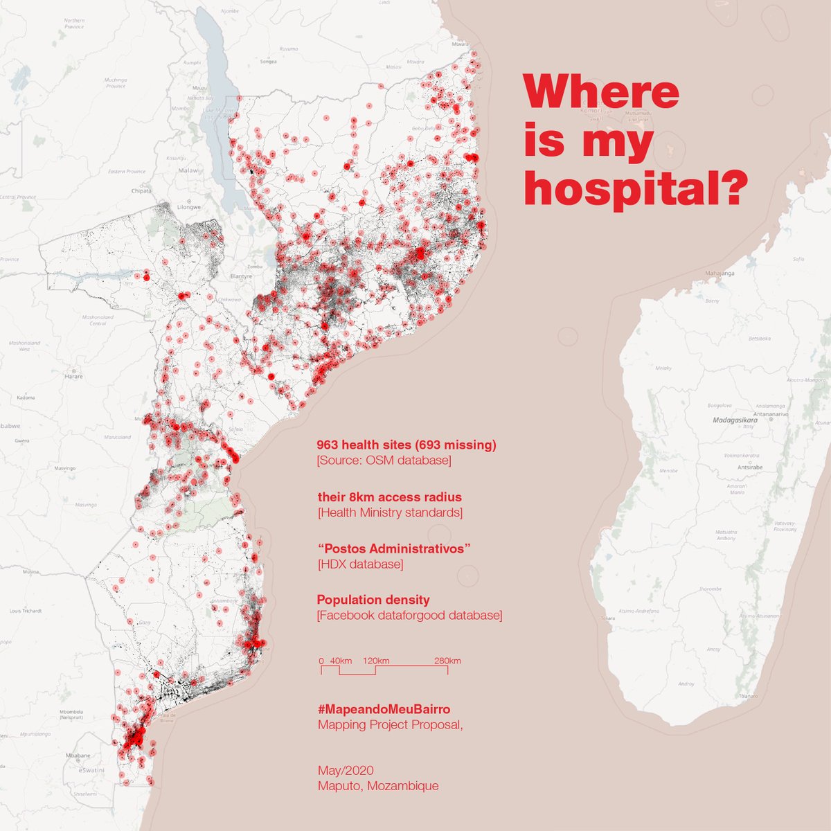
Shapes might look somewhat appealing, but they don’t represent reality. We are missing about half the #HealthFacilities and A LOT of road network. This project seeks to contribute @OpenStreetMap data and thus help the Mozambican Ministry of Health in responding to COVID19.
1/3
We want to help the Ministry of Health create an “interactive geographic Model” that initially will indicate areas of Mozambique where people live farthest away from a Health Facility. Because for patients, doctors, planners its sometimes hard to find out: #WhereIsMyHospital?
3/3
The project includes working at the base of the health system, with the existing Mobile Units of the Ministry, whose travels across remote populations are an essential part of the Model.
We are currently in the stage of raising funds to advance implementation of the project.
2/3
The Model will be useful to plan the response to COVID19 but also improve the efficiency of all other health services. As always at #MapeandoMeuBairro, the Model is based on @OpenStreetMap data, plus new data that we are receiving from the Ministry and its networks.
3/3
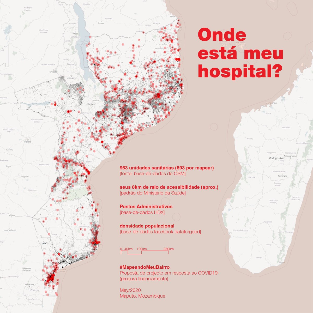
O projecto inclui trabalhar na base do Sistema de Saúde, com as brigadas móveis do Ministério já existentes, e cujas movimentações pelas povoações recônditas são parte essencial do Modelo.
Neste momento estamos em fase de angariação de fundos para implementar o projecto.
1/3
Queremos ajudar o Ministério da Saúde a criar um “Modelo geográfico interactivo” que em 1ª fase irá indicar as áreas de Moçambique onde as pessoas vivem mais longe de um Posto de Saúde. Para pacientes, médicos e planificadores às vezes é difícil saber: #OndeEstáMeuHospital?
2/3
O Modelo será útil para planificar resposta ao COVID19 e melhorar a eficiência de todos outros serviços de saúde. Como sempre no #MapeandoMeuBairro, o Modelo basea-se em dados do @OpenStreetMap, e novos dados que estamos a receber do Ministério e suas redes de trabalho.