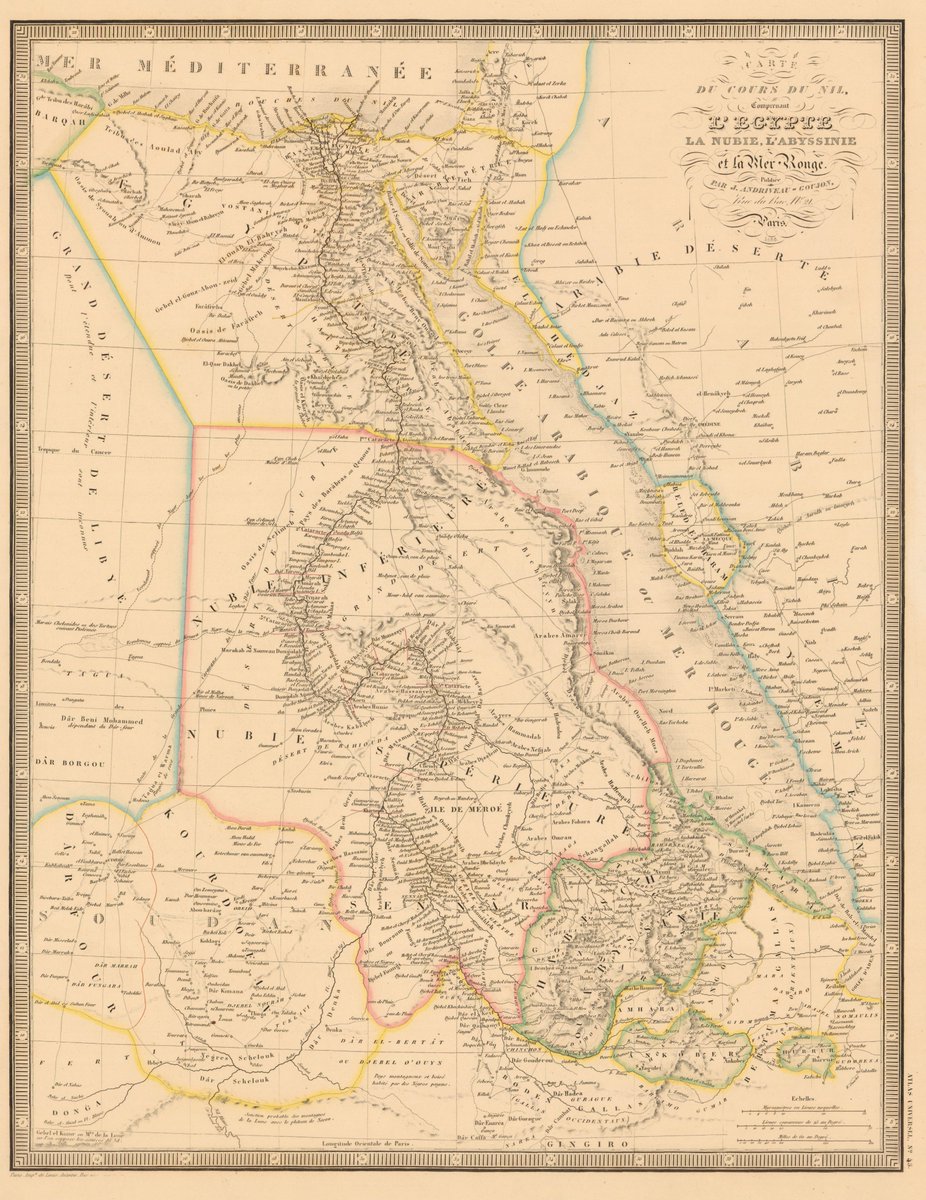
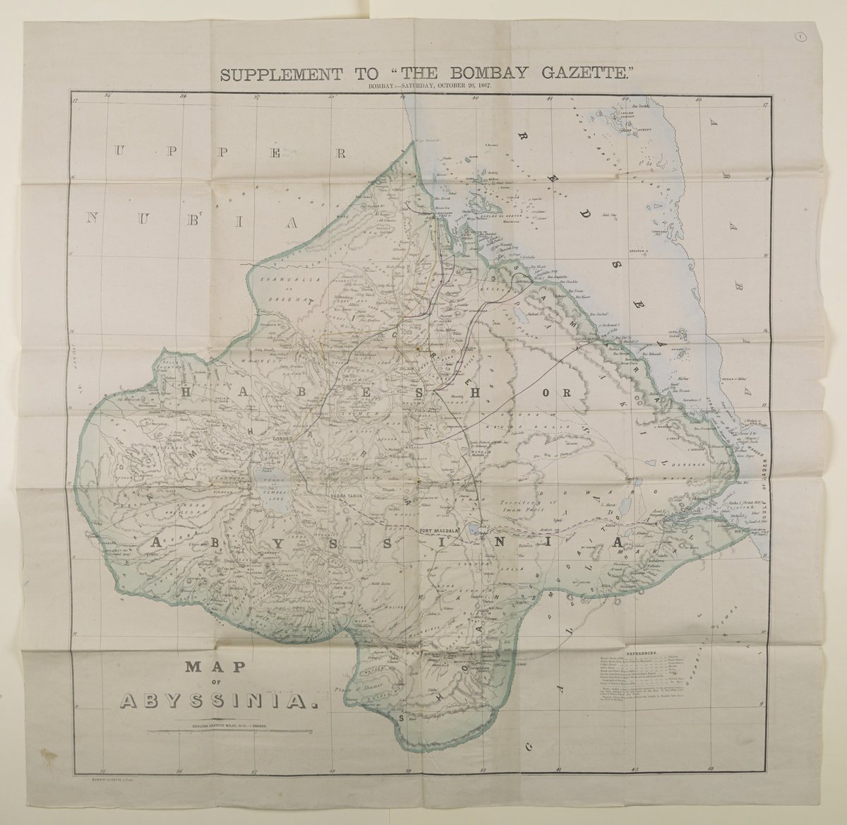
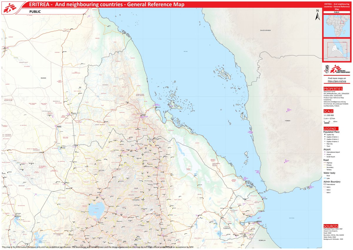
Interesting to note the extent of Abyssinia from the Red Sea to Blue Nile. Meaning Ethiopia has a historical claim to the sea. And that Oromia was largely existed outside the territorial limits of the Abyssinian empire. Fascinating to see such contested claims on a map
Road Map of Addis Ababa
By A. Anderson Bell
Published by Addis Ababa City Planning Department
Addis Ababa, September 1955
This map is one of my favorites, and thanks to @abbasshash for explaining the story of "Casa Inces" last time I posted it
European territorial claims on the coasts of the Red Sea
By Rawson William, Weller, Edward
Published by Edward Stanford, Proceedings of the Royal Geographical Society
London, 1885
Inset: Gulf of Tajura, Obock, Assab Bay, Sheikh Syed and Perim Island
As the saying goes, a drowning man will clutch at a straw
When you lose the battlefield, you freeze the frame, zoom in on the pupil, enhance it, and make up some batshit nonsense
We could say a lot about the 27-minute so-called interview that the great pretender, Abiy Ahmed, gave to his own megaphone television yesterday.
Study the camera shots carefully. This time, they spend very little time on his face and much more time on wide shots and the interviewer. Why? Because he is constantly reading from a screen, reciting words prepared for him by either Getachew or Tsadkan.
Yet, despite the producer’s and editor’s best efforts to conceal this, look what I found! You can actually see him reading from a screen strategically positioned behind the interviewer, creating the illusion that he is speaking freely to the interviewer or the camera.
But I froze the footage, zoomed in on his pupils, and guess what? Hehehehe! He is reading and repeating words from a big-screen like a parrot!
Abiy is as fake as they come: a pretender, a coward and a bigmouth. Behind the carefully staged performance and bluster, we all know he is terrified.
#Eritrea #Ethiopia @TomGardner18@TheEconomist@NewYorker@DailyNewsEgypt
The Trans Nzoia plateau and Nzoia valley from 40000 ft.
Three of Kenya's five highest places are visible in this image. Mt. Elgon (2nd), Cherangany Hills (4th) and Mt. Mtelo (5th). River Nzoia drains Elgon and Cherangany before draining into Lake Victoria
Happy Mashujaa Day 🇰🇪
Map of the Nile Basin
By the Egyptian Government Survey Department
Part of the Survey Department
Cairo, 1949
*This map was the official visual blueprint of the Century Storage Scheme. A project to manage the Nile by building massive dams, including raising the level of Lake Tana
Let us not mince our words and call a Spade a Spade!
1. The Potemkin Party has been obsessed/immersed in unparalleled military expenditure spree in the last three years.
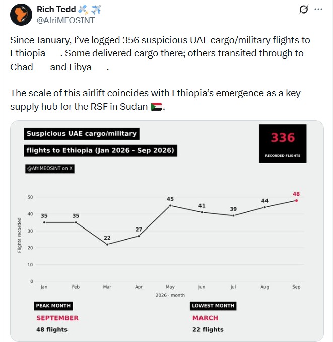
2. In the last three quarters of 2026 alone, the regime has received 365 UAE Cargo/military deliveries for use in its multiple domestic conflicts and concomitant acts/designs of regional destablization.
3. At the same time, the regime has received - and these are conservative estimates - over 30 billion US Dollars in cumulative external financial assistance in the last eight years from several multilateral and bilateral donors.
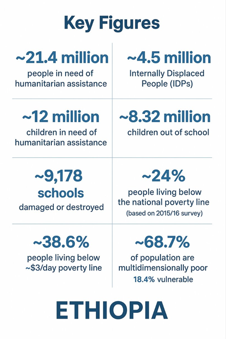
4. And yet, almost 21.4 million people all over the country remain in dire conditions whose survival depends on humanitarian assistance.
In a nutshell, the priorities of this callous regime are crystal clear; reckless wars of delusional "grandeur" in lieu of the welfare of the majority of its people and enduring regional peace and stability.
#Eritrea did not "officially" invade #Ethiopia. Only an Eritrean official could officially declare war. They would issue an official declaration and most likely speak publicly as an official. This headline is fraudulent and sensational.
https://t.co/niYrpEDk2e
Map of Saudi Arabia and Environs
By Al-Raghaib Press Arabic (Egypt Newspaper)
A Gift from 'Al-Qahira' Newspaper to King Abdulaziz Al Saud
Published in Cairo, 1955
Ethiopia: Transportation and Administration
By the Imperial Ethiopian Mapping and Geography Institute
Published by Berhan and Selam Printing Press
January, 1966