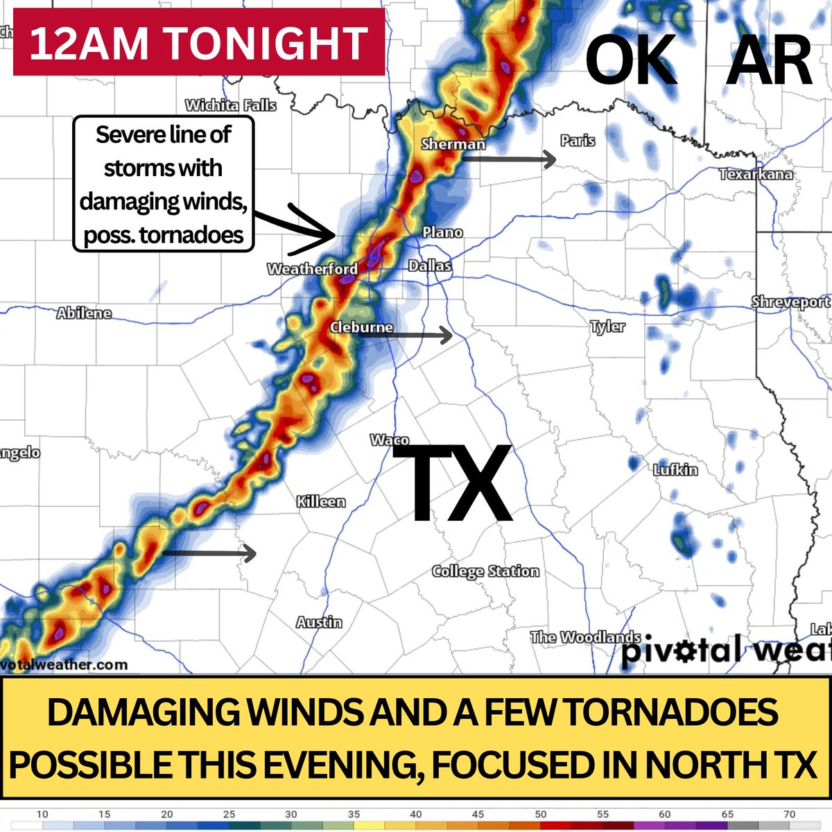
⚡ DFW STORM FORECAST: The latest run of the HRRR model (17z or 11 AM CST) predicts a line of intense storms moving through the DFW Metroplex around midnight tonight.
The environment will support a threat for damaging wind gusts and perhaps a few tornadoes. The tornado threat today will be greatest northwest of the metroplex earlier on, but DFW may still see some spin-ups within the line. Damaging winds should be the primary hazard by the time this storm line moves into DFW. Beware of dangerous frequent lightning and street flooding as well.
Have multiple ways to receive critical weather warnings that will wake you up, like a weather radio. You can also review our helpful alert service in the comments. - Jason