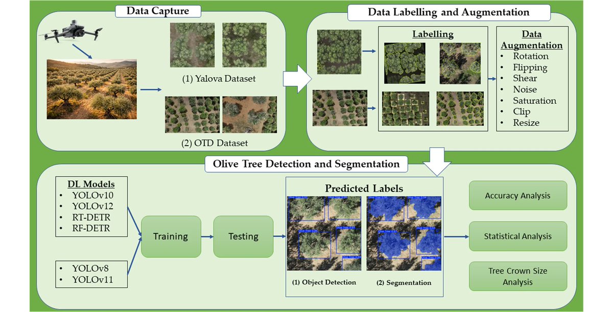
🌐New Publication🌐
Benchmarking YOLO and Transformer-Based Detectors for #Olive Tree Crown Identification in #UAV Imagery
By Muhammed Enes Atik and Mehmet Arkali
🔗See the paper: https://t.co/aIF9fqhAVd
#photogrammetry#deeplearning#olivetree
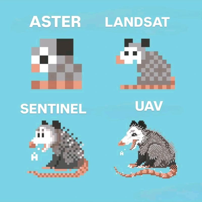
1. Spatial Resolutions: ASTER, Landsat, Sentinel & UAVs
In EO, spatial resolution determines the size of the smallest object that can be detected by a sensor. Choosing the right dataset often depends on the balance between resolution, cost & coverage. Here's a quick comparison:
New Article Alert 🚨
Our new publication with my advisor Dr Muhammed Enes Atik and Dr Şaziye Özge Atik has been published in @Drones_MDPI journal.
🆕 Impact of UAV-Derived RTK/PPK Products on Geometric Correction of VHR Satellite Imagery
@MDPIOpenAccess
https://t.co/kDoKknjtmm
Harita Genel Müdürlüğü tarafından hazırlanan “ITRF Koordinat Dönüşüm Uygulaması” kullanıma sunulmuştur. Harita Genel Müdürlüğü web sayfasında yer alan Uygulamalar/Jeodezik Hesaplamalar bölümüne eklenmiştir. Detaylı bilgi için⤵️
https://t.co/MGxbh4j6pb
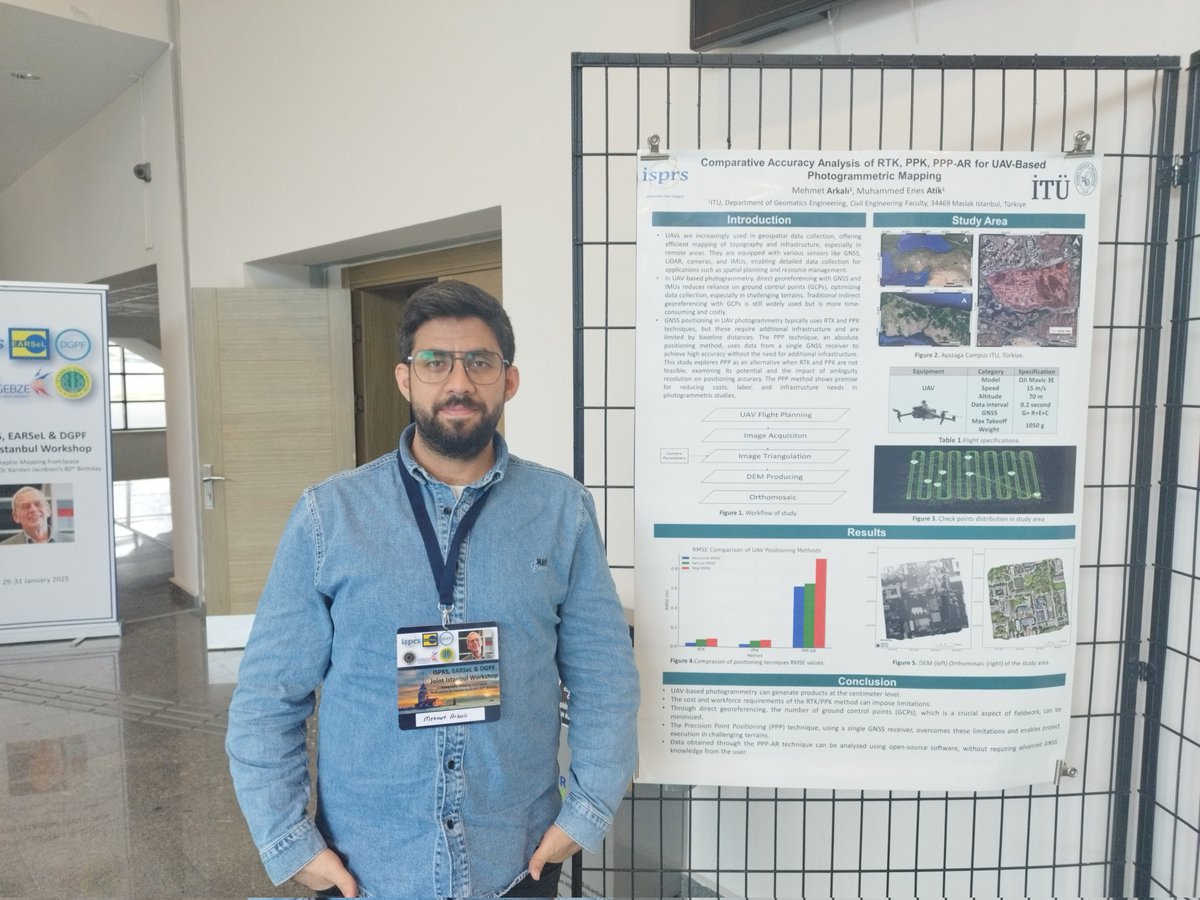
I presented two studies at the ISPRS, @EARSeL_tweet & DGPF Workshop at @YildizEdu on January 29-31, 2025. Thank to Dr. Muhammed Enes Atik and Dr. Şaziye Özge Atik. I am grateful for the opportunity to contribute to the event as part of ITU Geomatics.
@itu_geomatik
@ISPRS_SC
I am honored to have been awarded a grant under @Tubitak 2211-A National PhD Scholarship Program. I would like to express my appreciation to my supervisors and colleagues for their valuable support during my projects and publications.
New paper alert!🚨
I am pleased to announce the publication of our article in @Drones_MDPI in collaboration with my supervisor, Dr. Muhammed Enes Atik.We look forward to achieving even more excellent results in 2025.
https://t.co/CRKviK14ud
🌍 Discover the Importance of #TerrestrialReferenceFrames 🌍 @IAG_GGOS released a 2 min video on the crucial role of geodetic reference frames. Essential for science & society, enabling innovative, location-based apps.📽️ Watch now: https://t.co/xVoy3qt48H
@iag_geodesy#UNGGCE