We have been working with Cole on his documentaries for some time now, mainly on the map animations. His latest video is very interesting.
https://t.co/JDxLyaJbGm
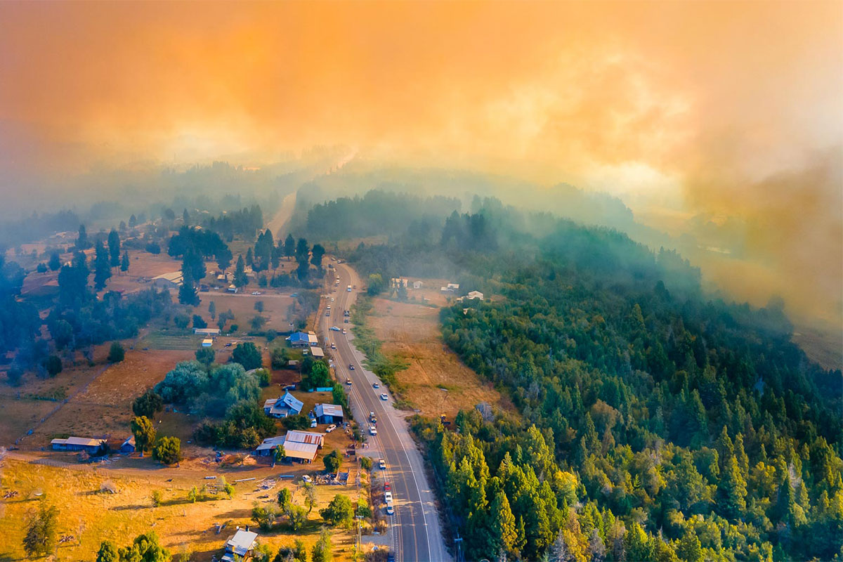
Day 15 — Fire
Before & after of a wildfire in El Bolsón, Patagonia Argentina.
Extreme drought and rising temperatures turned the region into a high-risk zone this summer. Visualizing how quickly the landscape can change.
#30DayMapChallenge
Day 15 — OpenStreetMap
Four of Europe’s greenest capitals, mapped exclusively with OSM land-use data.
A look at how open data helps reveal the structure of our cities and the green spaces within them.
#30DayMapChallenge
Day 13 — 10 minute map
Mapping the distribution of capybaras across the world.
I'm also surprised that there aren't any in Guyana and Suriname, but I did it with the data I found. 🤷♂️
#30DayMapChallenge
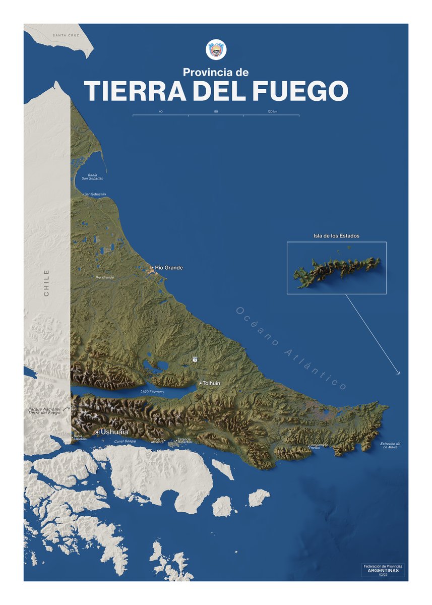
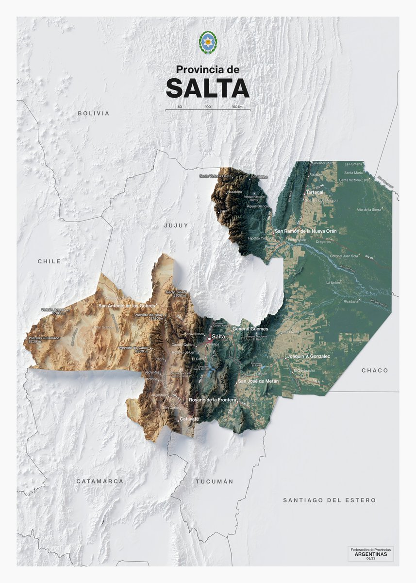
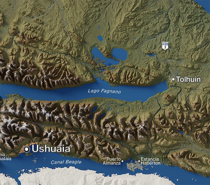
🗺️ My second map of a new project I’ve been working on — a collection of relief maps of Argentina’s provinces.
Tierra del Fuego, the southernmost land in the country.
Still a long way to go, but I’m loving the process.
#cartography#Argentina#TierraDelFuego#geography
@kimura Great!
I make them with QGIS and refine them in Photoshop.
I haven't been doing them for very long, but there are some tricks in QGIS that help elevate our maps visually. A good way to learn is with courses from @undertheraedar
Day 10 — Air
Flight routes departing from Atlanta (ATL) and Shanghai (PVG).
The busiest air hubs of the United States and China.
Mapping the patterns of global air travel.
#30DayMapChallenge
Day 7 — Accessibility
Mapping access to healthcare in Madrid.
The red polygons represent hospitals and clinics located within a 10 km radius from the city center.
#30DayMapChallenge
Day 5 — Earth
The El Chaltén Massif, a granite mountain group in southern Patagonia dominated by Mount Fitz Roy and Cerro Torre.
Snow, rock, and ice define one of the most dramatic landscapes of the Andes.
#30DayMapChallenge
@bbboubacar03 Yes!
I downloaded my route as KML from Google My Maps.
Then I converted it to GeoJSON (with QGIS), and imported it into After Effects, where I used the #Geolayers plugin to animate the route and create the globe (as well as stylizing it a bit).
Day 4 — My Data
On December 31st, with friends, we took a train in Buenos Aires and arrived in Cusco.
In the map I show the route on the way there. You can see the goal achieved in the final photo!
#30DayMapChallenge