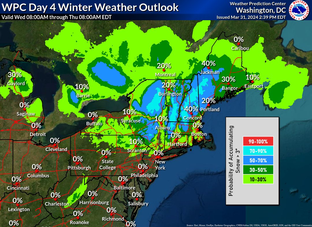
We are monitoring a long-duration storm that will impact the region Tuesday through Thursday with high-elevation snow, and valley rain changing to snow. This map shows the chance for >3" of snow between 8 AM WED - 8 AM THU. Additional snow accumulation is likely after 8 AM THU.
No, this is NOT an April Fool's Joke! Confidence is increasing that a significant winter storm will bring heavy snow and gusty winds to portions of the Great Lakes and Northeast later this week. Please stay tuned for forecast updates the next few days.