Showers and scattered heavy thunderstorms expected to be stronger on Saturday and continue through the weekend. These storms may produce strong wind gusts with straight-line winds being the main threat along with possible flooding.
Stay Safe Maury County!
#TeamMaury
Well, the weather has been nice and quiet for several weeks but has had us in an extreme drought since October. Change is coming with showers developing tonight through the weekend.
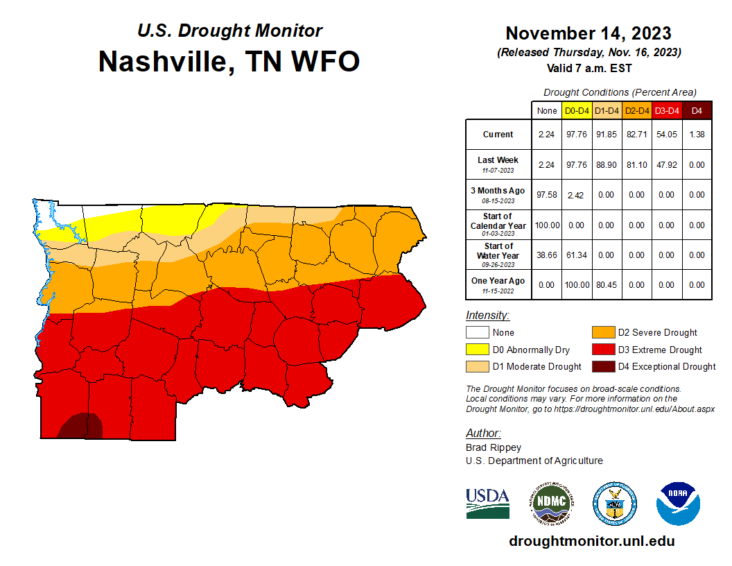
The latest drought map was released yesterday and conditions across Middle Tennessee continue to worsen. More than 90% of the mid state is considered to be experiencing drought conditions to some degree, and more than half of the region is in an extreme or exceptional drought.
UPDATE: The Safe Space is now closed. It appears the worst of the storm is passed. We will get more rain and possibly thunderstorms. If conditions change, or we are placed under a warning, we will reopen the safe space.
The Safe Space at 1451 Tom J Hitch Pkwy is open for the duration of the incoming storms. We do not recommend driving through the storm if at all possible.
Know where to go in the event of a severe weather warning.
Make a plan now.
Lowest level, most interior room or space.
Charge your devices.
Have multiple ways to receive alerts.
Stay weather aware.