19, #1 deadlock fan, Floridian weather nerd | Do not follow me if your a hateful person you get blocked | My names not actually Maximillian its just Max :)
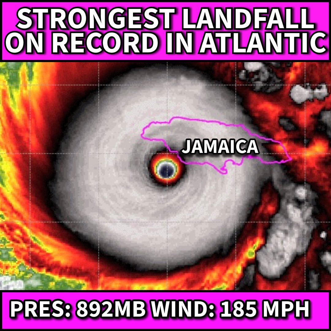
***ALL-TIME RECORD***
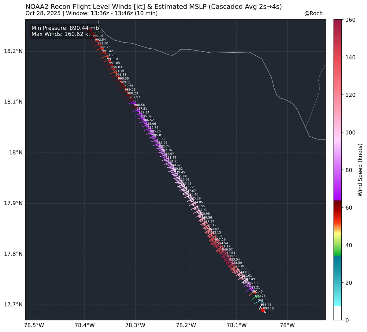
#Melissa is now the Strongest landfalling storm ever on record in the Atlantic (and it may be getting stronger)
892mb, winds 185 mph. (Tied with the FL Keys Labor Day Hurricane of 1935 in wind and pressure)
Let’s see what the official “landfall” is to verify.
#jamaica
Overheated deep-hot Caribbean waters are a big reason for this history making event… 2 degree F + above their 20th century normals. Hotter water = Stronger Potential Intensity as has beared out in Melissa
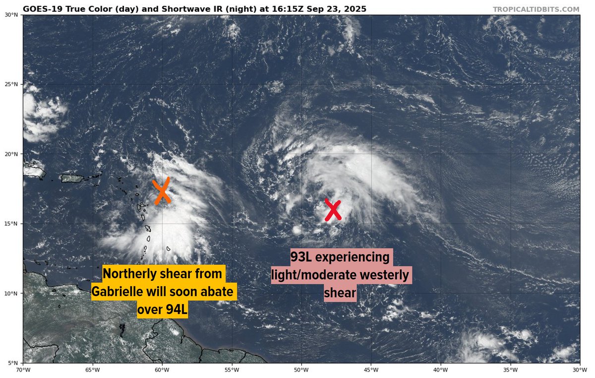
I wish I could make more sense of what is happening here, but all I can say is that 94L seems to be doing everything that it possibly can to go off script and defy models. NHC has the red X just to the E of Puerto Rico, but now the deepest convection has migrated further south and away from the island. The best vorticity is probably just north of the current burst of convection, but still quite a ways from where modelling is putting the X right now. This has been failing to make much if any further progress towards the north since last night, and while we are waiting on a more robust and defined vortex to become established, we can see new areas of vorticity form closer to the convection, and that is another thing that can throw a curveball at us. So until we get more clarity, continue to expect the unexpected!
The steering for next week is both incredibly complex and fascinating. Three low pressures, all exerting influence, dancing around each other. Outcome is very difficult to determine.
The medium range (4-6 day) forecast for #93L and #94L is highly uncertain for a few reasons. First, the waves are spaced very close together, but models are beginning to insist on a rather unusual upper-level pattern that would allow both to develop. The systems will... (1/3)
Make no mistake, this is a monstrous Category 5 Super Typhoon that is reaching the upper echelons of plausible cyclonic intensity. Landfalling storms do not get much stronger than this.
We are about to go LIVE on X and YouTube with breaking news coverage of Ragasa (NandoPH).