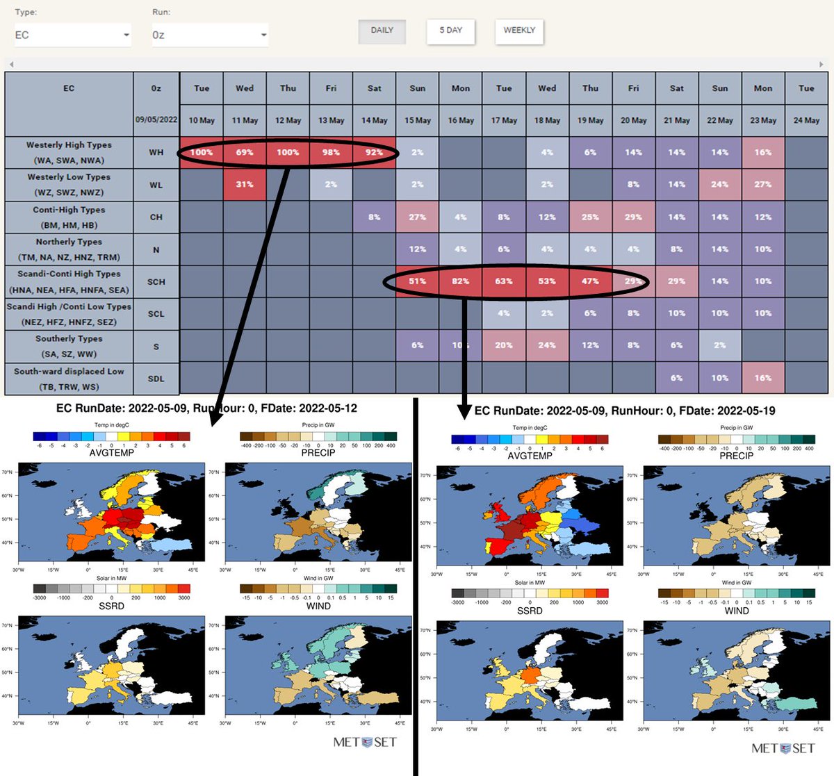
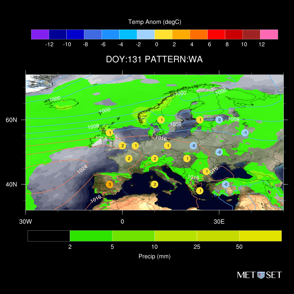
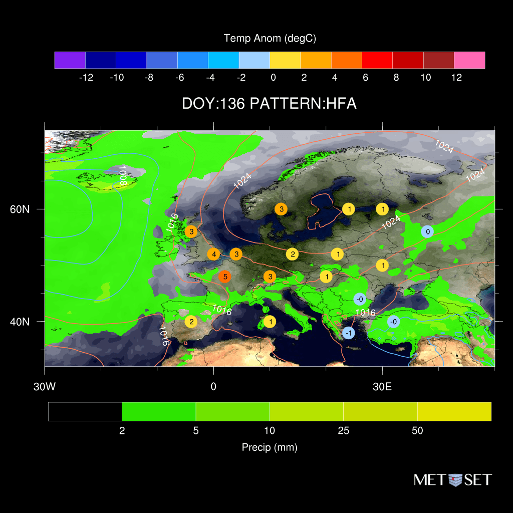
Westerly High this week - widely warm - wet/windy N Europe, dry/sunny mainland Europe, bit of cloud UK.
Scandi-Conti High next week - widely calm/dry/sunny inc. Nordic, sunny UK bit of wind perhaps (more cloud/wind here if we switch to southerly type). Hot W/C Europe - cooler E
1/5
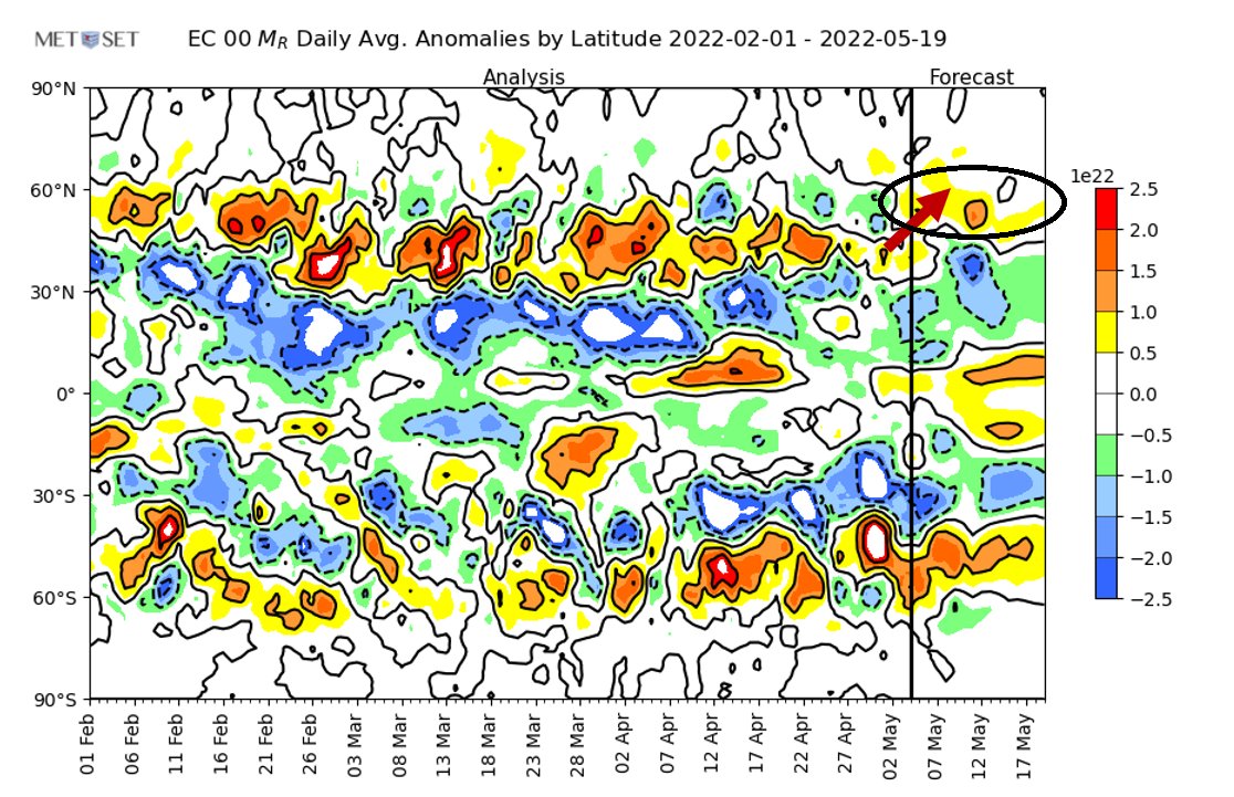
GLobal Atmospheric Angular Momentum (GLAAM or AAM), ever heard of it?
It shows anomalous zonal wind speeds across the Globe, and in the NH, recently anomalous W flow has been 35-45N denoting a south-ward shift in the Jet-Stream but forecast shifts the Jet back to 50-60N
5/5
WA (Westerly Anticyclonic) sees a slightly weaker mainland Europe high which allows Atlantic low pressure to cut across N UK/Nordic to bring more wind/precip/cloud here and a cap in temps here - still overall on the warm side - mostly calm/dry/sunny Mainland Europe still.
4/5
HFA (High Fennoscandia/Anticyclonic mainland) sees low pressure in the N ATL being held back by a stronger European high pressure to draw more southerly flow esp. W Europe that brings the risk of more extreme warmth - calm/dry/sunny conditions extend into UK/Nordic.
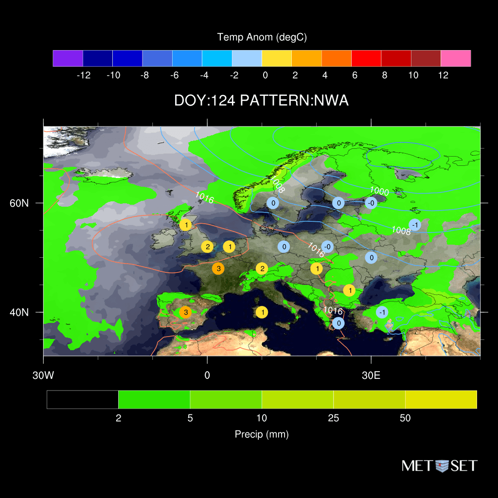
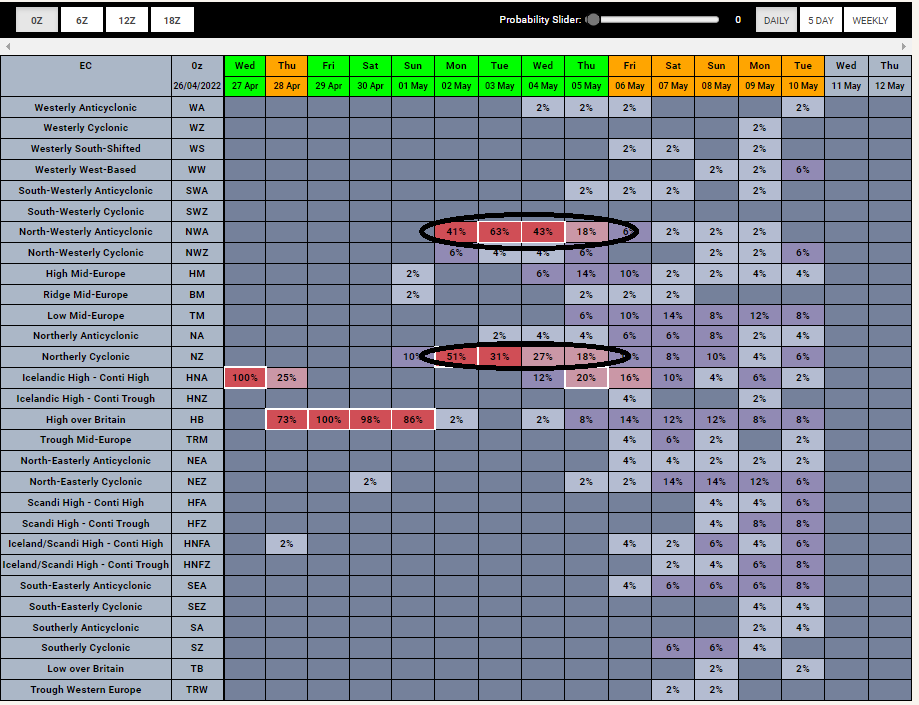
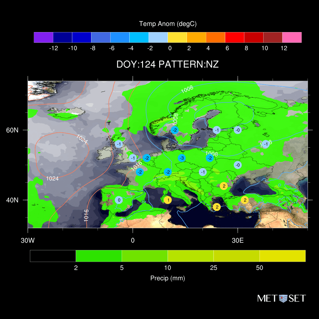
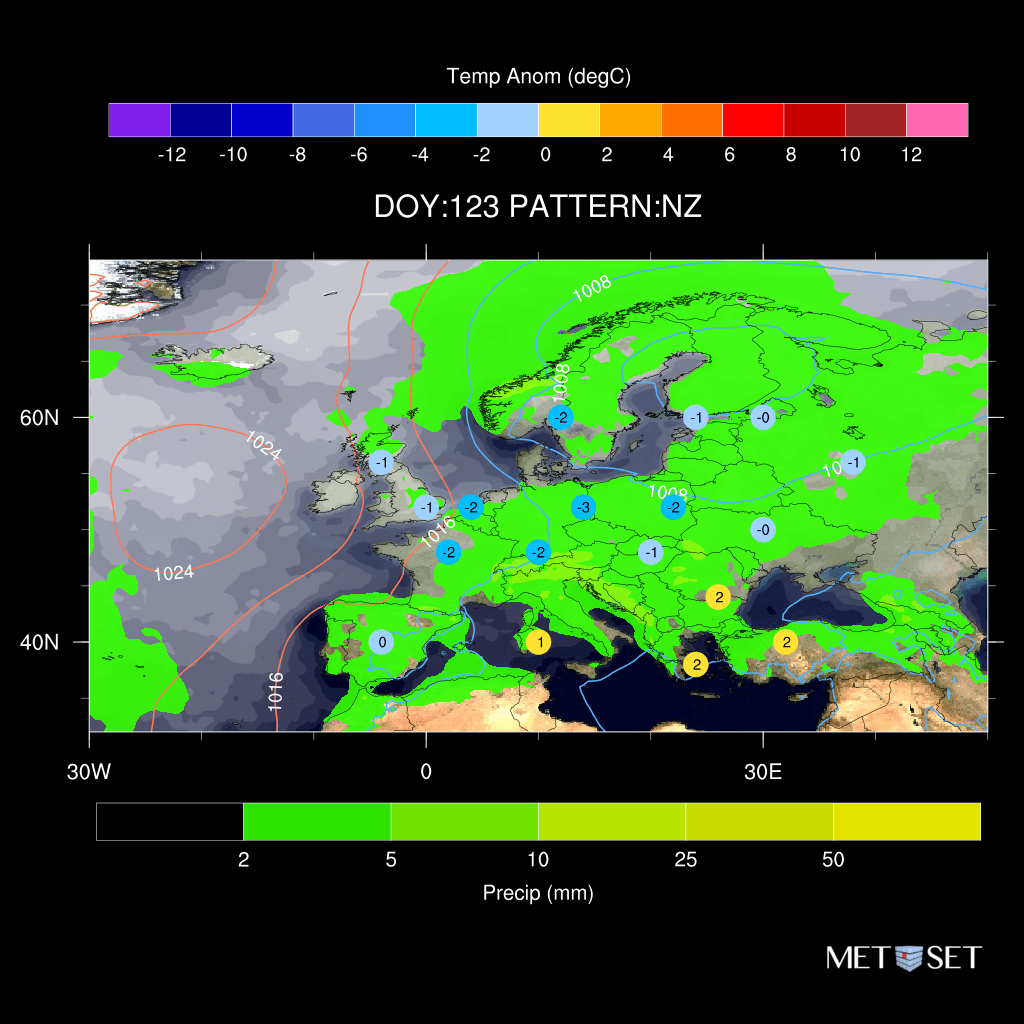
Early/mid next week sees ATL ridge with low pressure Nordic, but slight shifts in the ridge make a difference. NWA (North-Westerly Anticyclone) where ridge extends into W Europe is warmer here with cold limited to NE Europe. NZ (Northerly cyclonic) keeps ridge west = cold widely
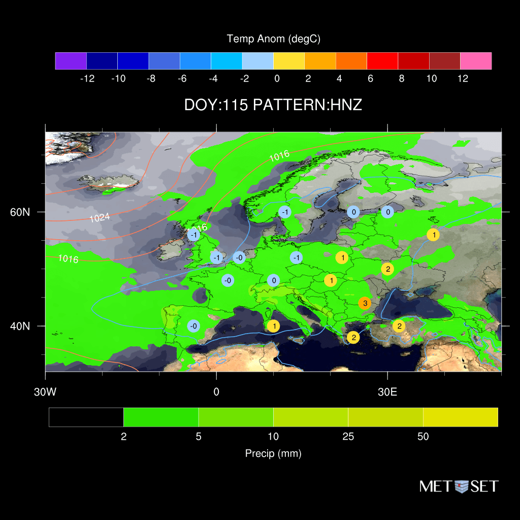
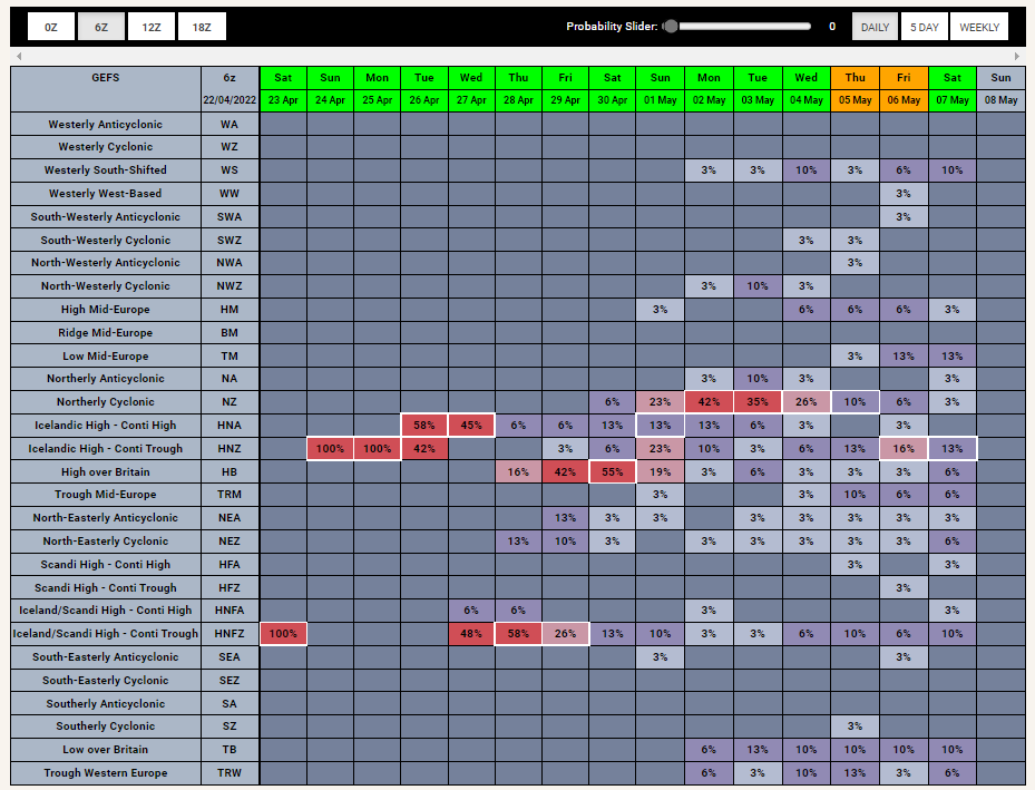
Northerly coldest direction now. Outlook sees Nordic high (HNF=High over Norwegian sea and Fennoscandia, Z=cyclonic) shift to HNZ (just Norwegian Sea) opens the door to northerly. Colder version of this is NZ (Northerly Cyclonic) which threatens UK May Bank holiday of course...
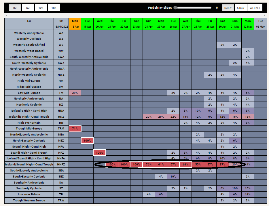
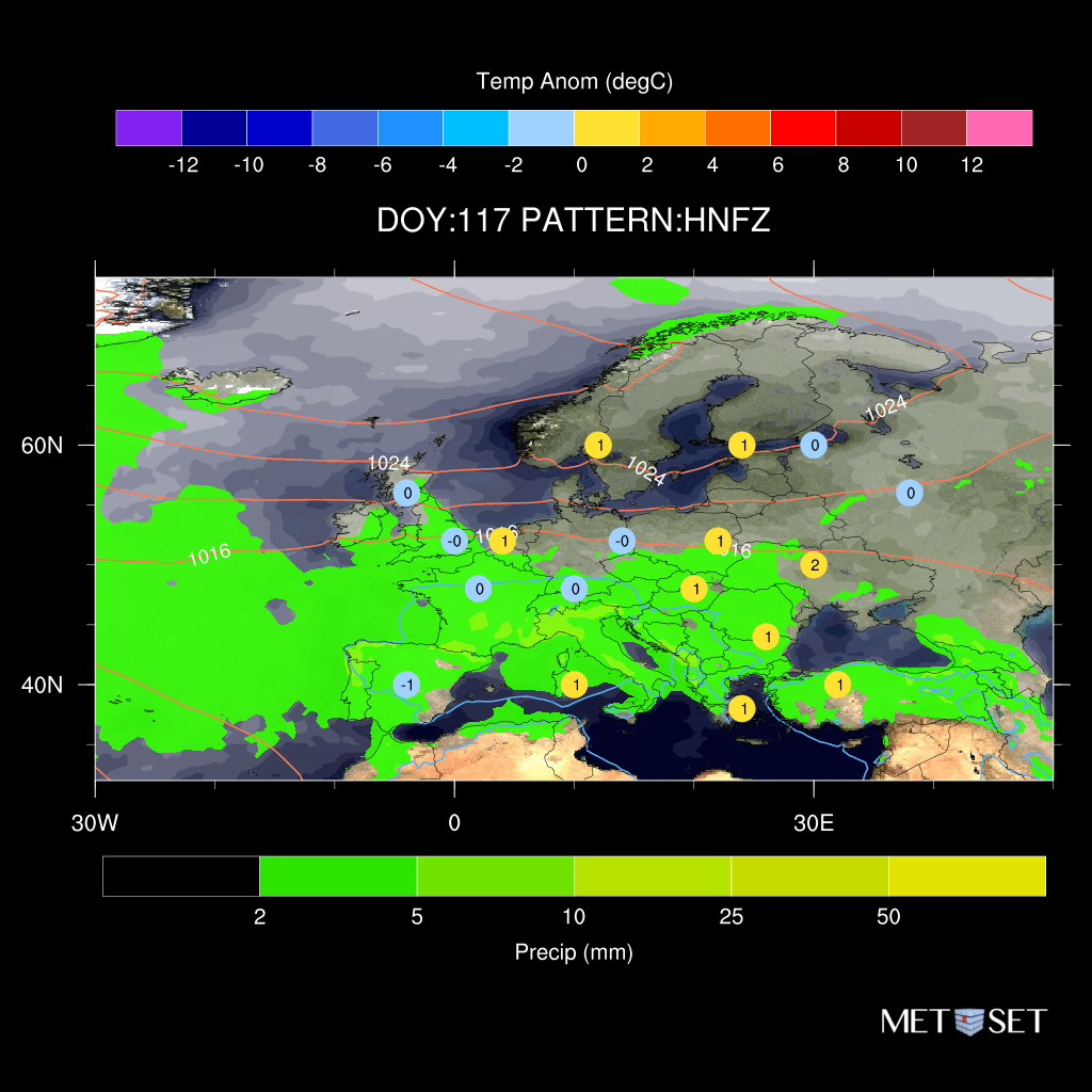
Strong/early final stratospheric warming event has brought a surface block (- NAO/AO) clear forecast for HNFZ regime in late Apr. However whilst this is the coldest regime in Feb (DOY33) - blocking doesn't have the same impact now - instead bringing near normal temps (DOY117)
Whilst all these patterns are westerly-types - the slight differences between them do make a large impact on the energy market - as the zone of strongest winds (map of turbines)/warmest temp anomalies shifts about and thus it is important info to know which pattern it'll be 8/8
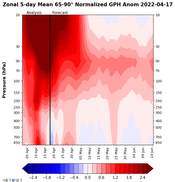
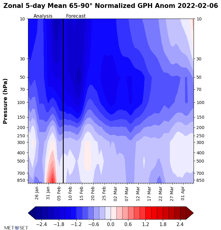
The outlook is blue! But what does blue mean?
This chart shows the forecast (dates left to right) of pressure at numerous levels (stratosphere at the top & troposphere bottom) where blue is lower than normal pressure, thus strong low pressure dominates across the N. latitudes 1/8
Late next week still mostly WA/WZ - further risk of wet/windy N Europe - calm/dry S Europe and widely mild. Some risk of being in SWA/NWA instead (not as windy) or even NWZ (North-Westerly cyclonic/Zyklonal) - spreads more wind/warmth into SE Europe - WZ/NWZ less mild N UK 7/8
@JanegaTomas@PvForecast Not so in the forecasts but it is far enough out where skill is low and thus could happen - even for cold lovers I think this is the one winter where it's better if it doesn't happen and we turn very mild, otherwise our electricity bills will go through the roof!
Latest forecasts (from C3S) for February showing quite a similar outlook in the different models for very mild south-westerly flow into NW Europe - strong ATL low pressure/Mainland Europe high - all except MeteoFrance which has a stronger high pressure. https://t.co/ETYYbPywPV
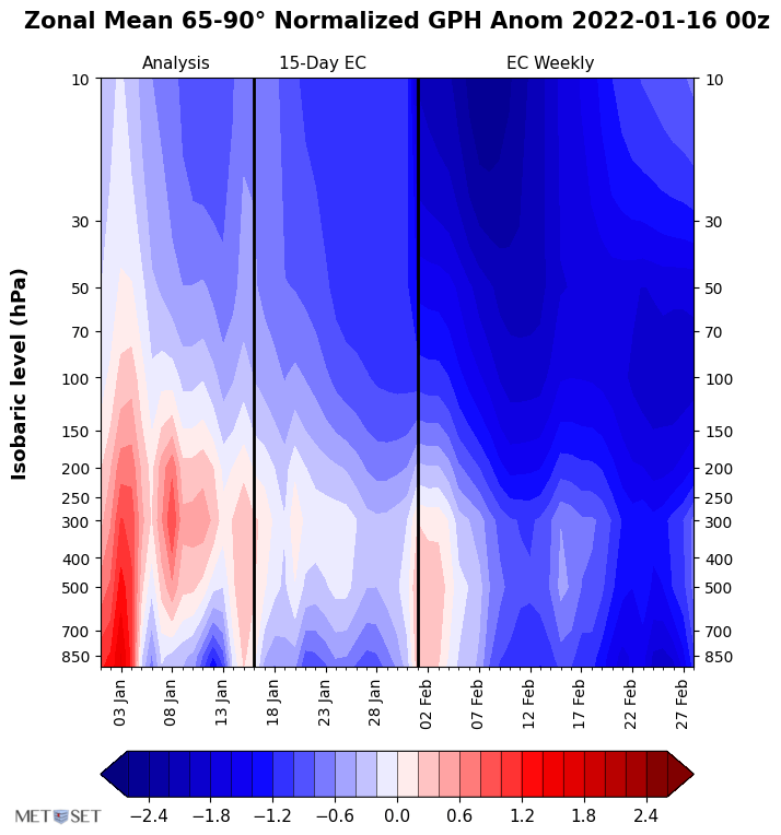
@JanegaTomas@PvForecast The latest ECMWF keeps a solid westerly (blue) vortex aloft extending down to the surface with greater intensity during Feb into March thus agrees with the seasonal signal of ATL low pressure/Mainland Europe high and widespread mild temps - but of course things can always change!