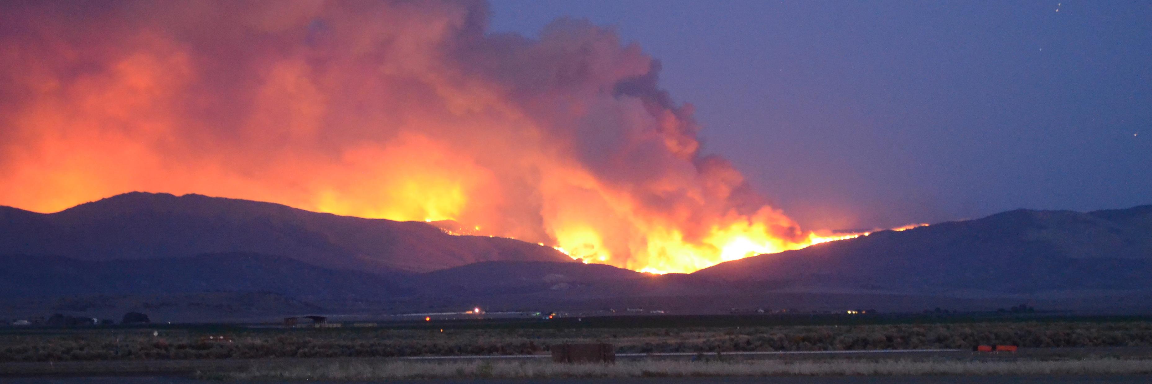
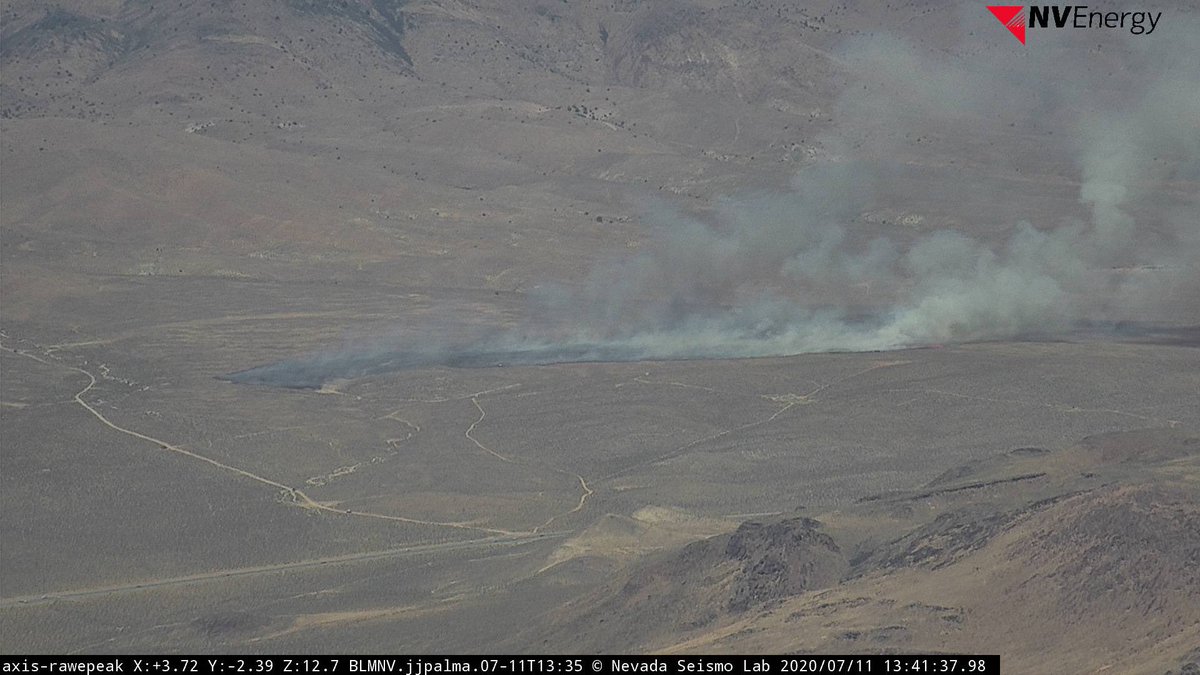
WILDFIRE UPDATE - The LUCKY FIRE at 6:12pm.
Please stay clear of the area as resources engage with suppression effort
@KTVN@KOLO8@fox11reno @KRNV @blmnv @nevadadivision
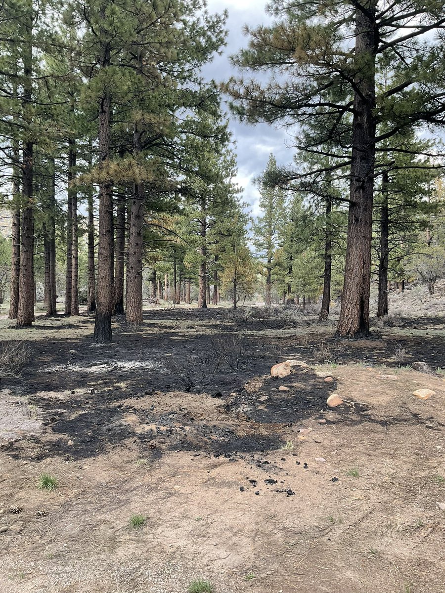
Here are two current maps of the #dogvalleyprescribedfire. One shows the locations of the units with the 335 acres achieved, while the other shows the general location of the region.
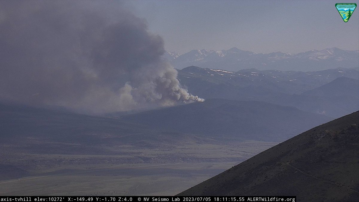
Crews will continue working, on-scene, to complete the fire mop-up. Smoke will still be visible
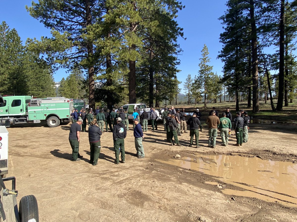
Fire teams from the #whitescreekrx have now moved over to brief and concentrate their efforts on the Dog Valley Prescribed Fire, northeast of Verdi, NV. 273 acres are planned for the burn which will start Tuesday, May 16th around 10am.
#prescribedfire#wildlandfirefighters
The Fire and Fuels staff of the HTNF-Carson Ranger District, had great success with the Whites Creek #prescribedfire. This allows space for the larger trees to thrive by providing new and healthy growth of the native vegetation.
#wildlandfirefighters#prescribedfires
Prescribed pile burning resumes this week on the SMNRA in the Potosi project area, located off SR160 near mile marker 19. Smoke may be visible from SR160 and in the community of Mountain Springs, please do not report.
https://t.co/y6pc21m3HK
#GoodFire#RXFire
Crews on the Bridgeport Ranger District are conducting prescribed pile burning today in the Four Mile project area, located on the west side of Highway 338, south of Desert Creek Road. Smoke may be visible from Smith Valley and Wellington, Nv. Please do not report. #GoodFire
Pile burning resumes today in the Mill Canyon area located southwest of Walker, Ca off of Hwy 395. Smoke From the #MillCanyonProject may be visible from Highway 395 near Walker. Local fire departments are aware of this project, please do not report.
https://t.co/reDDjeVNtk
Prescribed pile burning will be taking place today in the Clear Creek drainage off U.S Hwy 50 below Spooner Summit, two miles south of Carson City.
Smoke may be visible from Hwy 50 and the Carson Valley, please do not report. #ClearCreekProject
https://t.co/zcsl816H5L
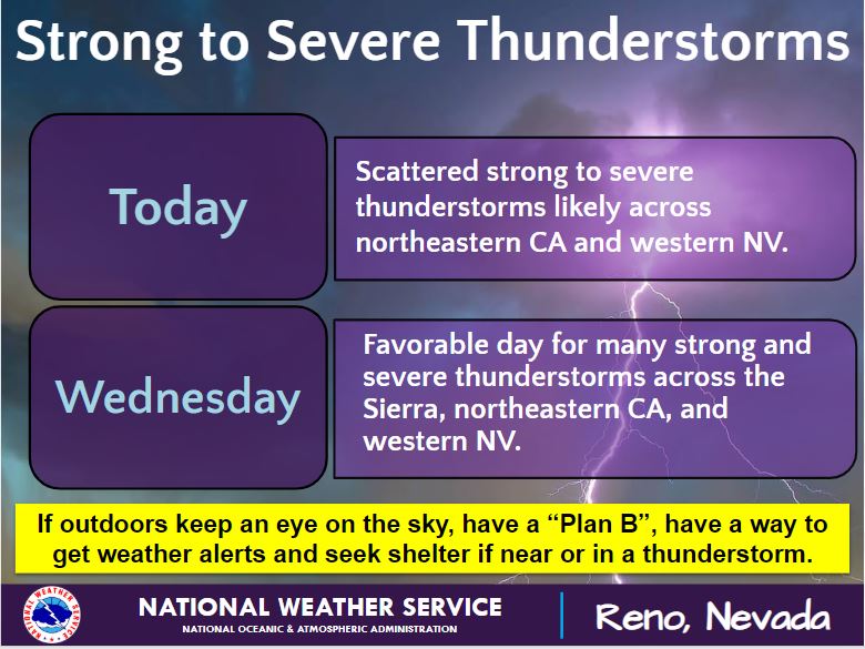
T-storm coverage/strength is expected to increase today & peak on Wed. Expect gusty winds, brief heavy rain fall w/localized flash flooding, dangerous lightning, new fire starts and hail near any t-storms that develop. If outdoors keep an eye on the sky, have a “Plan B”! #NVWx
An engine is on scene of a 1/10 of an acre fire near Burnside lake on the Carson Ranger district #Hawkins. For currents updates visit. https://t.co/0SiDLUP38s
@NevadaFireInfo
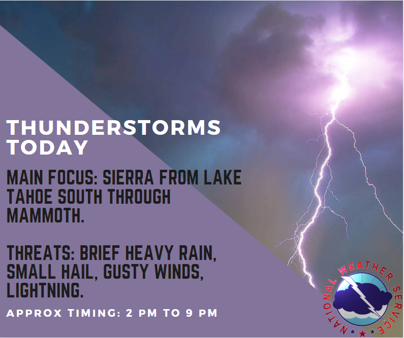
Thunderstorms will once again form this afternoon lasting into the evening. The main focus will be in the Sierra from Lake Tahoe south through Mammoth, but a few storms may work their way east into Douglas, Lyon and Mineral Counties as well.
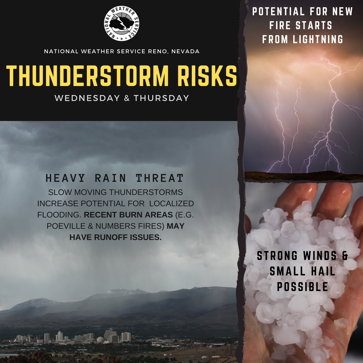
Thunderstorm Threats for WED & THURS:
⚡️🔥 New fire starts possible from lightning with strong outflow winds.
⛈Localized heavy rain with flash flooding near storm cores.
Recent burn areas #PoevilleFire#NumbersFire may have runoff issues.
Details - https://t.co/SGKsXuiXgy
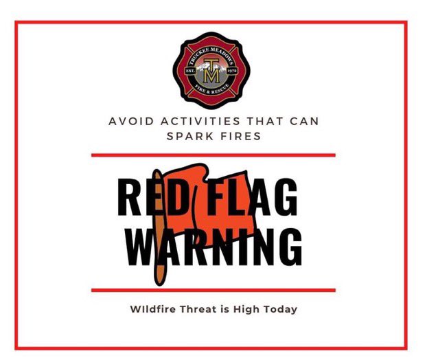
⚠️#RedFlag Warning is in effect today, July 12, until 9 PM due to high gusty winds and low humidity. Avoid outdoor activities that can start fires. Pile burning is strictly prohibited. @washoecounty@NWSReno 🔥