#DisclosureDay is another Spielberg magic trick. Starts as a conspiracy thriller from one of the best filmmakers at conveying information visually. Ends as something profoundly emotional.
The whole universe wants to be understood, and the best gift you can give is understanding
Lex Luthor’s warsuit was first introduced in 1983’s ACTION COMICS #544 by Cary Bates and Curt Swan. It’s been a huge part of SUPERMAN comics ever since, but I believe this will be its first theatrical appearance.
Very cool to see this take — and practical, no less
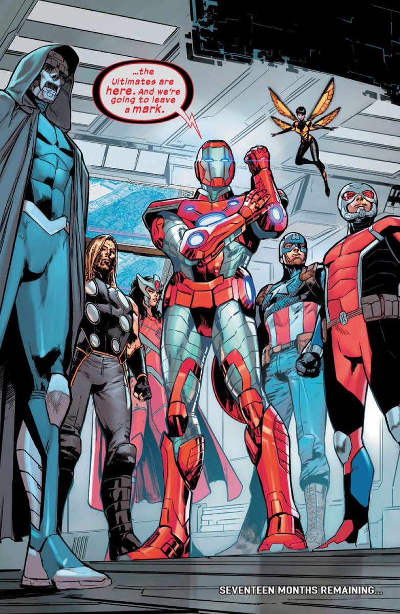
With the final issue out today, @DenizCamp’s ULTIMATES deserves to go down as one of the greatest 24-issue stretches we’ve ever seen at the Big 2. Always one of the most urgent & intelligent books on the shelf
I’m sad to say goodbye to 6160, but so grateful for this comic
If you’re a NASCAR under the age of 47, you’ll be watching your first ever Cup race today without a Busch or an Earnhardt in it.
The 2026 Coca-Cola 600 will be the first NASCAR Cup Series race without an Earnhardt or Busch in the field since 1979.
Are you the barista that wrote "Yummers!" on Jessie T. Usher's Starbucks cup?
On the red carpet for the finale of @TheBoys, I chatted with the A-Train actor about one of many viral #TheBoys memes and his character making it to "The beginning of the end."
@TheWrap@VoughtIntl
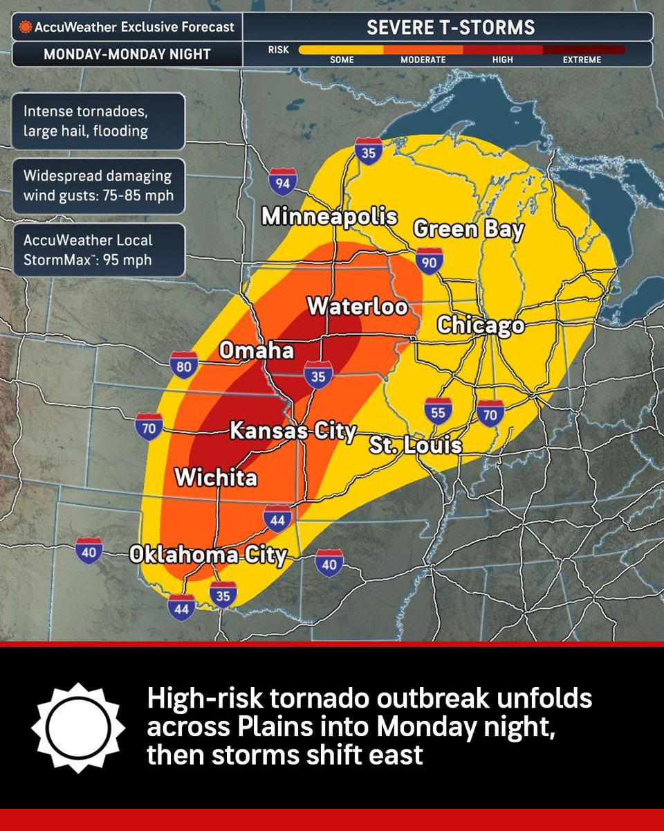
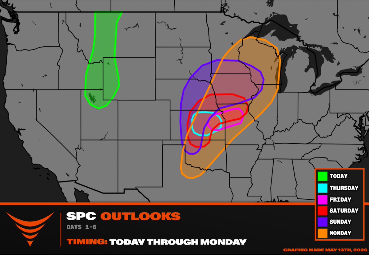
Powerful thunderstorms could unleash dozens of tornadoes, destructive 85 mph wind gusts, giant hail and flash flooding from the Plains to the Midwest as a dangerous severe weather outbreak peaks Monday night. https://t.co/y6GaZHtnJY
It is not often we see a Level 4 risk show up this early in the forecast for the Central Plains. This setup is looking much more aggressive than your typical spring storm day. Intense tornadoes and giant hail are likely tomorrow afternoon.
Horror Confessions: #Obsession
Curry Barker, Andy Richter, Inde Navarrette, and the team behind #ObsessionMovie share the first horror films they were ever obsessed with.
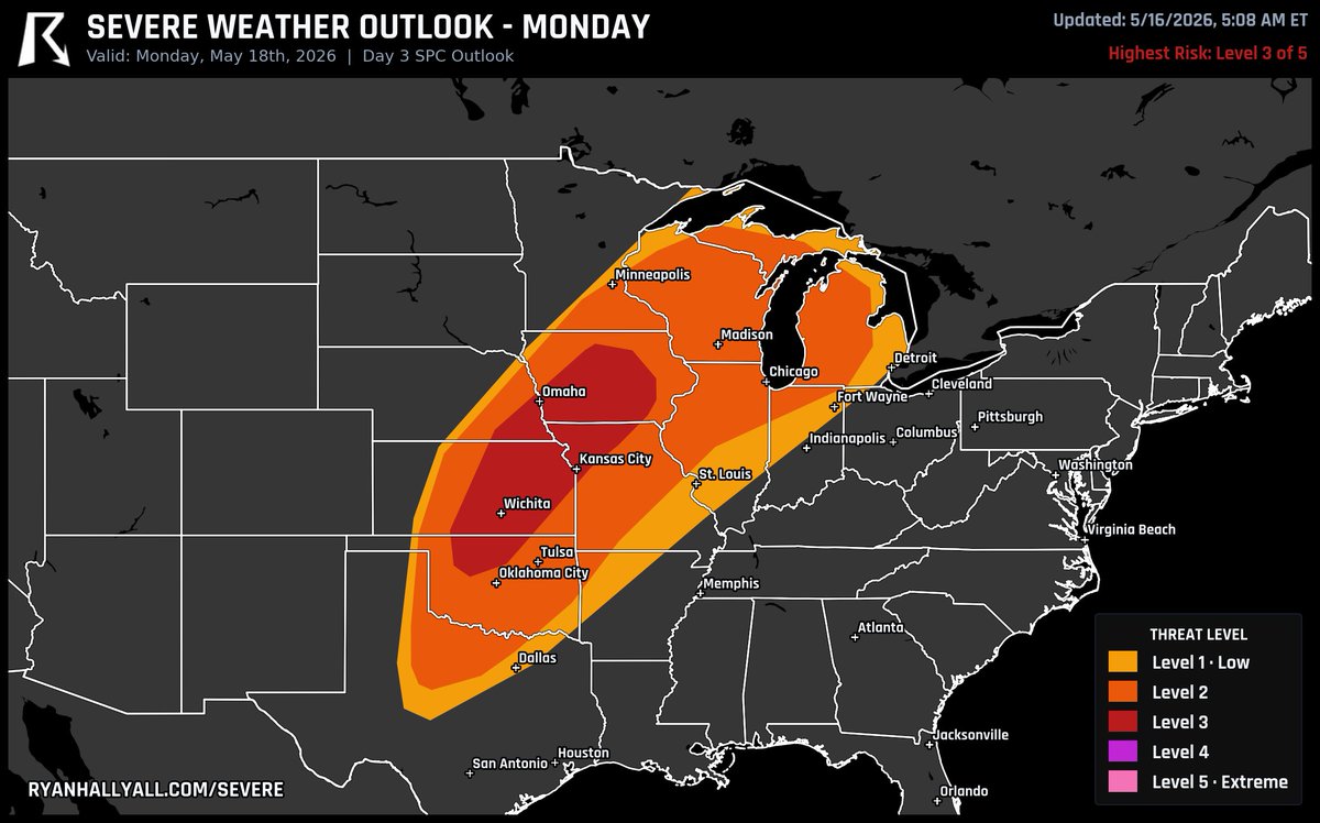
A severe weather outbreak is possible this Monday across the central Plains, including Omaha, Kansas City, Wichita, and northern Oklahoma. The Storm Prediction Center warns of potential strong to intense tornadoes Monday afternoon into the night. Have a shelter plan ready today.
HISTORIC PATTERN FOR TORNADOES POSSIBLE second half of May
Live emergency update on a multi-day #tornado outbreak threat across the central U.S. from Oklahoma to Wisconsin starting this weekend! This tornado outbreak sequence will peak on Sunday-Monday across Kansas and Oklahoma east of a dry line. A massive trough-ridge pattern is forecast to evolve across North America, which will set the stage for volatile warm sectors with #tornado potential day-after-day.
We are gearing up the Dominator 3 for full-blown #tornado intercept mode.
Stay tuned!
MAJOR SEVERE WEATHER PATTERN with 5 days in a row of severe weather possible and increasing #tornado threat this weekend!
THURSDAY: Hailers in central Kansas
FRIDAY: Late night severe weather in red KS to IA
SATURDAY: Oklahoma dry line, supercells and tornadoes possible Oklahoma to Iowa
SUNDAY: This sequence peaks with another southern Plains to Upper Midwest large warm sector
We are hoping to deploy the #Dominator 3 as peak season is arriving for the second half of May into June!