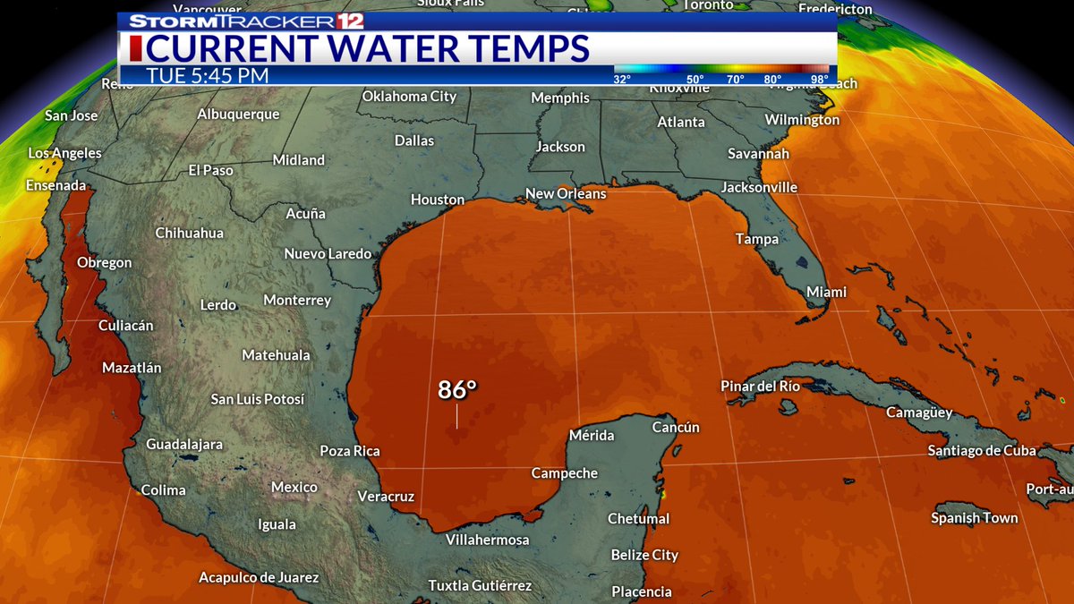
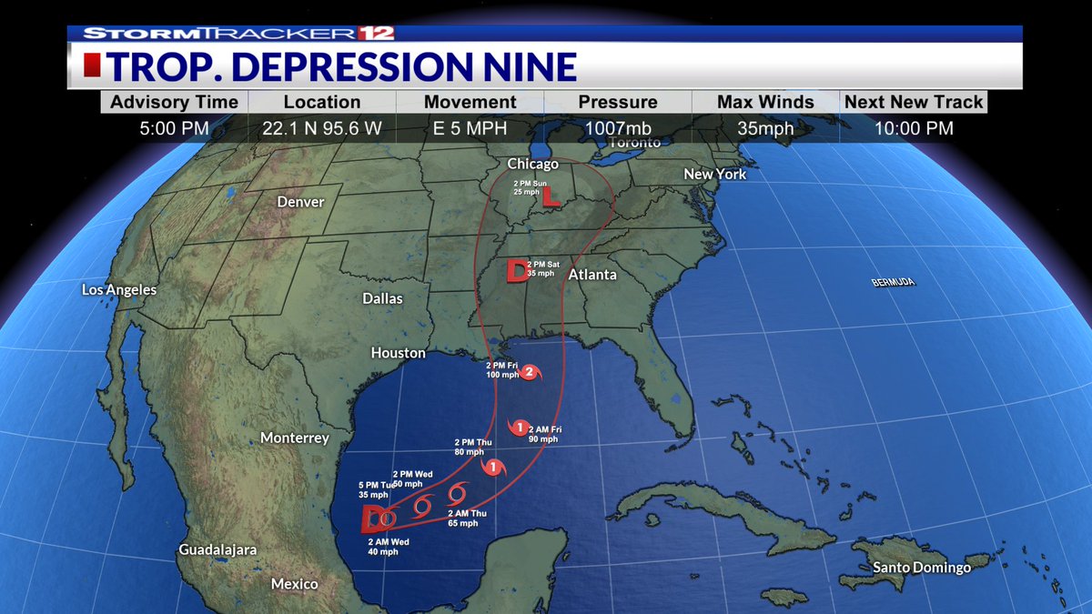
The Atlantic has finally come alive. Tropical Depression Nine has formed in the Gulf off east-central Mexico. Guidance suggests it could become Isaias, reach hurricane strength, and make landfall Friday evening from SE Louisiana to the western Florida Panhandle.
Wet weather returns to north-central West Virginia Friday afternoon as a weakening cold front moves through. Gusty winds and showers develop after lunch and linger into early evening. The weekend turns drier and cooler, with a slight shower chance Saturday night into Sunday.
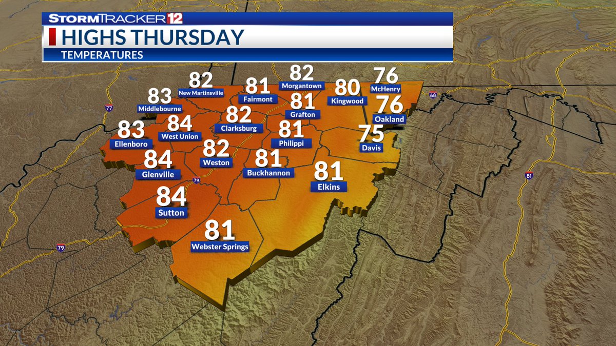
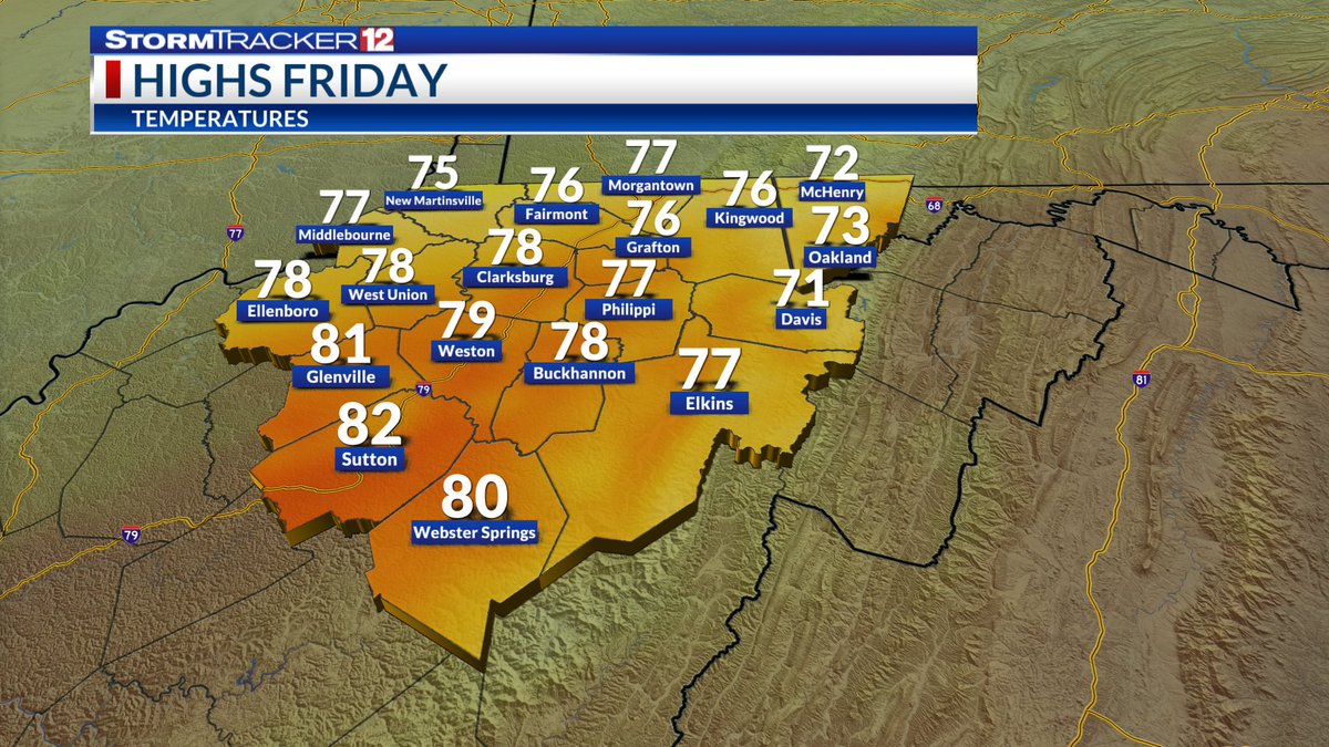
For our first day of October, it will be unseasonably warm across north-central West Virginia. Highs will rise into the low-to-mid 80s under mostly sunny skies. The sunshine will be short-lived, as a cold front moves in Friday which will bring some showers in the afternoon.
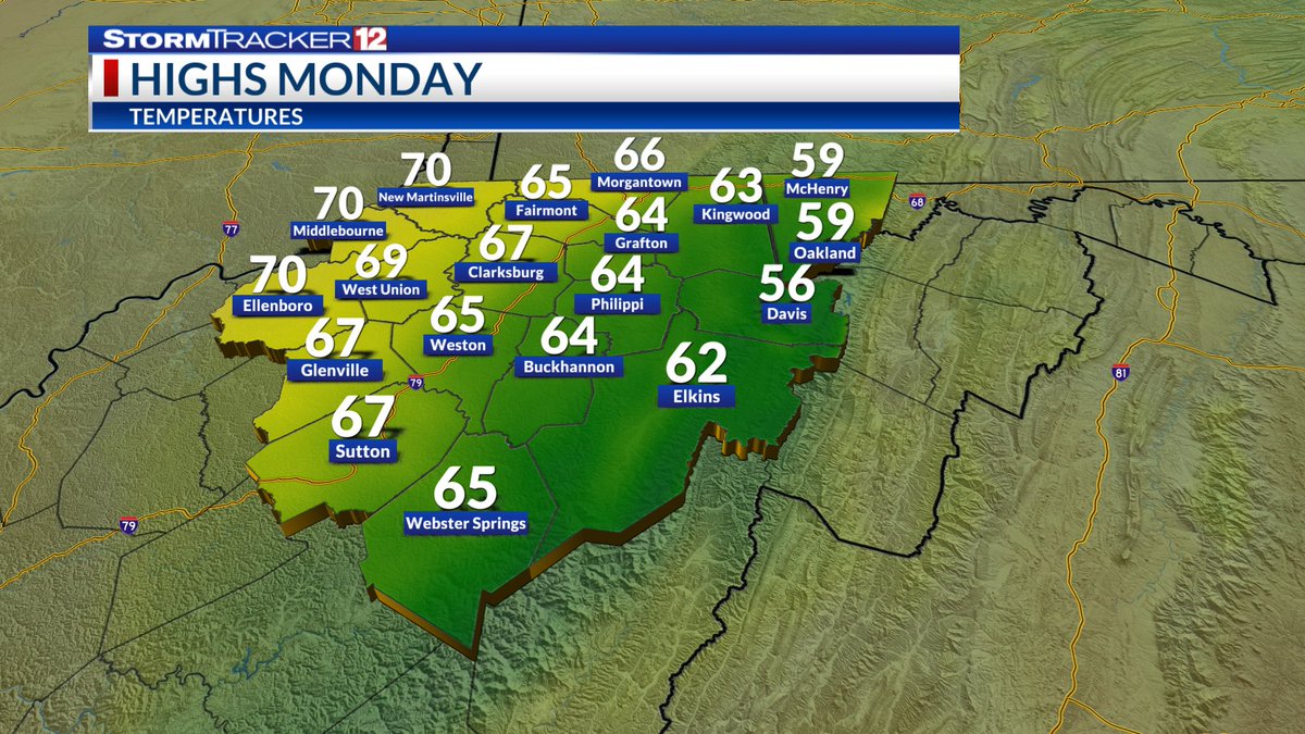
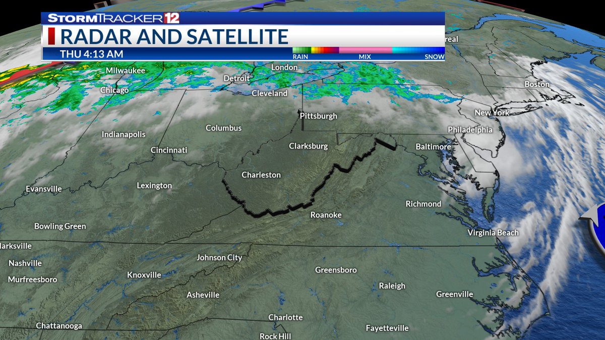
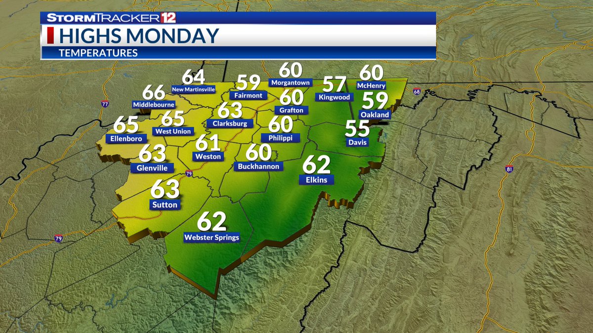
Clouds have returned to the area as the weakening nor'easter slows down and jogs west. As a result, Sunday night will be milder with lows in the mid-50s. Clouds stick around Monday, with highs in the low 60s. Sunshine returns Tuesday with highs rebounding to the low 70s.
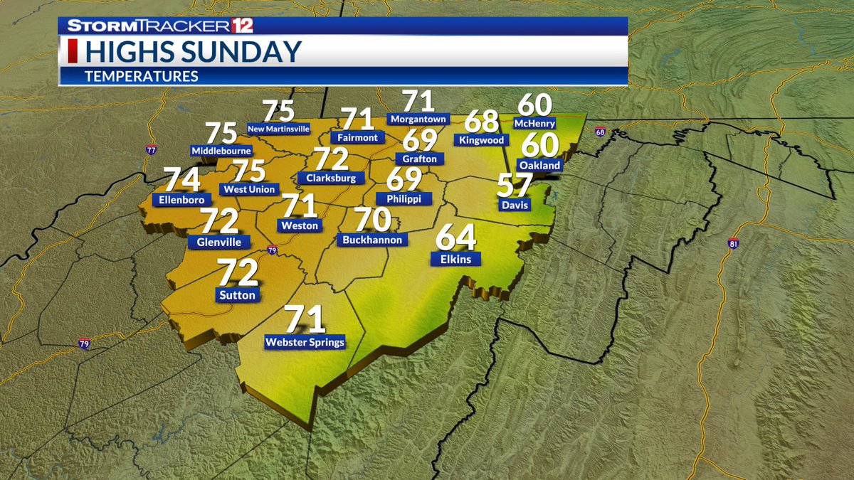
Clouds are rolling into north-central WV Saturday evening as the coastal nor’easter pushes northwest. Most areas stay dry, though drizzle is possible over the next two days, especially eastward. Sunday reaches the lower 70s, while Monday stays cooler in the mid-60s.
09/13/2026 - 7:52 PM EST: A Severe Thunderstorm Warning has been issued for portions of Tyler, Pleasants, and Ritchie Counties until 8:15 PM. This storm is moving east at 30 mph. Hazards include 60 mph wind gusts and penny sized hail.
09/13/2026 - 7:50 PM EST: A Severe Thunderstorm Warning has been issued for portions of Wood, Wirt, and Ritchie Counties until 8:30 PM. This storm is moving east at 30 mph. Hazards include 60 mph wind gusts and penny sized hail.
After a partly cloudy day, a cold front bring scattered showers & storms this evening across north-central West Virginia. A few storms could be severe in our northern counties. Behind the front we clear out and cool off Monday, feeling like fall, with highs in the low 70s.
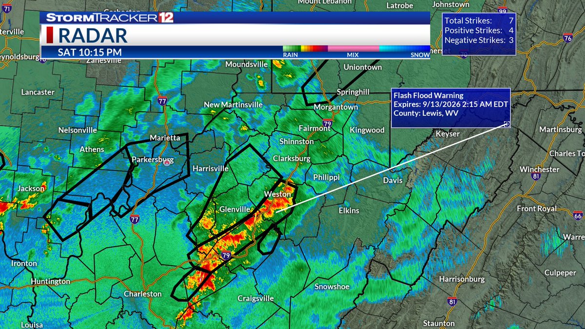
09/12/2026 - 10:15 PM EST: A Flash Flood Warning has been issued for portions of Roane, Braxton, Gilmer, Calhoun, Clay, and Lewis Counties. Up to 1.5 inches of rain have fallen and an additional 1.5 inches could be observed in the warned area.
09/12/26 - 7:10 PM EST: A Flood Warning is in effect for portions of Ritchie, Doddridge, Gilmer, Lewis, and Harrison Counties until 11:00 PM. Take caution near rivers, creeks, streams, and other low-lying areas.
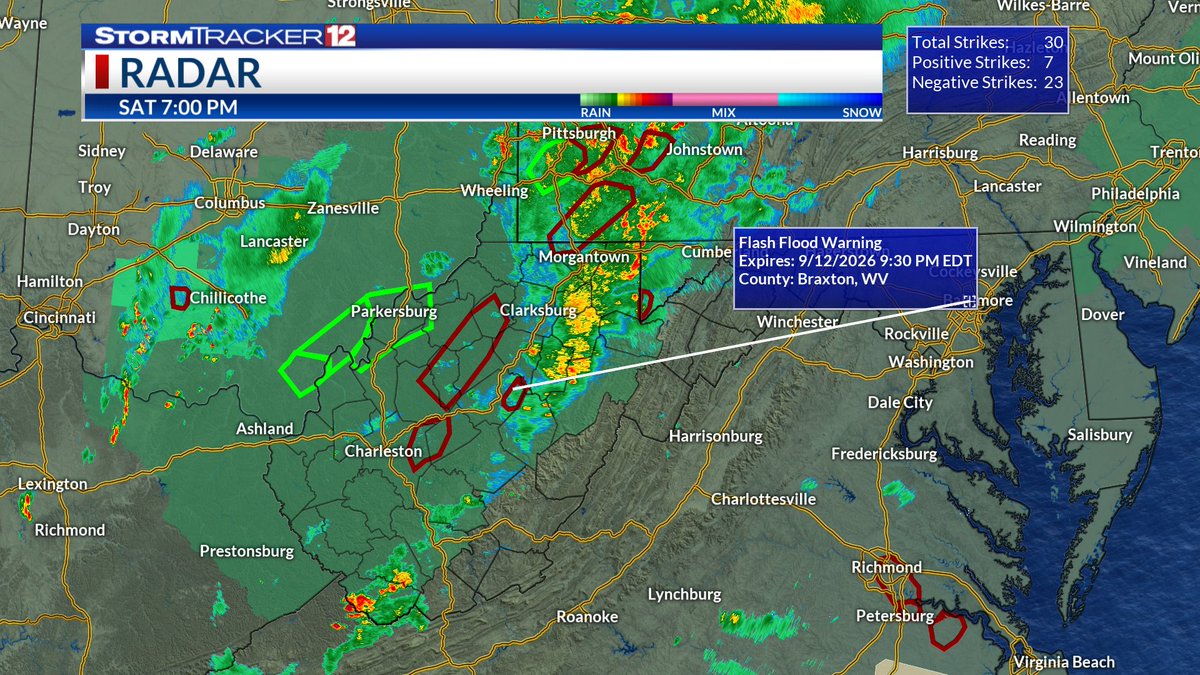
09/12/26 - 7:00 PM EST: The Flash Flood Warning in effect for east-central Braxton County has been extended until 9:30 PM. Between 3 to 7 inches of rain have already fallen. Flash Flooding is ongoing per Law Enforcement. Turn around, don't drown!
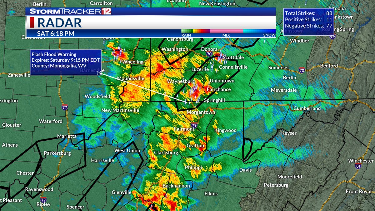
09/12/26 - 6:20 PM EST: A Flash Flood Warning has been issued for north-central Monongalia County until 9:15 PM. Between .5 and 1 inch of rain have fallen. We could see up to an additional inch of rain in the next few hours.
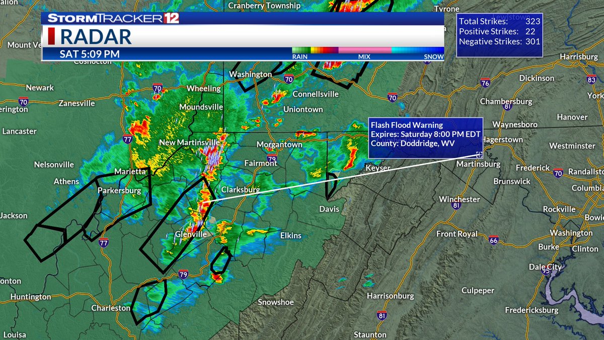
09/12/26 - 5:10 PM: A Flash Flood Warning has been issued for portions of Doddridge, Gilmer, Ritchie, and Lewis Counties until 8:00 PM. Between 1 and 3 inches of rain have fallen. Turn around don't drown!
09/12/26 - 2:50 PM EST: A Flash Flood Warning is in effect for east-central Braxton County until 5:30 PM. Between 1 to 2 inches of rain have already fallen. Flash Flooding has already begun or is imminent. Turn around, don't drown!
09/12/2026 - 4:55 PM EST: A Flash Flood Warning has been issued for Garrett County, MD until 7:45 PM. Between 1 and 2 inches of rain have already fallen. Flash Flooding is imminent or will begin shortly.
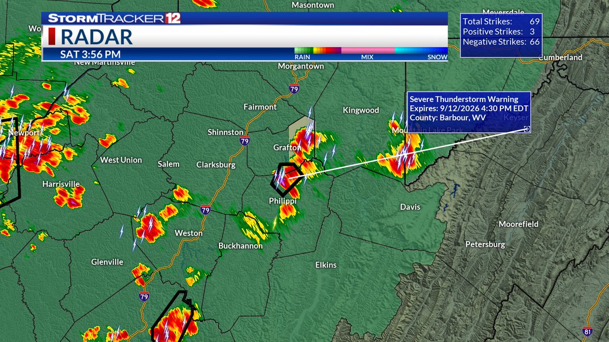
09/12/2026 - 4:00 PM EST: A Severe Thunderstorm Warning has been issued for south-central Taylor County and north-central Barbour Counties until 4:30 PM. Hazards include 60 mph winds and nickel size hail. Stay safe out there!
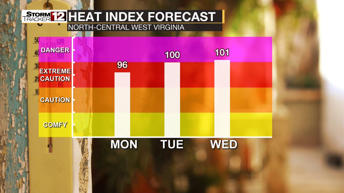
Hot and humid conditions returned to north-central West Virginia Sunday, with highs in the mid-to upper 80s and a few isolated showers and storms. The heat builds into the new work week, with temperatures in the low 90s and heat indices nearing 100°. Summer says, “I’m back!”
One last pleasant day before heat and humidity ramp up across north-central WV. Mostly clear skies Saturday night with mild mid-60s temps. Sunday brings sunshine, upper 80s, and heat indices in the mid-90s. Late-summer heat takes hold into the new workweek, staying mostly dry.
08/27/2026 - 8:58 PM EST: A Severe Thunderstorm Warning is in effect for east central Preston County until 9:30 PM. This thunderstorm is moving east at 20 mph. Hazards include wind gusts of up to 60 mph, and heavy downpours.