Rough ride over the Rockies west of Calgary this morning.
A Fedex cargo jet hit intermittent severe turbulence at 40,000 feet, about 80km west of YYC not long ago.
Evidence of vertically-propagating mountain waves breaking at the tropopause. #yyc#washingmachine
The cooling Arctic atmosphere… a response to decrease in sunlight is reminding us of colder times ahead.
A sure sign with developing wintertime polar vortex in late August. The stratospheric easterlies/polar vortex looks to return a little earlier than average date. Might be beneficial for sea ice approaching minimum.
The biggest medical scam:
ADHD.
It’s not a mental disorder, it’s a superpower in disguise.
Here’s how you turn ADHD into hyper-focus (backed by science):
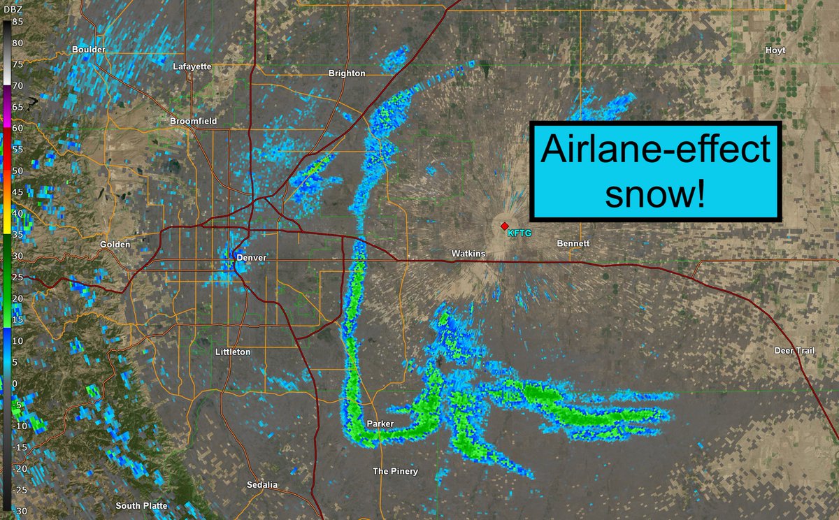
SNOW produced by AIRPLANES!? It just happened in Denver on Saturday! ❄️ A type of "accidental cloud seeding" by several United Airlines flights!
How did it work? The airplanes flew through a layer of supercooled water droplets on their approach to Runways 35L and 35R. Supercooled water droplets are water droplets that remain a liquid even at temperatures below freezing. The air is too clean, and the droplets have nothing to freeze onto – so they remain suspended as a very, very cold liquid...
UNTIL an airplane flies through that layer (in this case, about 1,500 to 3,000 feet). That's where the supercooled water droplets were. Planes have dirty exhaust, with little bits of soot and microscopic metallic particulates. Those aerosols act as "condensation nuclei" for moisture to congeal on and, in subfreezing conditions, freeze. Then ice crystals can form.
Generally speaking, ice crystals naturally form/grow at temperatures between 0 and 10 degrees Fahrenheit. It was 17.4 degrees at the surface, but, at 3,000 feet, temperatures would have been around 5 degrees Fahrenheit... PERFECT for ice crystal formation!
Those ice crystals fell! We know based on observations at the airport. It was the only snow/precipitation in the region! And you can see on radar how it traces the arrival path of aircraft.
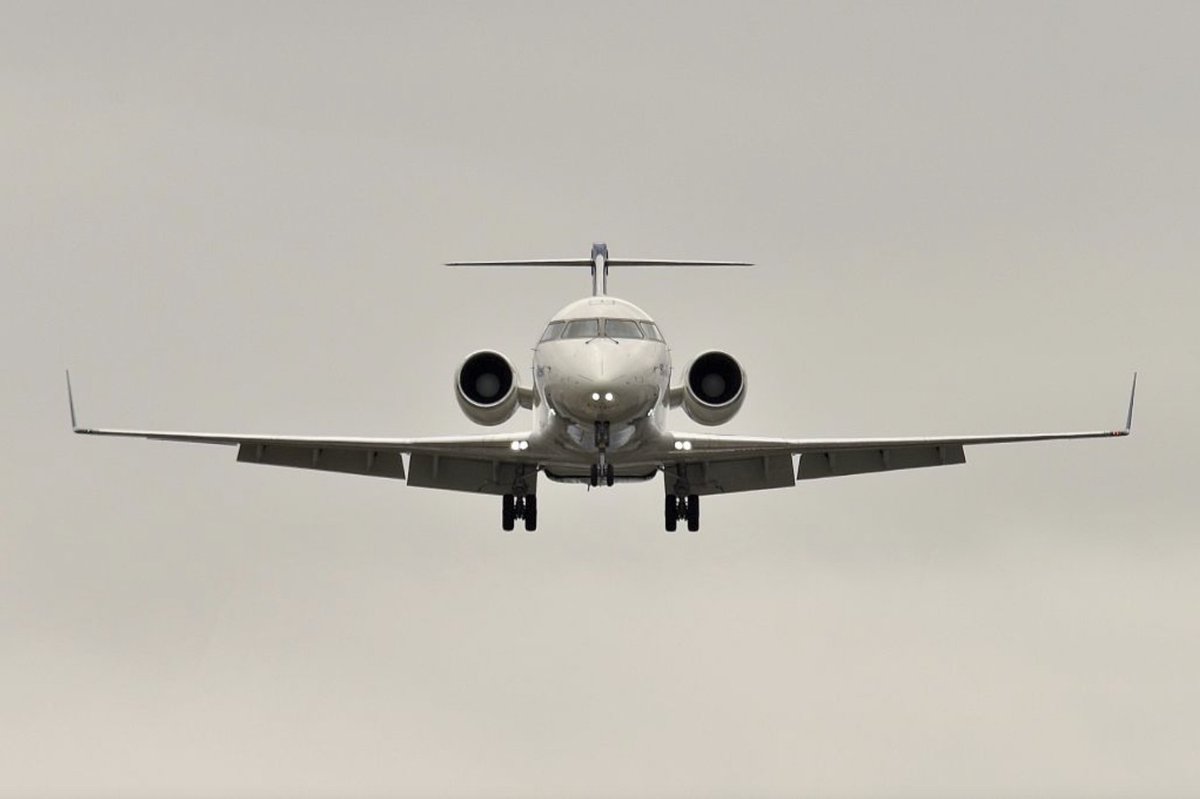
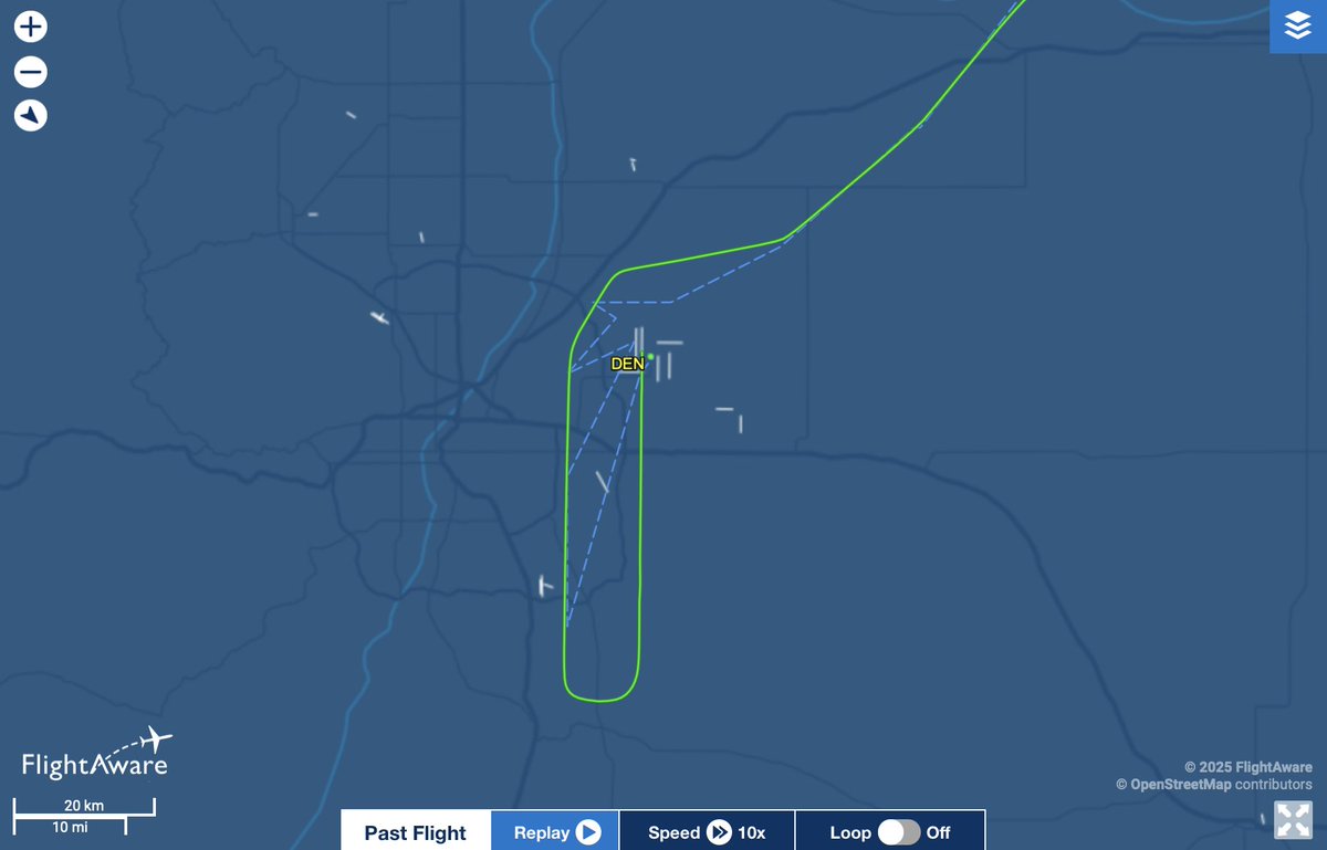
There was one plane that was an especially-efficient snow producer... it is perhaps an older plane and therefore a little bit dirtier: United Flight 5528 — operated by SkyWest Airlines — which originated from Williston Basin International Airport in northwest North Dakota. (I've pasted the flight plan below).
This has happened a couple other times before – in Chicago with planes landing at O’Hare on Nov. 27, 2018, and in Dallas on Feb. 12, 2021.
@wxkels Who tf cares you read how CAPE is above xxxx can cause severe storms on google. What is CAPE? How do you find it? Whats the different types? How does it change? Just ask them that and they go blank and get mad.
@Levi15091 Very weak shear, low helicty, low vorticty, low temperatures, massive temperature dewpoint depression, massive CinH, negative CAPE oh and last but not least synoptic scale subsidence under a ridge.