@Yemihazan@Alex_Houseof308 https://t.co/0QkwzI1nsE
This soundtrack was used in ps2 or ps3 fifa. So you have probably heard one of his songs if you play fifa.
If you want to explore the full reconstruction yourself, I mapped everything out here:
https://t.co/czdkWcTavz
I started from a random tweet and ended up reconstructing a probable WWII airstrip location in Osogbo. If anyone has archival maps or local history, this could get even more precise. But for now, this is probably as close as you can get without original wartime coordinates. End of rabbit hole 🧵
🧵: I went down a random WWII rabbit hole… and may have helped locate a lost airstrip in Osogbo @InsideOsogbo
This tweet about WWII aircraft being ferried across Africa to Egypt, and one detail caught my attention:
Planes were assembled in Takoradi (Ghana) and flown across West Africa to Cairo.
And one of the stops?
Osogbo, Nigeria.
Being largely interested in the history of Osogbo before the reign of Oba Samuel Adeleye Adenle I, 19th Ataoja of Osogbo. I started digging.
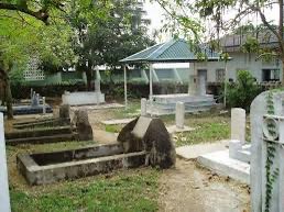
Each time we visit my mother in law’s grave in Ibadan, I see the headstone of a South African Air Force officer in front of her’s.
Lt. Pieter de Jager Fritz, a 22-year-old pilot, died in 1941.
I know the Commonwealth keeps meticulous grave records, so I decided to research.
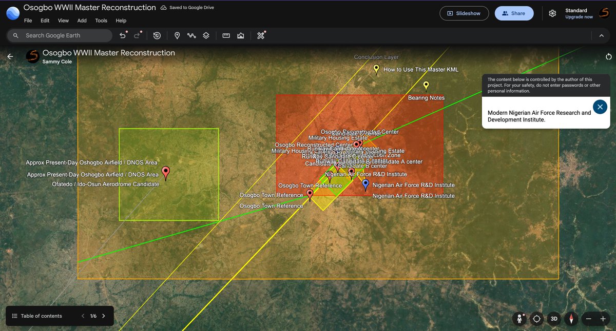
I then tested the strongest alternative candidate, the Ofatedo or Ido-Osun aerodrome area, against the route geometry.I tested the Ofatedo site against the route geometry.
Using bearings from Lagos:
Lagos → Kano: 42.44°
Osogbo corridor: ~43.4°
Ofatedo: ~40.96°
It is still plausible. But when I compared bearings from Lagos, the Osogbo reconstruction corridor aligned more closely with the Lagos-to-Kano heading.
The Ofatedo or DNOS point came out about 1.48° west of that heading.
That is not a huge miss. It keeps Ofatedo in the conversation.
But it does mean the Osogbo triangle corridor remains the better fit on route geometry.
I tested the Ofatedo site against the route geometry.
Using bearings from Lagos:
Lagos → Kano: 42.44°
Osogbo corridor: ~43.4°
Ofatedo: ~40.96°
So my conclusion now is this:
The Osogbo triangle remains the strongest candidate for the WWII landing ground.
Ofatedo is a serious secondary candidate, but not the stronger one.
You travel because movement feels like freedom.
Airports. Buses. New cities with unfamiliar skies. You chase distance like it is a cure, like if you get far enough away, the memories will not know how to follow.
But at night, they always find you.
You tell people you love traveling. The excitement. The adventure. The endless horizon.
But the truth is much simpler:
You are not exploring new places.
You are running from old ones.