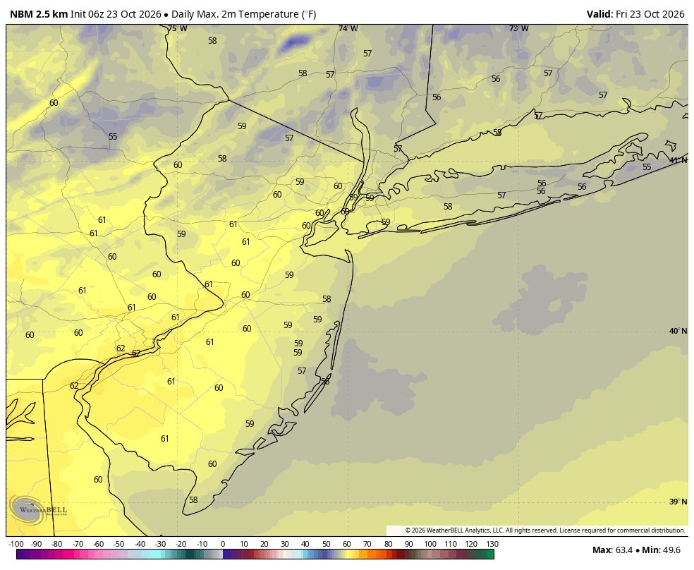
Happy Friday, NYC metro! Our stretch of beautiful weather continues today. We’ll have sunny skies again. High temps will be cooler, in the upper 50s or near 60°F. But winds are finally lighter out the northeast, for most of the day.
In the current political climate, including cuts to NWS and all sciences, our community (and those with a big following) should not be advocating for cuts or to privatize NWS. Shoot them an email, be a journalist and investigate what happened. Not constantly bash them every second you can non stop.
Yesterday's supercell outbreak in Arizona was quite the sight to see. Severe thunderstorm warnings were active for nearly 24 hours, and the towns of Prescott, Flagstaff, and Show Low all received tornado warnings. Heber-Overgaard was even directly struck by a likely tornado.
Happy Thursday, NYC metro! Today will be nice and a bit warmer again. We’ll have mostly sunny skies. High temps will reach the mid to upper 60s and dew points remain comfortably low. A northerly breeze will still gust up to around 25mph at times. Go outside!
Subtropical Storm #Josephine Advisory 1 (5 PM AST, Wed Oct 21): Subtropical Storm Josephine Forms. Forecast to Move Northeastward Away from the United States. https://t.co/GrztW6mQJV
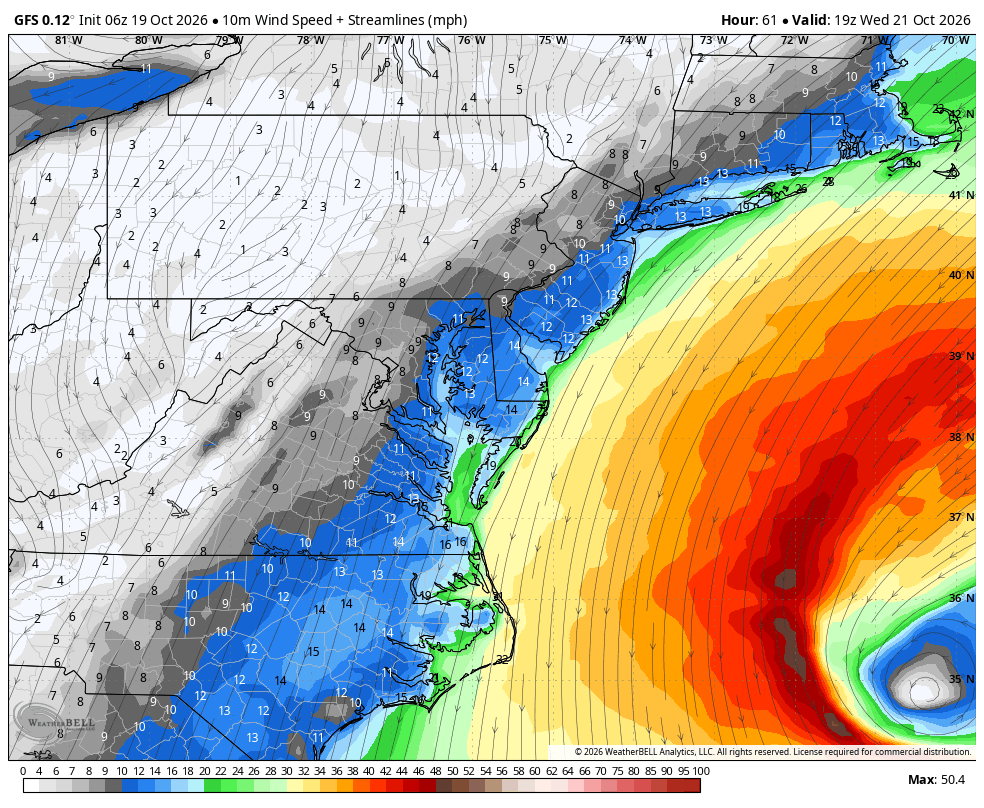
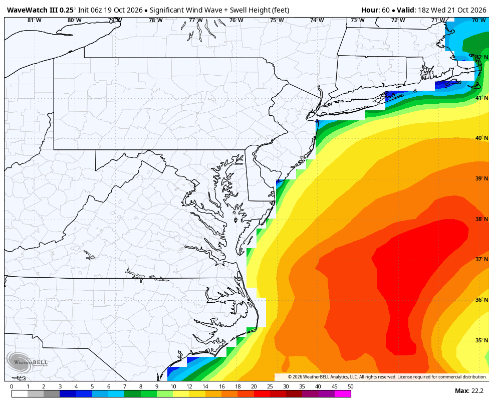
The ocean storm has acquired some subtropical characteristics and could get a name by tonight. But very minimal impacts to the NJ, NYC and Long Island coasts will not change. The storm will begin moving further away on Thursday.
Oct 21 Wed afternoon: NHC is monitoring 2 systems over the central and NW Atlantic Ocean. The westernmost one (Invest #AL93) has a 50% chance to become a subtropical storm, with low chances for the system well E-SE of Bermuda. More: https://t.co/GrztW6nozt
EA is canceling the new Mass Effect and shutting down BioWare, the storied RPG studio it acquired 19 years ago.
It's the first massive change after Saudi Arabia took EA private in the biggest leveraged buyout in history.
https://t.co/2KVTAhsDIN
There are some things visible/IR satellite can’t always show effectively like surface fronts — and the latest ASCAT pass indicates the frontal boundary is just barely enough detached from the center to make the case it might be a close to or classifiable as a subtropical cyclone.
We had a close call with a big coastal storm this week - check out visible satellite imagery this morning! Winds are a bit gusty at times today. Otherwise, we're happily on the outskirts of this one.
Happy Wednesday, NYC metro! Today will feel a little cooler, but it’s still nice with mostly sunny skies. Just some high clouds may filter sunshine later. High temps will reach the the lower 60s. A north-northeasterly breeze will remain gusty up to around 30mph at times.
SPC has upgraded to a Day 2 Enhanced Risk (level 3/5) across parts of central/northern Arizona for tomorrow (Wed, Oct 21). Confidence is increasing for supercells capable of producing all severe hazards, including tornadoes, damaging winds, and large to very large hail tomorrow afternoon. The parameter space is certainly upper echelon for the region, and this is the first time ever that the SPC has issued a Day 2 Enhanced Risk in this area.
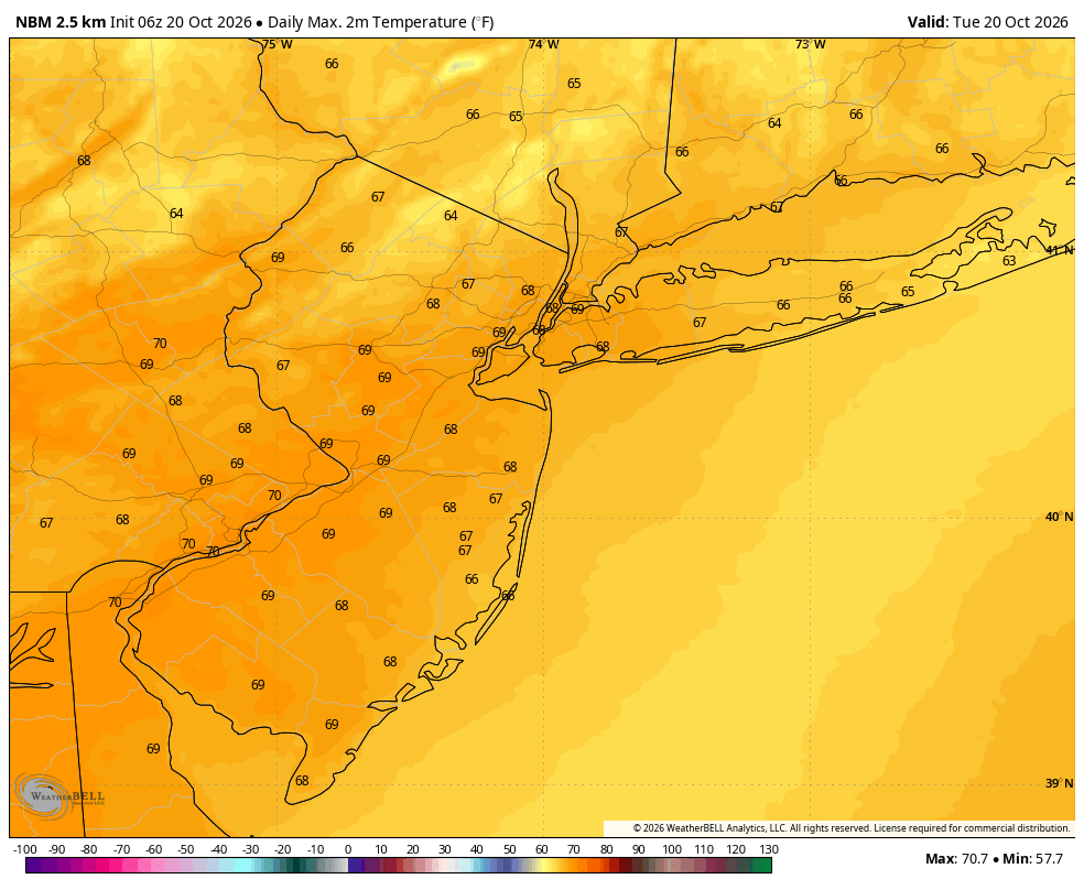
Happy Tuesday, NYC metro! Today will be another beauty. We’ll have sunny skies, low humidity, and high temps in the upper 60s this afternoon. A north-northeasterly breeze will be gusting between 20- 30mph at times, especially near the coast.
An ocean storm/Nor’easter will stay well offshore this week. Rainfall and strong winds are not expected in the NJ, NYC and Long Island areas. But a persistent onshore flow and swells may lead to some beach erosion and minor coastal flooding during high tides by Wednesday.
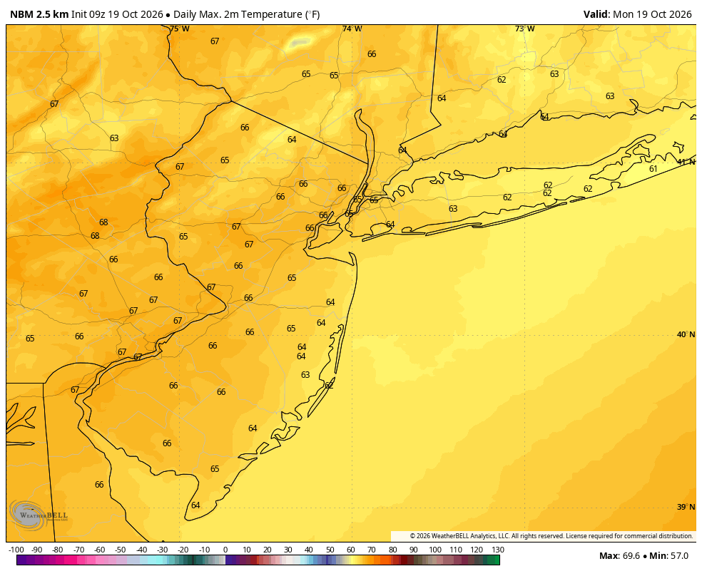
Happy Monday, NYC metro! Today will be a beautiful Fall day. We’ll have mostly sunny skies, low humidity and a light northeasterly breeze. After a chilly start, it will be warmer with high temps reaching the mid 60s this afternoon. Go outside!