Broadcast Meteorologist. MS State grad. Delivering your weather with a side of humour & humility weekday mornings on @weathernetwork. Forever CFL fanatic.
This is better than being on the cover of Rolling Stone! Snag your hard copy as soon as it hits the shelves mid-month. It's an a-lure-ing interview 🐟 Dream come true! @OODMag@GordEllis@weathernetwork@cbchh
Our August 2023 issue features an interview with weatherman Chris Murphy, tricks to pull off a sneaky duck hunt, and more.
Available today at https://t.co/3dXJrnAc6K or on the OOD app.
@ofah@MurphTWN
https://t.co/xGB4HG0c8B
#Hunting#Fishing#Outdoors#August#Magazin#News
Labour Day weekend wouldn’t be right without some friendly banter. Showing Ticat fans what a ring looks like 🤣
We start walking to Hamilton tomorrow, see you guys there!
The closing weekend for both the CNE in #Toronto & the PNE in #Vancouver. Weather looks good for the airshow at the EX on Monday. The #Snowbirds last flight over the CNE! The final Snowbirds final show will be at the Grey Cup in #Calgary in November.
Heavy rain continues today in NW Alberta. As that tapers off, moisture streams north from the Pacific AND the Gulf! Potential for soaking rains Sunday into Monday for the southern Prairies. Worth watching this development through the long weekend. @weathernetwork
Slow moving storm system continues to plague several regions of Atlantic Canada today & will do so during the weekend. #Halifax north & east upwards to 80 mm with potential for 100+ mm in PEI & Cape Breton. For #YYT, over 50 mm is possible Saturday into Sunday.
Just want to mention, there is potential for rain & even thunderstorms in #Regina on Sunday. It'll come down to timing, but want to give the heads up.
Next to the Playoffs, the #LabourDayWeekend is the biggest weekend in the @CFL! It's a bit too early to give hourly forecasts for Monday in Hamilton & Calgary, so I've included the forecast high for each city. It all kicks off this evening in Montreal - Rourke vs Alexander!
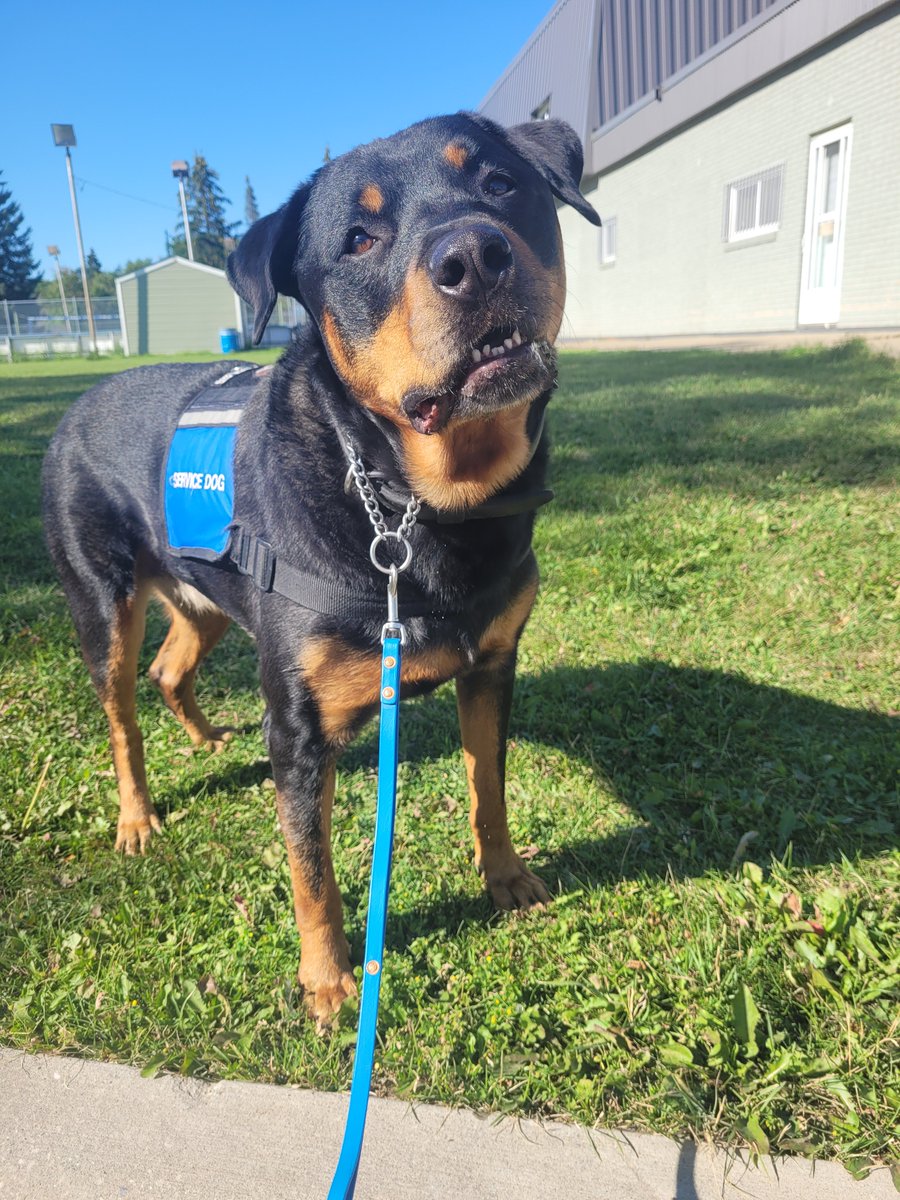
So many times I said "I can't do this."
And so many times he looked at me and his expression said, "But we can. You and me."
And we almost always did.
He made the impossible probable.
I sure miss that face.
Admin🐾❤️
#ThrowbackThursday
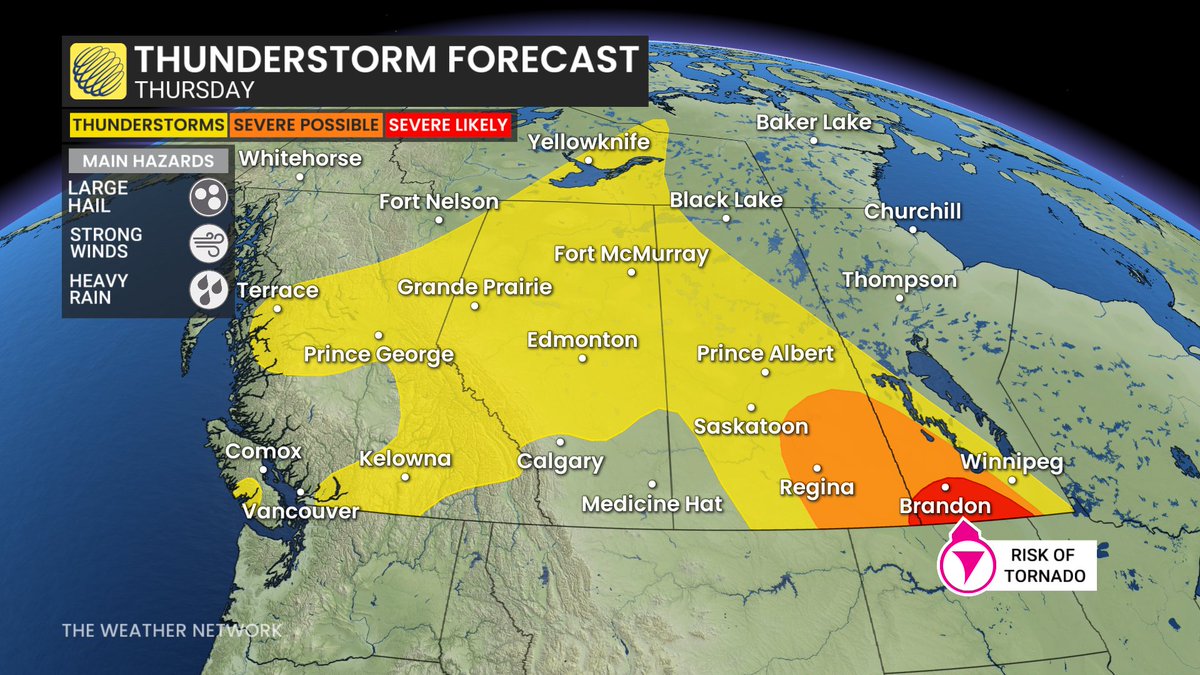
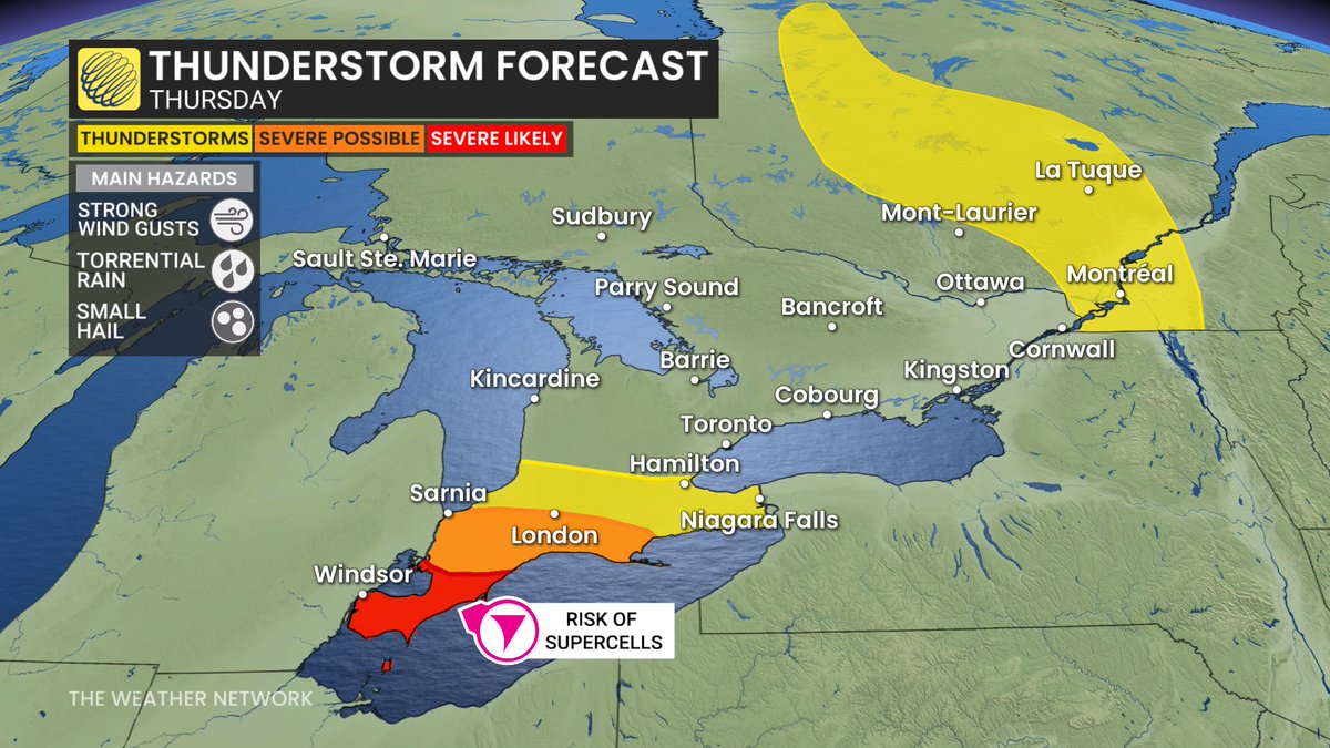
Today's #thunderstorm risk zones: 1) southwestern Ontario this aft into the evening. Should stay west of the GTA. Some potent storms should be expected. 2) Across the Prairies with heavy rain & even funnel clouds in NW Alberta; powerful storms near the U.S. border of MB & SK
For those of you thinking only Whistler Peaks saw Snowflakes falling. Guess again! Snow was also falling as low as 1,700m (5,577 feet) elevation up at Pennask on BC Hwy 97C yesterday and today...
#bcstorm#shareyourweather@weathernetwork@50ShadesofVan@MurphTWN
@Bonsie24@AirCanada I flew with @AirCanada 3 weeks ago. They changed my morning departure to an evening departure 3 days before flying out. No explanation. No apology. Not even a voucher for a hot dog. Stole a full day off my 5 day vacation I saved & planned for. I both sympathize & empathize
A slow moving & moisture-laden storm system to bring widespread rain, at times torrential to the East Coast, along with some gusts out of the northeast. Not everyone gets it at the same time, but there will be impact to the Labour Day weekend. Timing info on TV @weathernetwork
@Darinb75@weathernetwork For a storm to qualify as a derecho, it must have winds of a minimum strength (roughly 90 km/hr), over a long stretch of territory (over 600 kms or so) and last for a minimum amount of time (4-6 hours I believe). I don't think this storm qualifies. But it was still a doozy!