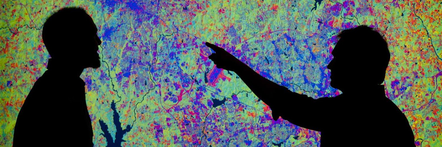
Everything is spatial and location matters at the Center for Geospatial Analytics, an interdisciplinary teaching and research center at NC State University.
New book by Faculty Fellow Paul Liu covers the practical use of generative AI techniques for scientific research and discovery across disciplines! Available at Amazon: https://t.co/BVkDstEkP5 and Leanpub: https://t.co/3SOnRJgzhG. Code: https://t.co/YnAqoTInv7
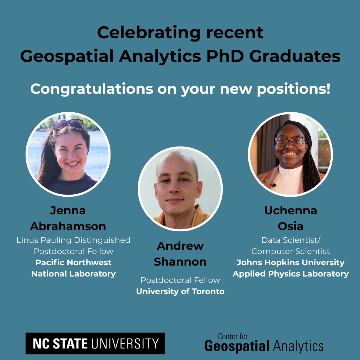
Congratulations to our recent Geospatial Analytics PhD graduates on their new positions! --> Dr. Jenna Abrahamson, Dr. Andrew Shannon and Dr. Uchenna Osia
What better way to close the year than celebrating CGA’s incredible presence at #AGU25 (DEC 15–19)? Our students, researchers, and faculty will highlight advances in flood prediction, energy infrastructure planning, wildfire mitigation & more! Explore > https://t.co/16Haj2P0HJ
Congratulations to Dr. Jenna Abrahamson on unconditionally passing her Ph.D. defense on Monday! Jenna's presentation was entitled "Quantifying the Ephemeral: Tracking Wetland Inundation from Space to Understand Methane Dynamics."
At next Thursday's (NOV 6) Geospatial Forum, NC State's Dr. Jacelyn Rice-Boayue will discuss geospatial frameworks for watershed-scale surveillance of down-the-drain pesticides and antibiotics. Join us!
Learn more: https://t.co/ifKcE7Co5i
Congratulations to Dr. Andrew Shannon on unconditionally passing his Ph.D. defense yesterday! Andrew's presentation was entitled "Oaks & Pines: Forecasting the future of forests across North America."
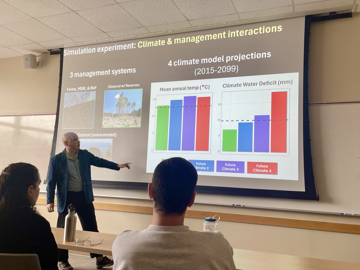
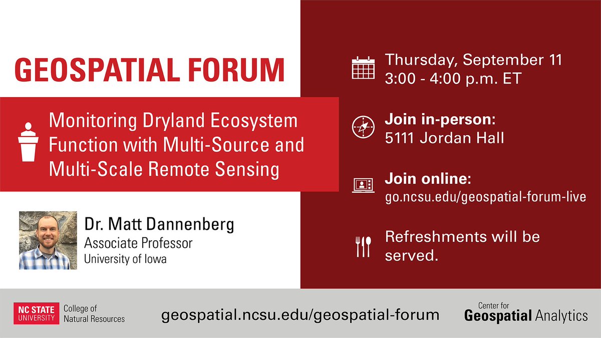
At the next Geospatial Forum, Dr. Matt Dannenberg will discuss the potential for multi-source, multi-scale remote sensing to improve monitoring of dryland primary production and evapotranspiration. Join us!
Learn more: https://t.co/j5t0nyv7uO
We’re excited to partner with @nature_org to host a Postdoctoral Fellowship focused on advancing coastal wetland resilience. Apply for this TNC-based fellowship, with the opportunity to affiliate with CGA!👉https://t.co/fxV3GQjleP
IALE-NA just wrapped!
Our team showed up as a force of nature—leading sessions on AI in landscape ecology, climate migration, invasive species, wildfire, forest change & more.
Geospatial analytics crosses disciplines to address today’s biggest environmental & social challenges.
Curious about CGA’s latest research & real-world impact?
Join our symposia, talks, posters & workshops at @IALE_NA next week. Plenty of opportunities to engage, ask questions, and connect—hope to see you there!
Learn more: https://t.co/8DZ5yFZZNL
At the April 10 Geospatial Forum, Nick Okafor of trubel&co will discuss how critical GIS, guided by abolitionist strategies, can serve as a transformative tool to amplify fairness and spark civic imagination.
More info at: https://t.co/cOThh1dz62
Join us this Thursday for our fifth doctoral student edition of the Geospatial Forum! Four of our Geospatial Analytics Ph.D. students will share their current research in a series of short talks.
More info: https://t.co/BjSiRC6i8L
At this Thursday's Geospatial Forum, Dr. Matt Dannenberg will discuss the potential for multi-source and multi-resolution remote sensing to improve monitoring of dryland primary production and evapotranspiration: https://t.co/j5t0nyv7uO
In his March 7 public presentation, Varun Tiwari will discuss how Earth observation data and machine learning can be harnessed to support climate-resilient agriculture (rice production) and flood disaster management in data-scarce Bangladesh. https://t.co/BYtciRfSiO
In her March 4 public presentation, Deja Perkins will discuss her analysis of socio-spatial gaps in participatory science in the U.S. and how her findings can enhance volunteer data collection, broaden environmental knowledge and democratize science. https://t.co/SRosHQXXNy
The recording of our February 6 Geospatial Forum with Dr. Eleni Bardaka, Associate Professor in NC State's Department of Civil, Construction, and Environmental Engineering (CCEE), and a CGA Faculty Fellow, is now available.
Watch here: https://t.co/q9dZMujRqC
At this Thursday's Geospatial Forum, Dr. Eleni Bardaka will discuss the socioeconomic impacts of transit infrastructure investments through the application of advanced econometric and spatial analysis methods.
More info: https://t.co/yA0j2yX11m
Our Nov. 22 Geospatial Forum Lecture with Dr. Emil Cherrington, West African Regional Science Coordination Lead for the @NASA/@USAID SERVIR program and Principal Research Scientist at the @UAHuntsville's Earth System Science Center, is available: https://t.co/hNvop2yLc3
The recording of our Nov. 22 Geospatial Forum with Dr. Emil Cherrington, West African Regional Science Coordination Lead for the @NASA/@USAID SERVIR program and Principal Research Scientist at the @UAHuntsville’s Earth System Science Center, is available: https://t.co/fRYoDKdo37