🌍 New publication! Our geospatial approach ensured that over 94% of Benin's population can reach EmONC within 1 hour, accounting for sub-national travel specificities.
https://t.co/svdfod21OW
@ISG_UNIGE@UNIGEnews@UNFPA@MSbeninOfficiel@unfpa_benin
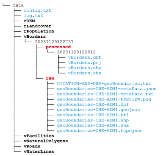
📢 Our new article on inAccessMod, an R package streamlining data input in #AccessMod, is now published! It automates data downloading, cropping, masking, projection, resampling, and aids in handling health facility data from WHO/HeRAMS. Read it here: https://t.co/70e3RaqzED
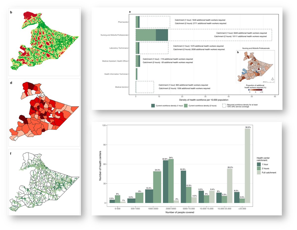
New publication! We used a mixed geospatial approach to assess healthcare accessibility and workforce availability towards optimizing the Health Extension Program in Ethiopia.
https://t.co/nPebCirPm6
@unige_ise @ISG_UNIGE@UNIGEnews#accessmod#UHC#Ethiopia
Dans les pays à revenu faible, les femmes enceintes sont confrontées à des défis importants pour accéder aux services obstétricaux et néonatals d’urgence.
➡Améliorer l’accès aux maternités: un enjeu clé : https://t.co/QN6HHeoWgi
@NicolasRay7@FleurHierink
“Health authorities urgently need to reinstate a reliable Covid health monitoring system," and I called “for wastewater to be analysed to detect virus trends.” https://t.co/2EEcDOf8Js
🐍 R&D funding for #Snakebite envenoming (SBE) has increased significantly 👉 https://t.co/nzlRJUe1d6
Now is the time to build on this success & map the road ahead
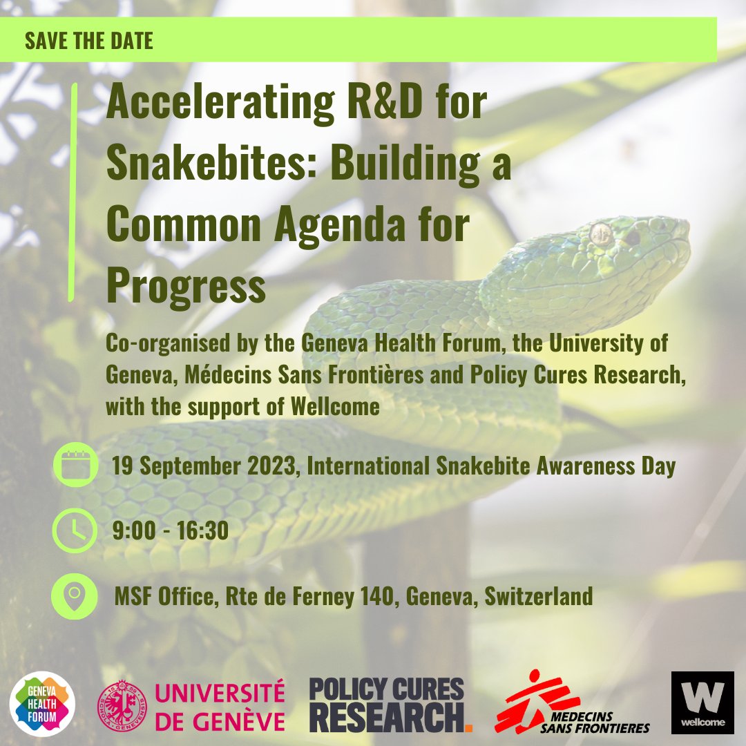
Join us in Geneva on Sept 19 to determine how to accelerate progress for SBE R&D
🎟️ https://t.co/9yktV3J1US
#ISBAD
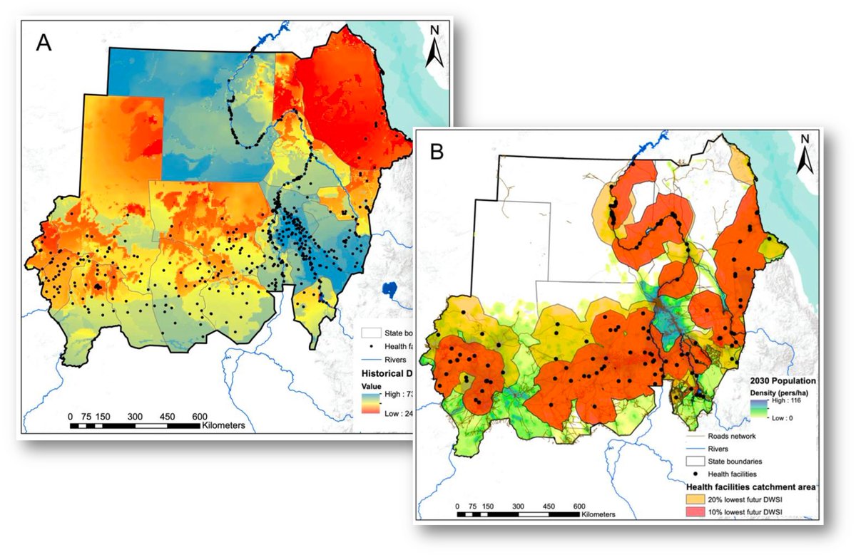
New paper out ! We developed a new index to assess drinking water security in Sudan, also looking at geo access to maternities. 18.97 mio ppl are in catchments of water-unsecure maternities, 60% more projected by 2030.
https://t.co/y7whukfZd0
@unige_ise @ISG_UNIGE@UNIGEnews
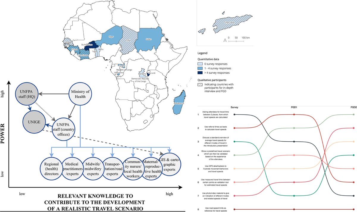
Our latest paper evaluates the challenges in eliciting expert knowledge on modes and speeds of transport for patient seeking care. Insights from travel scenario workshops in 14 countries help improve accessibility models.
https://t.co/PmtRwpJpf4
@unige_ise @ISG_UNIGE@UNIGEnews
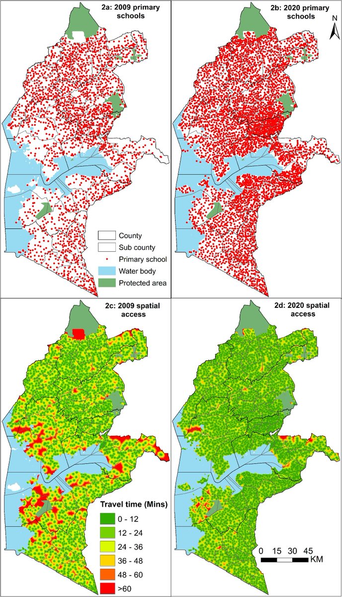
Lead by @Pete_M_M, we modelled geographic access to schools in western Kenya to assess progress toward timely access to education, identify marginalised children, and support subnational planning.
https://t.co/bbNshvHBew
@unige_ise @ISG_UNIGE@UNIGEnews
Our new paper is out in
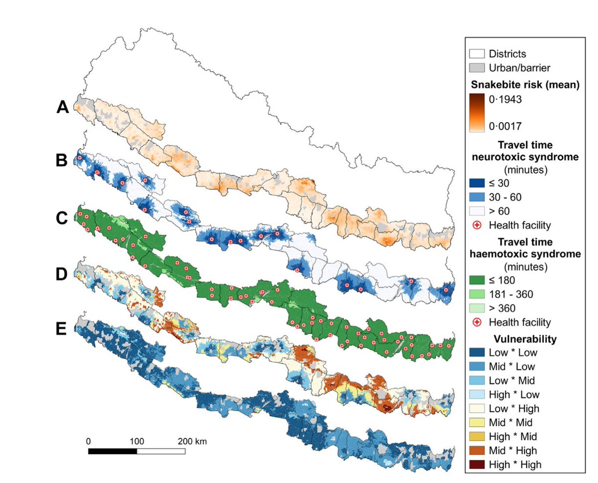
@LancetRH_SEAsia: first high-resolution map of access to antivenom and vulnerability to #SnakeBite envenoming. 2.07 mio. people highly vulnerable in Nepal.
https://t.co/Lwlqe2DQ7a
@unige_ise @ISG_UNIGE@UNIGEnews
New paper! Lead by @nickoliphant, we modelled the optimized scale-up and deployment of #CHWs in Mali. An important work, as the Ministry of Health is using it to inform the ongoing microplanning to deploy new CHWs.
https://t.co/50ZQhZaF6k
@unige_ise @ISG_UNIGE@UNIGEnews
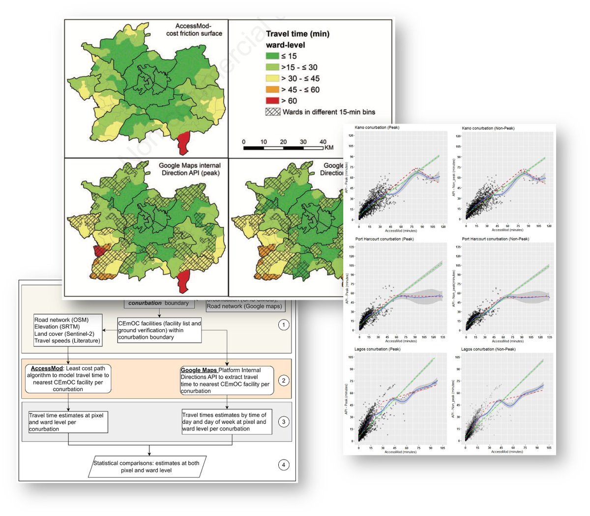
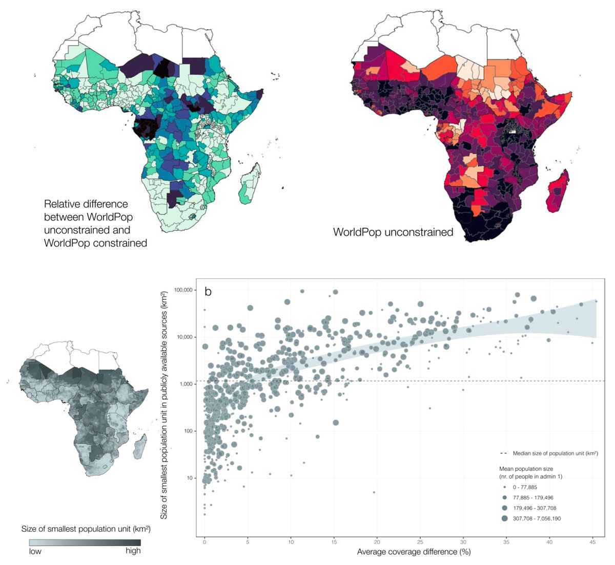
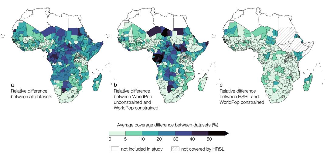
New paper out in @CommsMedicine ! We explored the effects of using various gridded population datasets on measures of geographic accessibility to health care.
Effects on pop coverage can be large (>70%) !
https://t.co/ZoXulouCVq
@unige_ise @ISG_UNIGE@UNIGEnews
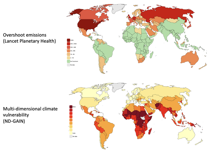
The tragedy in Pakistan is a stark reminder of climate injustice. The top map shows which nations are most responsible for excess emissions. The bottom map shows which nations are most impacted by it. Climate breakdown is playing out along colonial lines.
Our #preprint on approaches used to define health facility catchment in SSA
Driven by lack of data: geocoded patients' addresses linked to utilized facility & care-seeking behaviour
Realistic catchments will require more data & innovative approaches
https://t.co/HRmDF9FiD8
😮You'll never guess what @LancetGH just published.
In less than 2⃣ minutes, we make the case re: one of the biggest "debates" of our time.
https://t.co/IAfT6RVQDY
Last Friday, I successfully defended my doctoral thesis in the Global Health program at the University of Geneva. The thesis applies, evaluates, and reviews geographical accessibility models in different settings in LMICs. A scientific body of work with a practical implication.
New paper! Lead by @nickoliphant % of pop within 30 min walk to the nearest CHW increased from 16.1% to 80.4% between 2000-2015 in Sierra Leone. Optimised CHW networks more efficiently deployed than existing networks by 22.4%–71.9%.
https://t.co/QG8UU3wlNP
@unige_ise @ISG_UNIGE
Gridded population data are essential for research, policy-making and humanitarian action. In our preprint we show how the use of different population data can lead to diverging patterns of healthcare coverage, underscoring an essential source of uncertainty in access modelling.