FRIDAY NIGHT FOOTBALL: Tonight's forecast is looking great for football across the Chattahoochee Valley. We have a breeze, clear skies, and cool temperatures. Temperatures will cool into the 60s by the time many of you head home.
#alwx#gawx#columbusga#footballweather
LANDFALL: Hurricane Isaias has made landfall near Destin Florida around 9:30 PM ET. Isaias had maximum sustained winds of 105mph and gusts up to 150 mph. #alwx#gawx#pensacola#mobileal#columbusga
The 2026 Atlantic Hurricane Season now has its first hurricane. Isaias has strengthened, and the track has sped up. The forecast track is also trending slightly farther west, with a small jog toward the west as the storm moves over land. We’ll continue to closely monitor Isaias.
At this hour Isaias, has strengthened into a strong tropical storm just under a hurricane strength. This storm will become a hurricane by the time Cody is on air in the morning. There's a slight jog when it is over land to drift further westward.
2PM ET Update...Tropical Storm Isaias: The storm track has moved farther east and the concern now will be the outer rain bands impacting all points eastward with strong wind gusts and the threat of a few isolated spin-up tornadoes. There will be more changes to come.
Tropical Depression Nine is expected to strengthen into Tropical Storm Isaias. The track remains uncertain, with possible deviations. If we stay on the east side, expect heavy rain bands and isolated tornadoes. Stay tuned for updates.#trackingthetropics
First Alert Weather: The first day of autumn ushers in a change with scattered showers and storms. Behind this front will be a true taste of fall weather, with morning low readings dipping down in the upper 50s.
CHATTAHOOCHEE: A Severe Thunderstorm Warning has been issued until 5:15PM ET. Areas impacted include Cusseta and Fort Benning. Primary threats include 60 mph wind gusts and quarter sized hail.
SCHLEY AND SUMTER: A Severe Thunderstorm Warning has been issued until 4:30 PM ET. Primary threats include damaging winds up to 60 mph and quarter sized hail. Areas impacted include Americus, Plains, La Crosse, and Bumphead.
SCHLEY, TAYLOR, AND MACON: A Severe Thunderstorm Warning has been issued until 4:30 PM ET. Primary threats include winds up to 60mph and quarter sized hail. Areas impacted include Reynolds, Rupert, and Potterville.
MUSCOGEE AND HARRIS: Another Severe Thunderstorm Warning has been issued for this cluster of storms until 4:30 PM ET. Primary threats include wind gusts up to 60mph and quarter sized hail. Areas impacted are Columbus, Flat Rock, Green Island Hills, and Benning Hills.
HARRIS AND MUSCOGEE: A Severe Thunderstorm Warning has been issued until 4:30 PM ET. Primary threats include 60mph gust, quarter sized hail, and frequent lightnting. Areas impacted include Hamilton, Flat Rock, Cataula, Pine Mountain, and Lake Harding.
Good Sunday morning!
Tracking a cold front that will bring us showers and storms this afternoon and evening, a few storms ahead of the front will be strong with damaging winds the primary threat. Be sure to have multiple ways to receive watches and warnings if they are issued.
LABOR DAY: Things are still on track to be cooler for Labor Day! Highs will drop into the lower 90s behind a cold front tomorrow. There will be some isolated storms, but it won't be enough to ruin the day. #columbusga#auburnal#laborday
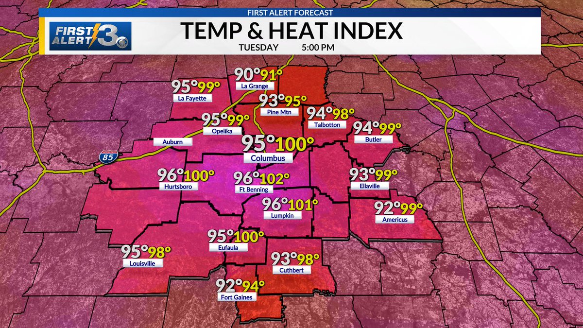
EXPANDED HEAT ADVISORY: More counties are now under HEAT ADVISORIES through Saturday afternoon. Heat index temperatures could reach up to 106 degrees. Please take breaks from the sun and stay hydrated! #heat#alwx#gawx#columbusga
Tropical Depression Edouard is weakening over land, so this will be our FINAL update on the system. We’ll be watching another tropical disturbance late this week — potentially bringing better rain chances heading into the weekend.
For our region, the key takeaway is that Edouard's westward track should limit the amount of tropical moisture available locally, while high pressure helps keep the system focused toward the Texas/Louisiana coast. The storm is currently about 140 miles southeast of Cameron, LA
FRIDAY NIGHT FOOTBALL: We are tracking isolated storms already bubbling up this afternoon. While some areas will stay dry, showers and storms will continue to develop over the next few hours. Keep an eye on the radar if you are headed to any game tonight! #columbusga#gawx#alwx