The first true heat wave of the summer will arrive next week across much of the Central and Southern Plains, eventually making its way to the east coast towards the end of the week.
A wet start to June is favored for Florida, which may bring much needed drought relief. According to the U.S. Drought Monitor valid May 19, nearly three-quarters of the state is designated with extreme (D3) to exceptional (D4) drought.
Southerly flow from the Gulf and a stationary front favor increasing chances of heavy rainfall along with localized river and flash flooding across portions of the south-central and southeastern U.S. beginning next week and continuing into the Memorial Day holiday weekend.
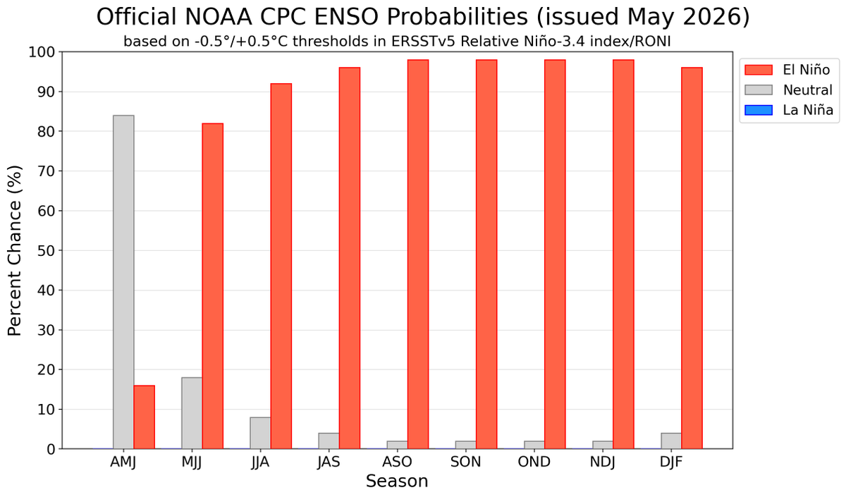
El Niño is likely to emerge soon (82% chance in May-July 2026) and continue through Northern Hemisphere winter 2026-27 (96% chance in December 2026 – February 2027). An #ElNino Watch remains in effect. #ENSO https://t.co/5zlzaZ0D9Z
Temperatures are likely to reach the upper 90’s to around 100 degrees F centered over portions of the Central and Southern High Plains, with heat index values of 100-105 degrees F. Dry, gusty surface winds may elevate wildfire risk during the first few days of the week-2 period.
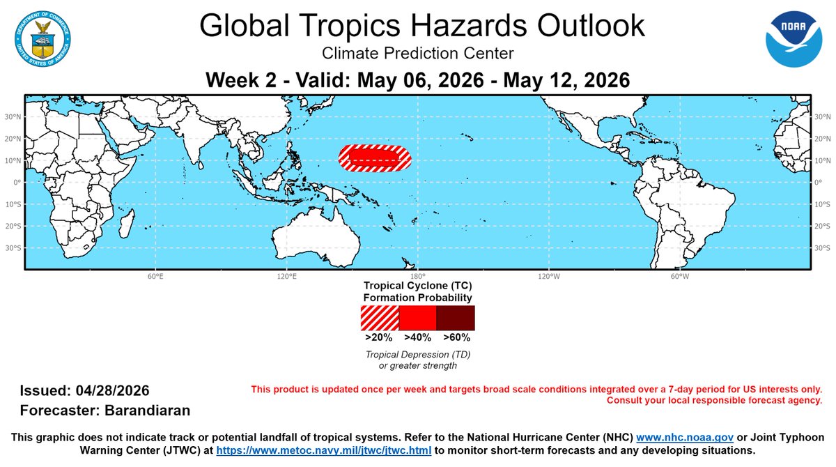
May looks to be a busy month for possible tropical cyclone (TC) formation over parts of the western North Pacific. There is a 20-40% chance of TC formation around Guam and the CNMI during week-2, and greater than 60% chance of TC development in this same region during week-3.
Temperatures are likely to reach the upper 90’s to around 100 degrees F centered over portions of the Central and Southern High Plains, with heat index values of 100-105 degrees F. Dry, gusty surface winds may elevate wildfire risk during the first few days of the week-2 period.
Triple-digit heat is likely for parts of California and the Southwest late this weekend into next week, with highs potentially reaching 110 degrees F in the Desert Southwest, and 100 to 105 degrees F in southern sections of the Central Valley of CA.
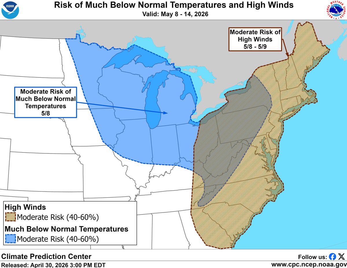
Unseasonably chilly and windy conditions likely across much of the Midwest and East late next week. Freezing or near-freezing temperatures may damage sensitive crops across areas of the Midwest. In some areas, high winds could result in low wind chills not typically seen in May.
Based on current model forecasts, a moderate risk (40 to 60% chance) of tropical cyclone development is indicated for the Western Pacific from the Marianas to the western Marshall Islands, during the period of May 6 to May 12. See short-range updates at https://t.co/W9tMBmkGZF.
An unseasonably cold pattern is favored across most of the central and eastern US end of April into early May. Possible much below normal temperatures and near freezing low temperatures across parts of the Upper Midwest and Great Lakes region could damage early blooming crops.
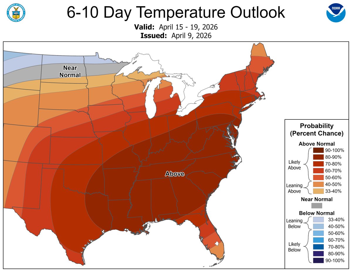
Early season heat is forecast across the eastern U.S. next week, with portions of the Mid-Atlantic and Southeast possibly having temperatures above 90 deg F for the first time this year. Drought expansion and increased wildfire threat are also a concern.
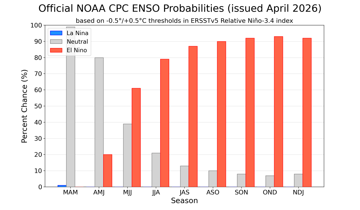
#ENSO-neutral conditions are present and are favored through April-June 2026 (80% chance). In May-July 2026, El Niño is likely to emerge (61% chance) and persist through at least the end of 2026. (1/2) https://t.co/5zlzaZ0D9Z
Parts of TX, OK, AR, and northwest LA may see heavy precip and flooding late next week. Heavy precip is also possible from the Southern Plains to the Great Lakes. Watch for flash flood alerts and rising river levels, especially in areas that have had recent precip!
A high risk of heavy precip is posted for parts of TX, OK, AR, and Northwest LA Apr 10-11, with a moderate risk from the S. Plains to the Great Lakes Apr 10-12. Heavy precip may lead to flash flooding and increased river levels, especially in areas that have had recent precip.
Heavy rainfall and thunderstorms are forecast from eastern portions of the Southern Plains and Lower Mississippi Valley northeast towards the Great Lakes region during the first half of week-2. This is associated with a low pressure system and adequate Gulf moisture.