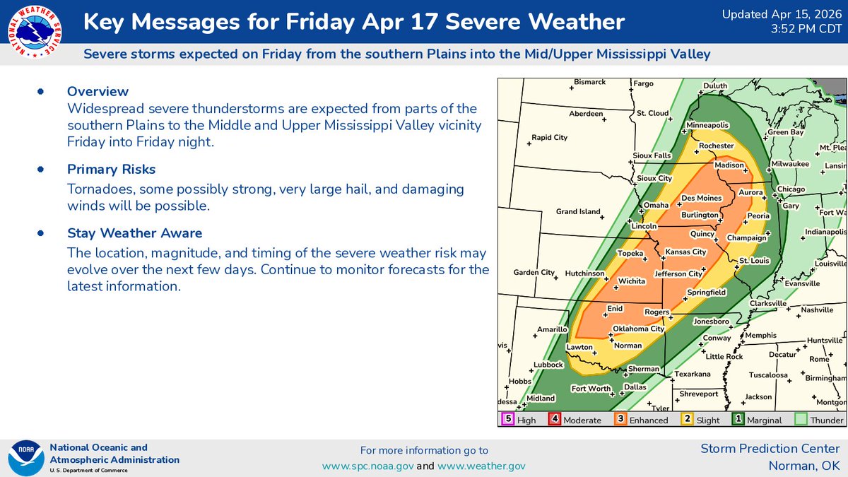
Major hail threat will exist across the Central Plains on Friday. Instead of parking your car under an overpass, park it in your garage and stay weather aware!
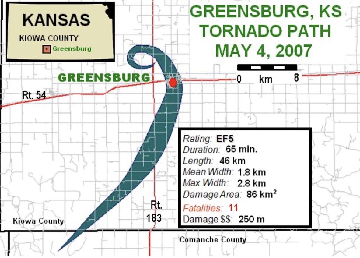
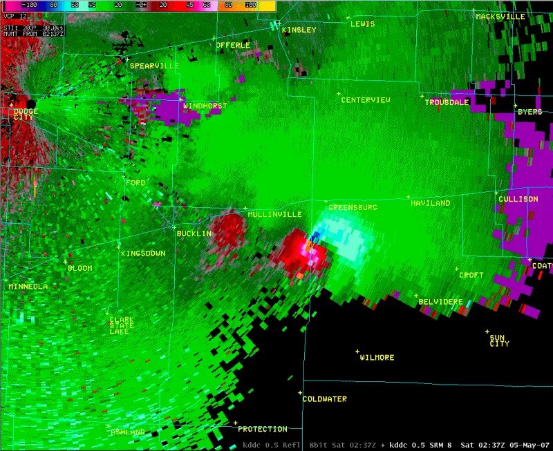
19 years ago tonight, (May 4, 2007) a catastrophic EF5 tornado struck Greensburg, Kansas. 🌪️
Striking at 9:45 p.m. with estimated 205 mph winds, it stayed on the ground for 65 minutes tracking 28+ miles and reaching up to 1.7 miles wide, destroying 95% of the town. 11 people were killed.
Sirens sounded about 20 minutes before impact, but more than 1,400 homes and businesses were damaged or destroyed.
KAKE storm tracker @LannyDean_ described how dangerous it was: the massive tornado was nearly invisible at night, only revealed at times by lightning flashes and power flashes as it tore through the town.
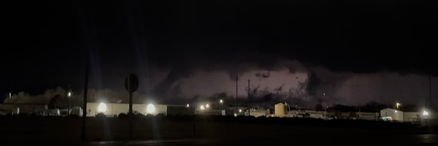
Amid all the negative news in 2026, how about this — a neighborhood in Oklahoma was *wiped off the map* with ZERO fatalities.
The watches and warnings happened perfectly.
The science unfolded right.
The residents did exactly what they should have.
This is so encouraging.
A High Wind Warning is in effect for all of Kansas today. 35-45mph winds will be blowing consistently with gusts already reported at 55mph. Light snow will fall periodically along with the high wind today. Stay safe and keep your eyes on the sky!
SEVERE WEATHER OUTBREAK is becoming increasingly likely on Sunday, as the enhanced risk of severe weather has grown!
Widespread damaging wind event with some tornadoes is likely across the Mississippi River Valley. This will be prompted by a large squall line that will stretch from Illinois to Texas. This is very concerning, especially since many of these storms will arrive in the Ohio Valley AFTER sunset.
Now is the time to prepare and spread the word about this rapidly growing threat.
A High Wind Watch is in effect for most of Kansas through Sunday night. Sunday is forecast to feature consistent 35-45mph winds with gusts up to 60mph, coming from the Northwest. Winds are expected to kick in sometime Sunday morning, so take caution if traveling.
🚨High Wind Warning will go into effect for most of Kansas by 11am today! Wind gusts up to 55mph are possible today! Be safe if you’re traveling! This is in addition to a Red Flag Warning.🚨
From Comanche County, KS Emergency Management: Areas along Highway 160 on southward to the Oklahoma border are asked to evacuate. Those evacuating can go to South Central High School in Coldwater for emergency shelter.
Avoid Kansas State Route 1 in southern Comanche County #kswx