Hi all!
A long overdue announcement that we'll be winding down our activity here. It was great while it was great, then not.
You can find us as @ohmap over at the blewe skye app. Not sure if they're filtering links, so DM if you need the direct link.
Best wishes, OHM
📍With just a few lines of code, you can now overlay historic maps on a @LeafletJS map with the new Allmaps plugin. See https://t.co/gokdS7ILoH to try it out‼️
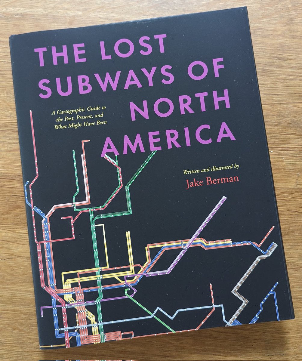
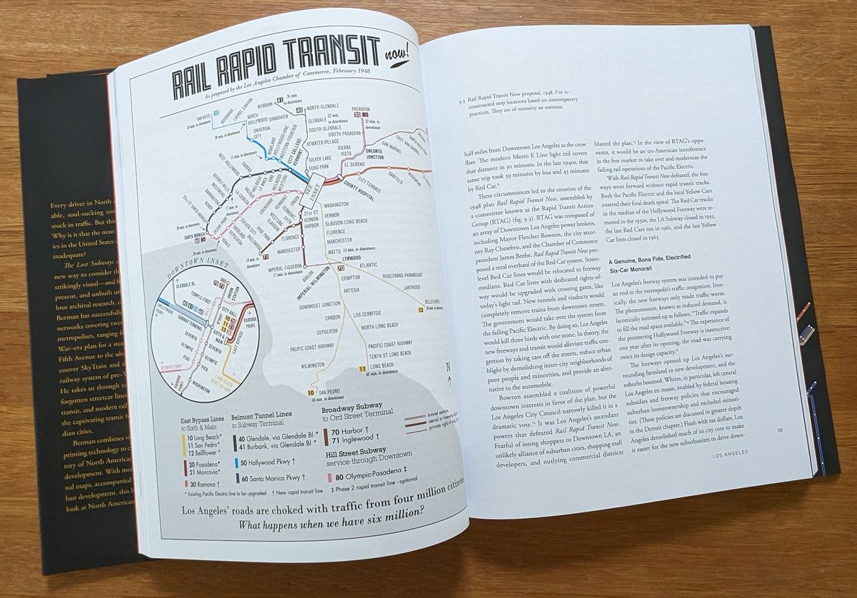
Fantastic new book by @lostsubways has arrived chock full of great original maps of transit systems as they might have been if plans & decisions were different. An atlas of what could have been if the US was weaned off its obsession with the car.
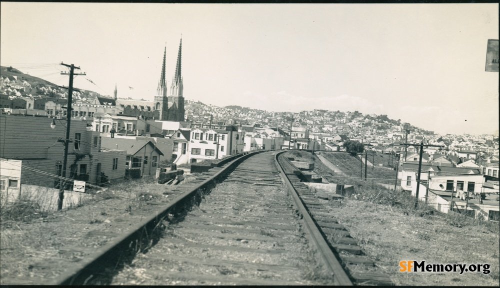
Noe Valley, 1942
SFMemory: Robert McFarland's 126 photos of SP's last days
Southern Pacific's Old Main Line was torn out in the early 1940s, starting with scrap metal drives to reuse the 7 railroad bridges between 27th & 30th Streets.
#sfhistory
https://t.co/wds30Amz2L
#30DayMapChallenge 2023 themes are here for November🌎
Main guidelines: have fun, get inspired by beautiful maps, try to learn new things and support others!
Any volunteer who gets a call out by Dr. Gadd deserves all the applause we can provide!
ALL THE CROWDSOURCE KUDOS AND KARMA TO YOU, @DavidJohnCant!!!
🗺️🗺️🗺️🗺️🗺️🗺️🗺️🗺️🗺️🗺️🗺️🗺️🗺️🗺️🗺️👏👏👏👏👏👏👏👏👏👏👏👏👏👏👏🗺️🗺️🗺️🗺️🗺️🗺️🗺️🗺️🗺️🗺️🗺️🗺️🗺️🗺️🗺️👏👏👏👏👏👏👏👏👏👏👏👏👏👏👏
@sixteenthCgirl Like @docuracy, @ViaeRegiae, and many other fantastic projects noted on this thread, @OpenHistMap is trying to help compile and crowdsource data from a wide variety of sources into a map format. Is there a particular time & place you have in mind?
17th and Market St. photographed in 1939. A Standard gas station is seen in the foreground, and the Bank of America at the corner of Castro Street at left. In the background, the Twin Peaks Tunnel can be seen.
https://t.co/qwYmmn8gCA