Sharing historical maps, history, and aerials from across the 🌎
Pastmaps offers cutting-edge maps & tools for historical research. Get started for free!
I set a goal in November of getting 100 strangers to sign up for @pastmaps by the end of 2022 to prove that it had legs and was worth going fulltime on it as a startup in 2023
Goal crushed with 151 signups and growing 5-10 every day now
lets go
#buildinpublic
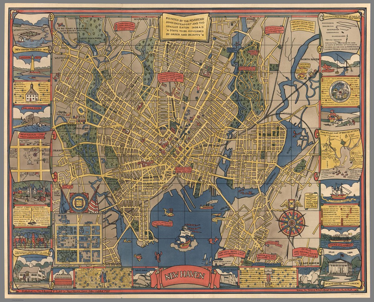
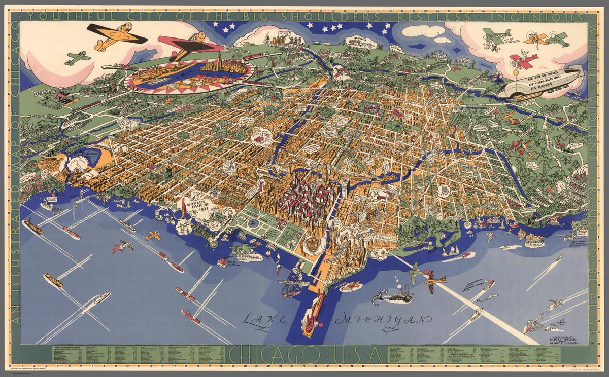
A fun pictorial #map of New Haven, CT: likely made as advertising for tourism (1928).
The border includes a ton of fun facts about the city, places of interest, etc
#connecticut#newhaven
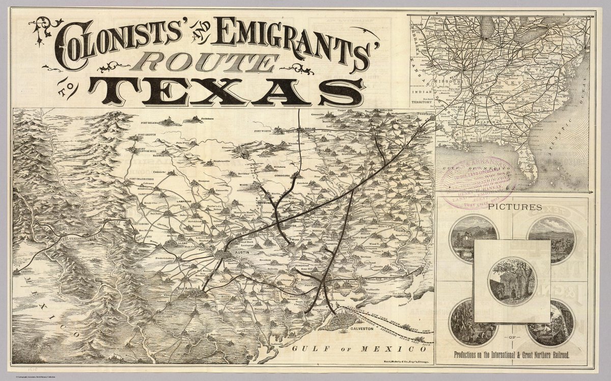
Colonists' & Emigrants' Route to #Texas: an early map marketing a new exciting life in the West and the new #railways connecting #Austin, #Houston, #SanAntonio, and more (1878)
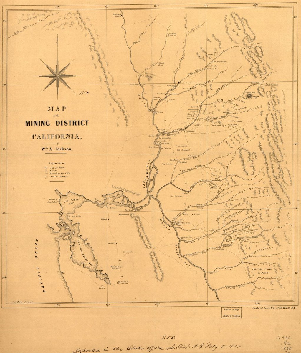
Map of the #Mining District of CA (1850) - one of the most detailed #maps of gold rush-era camps ever created
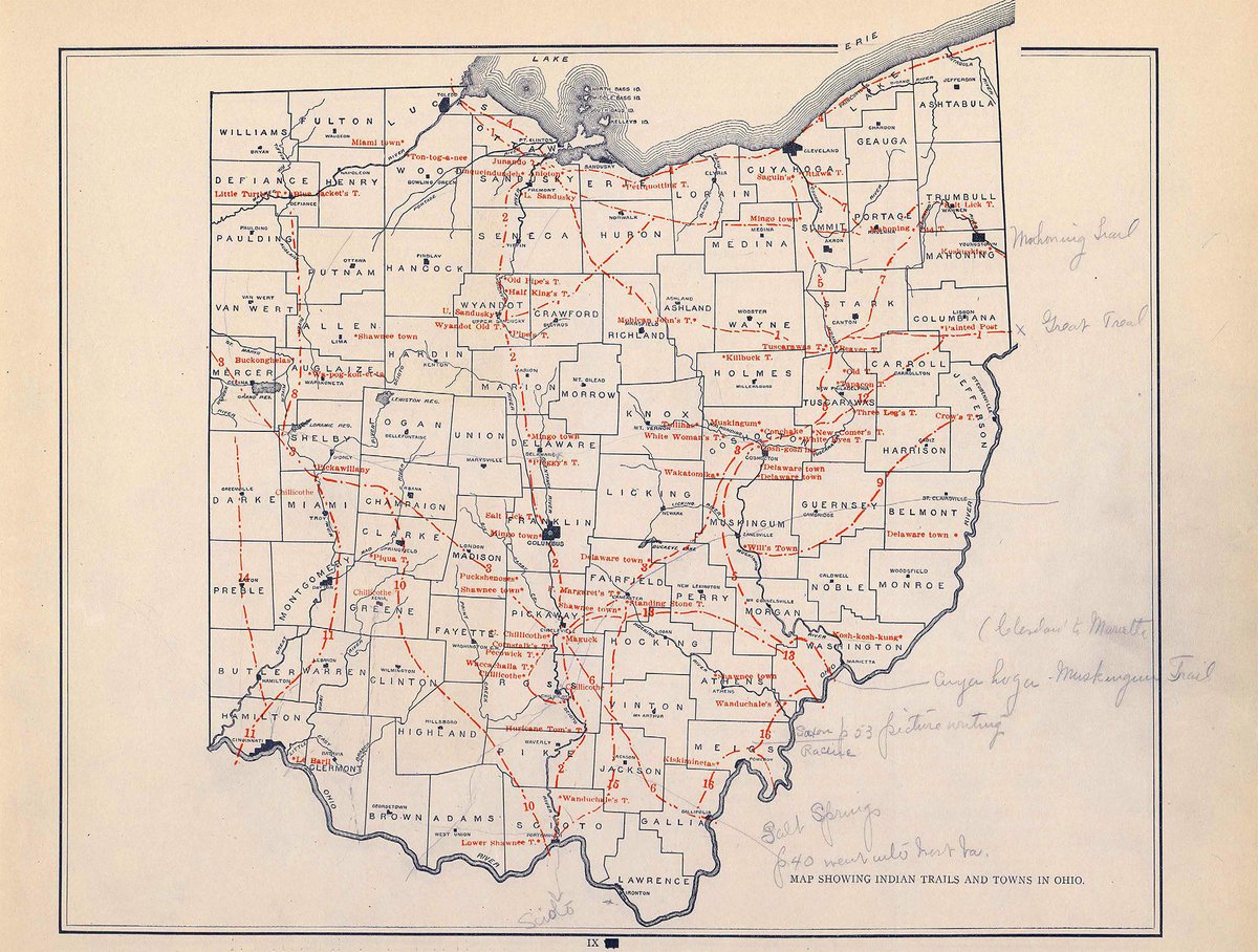
Fun fact: this map also marks the locations of various Indian Villages which was a pretty uncommon map feature for the time
#california#history
Until 1600 Spain was the only European nation having permanent colonies in North America. The wealth obtained from the West Indies made Spain great and yet prepared the way for her downfall, for the English attacked first Spanish commerce, then colonies, and then home country.
Hello world! 👋
Peep https://t.co/5x4T5aOA8H for what we're cooking up - imagine if Google Maps and a time machine had a baby. Plus some razzle-dazzle 🎊
Sign up to secure your early access spot